Bucks Green

Settlement in Sussex Horsham

England

Bucks Green

Downs Link, near Slinfold A view of the Downs Link path as it approaches Slinfold in West Sussex.  The path follows a dismantled railway line.  It also forms part of route 223 of the National Cycle Network.

Here, a public footpath crosses the Downs Link path.
Downs Link, near Slinfold Credit: Malc McDonald

Bucks Green is a small village located in the county of Sussex, England. Situated approximately 7 miles southeast of Horsham, it lies within the district of Horsham and is part of the civil parish of Slinfold.

The village is characterized by its picturesque rural setting, surrounded by rolling hills and lush green fields. It is known for its quaint and charming atmosphere, with a scattering of traditional cottages and farmhouses dotting the landscape. The area is predominantly residential, with a close-knit community that values its peaceful surroundings.

Despite its small size, Bucks Green offers a range of amenities to its residents. These include a local pub, The Barley Mow, which serves as a social hub for the village. Additionally, the nearby village of Slinfold provides more extensive facilities, such as shops, schools, and a village hall.

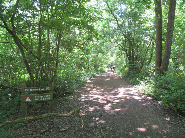
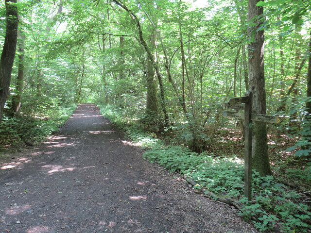
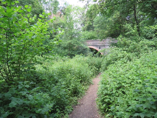
Nature enthusiasts are drawn to Bucks Green for its proximity to beautiful countryside walks and outdoor activities. The village is surrounded by scenic trails and bridleways, offering opportunities for leisurely strolls and horseback riding. The nearby Warnham Local Nature Reserve provides further opportunities for wildlife observation and exploration.

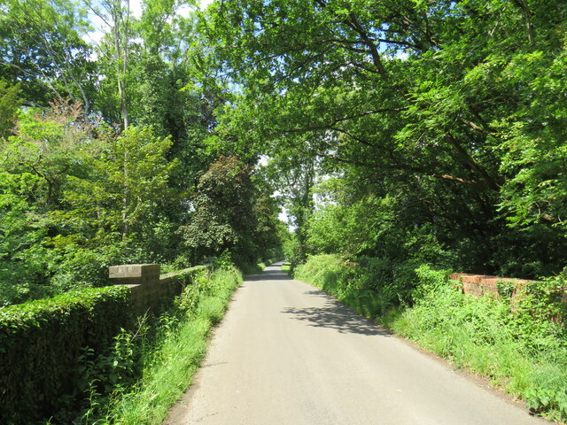
Bucks Green benefits from its convenient location, with good transport links to nearby towns and cities. The A29 road runs close to the village, connecting it to Horsham and the wider road network. The village is also served by a local bus route, providing access to surrounding areas.

Overall, Bucks Green offers a peaceful and idyllic setting for those seeking a rural retreat, while still providing easy access to nearby amenities and attractions.

If you have any feedback on the listing, please let us know in the comments section below.
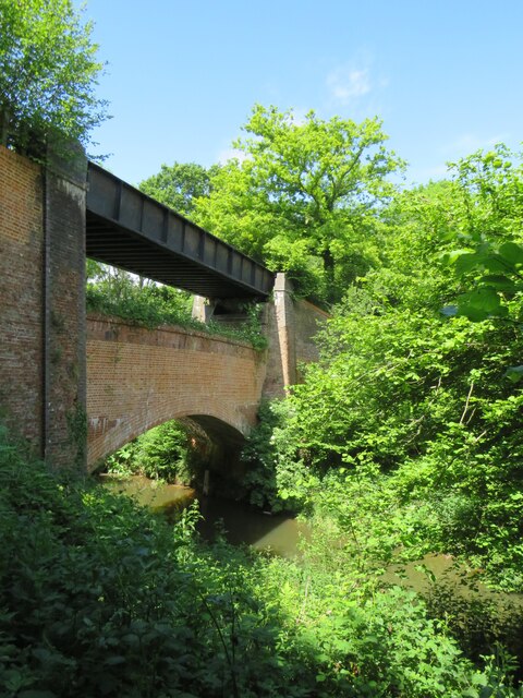
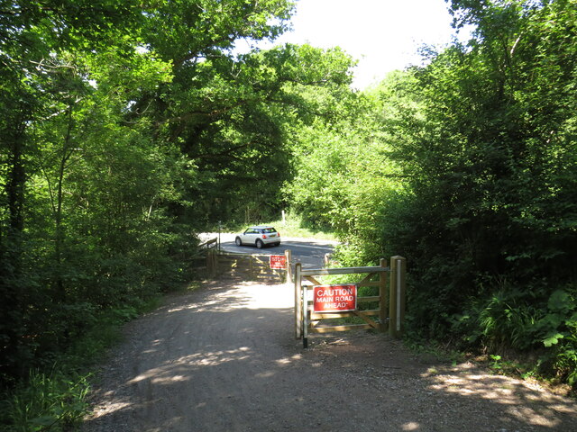
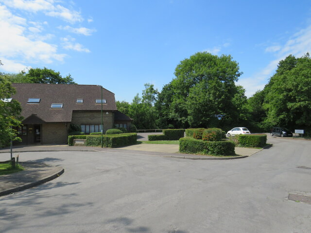
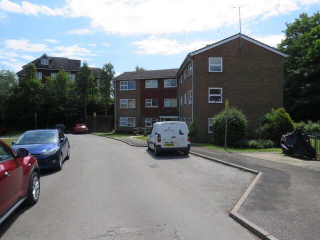
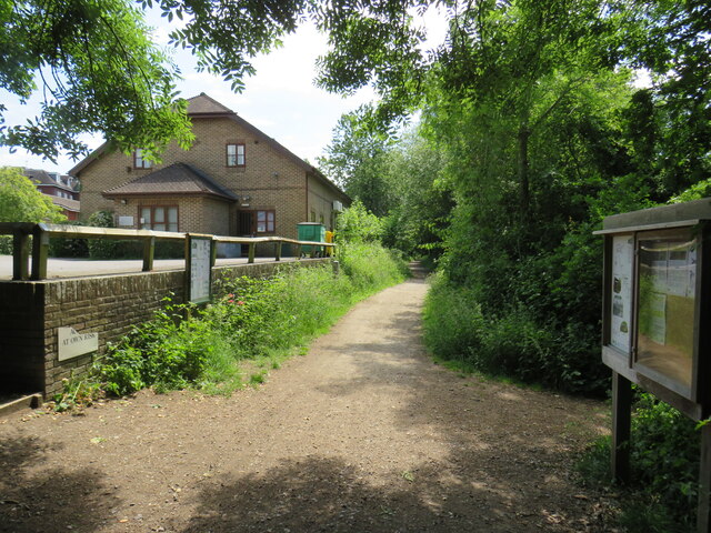
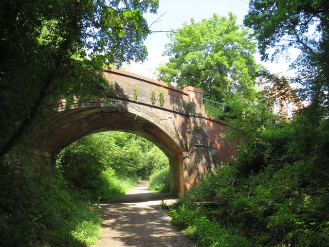
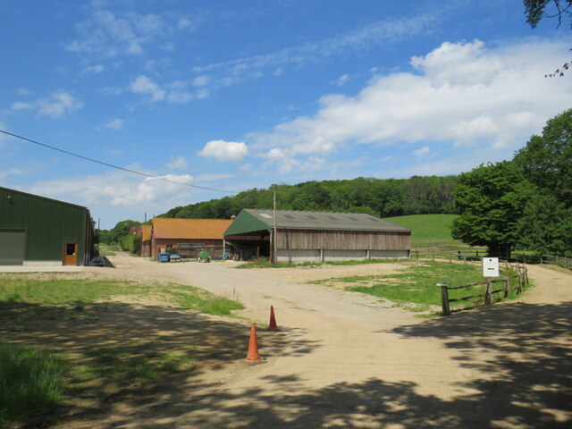
Bucks Green Images

Images are sourced within 2km of 51.086566/-0.460799 or Grid Reference TQ0733. Thanks to Geograph Open Source API. All images are credited.

Downs Link, near Slinfold A view of the Downs Link path as it approaches Slinfold in West Sussex.  The path follows a dismantled railway line.  It also forms part of route 223 of the National Cycle Network.

Here, a public footpath crosses the Downs Link path.
Downs Link, near Slinfold
A view of the Downs Link path as it approaches Slinfold in West Sussex. The path follows a dismantled railway line. It also forms part of route 223 of the National Cycle Network. Here, a public footpath crosses the Downs Link path.
Double bridge near Rudgwick, West Sussex The double bridge which crosses the River Arun near Rudgwick is unique in Britain, in having both a brick arch and an iron girder.

The brick arch was built to carry a railway line across the river.  However, on the far side of the river, the railway would then climb a steep gradient into Rudgwick station.  Inspectors from the government's Board of Trade refused permission for the railway to open, as they felt the gradient up to Rudgwick station was too steep.  The railway compamny therefore had to rebuild this section of the route with higher embankments, so that the gradient into Rudgwick was less steep.  As the railway had been raised to a higher level at this location, the iron girder bridge was installed to carry it across the river.  The brick arch has never been used for its intended purpose.

The railway opened in 1865 but closed a century later.  The railway route now forms part of the Downs Link long distance path, which itself forms part of route 223 of the National Cycle Network.
Double bridge near Rudgwick, West Sussex
The double bridge which crosses the River Arun near Rudgwick is unique in Britain, in having both a brick arch and an iron girder. The brick arch was built to carry a railway line across the river. However, on the far side of the river, the railway would then climb a steep gradient into Rudgwick station. Inspectors from the government's Board of Trade refused permission for the railway to open, as they felt the gradient up to Rudgwick station was too steep. The railway compamny therefore had to rebuild this section of the route with higher embankments, so that the gradient into Rudgwick was less steep. As the railway had been raised to a higher level at this location, the iron girder bridge was installed to carry it across the river. The brick arch has never been used for its intended purpose. The railway opened in 1865 but closed a century later. The railway route now forms part of the Downs Link long distance path, which itself forms part of route 223 of the National Cycle Network.
Downs Link, near Rudgwick The Downs Link path follows a dismantled railway line for almost all of its length.  It also forms part of route 223 of the National Cycle Network.

Here, there used to be a bridge carrying the railway across the A281 road.  The bridge was demolished after the railway closed, and the Downs Link path therefore descends to road level to cross the road.  There has been a long-running campaign to reinstate a bridge here.  Sadly, a 20-year-old cyclist was killed in 2020 whilst crossing the road at this point.
Downs Link, near Rudgwick
The Downs Link path follows a dismantled railway line for almost all of its length. It also forms part of route 223 of the National Cycle Network. Here, there used to be a bridge carrying the railway across the A281 road. The bridge was demolished after the railway closed, and the Downs Link path therefore descends to road level to cross the road. There has been a long-running campaign to reinstate a bridge here. Sadly, a 20-year-old cyclist was killed in 2020 whilst crossing the road at this point.
Downs Link, Rudgwick A view of the Downs Link path at Rudgwick in West Sussex.  The path follows a dismantled railway line.  It also forms part of route 223 of the National Cycle Network.  The bridge in this photo carries a road across the former railway line.
Downs Link, Rudgwick
A view of the Downs Link path at Rudgwick in West Sussex. The path follows a dismantled railway line. It also forms part of route 223 of the National Cycle Network. The bridge in this photo carries a road across the former railway line.
Downs Link, Rudgwick A view of the Downs Link path at Rudgwick in West Sussex.  The path follows a dismantled railway line.  It also forms part of route 223 of the National Cycle Network.

Here, the path passes through the site of Rudgwick station.  The station and railway line closed in 1965, and very little trace of the station remains.  The block of flats to the right of the path has been built on the site of the station's goods yard.  More information about Rudgwick station, including photographs, can be found on the Disused Stations website: <span class="nowrap"><a title="http://www.disused-stations.org.uk/r/rudgwick/" rel="nofollow ugc noopener" href="http://www.disused-stations.org.uk/r/rudgwick/">Link</a><img style="margin-left:2px;" alt="External link" title="External link - shift click to open in new window" src="https://s1.geograph.org.uk/img/external.png" width="10" height="10"/></span>
Downs Link, Rudgwick
A view of the Downs Link path at Rudgwick in West Sussex. The path follows a dismantled railway line. It also forms part of route 223 of the National Cycle Network. Here, the path passes through the site of Rudgwick station. The station and railway line closed in 1965, and very little trace of the station remains. The block of flats to the right of the path has been built on the site of the station's goods yard. More information about Rudgwick station, including photographs, can be found on the Disused Stations website: LinkExternal link
Houses on Station Road, Rudgwick Houses close to the site of Rudgwick station, which closed in 1965.
Houses on Station Road, Rudgwick
Houses close to the site of Rudgwick station, which closed in 1965.
Site of railway station, Rudgwick near Horsham This was the site of Rudgwick's railway station, which closed in 1965.  Little trace of the station remains, with the site put to new uses.  The building to the left of the image is a health centre.
Site of railway station, Rudgwick near Horsham
This was the site of Rudgwick's railway station, which closed in 1965. Little trace of the station remains, with the site put to new uses. The building to the left of the image is a health centre.
The Sidings, Rudgwick The Sidings is a small residential development on the site of the former station goods yard at Rudgwick, in West Sussex.
The Sidings, Rudgwick
The Sidings is a small residential development on the site of the former station goods yard at Rudgwick, in West Sussex.
The Sidings, Rudgwick The Sidings is a small residential development on the site of the former station goods yard at Rudgwick, in West Sussex.  The building to the left of the image is a health centre.
The Sidings, Rudgwick
The Sidings is a small residential development on the site of the former station goods yard at Rudgwick, in West Sussex. The building to the left of the image is a health centre.
Downs Link at Rudgwick station site The Downs Link path follows a dismantled railway line for most of its length.  It also forms part of route 223 of the National Cycle Network.

Here, the path passes through the site of Rudgwick railway station.  More information about Rudgwick station can be found on the Disused Stations website: <span class="nowrap"><a title="http://www.disused-stations.org.uk/r/rudgwick/" rel="nofollow ugc noopener" href="http://www.disused-stations.org.uk/r/rudgwick/">Link</a><img style="margin-left:2px;" alt="External link" title="External link - shift click to open in new window" src="https://s1.geograph.org.uk/img/external.png" width="10" height="10"/></span>
Downs Link at Rudgwick station site
The Downs Link path follows a dismantled railway line for most of its length. It also forms part of route 223 of the National Cycle Network. Here, the path passes through the site of Rudgwick railway station. More information about Rudgwick station can be found on the Disused Stations website: LinkExternal link
Bridge over the Downs Link path near Rudgwick A view of the Downs Link path near Rudgwick in West Sussex.  The path follows a dismantled railway line.  It also forms part of route 223 of the National Cycle Network.

The bridge carries a road over the former railway line.
Bridge over the Downs Link path near Rudgwick
A view of the Downs Link path near Rudgwick in West Sussex. The path follows a dismantled railway line. It also forms part of route 223 of the National Cycle Network. The bridge carries a road over the former railway line.
Woodsomes Farm, near Rudgwick Woodsomes Farm in countryside close to the West Sussex/Surrey border.
Woodsomes Farm, near Rudgwick
Woodsomes Farm in countryside close to the West Sussex/Surrey border.
Downs Link, near Rudgwick A view of the Downs Link path near Rudgwick in West Sussex.  The path also forms part of route 223 of the National Cycle Network.

For most of its length, the path follows the course of a dismantled railway.  Between Cranleigh and Rudgwick, however, the railway passed through a tunnel.  The path avoids the tunnel, instead climbing over the hill.  This view looks downhill towards Rudgwick.  A sign warns cyclists of a steep gradient and a blind bend.
Downs Link, near Rudgwick
A view of the Downs Link path near Rudgwick in West Sussex. The path also forms part of route 223 of the National Cycle Network. For most of its length, the path follows the course of a dismantled railway. Between Cranleigh and Rudgwick, however, the railway passed through a tunnel. The path avoids the tunnel, instead climbing over the hill. This view looks downhill towards Rudgwick. A sign warns cyclists of a steep gradient and a blind bend.
Downs Link and Sussex Border Path near Rudgwick A view of the Downs Link path near Rudgwick in West Sussex.  The path also forms part of route 223 of the National Cycle Network.

For most of its length, the path follows the course of a dismantled railway.  Between Cranleigh and Rudgwick, however, the railway passed through a tunnel.  The path avoids the tunnel, instead climbing through woodland over a hill.  Here, the Downs Link path meets the Sussex Border Path.  Both paths take the path ahead for a short distance.  This location is also the county boundary between West Sussex and Surrey.
Downs Link and Sussex Border Path near Rudgwick
A view of the Downs Link path near Rudgwick in West Sussex. The path also forms part of route 223 of the National Cycle Network. For most of its length, the path follows the course of a dismantled railway. Between Cranleigh and Rudgwick, however, the railway passed through a tunnel. The path avoids the tunnel, instead climbing through woodland over a hill. Here, the Downs Link path meets the Sussex Border Path. Both paths take the path ahead for a short distance. This location is also the county boundary between West Sussex and Surrey.
Cox Green Road, near Rudgwick Cox Green Road near Rudgwick, on the borders of Surrey and West Sussex.  Here, a bridge carries the road over the course of a dismantled railway.

Much of the dismantled railway forms the route of the Downs Link path and route 223 of the National Cycle Network.  A short distance south of this location, however, the railway passed through a tunnel.  The tunnel is closed, therefore the path and cycle route climb up to the road, crossing the bridge then passing through woodland before rejoining the railway route.
Cox Green Road, near Rudgwick
Cox Green Road near Rudgwick, on the borders of Surrey and West Sussex. Here, a bridge carries the road over the course of a dismantled railway. Much of the dismantled railway forms the route of the Downs Link path and route 223 of the National Cycle Network. A short distance south of this location, however, the railway passed through a tunnel. The tunnel is closed, therefore the path and cycle route climb up to the road, crossing the bridge then passing through woodland before rejoining the railway route.
Downs Link near Rudgwick The Downs Link path descending into a railway cutting where it will pass beneath the bridge visible ahead.  The path also forms part of route 223 of the National Cycle Network.

Much of the Downs Link path follows the course of a dismantled railway.  The tunnel is closed, therefore the path and cycle route climb through woodland to avoid the tunnel before rejoining the railway route.
Downs Link near Rudgwick
The Downs Link path descending into a railway cutting where it will pass beneath the bridge visible ahead. The path also forms part of route 223 of the National Cycle Network. Much of the Downs Link path follows the course of a dismantled railway. The tunnel is closed, therefore the path and cycle route climb through woodland to avoid the tunnel before rejoining the railway route.
Lawns Road at the junction of Cox Green Road
Show me another place!

Bucks Green is located at Grid Ref: TQ0733 (Lat: 51.086566, Lng: -0.460799)

Administrative County: West Sussex

District: Horsham

Police Authority: Sussex

What 3 Words

///flattered.regard.timidly. Near Rudgwick, West Sussex

Related Wikis

Rudgwick railway station

Rudgwick railway station was on the Cranleigh Line. It served the village of Rudgwick in West Sussex until June, 1965. == History == Rudgwick station opened...

Tisman's Common

Tisman's Common is a hamlet in the Horsham District of West Sussex, England. It stands in the parish of Rudgwick, on the Rudgwick to Loxwood road, 6.4...

Rudgwick

Rudgwick is a village and civil parish in the Horsham District of West Sussex, England. The village is 6 miles (10 km) west from Horsham on the north...

Holy Trinity Church, Rudgwick

Holy Trinity Church is the Anglican parish church of Rudgwick, a village in the Horsham district of West Sussex, England. The oldest part of the church...

Baynards railway station

Baynards was a railway station on the Cranleigh Line, between Guildford, Surrey, and Horsham, West Sussex, England. The station opened with the line on...

Rikkyo School in England

Rikkyo School in England (立教英国学院, Rikkyō Eikoku Gakuin) is a Japanese boarding primary and secondary school in Rudgwick, Horsham District, West Sussex...

Baynards Park

Baynards Park is a 2,000 acres (810 ha) estate and site of a demolished country house with extant outbuildings, privately owned, in the south of the parishes...

Slinfold railway station

Slinfold railway station was on the Cranleigh Line and served the village of Slinfold in West Sussex. == History == The line had a single track and opened...

Nearby Amenities

Located within 500m of 51.086566,-0.460799
Bucks Green
Place: village
Lat/Long: 51.0859801/-0.4605086
Recycling
Lat/Long: 51.0855383/-0.4594072
Bus Stop
Queen's Head
Naptan AtcoCode: 4400HR0011
Naptan Bearing: W
Naptan CommonName: Queens Head
Naptan Indicator: adj Haven Road
Naptan Landmark: Haven Road
Naptan NaptanCode: wsxatdtw
Naptan Street: Guildford Road
Naptan Verified: no
Public Transport: platform
Source: naptan_import
Lat/Long: 51.085488/-0.45722
Bus Stop
Queen's Head
Bench: yes
Bin: yes
Bus: yes
Naptan AtcoCode: 4400HR0012
Naptan Bearing: E
Naptan CommonName: Queens Head
Naptan Indicator: opp. Haven Road
Naptan Landmark: Haven Road
Naptan NaptanCode: wsxatdwa
Naptan Street: Guildford Road
Naptan Verified: no
Public Transport: platform
Shelter: yes
Source: naptan_import
Lat/Long: 51.085632/-0.4580271
Bus Stop
The Fox PH
Naptan AtcoCode: 4400HR0554
Naptan Bearing: N
Naptan CommonName: The Fox PH
Naptan Indicator: Garage
Naptan Landmark: Loxwood Rd
Naptan NaptanCode: wsxdpwat
Naptan Street: Guildford Rd
Naptan Verified: no
Public Transport: platform
Source: naptan_import
Lat/Long: 51.0860648/-0.4617529
Old Cottage
Local Ref: NR
Naptan AtcoCode: 4400HR1102
Naptan Bearing: SW
Naptan BusStopType: CUS
Naptan CommonName: Old Cottage
Naptan Indicator: nr
Naptan Landmark: Hail & Ride
Naptan NaptanCode: wsxgdjtj
Naptan Street: Lynwick Street
Naptan Verified: no
Source: naptan_import
Lat/Long: 51.0901579/-0.4602902
James Paul
Shop: car
Lat/Long: 51.0860411/-0.4614533
Post Box
Operator: Royal Mail
Post Box Type: lamp
Ref: RH12 71D
Royal Cypher: EIIR
Royal Cypher Wikidata: Q33102113
Lat/Long: 51.08569/-0.4594153
Crossing
Crossing: traffic_signals
Lat/Long: 51.0855352/-0.4568736
Addr Housename: Burnalls
Lat/Long: 51.0856557/-0.4558627
Addr Housename: Burnalls Cottage
Lat/Long: 51.0856697/-0.4557191
Addr Housename: Meadow Cottage
Lat/Long: 51.0860452/-0.4567898
Addr Housename: Bacon Cottage
Lat/Long: 51.0860229/-0.4570286
Addr Housename: Snoxall
Lat/Long: 51.0857918/-0.4567895
Addr Housename: The Old Cottage
Lat/Long: 51.0857472/-0.4569558
Access: private
Man Made: water_well
Lat/Long: 51.089232/-0.4608722
Booth: K6
Covered: booth
Man Made: telephone_box
Lat/Long: 51.085681/-0.4593306
The data included in this document is from www.openstreetmap.org. The data is made available under ODbL.

Have you been to Bucks Green?

Leave your review of Bucks Green below (or comments, questions and feedback).