Wetherden

Civil Parish in Suffolk Mid Suffolk

England

Wetherden

View northwards towards Darsham's Farm, from the railway
View northwards towards Darsham's Farm, from the railway Credit: Christopher Hilton

Wetherden is a civil parish located in the county of Suffolk, England. It is situated about 6 miles east of the town of Stowmarket and covers an area of approximately 6 square miles. The parish is surrounded by picturesque countryside, with rolling hills and open fields, making it an attractive location for those seeking a peaceful rural setting.

The village of Wetherden itself is a small and close-knit community, with a population of around 500 residents. It has a rich history, with evidence of human activity in the area dating back to the Neolithic period. The village is known for its charming traditional cottages, many of which are built from the local Suffolk pink bricks.

A notable landmark in Wetherden is the St. Mary's Church, a Grade II listed building that dates back to the 14th century. The church features a striking tower and several interesting architectural features, making it a popular attraction for history enthusiasts.

The village also has a primary school, providing education for children in the local area. Additionally, there is a village hall that hosts various community events, including social gatherings, clubs, and activities.

Wetherden is well-connected to nearby towns and cities through a network of roads, making it easily accessible for residents and visitors alike. The peaceful and scenic surroundings, combined with its rich history and sense of community, make Wetherden an appealing place to live or visit for those seeking a tranquil countryside experience in Suffolk.

If you have any feedback on the listing, please let us know in the comments section below.
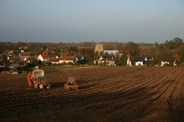
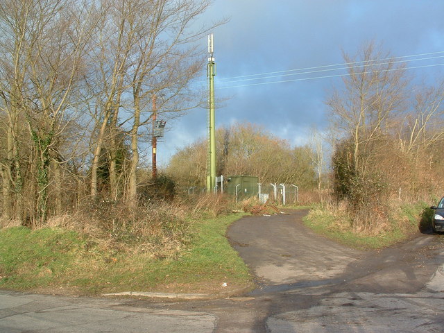
Wetherden Images

Images are sourced within 2km of 52.237319/0.945374 or Grid Reference TM0163. Thanks to Geograph Open Source API. All images are credited.

View northwards towards Darsham's Farm, from the railway
Field north of Mutton Hall, from the railway
Timber-framed cottages at Wetherden, Suffolk
Fir Tree Lane, Haughley Green, Suffolk
Grove Lane Industrial Estate, Elmswell These premises belong to Suffolk Meat Traders Ltd.
Grove Lane Industrial Estate, Elmswell
These premises belong to Suffolk Meat Traders Ltd.
Grove Lane Industrial Estate, Elmswell These premises belong to Safety Kleen.
Grove Lane Industrial Estate, Elmswell
These premises belong to Safety Kleen.
Down The Tracks Looking Ipswich bound on the Bury St.Edmunds to Ipswich line near Haughley Suffolk.
Down The Tracks
Looking Ipswich bound on the Bury St.Edmunds to Ipswich line near Haughley Suffolk.
Railway Line Looking Ipswich bound on the Bury St.Edmunds to Ipswich line near Haughley Suffolk.
Railway Line
Looking Ipswich bound on the Bury St.Edmunds to Ipswich line near Haughley Suffolk.
Wetherden village Looking north from the old A45.
Wetherden village
Looking north from the old A45.
Transmitter Mast Transmitter mast and fly tipping near to Wetherden Suffolk.
Transmitter Mast
Transmitter mast and fly tipping near to Wetherden Suffolk.
Meadow at Wetherden Trees in this field on the outskirts of Wetherden show signs of storm damage. Viewed from Captain's Lane, a little-used by-road north of the village.
Meadow at Wetherden
Trees in this field on the outskirts of Wetherden show signs of storm damage. Viewed from Captain's Lane, a little-used by-road north of the village.
Footpath to Little London This path, north of Wetherden, is part of a shortcut between the village and Mutton Hall, Little London.
Footpath to Little London
This path, north of Wetherden, is part of a shortcut between the village and Mutton Hall, Little London.
St Mary's Church, Wetherden An interesting church in the heart of a pretty village.  <span class="nowrap"><a title="http://www.suffolkchurches.co.uk/wetherden.htm" rel="nofollow ugc noopener" href="http://www.suffolkchurches.co.uk/wetherden.htm">Link</a><img style="margin-left:2px;" alt="External link" title="External link - shift click to open in new window" src="https://s1.geograph.org.uk/img/external.png" width="10" height="10"/></span>
St Mary's Church, Wetherden
An interesting church in the heart of a pretty village. LinkExternal link
Footpath at Base Green This permissive path leads westwards alongside the railway line; the brickwork to the left is part of the road bridge over the railway.
Footpath at Base Green
This permissive path leads westwards alongside the railway line; the brickwork to the left is part of the road bridge over the railway.
Field margin near Wetherden Much of the fields in this part of Suffolk look the same as this at this time of year, with winter wheat poking through in a fairly flat landscape.
Field margin near Wetherden
Much of the fields in this part of Suffolk look the same as this at this time of year, with winter wheat poking through in a fairly flat landscape.
Track to Whitehouse Farm This farm is a mile north of Wetherden, on the minor road to Wyverstone.
Track to Whitehouse Farm
This farm is a mile north of Wetherden, on the minor road to Wyverstone.
Footpath to Haughley Green This path commences on the minor road at Wetherden Upper Town, heading eastwards.
Footpath to Haughley Green
This path commences on the minor road at Wetherden Upper Town, heading eastwards.
Footpath to Haughley Green This path crosses rich agricultural land before branching to Bacton Hall and Haughley Green.
Footpath to Haughley Green
This path crosses rich agricultural land before branching to Bacton Hall and Haughley Green.
Show me another place!

Wetherden is located at Grid Ref: TM0163 (Lat: 52.237319, Lng: 0.945374)

Administrative County: Suffolk

District: Mid Suffolk

Police Authority: Suffolk

What 3 Words

///pickup.lecturers.dumps. Near Elmswell, Suffolk

Nearby Locations

Base Green Wetherden

Related Wikis

Wetherden

Wetherden is a village and civil parish in the county of Suffolk, England, situated about 4 miles (6.4 km) northwest of Stowmarket and about 1.25 miles...

Hillcroft Preparatory School

Hillcroft Preparatory School was an independent private co-educational school, located at Walnutree Manor, Haughley Green. Established in 1911, it was...

Haughley Road railway station

Haughley Road railway station was the original station serving Haughley, Suffolk. It closed in 1849 and was replaced by Haughley railway station which...
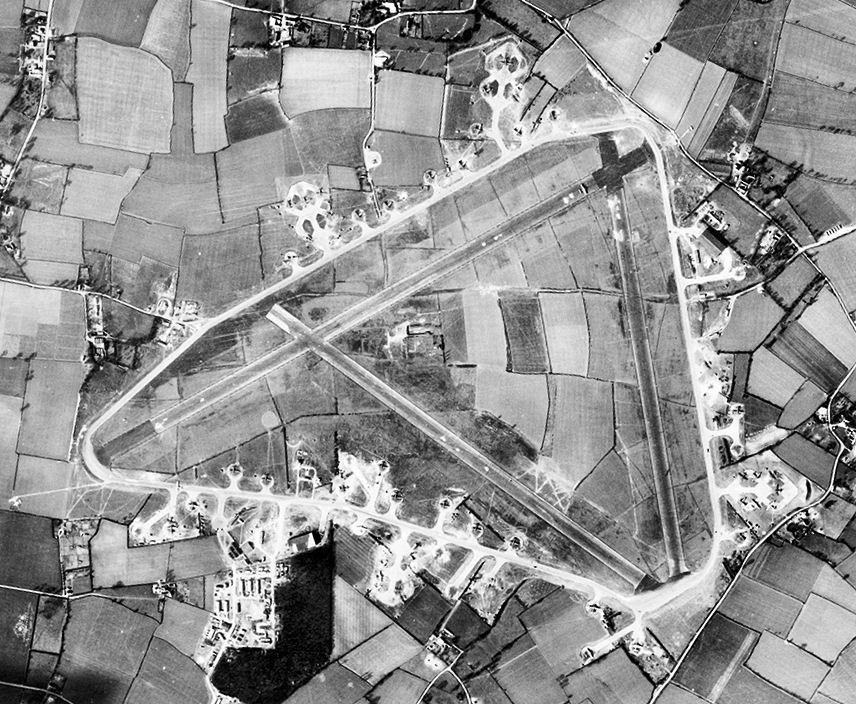
RAF Great Ashfield

Royal Air Force Great Ashfield or more simply RAF Great Ashfield is a former Royal Air Force station located 10 miles (16 km) east of Bury St. Edmunds...

Nearby Amenities

Located within 500m of 52.237319,0.945374
Railway: crossing
Lat/Long: 52.2337784/0.9449872
Railway: crossing
Lat/Long: 52.2338109/0.9449833
The data included in this document is from www.openstreetmap.org. The data is made available under ODbL.

Have you been to Wetherden?

Leave your review of Wetherden below (or comments, questions and feedback).