Weston under Wetherley

Civil Parish in Warwickshire Warwick

England

Weston under Wetherley

The bend of Mill Lane, Cubbington Mill Lane heads downhill to the right. Ahead is the drive to a couple of either large houses or small works.
The bend of Mill Lane, Cubbington Credit: Robin Stott

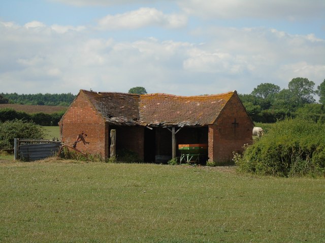
Weston under Wetherley is a civil parish located in the county of Warwickshire, England. Situated approximately 7 miles southeast of the city of Coventry, Weston under Wetherley covers an area of around 3 square miles.

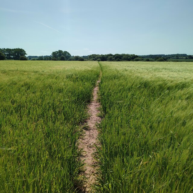
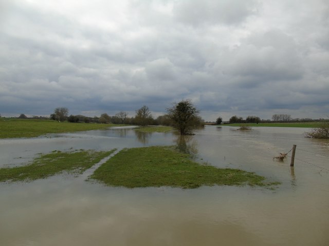
The parish is predominantly rural, characterized by picturesque countryside and agricultural land. It is home to a small population, with the 2011 census recording around 600 residents. The community is close-knit, and the parish has a charming, traditional English village feel.

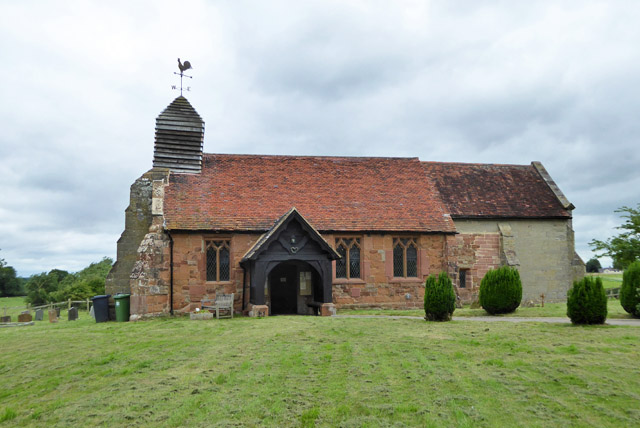
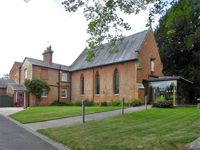
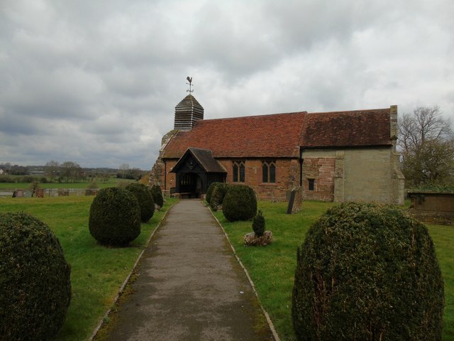
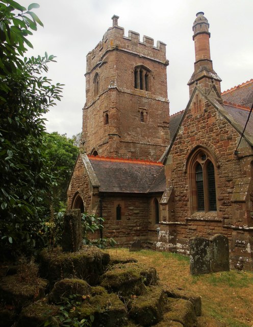
The village of Weston under Wetherley itself is centered around St. Michael's Church, a historic 12th-century building that serves as a focal point for the community. The church boasts a beautiful architecture, with elements from different periods, including Norman and Gothic styles.

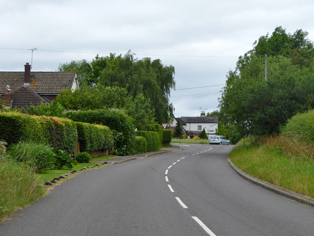
The parish also features a primary school, providing education for local children. Additionally, there are a few local businesses, including a pub and a village hall, which serves as a venue for community events and gatherings.

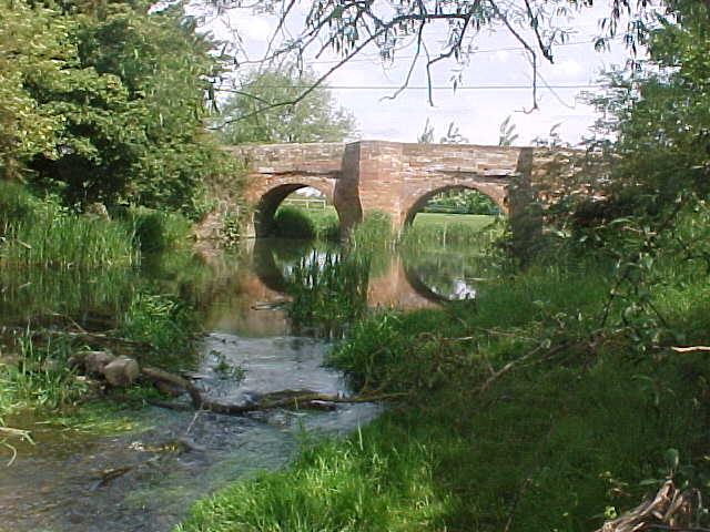
Surrounded by the Warwickshire countryside, Weston under Wetherley is a haven for nature lovers and outdoor enthusiasts. There are several walking and cycling routes in the area, offering stunning views of the surrounding landscapes.

Overall, Weston under Wetherley is a peaceful and idyllic village, offering a rural escape from the nearby urban areas. With its historic church, community spirit, and natural beauty, it is a charming destination for both residents and visitors alike.

If you have any feedback on the listing, please let us know in the comments section below.

Weston under Wetherley Images

Images are sourced within 2km of 52.320912/-1.470294 or Grid Reference SP3669. Thanks to Geograph Open Source API. All images are credited.

The bend of Mill Lane, Cubbington Mill Lane heads downhill to the right. Ahead is the drive to a couple of either large houses or small works.
The bend of Mill Lane, Cubbington
Mill Lane heads downhill to the right. Ahead is the drive to a couple of either large houses or small works.
Mill Lane climbs away from Cubbington On the left is a house near the end of The Grange. On the skyline is South Cubbington Wood – HS2 country. The mill referred to was perhaps a windmill: ahead is an exposed windy summit.
Mill Lane climbs away from Cubbington
On the left is a house near the end of The Grange. On the skyline is South Cubbington Wood – HS2 country. The mill referred to was perhaps a windmill: ahead is an exposed windy summit.
Mill Lane climbs to a summit east of Cubbington As I climbed up here it occurred to me that I was in an Arden landscape: massive hedges, tangled oaks. This is the Arden plateau's southeast corner.
Mill Lane climbs to a summit east of Cubbington
As I climbed up here it occurred to me that I was in an Arden landscape: massive hedges, tangled oaks. This is the Arden plateau's southeast corner.
New gate on Mill Lane near HS2 works The newness of the gate and the round timber post are hallmarks of HS2 accommodation works for farmers. Beyond, a diverted footpath skirts South Cubbington Wood.
New gate on Mill Lane near HS2 works
The newness of the gate and the round timber post are hallmarks of HS2 accommodation works for farmers. Beyond, a diverted footpath skirts South Cubbington Wood.
Mill Lane approaches HS2 works near South Cubbington Wood Gradually the extent and scale of the HS2 works becomes apparent.
Mill Lane approaches HS2 works near South Cubbington Wood
Gradually the extent and scale of the HS2 works becomes apparent.
HS2 enabling works near Cubbington, February 2021 (11) The footpath diversion ends at the end of the hedge; W130 returns to the village on its original line, right. HS2 will emerge from behind the trees on the right and proceed northwest roughly parallel to the edge of South Cubbington Wood.
HS2 enabling works near Cubbington, February 2021 (11)
The footpath diversion ends at the end of the hedge; W130 returns to the village on its original line, right. HS2 will emerge from behind the trees on the right and proceed northwest roughly parallel to the edge of South Cubbington Wood.
South Cubbington Wood on the skyline HS2 will sever the southwest corner of the wood: the right-hand end in this view from near Cubbington primary school. The 90 metre contour winds round the summit that South and North Cubbington Woods are on.
South Cubbington Wood on the skyline
HS2 will sever the southwest corner of the wood: the right-hand end in this view from near Cubbington primary school. The 90 metre contour winds round the summit that South and North Cubbington Woods are on.
Footpath to the River Leam
Bridge over the River Leam
Hunningham church St. Margaret's is a grade II listed building.
Hunningham church
St. Margaret's is a grade II listed building.
Outskirts of Weston under Wetherley Most of the village is off to the left at the junction ahead.
Outskirts of Weston under Wetherley
Most of the village is off to the left at the junction ahead.
Wappenbury Roman Catholic church St. Anne's is administered by the Missionaries of the Sacred Heart, I think it says on the glass porch.
Wappenbury Roman Catholic church
St. Anne's is administered by the Missionaries of the Sacred Heart, I think it says on the glass porch.
Hunningham Church
Hunningham Church
River Leam at Hunningham In flood, Easter 2018.
River Leam at Hunningham
In flood, Easter 2018.
Wappenbury Church
Wappenbury Church
Farm Building
Farm Building
River Leam
River Leam
Footbridge across the Leam
Show me another place!

Weston under Wetherley is located at Grid Ref: SP3669 (Lat: 52.320912, Lng: -1.470294)

Administrative County: Warwickshire

District: Warwick

Police Authority: Warwickshire

What 3 Words

///buns.landlords.shall. Near Royal Leamington Spa, Warwickshire

Related Wikis

Weston under Wetherley

Weston under Wetherley, often known by locals as just Weston, is a small village and civil parish in Warwickshire, England. It is on the B4453, 4 miles...

Cubbington Pear Tree

The Cubbington Pear Tree was a wild pear tree located near Cubbington in Warwickshire, England. Around 250 years old, it was the second largest wild pear...

Wappenbury

Wappenbury is a small village and civil parish in the English county of Warwickshire. Located on the north bank of the River Leam Wappenbury is almost...

Hunningham

Hunningham is a small village and civil parish in Warwickshire, England. It is 3 miles to the north-east of Leamington Spa, within the Radford Semele ward...

Related Videos

Walking Shakespeare’s Avon Way - Stage 4 - Wolston to Cubbingbton

Stage 4 of this walk saw us leave beautiful Wolston through woods and into areas which have been used for quarrying. The path ...

lavender💜 #lavender #weekend #flowers #farm #warwickshire #sun #fun #coventry #couplegoals #travel

lavender #weekend #flowers #farm #warwickshire #sun #fun #coventrycity #couplegoals #travelphotography.

The Millennium Way - Long Itchington to Offchurch

Stage 4 of our Millennium Way adventures on Day Walks. Every trail provides a rough day or two. This was one of them and it ...

Nearby Amenities

Located within 500m of 52.320912,-1.470294
Bus Stop
St. Michaels Close
Bus: yes
Naptan AtcoCode: 4200F076900
Naptan Bearing: E
Naptan CommonName: St. Michaels Close
Naptan Indicator: Adj
Naptan NaptanCode: wardgtap
Naptan Street: Rugby Road
Naptan Verified: no
Public Transport: platform
Source: naptan_import
Lat/Long: 52.3206607/-1.4696796
Bus Stop
Bus Shelter
Bus: yes
Naptan AtcoCode: 4200F077000
Naptan Bearing: W
Naptan CommonName: Bus Shelter
Naptan Indicator: Adj
Naptan NaptanCode: wardgtat
Naptan Street: Rugby Road
Naptan Verified: no
Public Transport: platform
Source: naptan_import
Lat/Long: 52.3205356/-1.4696541
Weston under Wetherley
Place: village
Wikidata: Q7989496
Wikipedia: en:Weston under Wetherley
Lat/Long: 52.3198823/-1.4681239
Barrier: kissing_gate
Lat/Long: 52.3168654/-1.4677909
Barrier: kissing_gate
Lat/Long: 52.3186134/-1.4732255
Barrier: kissing_gate
Lat/Long: 52.3189325/-1.4705548
Post Box
Brand: Royal Mail
Brand Wikidata: Q638098
Collection Times: Mo-Fr 16:15; Sa 07:00
Operator: Royal Mail
Operator Wikidata: Q638098
Post Box Type: lamp
Ref: CV33 72
Royal Cypher: EIIR
Royal Cypher Wikidata: Q33102113
Source: survey
Lat/Long: 52.3206883/-1.4701344
Defibrillator
Emergency: defibrillator
Ref: AG05
Source: survey
Lat/Long: 52.3208018/-1.4644712
Bench
Backrest: yes
Lat/Long: 52.3207038/-1.4642721
Generator Method: photovoltaic
Generator Output Electricity: yes
Generator Source: solar
Generator Type: solar_photovoltaic_panel
Location: roof
Power: generator
Lat/Long: 52.3212043/-1.4699994
Generator Method: photovoltaic
Generator Output Electricity: yes
Generator Source: solar
Generator Type: solar_photovoltaic_panel
Location: roof
Power: generator
Lat/Long: 52.3209977/-1.4694925
Generator Method: photovoltaic
Generator Output Electricity: yes
Generator Source: solar
Generator Type: solar_photovoltaic_panel
Location: roof
Power: generator
Lat/Long: 52.3212699/-1.4694361
Generator Method: photovoltaic
Generator Output Electricity: yes
Generator Source: solar
Generator Type: solar_photovoltaic_panel
Location: roof
Power: generator
Lat/Long: 52.32126/-1.4691089
Generator Method: photovoltaic
Generator Output Electricity: yes
Generator Source: solar
Generator Type: solar_photovoltaic_panel
Location: roof
Power: generator
Lat/Long: 52.3208108/-1.4689292
The data included in this document is from www.openstreetmap.org. The data is made available under ODbL.

Have you been to Weston under Wetherley?

Leave your review of Weston under Wetherley below (or comments, questions and feedback).