West Wycombe
Civil Parish in Buckinghamshire
England
West Wycombe

West Wycombe is a civil parish located in the county of Buckinghamshire, England. Situated in the Chiltern Hills, it is approximately 30 miles west of London. The parish encompasses the village of West Wycombe, as well as the nearby hamlets of Bradenham and Wheeler End.
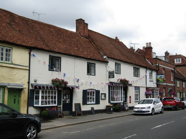
The village of West Wycombe is known for its picturesque setting, with charming cottages and historic buildings. It is home to the iconic West Wycombe Park, a Palladian mansion that dates back to the 18th century. The park boasts extensive gardens and parkland, offering visitors a tranquil and scenic retreat. Additionally, the village features St. Lawrence's Church, an elegant 18th-century structure that stands as a testament to the area's rich architectural heritage.
West Wycombe is also renowned for its distinctive landmark, the Hell-Fire Caves. These man-made caves were excavated in the 18th century and were used as a meeting place for the Hellfire Club, a notorious secret society. Today, the caves are open to the public and provide a fascinating insight into the area's intriguing history.
The civil parish of West Wycombe is a vibrant community, with a range of amenities including shops, pubs, and schools. The area is well-connected, with good transport links to nearby towns and cities. The surrounding countryside offers ample opportunities for outdoor activities, including walking, cycling, and horse riding.
Overall, West Wycombe is a charming and historically significant civil parish, offering a blend of natural beauty, cultural heritage, and a thriving community atmosphere.
If you have any feedback on the listing, please let us know in the comments section below.
West Wycombe Images
Images are sourced within 2km of 51.645639/-0.802207 or Grid Reference SU8294. Thanks to Geograph Open Source API. All images are credited.


West Wycombe is located at Grid Ref: SU8294 (Lat: 51.645639, Lng: -0.802207)
Unitary Authority: Buckinghamshire
Police Authority: Thames Valley
What 3 Words
///metals.newest.glue. Near High Wycombe, Buckinghamshire
Nearby Locations
Related Wikis
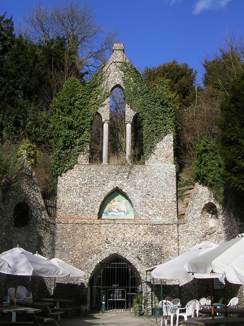
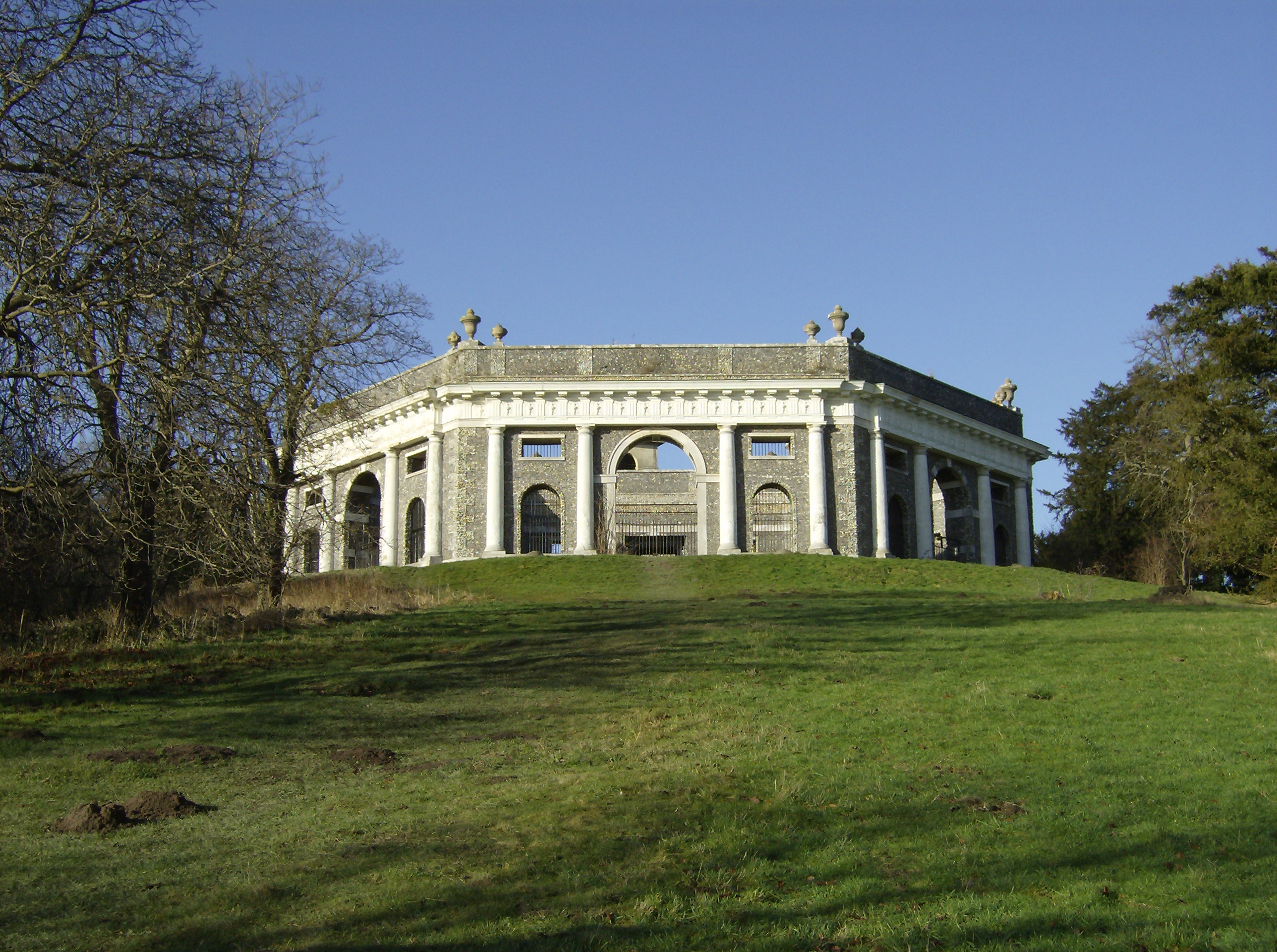
Hellfire Caves
The Hellfire Caves (also known as the West Wycombe Caves) are a network of man-made chalk and flint caverns which extend 260m underground. They are situated...
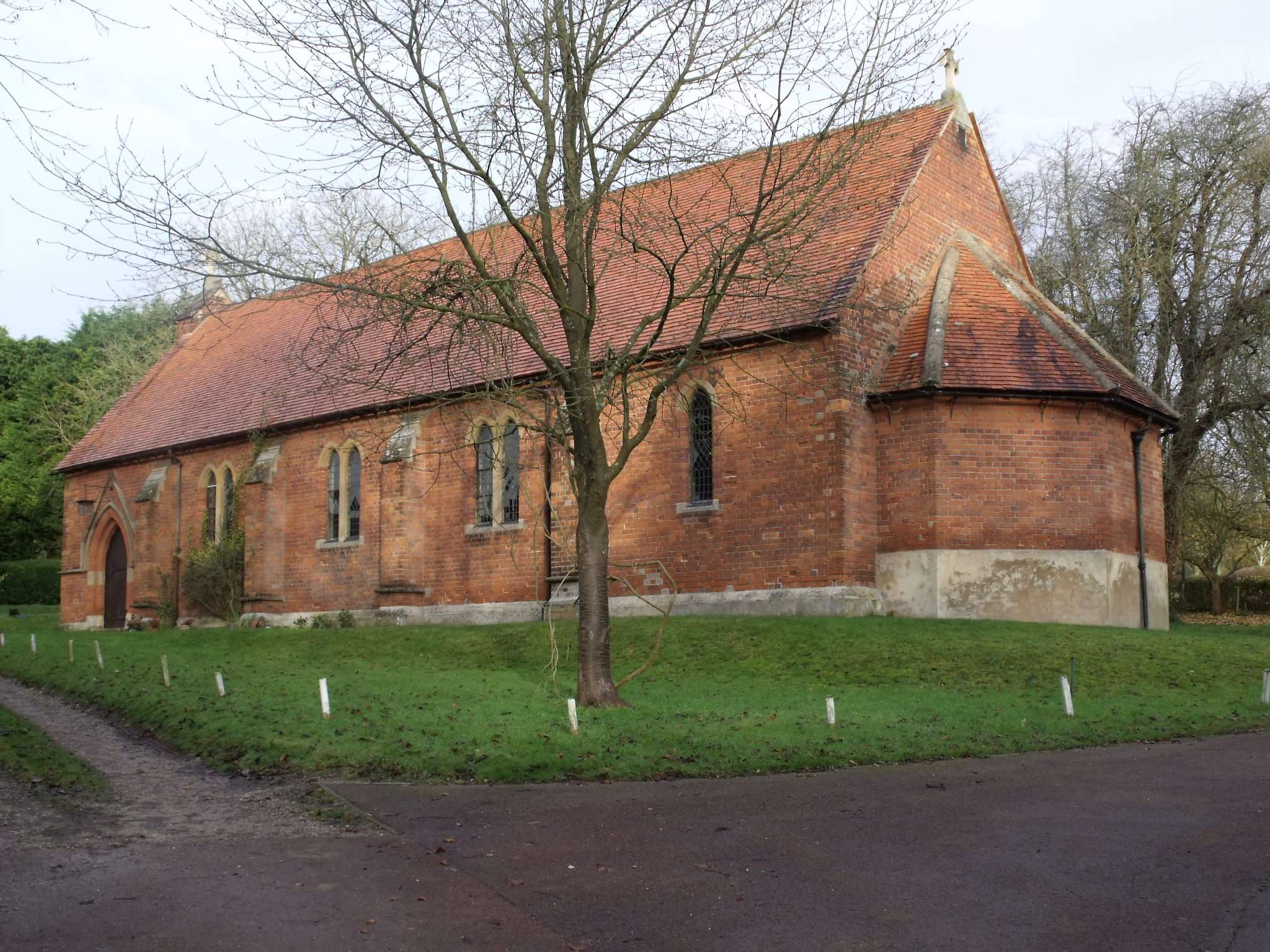
St Paul's Church, West Wycombe
St. Paul's Church, in High Street, West Wycombe, England, is one of two Anglican churches in the village. St. Paul's was built by Lady Elizabeth Dashwood...
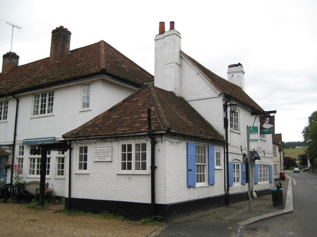
The Swan, West Wycombe
The Swan is a Grade II listed pub at High Street, West Wycombe, Buckinghamshire.It is on the Campaign for Real Ale's National Inventory of Historic Pub...
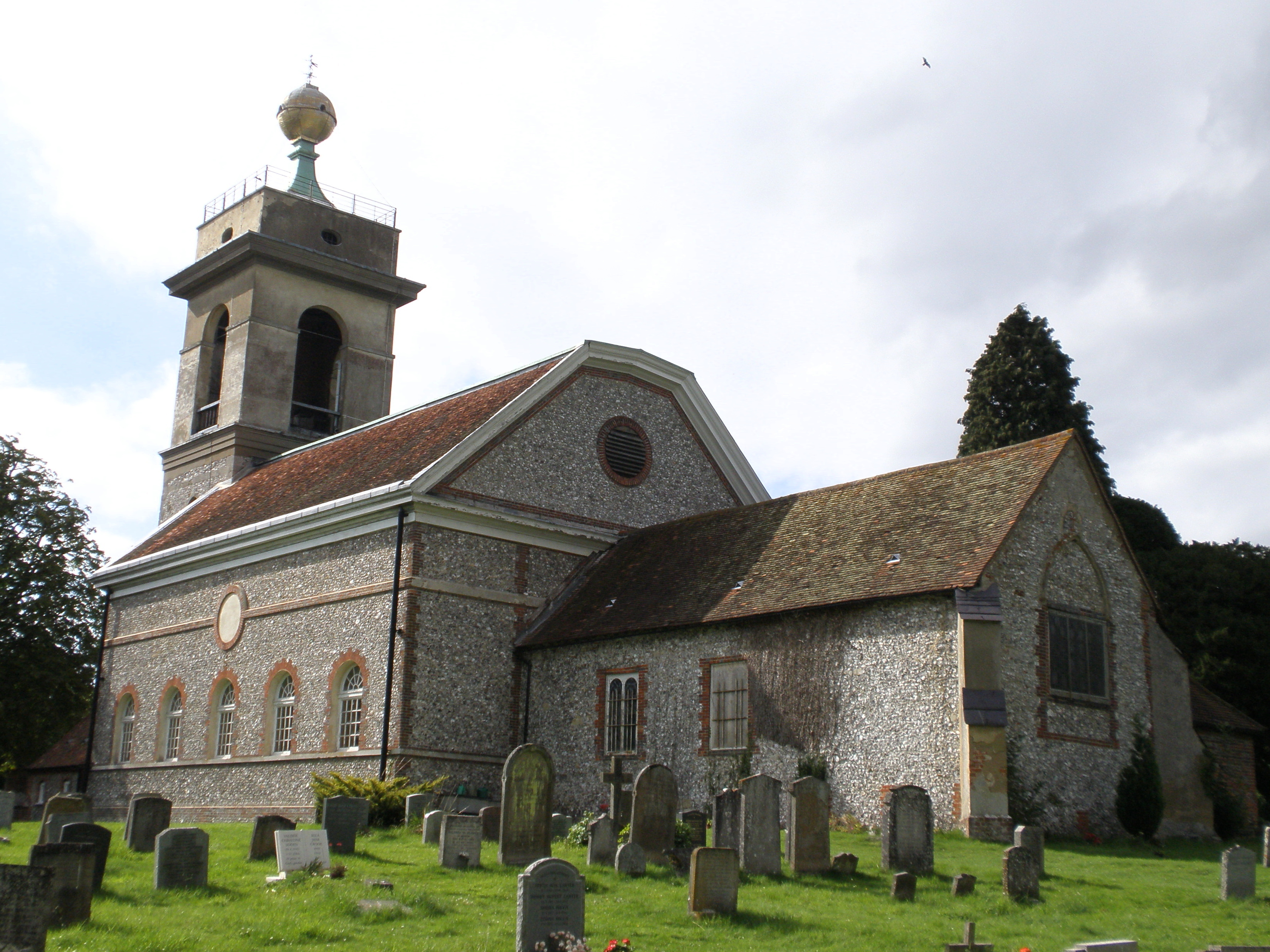
St Lawrence's Church, West Wycombe
St Lawrence's Church is a Church of England church in the parish of West Wycombe, Buckinghamshire, England. It sits on top of West Wycombe Hill in a prominent...
West Wycombe
West Wycombe is a small village famed for its manor houses and its hills. It is three miles west of High Wycombe, Buckinghamshire, England. The historic...
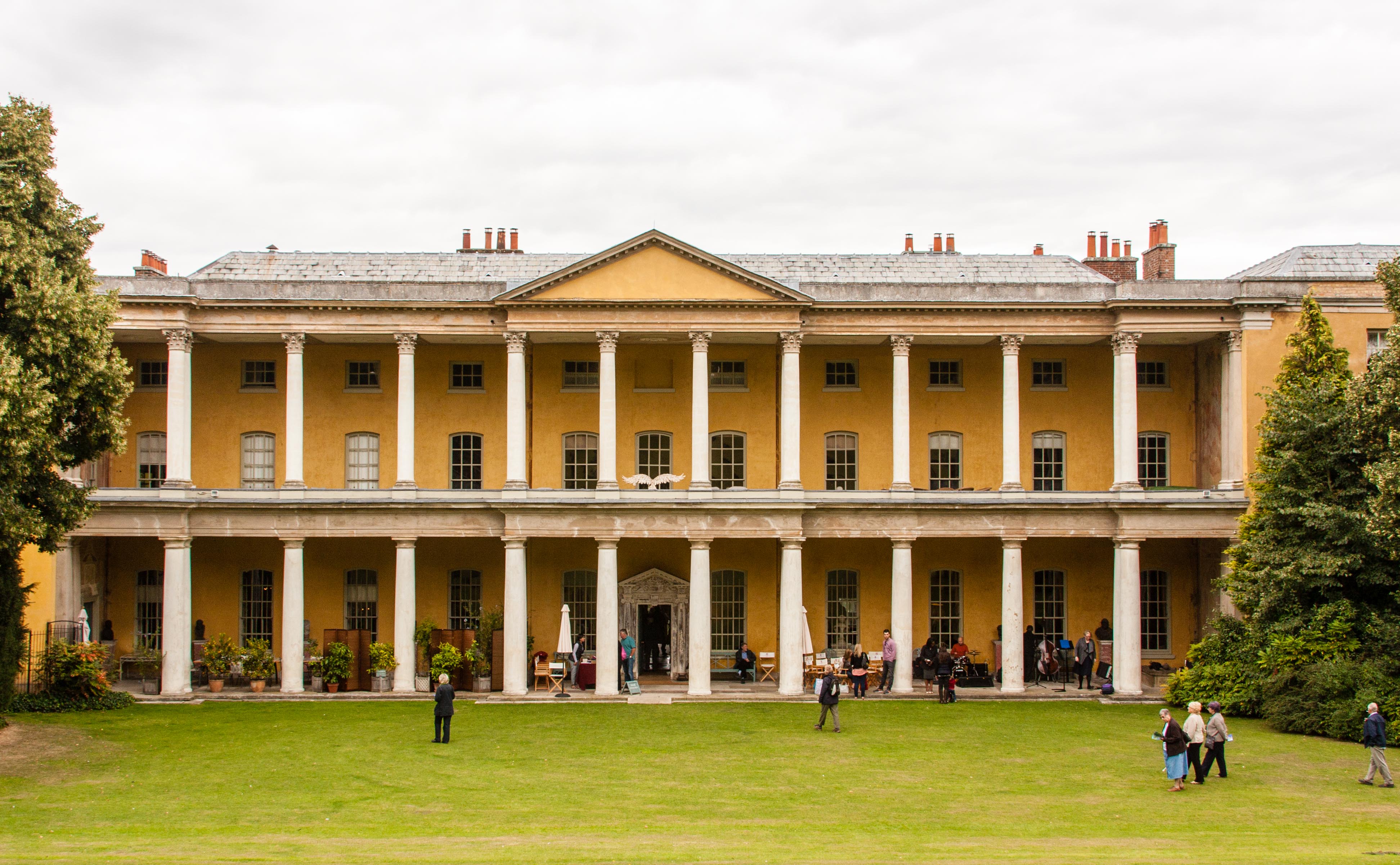
West Wycombe Park
West Wycombe Park is a country house built between 1740 and 1800 near the village of West Wycombe in Buckinghamshire, England. It was conceived as a pleasure...

West Wycombe railway station
West Wycombe railway station was a railway station that served the village of West Wycombe, Buckinghamshire Situated about 1⁄2 mile (0.80 km) east of...
Wycombe District
Wycombe District was a local government district in Buckinghamshire in south-central England. Its council was based in the town of High Wycombe. The district...
Nearby Amenities
Located within 500m of 51.645639,-0.802207Have you been to West Wycombe?
Leave your review of West Wycombe below (or comments, questions and feedback).