West Deeping

Civil Parish in Lincolnshire South Kesteven

England

West Deeping

Tallington Lakes from a boat A different view of the lakes.
Tallington Lakes from a boat Credit: Grant Baker

West Deeping is a civil parish located in South Kesteven district of Lincolnshire, England. Situated approximately eight miles southwest of Stamford and 11 miles northwest of Peterborough, it covers an area of around 5.3 square miles.

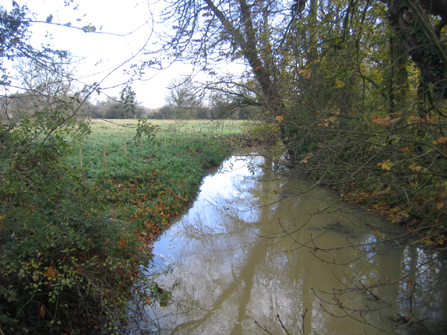
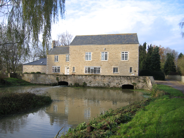
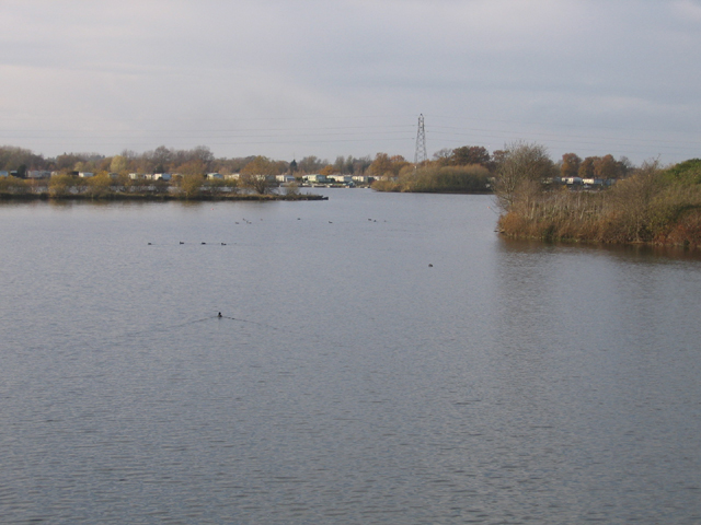
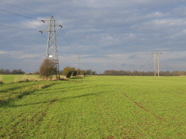
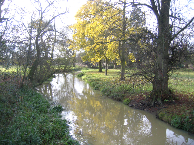
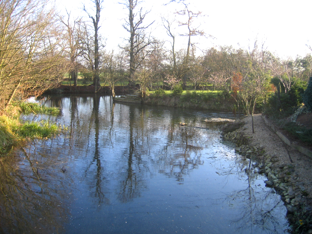
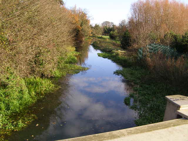
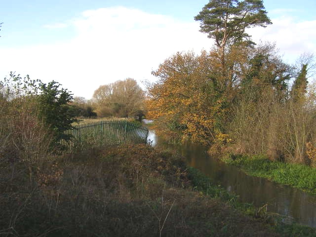
The parish is primarily a rural area, characterized by its picturesque countryside and charming village setting. It is bordered by the River Welland to the east, offering scenic views and opportunities for outdoor activities such as fishing and boating. The landscape is predominantly flat, with a mix of agricultural fields, meadows, and woodland.

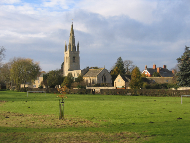
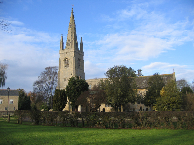
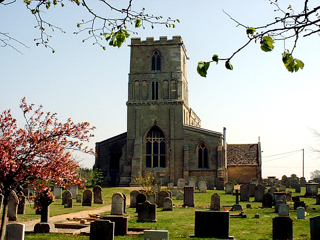
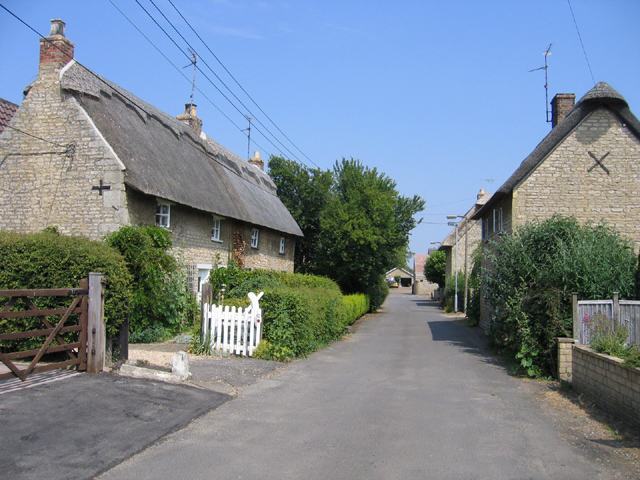
The village itself is small, with a population of around 400 people. It has a close-knit community feel and is known for its historic buildings and traditional architecture. The centerpiece of the village is St. Andrew's Church, a Grade I listed building dating back to the 12th century. The church features a distinctive tower and is a prominent landmark in the area.

West Deeping also benefits from its proximity to nearby towns and cities, providing residents with access to a range of amenities and services. The village has a primary school, a village hall, and a pub, which serves as a popular gathering spot for locals.

Overall, West Deeping offers a tranquil and idyllic setting, making it an attractive place to reside for those seeking a peaceful rural lifestyle within easy reach of urban conveniences.

If you have any feedback on the listing, please let us know in the comments section below.

West Deeping Images

Images are sourced within 2km of 52.67212/-0.350945 or Grid Reference TF1109. Thanks to Geograph Open Source API. All images are credited.

Tallington Lakes from a boat A different view of the lakes.
Tallington Lakes from a boat
A different view of the lakes.
Distributary of the River Welland – view E near the Lincs–Peterborough border.
Distributary of the River Welland
– view E near the Lincs–Peterborough border.
West Deeping parish church, Lincs – view from King Street Roman Road across the meadows of the River Welland.
West Deeping parish church, Lincs
– view from King Street Roman Road across the meadows of the River Welland.
The Mill, West Deeping, Lincs – built in the early 19th century although there was a water mill on this site for many centuries previously.
The Mill, West Deeping, Lincs
– built in the early 19th century although there was a water mill on this site for many centuries previously.
West Deeping parish church, Lincs The church is dedicated to St Andrew and tower and spire were probably built around 1370; restored in 1874–77.
West Deeping parish church, Lincs
The church is dedicated to St Andrew and tower and spire were probably built around 1370; restored in 1874–77.
Tallington Lakes, Lincs View W of the water-filled gravel pits with leisure development along the far bank.
Tallington Lakes, Lincs
View W of the water-filled gravel pits with leisure development along the far bank.
Farmland north of West Deeping, Lincs – view N through 'Middle Field'.
Farmland north of West Deeping, Lincs
– view N through 'Middle Field'.
Electricity sub-station, West Deeping, Lincs
River Welland mill stream, Lolham, Peterborough – view W towards Lolham Mill.
River Welland mill stream, Lolham, Peterborough
– view W towards Lolham Mill.
River scene, Market Deeping, Lincs Landscaped gardens beside a branch of the River Welland; view SE from the A16 bridge.
River scene, Market Deeping, Lincs
Landscaped gardens beside a branch of the River Welland; view SE from the A16 bridge.
Maxey Church Maxey is a quiet village between Stamford & Peterborough. St Peter's Church has a long history, with the earliest part of the building dated to about 1113. Evidence suggests that the first Vicar was instituted in 1191.
Maxey Church
Maxey is a quiet village between Stamford & Peterborough. St Peter's Church has a long history, with the earliest part of the building dated to about 1113. Evidence suggests that the first Vicar was instituted in 1191.
School Lane, Maxey, Peterborough
Village sign, Maxey, Peterborough at the junction of School Lane and High Street.
Village sign, Maxey, Peterborough
at the junction of School Lane and High Street.
Village sign detail, Maxey, Peterborough depicting the ancient church of St Peter, agriculture and the arms of three landowners - de la Mare, Beaufort and de Torpel.
Village sign detail, Maxey, Peterborough
depicting the ancient church of St Peter, agriculture and the arms of three landowners - de la Mare, Beaufort and de Torpel.
Maxey Mill Maxey Mill is still in use -- milling animal feeds. The Mill pond sluice passes under the mill. A couple of ancient mill stones are propped up against the rear wall, perhaps as a reminder of how grain was ground into flour in the past.
Maxey Mill
Maxey Mill is still in use -- milling animal feeds. The Mill pond sluice passes under the mill. A couple of ancient mill stones are propped up against the rear wall, perhaps as a reminder of how grain was ground into flour in the past.
Maxey Church View of Maxey Church from the footpath which passes the entrance to Lake Lodge.
Maxey Church
View of Maxey Church from the footpath which passes the entrance to Lake Lodge.
River Welland from the A15 bridge This view is looking east from the modern bridge over the River Welland close to the roundabout where the A15 and A16 intersect: Market Deeping bypass.
River Welland from the A15 bridge
This view is looking east from the modern bridge over the River Welland close to the roundabout where the A15 and A16 intersect: Market Deeping bypass.
River Welland from A15 bridge The presently sluggish River Welland as seen from the A15 roadbridge, looking west.
River Welland from A15 bridge
The presently sluggish River Welland as seen from the A15 roadbridge, looking west.
Show me another place!

West Deeping is located at Grid Ref: TF1109 (Lat: 52.67212, Lng: -0.350945)

Administrative County: Lincolnshire

District: South Kesteven

Police Authority: Lincolnshire

What 3 Words

///mankind.recur.crashing. Near Market Deeping, Lincolnshire

Nearby Locations

East Field West Deeping

Related Wikis

West Deeping

West Deeping is a village and civil parish in the South Kesteven district of Lincolnshire, England. The population of the civil parish at the 2011 census...

Maxey Castle

Maxey Castle was a medieval fortified manor house castle in Maxey, Cambridgeshire, England. == Details == Maxey Castle was built around the 1370s by William...

Maxey, Cambridgeshire

Maxey is a village in the Peterborough unitary authority, in the ceremonial county of Cambridgeshire, England, located between Peterborough and Stamford...

Lolham

Lolham is a hamlet in the City of Peterborough in England, located between Peterborough and Stamford on the border of Cambridgeshire and Lincolnshire....

Nearby Amenities

Located within 500m of 52.67212,-0.350945
Parking
Parking: layby
Lat/Long: 52.671155/-0.3556662
First Field
Place: locality
Source: Bing
Lat/Long: 52.6736765/-0.3506708
Middle Field
Place: locality
Source: Bing
Lat/Long: 52.6752503/-0.3551175
Lammas Close
Place: locality
Source: Bing
Lat/Long: 52.6698464/-0.3517676
Crossing
Crossing: unmarked
Crossing Markings: no
Kerb: lowered
Source: Bing
Lat/Long: 52.6708215/-0.3572951
Waste Basket
Lat/Long: 52.6711784/-0.3556063
Waste Basket
Lat/Long: 52.6712067/-0.354811
Power: pole
Lat/Long: 52.6718681/-0.3561209
Power: pole
Lat/Long: 52.6717153/-0.3560646
Power: pole
Lat/Long: 52.6712634/-0.3556603
Power: pole
Lat/Long: 52.6712661/-0.3544039
Power: pole
Lat/Long: 52.6712496/-0.3530173
Power: pole
Lat/Long: 52.6712546/-0.3516701
Power: pole
Lat/Long: 52.6712546/-0.3505153
Power: pole
Lat/Long: 52.6712293/-0.3487999
Power: pole
Lat/Long: 52.6710694/-0.347507
Power: pole
Lat/Long: 52.6708842/-0.3462435
Power: pole
Lat/Long: 52.6706762/-0.3446369
Crossing
Lat/Long: 52.671312/-0.3513358
Crossing
Lat/Long: 52.6722012/-0.3478241
Power: pole
Lat/Long: 52.6695762/-0.3562012
Power: pole
Lat/Long: 52.6686399/-0.3555894
Power: pole
Lat/Long: 52.6703882/-0.356695
The data included in this document is from www.openstreetmap.org. The data is made available under ODbL.

Have you been to West Deeping?

Leave your review of West Deeping below (or comments, questions and feedback).