Bucklebury Alley

Settlement in Berkshire

England

Bucklebury Alley

Track and farmland, Shaw Oil-seed rape, oaks and a cereal crop beside the byway connecting Long Lane and the western end of Curridge.
Track and farmland, Shaw Credit: Andrew Smith

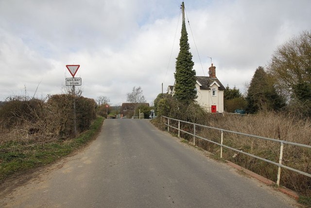
Bucklebury Alley is a charming village located in the county of Berkshire, England. Situated in the heart of the picturesque Berkshire countryside, it is surrounded by rolling hills, lush green fields, and quaint cottages. The village is nestled on the banks of the River Pang, offering stunning views and a tranquil atmosphere.

The history of Bucklebury Alley dates back centuries, with evidence of human habitation in the area since the prehistoric era. The village itself is characterized by its narrow, winding streets, lined with historic buildings and traditional thatched cottages. These buildings showcase architectural styles from various periods, including Tudor, Georgian, and Victorian.

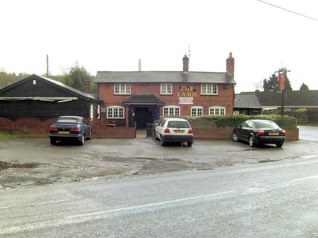
The village is known for its strong sense of community and friendly atmosphere. It boasts a range of amenities, including a local pub, a village hall, a primary school, and a post office. The village also hosts several annual events, such as the Bucklebury Beer Festival and the Bucklebury Summer Fete, which attract both locals and visitors.

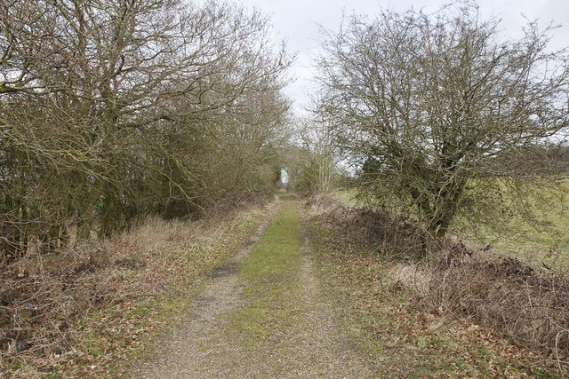
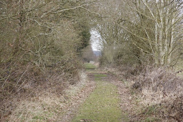
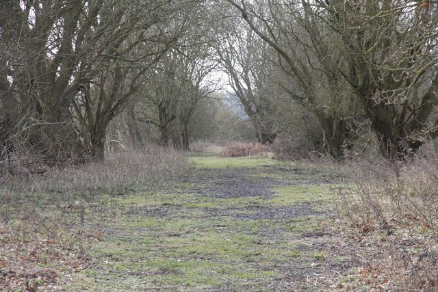
Nature enthusiasts will find plenty to explore in Bucklebury Alley, as it is surrounded by beautiful countryside and offers numerous walking and cycling trails. The nearby Bucklebury Farm Park is a popular attraction, offering visitors the opportunity to interact with farm animals and enjoy various outdoor activities.

Overall, Bucklebury Alley is a delightful village that preserves its historical charm while embracing modern amenities. Its stunning natural surroundings, strong community spirit, and range of attractions make it a truly idyllic place to visit or call home.

If you have any feedback on the listing, please let us know in the comments section below.

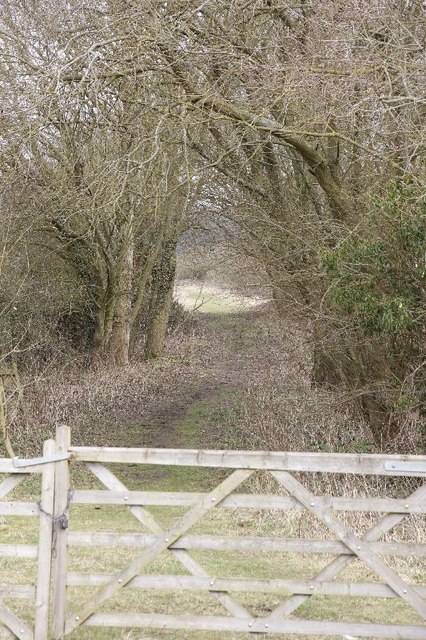
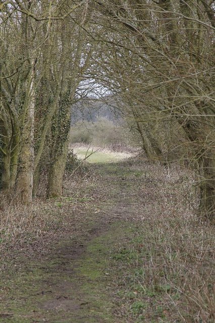
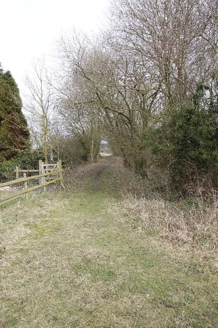
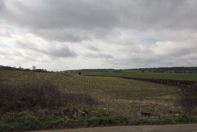
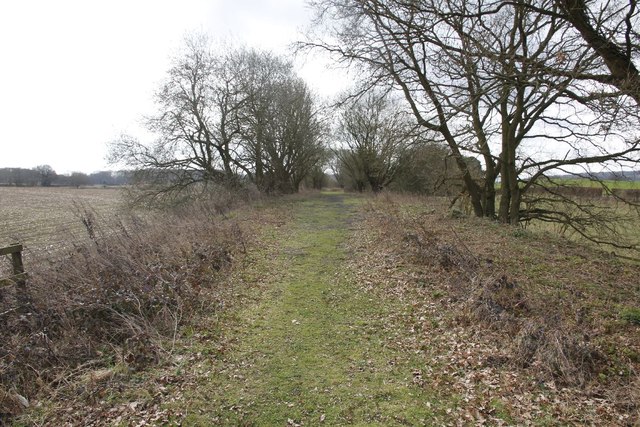
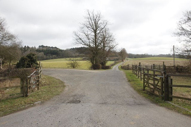
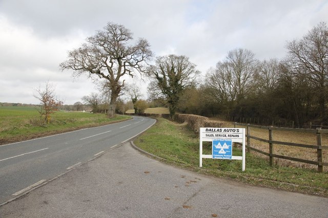
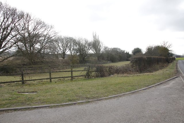
Bucklebury Alley Images

Images are sourced within 2km of 51.42672/-1.2678469 or Grid Reference SU5170. Thanks to Geograph Open Source API. All images are credited.

Track and farmland, Shaw Oil-seed rape, oaks and a cereal crop beside the byway connecting Long Lane and the western end of Curridge.
Track and farmland, Shaw
Oil-seed rape, oaks and a cereal crop beside the byway connecting Long Lane and the western end of Curridge.
Passing by the road View up towards where the old Didcot,Newbury and Southampton went near Craven Farm
Passing by the road
View up towards where the old Didcot,Newbury and Southampton went near Craven Farm
Along the line View along the old Didcot, Newbury and Southampton Railway near Craven Farm. The railway has almost been erased in farmland just past the trees to the left.
Along the line
View along the old Didcot, Newbury and Southampton Railway near Craven Farm. The railway has almost been erased in farmland just past the trees to the left.
Hedge by the road Here you can see that the old Didcot to Newbury railway (on the right) ran not far from the B4009.
Hedge by the road
Here you can see that the old Didcot to Newbury railway (on the right) ran not far from the B4009.
Gate at Fishers Lane This is where the Didcot Newbury and Southampton railway used to run at Fishers Lane crossing towards Hermitage, the land is now privately owned.
Gate at Fishers Lane
This is where the Didcot Newbury and Southampton railway used to run at Fishers Lane crossing towards Hermitage, the land is now privately owned.
Further down the track A zoomed shot of further along the track bed from the Didcot, Newbury and Southampton railway at Fishers Crossing.
Further down the track
A zoomed shot of further along the track bed from the Didcot, Newbury and Southampton railway at Fishers Crossing.
Gate in the fence The fence of a property bordering the old Didcot, Newbury and Southampton railway. The property was part of the gatekeeper's cottage.
Gate in the fence
The fence of a property bordering the old Didcot, Newbury and Southampton railway. The property was part of the gatekeeper's cottage.
Railway towards Newbury The view from Fishers lane crossing in the Newbury direction, looking here you would not realise the Didcot, Newbury and Southampton railway was here.
Railway towards Newbury
The view from Fishers lane crossing in the Newbury direction, looking here you would not realise the Didcot, Newbury and Southampton railway was here.
Towards the crossing View towards Fishers lane crossing, part of the old Didcot,Newbury and Southampton railway. The crossing is about where the rise is and to the right would have been the crossing signal box. The building in the distance was the crossing operatives house.
Towards the crossing
View towards Fishers lane crossing, part of the old Didcot,Newbury and Southampton railway. The crossing is about where the rise is and to the right would have been the crossing signal box. The building in the distance was the crossing operatives house.
In the hedge Had a quick look round for any signs of the railway and came across a piece of line, no doubt used in the fencing beside the crossing.
In the hedge
Had a quick look round for any signs of the railway and came across a piece of line, no doubt used in the fencing beside the crossing.
Line near Cold Ash Farm This is the remains of the line near Cold Ash Farm.
Line near Cold Ash Farm
This is the remains of the line near Cold Ash Farm.
Track at Cold Ash Farm Zooming in with the camera shows the track bed is still there and clear.
Track at Cold Ash Farm
Zooming in with the camera shows the track bed is still there and clear.
Towards Fishers lane Zoomed in view of the line looking towards Fishers Lane crossing from near Cold Ash farm
Towards Fishers lane
Zoomed in view of the line looking towards Fishers Lane crossing from near Cold Ash farm
Line towards Fishers lane Viewiof the trackbed looking towards Fishers Lane crossing from near Cold Ash Farm.
Line towards Fishers lane
Viewiof the trackbed looking towards Fishers Lane crossing from near Cold Ash Farm.
Cold Ash Farm Crossing Think this world have been a farm crossing for Cold Ash Farm along the former Didcot, Newbury and Southampton Railway.
Cold Ash Farm Crossing
Think this world have been a farm crossing for Cold Ash Farm along the former Didcot, Newbury and Southampton Railway.
Dallas Autos The sign stands at the entrance to Cold Ash Farm as we look towards Hermitage along the B4009.
Dallas Autos
The sign stands at the entrance to Cold Ash Farm as we look towards Hermitage along the B4009.
From the entrance View of the former Didcot, Newbury and Southampton railway as it heads off on the left towards Fishers Lane crossing. The B4009 can just be seen on the right.
From the entrance
View of the former Didcot, Newbury and Southampton railway as it heads off on the left towards Fishers Lane crossing. The B4009 can just be seen on the right.
The Lamb Inn Another country pub trying to curry favour.
The Lamb Inn
Another country pub trying to curry favour.
Show me another place!

Bucklebury Alley is located at Grid Ref: SU5170 (Lat: 51.42672, Lng: -1.2678469)

Unitary Authority: West Berkshire

Police Authority: Thames Valley

What 3 Words

///unveils.trickling.happen. Near Cold Ash, Berkshire

Related Wikis

Cold Ash

Cold Ash is a village and civil parish in West Berkshire centred 1 mile (1.6 km) from Thatcham and 2.5 miles (4 km) northeast of Newbury. == Geography... ==

Ashmore Green

Ashmore Green is a small hamlet in Berkshire, England. It is situated just to the west of the village of Cold Ash and to the north of Thatcham in the West...
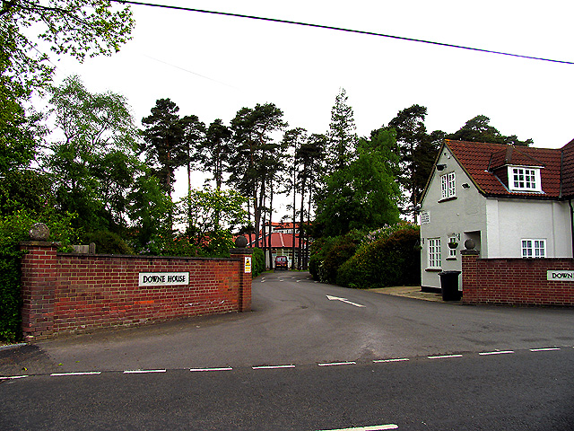
Downe House School

Downe House School is a selective independent girls' boarding and day school in Cold Ash, a village near Newbury, Berkshire, for girls aged 11–18.The Good...

Order of Silence

The Order of Silence (also known as The White Ladies) was a small Christian community based in Cold Ash, Berkshire between 1912 and 1921.Members of the...

Cold Ash Quarry

Cold Ash Quarry is a 0.4-hectare (0.99-acre) geological Site of Special Scientific Interest north of Newbury in Berkshire. It is a Geological Conservation...

Grimsbury Castle

Grimsbury Castle is an Iron Age "multiple enclosure" Hill Fort comprising a large circular encampment situated on a high hill. It is situated within Grimsbury...

Thatcham

Thatcham is a market town and civil parish in the West Berkshire unitary area of the county of Berkshire, England. It is 3 miles (4.8 km) east of Newbury...

Curridge

Curridge is a village in the civil parish of Chieveley in the English county of Berkshire. == Geography == Curridge is located in the south-east of the...

Related Videos

Berkshire 3.3 mile circular walk: Cold Ash

Cold Ash Village & Copse - 3.3 mile circular walk Guided Walk: ...

My walk for cancer research

Please support me by - join me walking https://www.facebook.com/maria.muha.1 - donate ...

Nearby Amenities

Located within 500m of 51.42672,-1.2678469
Cold Ash
Created By: Potlatch 0.9c
Place: village
Wikidata: Q2182890
Lat/Long: 51.4249842/-1.2623226
Turning Circle
Lat/Long: 51.4297057/-1.2670188
Defibrillator
Emergency: defibrillator
Indoor: no
Opening Hours: 24/7
Lat/Long: 51.4296869/-1.2687928
Entrance: yes
Wheelchair: yes
Lat/Long: 51.4300225/-1.2680761
Entrance: yes
Lat/Long: 51.4298834/-1.2682804
Entrance: yes
Lat/Long: 51.4297296/-1.2687006
The data included in this document is from www.openstreetmap.org. The data is made available under ODbL.

Have you been to Bucklebury Alley?

Leave your review of Bucklebury Alley below (or comments, questions and feedback).