Watford
Civil Parish in Northamptonshire
England
Watford

Watford is a civil parish located in the county of Northamptonshire, England. Situated approximately 10 miles northwest of the county town of Northampton, it covers an area of about 1,100 acres. The parish is primarily rural, with a small population of around 300 residents.
The village of Watford is surrounded by picturesque countryside and offers a tranquil setting for those seeking a peaceful retreat from the hustle and bustle of city life. The landscape is characterized by rolling hills, meandering streams, and charming woodland areas, providing ample opportunities for outdoor activities such as walking, cycling, and horse riding.
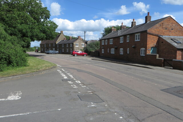
The village itself is small but boasts a rich history, with evidence of human settlement dating back to the Roman period. The architecture in Watford reflects its long-standing heritage, with a variety of Tudor and Georgian buildings adding to its charm.
Despite its rural setting, Watford is well-connected to nearby towns and cities. The A5 road runs close to the village, providing easy access to the wider road network, including the M1 motorway. The nearby town of Weedon Bec offers a range of amenities, including shops, schools, and healthcare facilities.
Overall, Watford is a picturesque and peaceful civil parish that offers a tight-knit community, beautiful countryside, and easy access to nearby towns and cities. It is an ideal location for those seeking a rural lifestyle while remaining within reach of urban conveniences.
If you have any feedback on the listing, please let us know in the comments section below.
Watford Images
Images are sourced within 2km of 52.321543/-1.111174 or Grid Reference SP6069. Thanks to Geograph Open Source API. All images are credited.


Watford is located at Grid Ref: SP6069 (Lat: 52.321543, Lng: -1.111174)
Unitary Authority: West Northamptonshire
Police Authority: Northamptonshire
What 3 Words
///plunge.pebbles.reporters. Near Long Buckby, Northamptonshire
Nearby Locations
Related Wikis
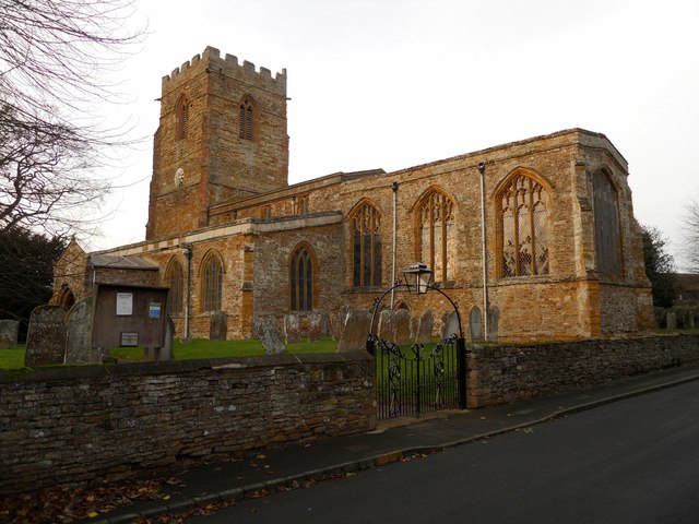
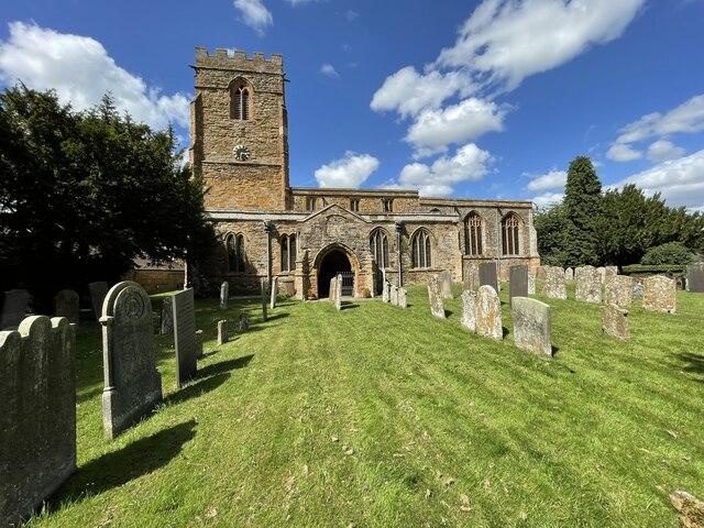
St Peter & St Paul's Church, Watford
St Peter & St Paul's Church is an Anglican Church and the parish church of Watford, Northamptonshire. It is a Grade I listed building and stands on the...

Watford, Northamptonshire
Watford is a village and civil parish in West Northamptonshire in England. At the time of the 2001 census, the parish's population was 224 people, including...

Watford Locks
Watford Locks (grid reference SP592688) is a group of seven locks on the Leicester Line of the Grand Union Canal, in Northamptonshire, England, famous...

Watford Gap services
Watford Gap services are motorway services on the M1 motorway in Northamptonshire, England. They opened on 2 November 1959, the same day as the M1, making...
Nearby Amenities
Located within 500m of 52.321543,-1.111174Have you been to Watford?
Leave your review of Watford below (or comments, questions and feedback).