Washford Pyne

Civil Parish in Devon Mid Devon

England

Washford Pyne

Washford Pyne: church and cottage St Peter’s church was completed in 1887; its predecessor was largely destroyed by fire in 1880. The three original bells from the earlier church have survived; there are now six bells. Washford Pyne is no more than a small hamlet. A church stood here in the 13th century. The churchyard stands by the Two Moors Way
Washford Pyne: church and cottage Credit: Martin Bodman

Washford Pyne is a civil parish located in the county of Devon, England. It is a small rural parish situated approximately 9 miles northeast of the town of Crediton. The parish covers an area of around 7 square kilometers and is home to a population of around 200 residents.

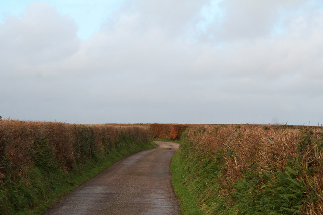
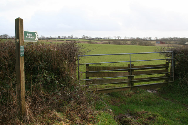
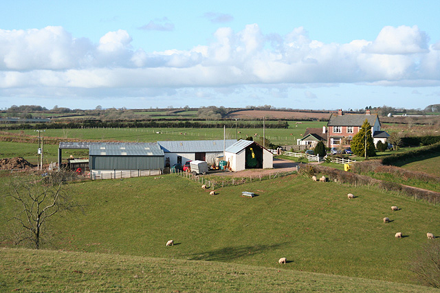
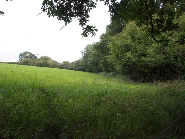
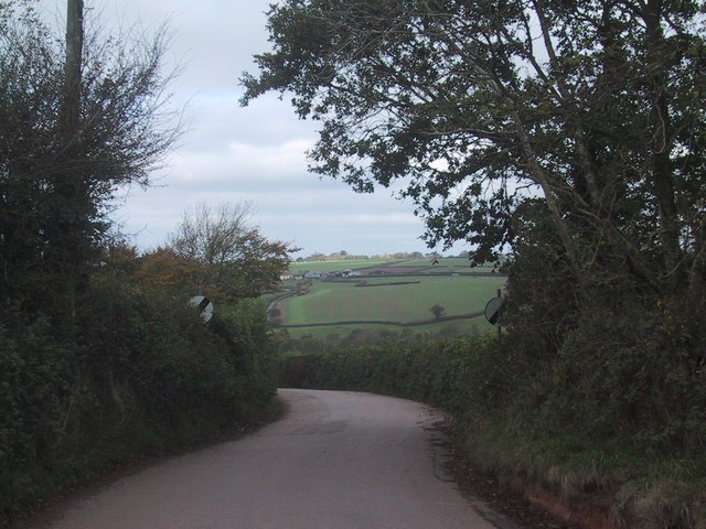
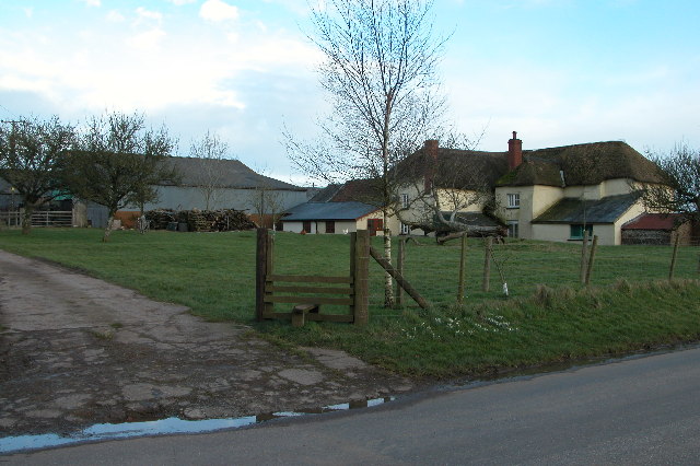
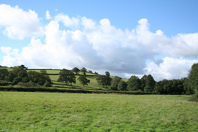
The landscape of Washford Pyne is predominantly agricultural, characterized by rolling hills, fields, and hedgerows. The area is known for its picturesque countryside, offering scenic views and tranquil surroundings. The parish is also dotted with a number of charming old cottages and farmhouses, adding to its rustic appeal.

The local community in Washford Pyne is close-knit and friendly, with a strong sense of community spirit. The parish has a village hall which serves as a social hub for various events and gatherings throughout the year. There are also a few local businesses, including a traditional pub that offers a warm welcome to both residents and visitors.

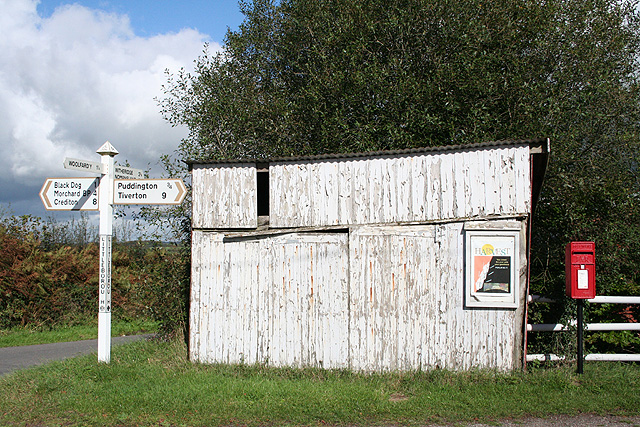
Washford Pyne is well-connected to neighboring areas by road, with easy access to the A377 and A396. This allows residents to easily commute to nearby towns and cities for work or leisure activities. The parish is also served by a local bus service, providing transport links to surrounding areas.

Overall, Washford Pyne is a charming and peaceful civil parish, offering a rural idyll for those seeking a slower pace of life amidst the natural beauty of the Devonshire countryside.

If you have any feedback on the listing, please let us know in the comments section below.

Washford Pyne Images

Images are sourced within 2km of 50.884682/-3.693568 or Grid Reference SS8010. Thanks to Geograph Open Source API. All images are credited.

Washford Pyne: church and cottage St Peter’s church was completed in 1887; its predecessor was largely destroyed by fire in 1880. The three original bells from the earlier church have survived; there are now six bells. Washford Pyne is no more than a small hamlet. A church stood here in the 13th century. The churchyard stands by the Two Moors Way
Washford Pyne: church and cottage
St Peter’s church was completed in 1887; its predecessor was largely destroyed by fire in 1880. The three original bells from the earlier church have survived; there are now six bells. Washford Pyne is no more than a small hamlet. A church stood here in the 13th century. The churchyard stands by the Two Moors Way
Washford Pyne: lane from Black Dog Looking north towards Washford Pyne
Washford Pyne: lane from Black Dog
Looking north towards Washford Pyne
Washford Pyne: footpath sign By the lane from Washford Pyne to Black Dog. The footpath leads to Lower Gatehouse. Looking south east
Washford Pyne: footpath sign
By the lane from Washford Pyne to Black Dog. The footpath leads to Lower Gatehouse. Looking south east
Washford Pyne: Littleborough Cross By Brin Villa Farm. Across the way, behind the camera, is Littleborough Chapel, built in 1907, and surviving with its own graveyard but not marked as a chapel on the Ordnance Survey Pathfinder map of 1976. Looking south west
Washford Pyne: Littleborough Cross
By Brin Villa Farm. Across the way, behind the camera, is Littleborough Chapel, built in 1907, and surviving with its own graveyard but not marked as a chapel on the Ordnance Survey Pathfinder map of 1976. Looking south west
Washford Pyne: Littleborough Cross Signpost, shed and post box by a crossroads: looking north. Behind the post box is Littleborough Chapel, built in 1907, and surviving with its own graveyard but not marked as a chapel on the Ordnance Survey Pathfinder map of 1976
Washford Pyne: Littleborough Cross
Signpost, shed and post box by a crossroads: looking north. Behind the post box is Littleborough Chapel, built in 1907, and surviving with its own graveyard but not marked as a chapel on the Ordnance Survey Pathfinder map of 1976
Puddington: towards Henceford Cross Looking north west on a lane that links Puddington and Witheridge
Puddington: towards Henceford Cross
Looking north west on a lane that links Puddington and Witheridge
Thelbridge: Henceford Cross The road ahead leads to Witheridge. Turn left for Washford Pyne; right for Nomansland and the main road to Tiverton
Thelbridge: Henceford Cross
The road ahead leads to Witheridge. Turn left for Washford Pyne; right for Nomansland and the main road to Tiverton
Thelbridge: north from Mill Barton The conifer to the left of the wood – and beyond the square – is a disguised communications mast. Antennae appear at the top of the tree. Looking west-south-west
Thelbridge: north from Mill Barton
The conifer to the left of the wood – and beyond the square – is a disguised communications mast. Antennae appear at the top of the tree. Looking west-south-west
Thelbridge: barns These buildings stand above the valley of the river Dalch. Looking east-north-east
Thelbridge: barns
These buildings stand above the valley of the river Dalch. Looking east-north-east
Thelbridge: poultry farm By the entrance to Stourton Barton, looking south east. The track to the farm and on to Washford Pyne, to the right of this shot, doubles as the Two Moors Way
Thelbridge: poultry farm
By the entrance to Stourton Barton, looking south east. The track to the farm and on to Washford Pyne, to the right of this shot, doubles as the Two Moors Way
Washford Pyne: towards Sentrys Looking north from a bridleway which runs west to Hele Lane
Washford Pyne: towards Sentrys
Looking north from a bridleway which runs west to Hele Lane
Washford Wood Looking out across a corner of a neighbouring field from the wood, near the Two Moors Way.
Washford Wood
Looking out across a corner of a neighbouring field from the wood, near the Two Moors Way.
Field Boundary near Black Dog
Road leaving Black Dog
Farm at Hele Barton, near Thelbridge Cross
Washford Pyne: by Hele Lane Bridge Looking south west in the Dalch valley. The barn on the skyline is at Horridge
Washford Pyne: by Hele Lane Bridge
Looking south west in the Dalch valley. The barn on the skyline is at Horridge
River Dalch at Hele Lane
Cornfield by the B3042
Show me another place!

Washford Pyne is located at Grid Ref: SS8010 (Lat: 50.884682, Lng: -3.693568)

Administrative County: Devon

District: Mid Devon

Police Authority: Devon & Cornwall

What 3 Words

///trending.parading.soups. Near Witheridge, Devon

Nearby Locations

Washford Pyne Hill Copse

Related Wikis

Washford Pyne

Washford Pyne is a village and civil parish in Devon, England. It is 7 miles NE of Morchard Road railway station and 8 N by W of Crediton.The local church...

Black Dog, Devon

Black Dog is a village in Mid Devon, ten miles west of Tiverton and six miles north of Crediton. The village is on one of the highest ridges of land between...

Berry Castle, Black Dog

Berry Castle is an earthwork probably dating to the Iron Age close to Black Dog in Devon north of Crediton and west of Tiverton. It does not fit the traditional...

Puddington, Devon

Puddington is a small village in Mid Devon within the Witheridge hundred. It is approximately nine miles from the town of Tiverton and 8 Miles from Crediton...

Nearby Amenities

Located within 500m of 50.884682,-3.693568
Power: pole
Lat/Long: 50.8889744/-3.6949039
Power: pole
Lat/Long: 50.8877561/-3.6945981
Power: pole
Lat/Long: 50.8867781/-3.6943352
Power: pole
Lat/Long: 50.8858509/-3.6940992
Power: pole
Lat/Long: 50.8848796/-3.6938444
Power: pole
Lat/Long: 50.8838626/-3.6932758
Power: pole
Lat/Long: 50.8827965/-3.6927018
Power: pole
Lat/Long: 50.8818454/-3.6921331
Power: pole
Lat/Long: 50.8810382/-3.6916906
The data included in this document is from www.openstreetmap.org. The data is made available under ODbL.

Have you been to Washford Pyne?

Leave your review of Washford Pyne below (or comments, questions and feedback).