Buckholm

Settlement in Roxburghshire

Scotland

Buckholm

Rough grazing at Halkburn This is on the east side of the Halk Burn near Halkburn Farm.
Rough grazing at Halkburn Credit: Walter Baxter

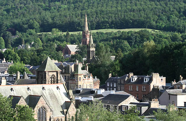
Buckholm is a charming rural village located in the county of Roxburghshire, Scotland. Situated in the southern part of the country, it is nestled within the beautiful and scenic Scottish Borders region. The village is known for its picturesque landscapes, rolling hills, and tranquil atmosphere.

Buckholm is a small community with a population of around 200 residents. The village is characterized by its traditional stone cottages and well-maintained gardens, adding to its idyllic charm. The local community takes great pride in preserving the village's history and heritage, evident in the well-preserved architecture and historic landmarks.

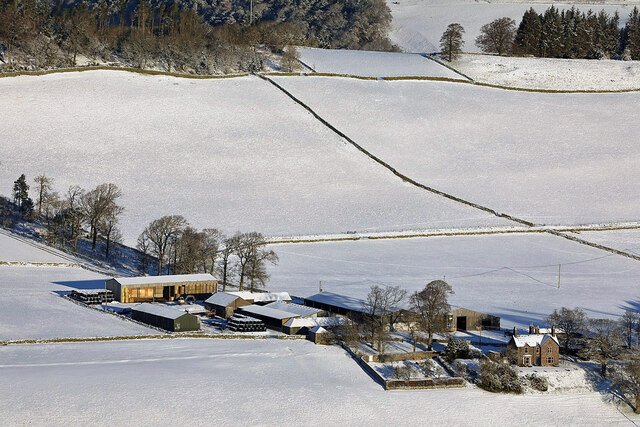
One of the notable features of Buckholm is its close proximity to the River Tweed, a renowned salmon fishing river. This makes it a popular destination for anglers seeking to enjoy the sport amidst stunning natural surroundings. The village is also surrounded by lush green fields, offering opportunities for leisurely walks and outdoor activities.

Despite its rural setting, Buckholm benefits from good transportation links, with easy access to nearby towns and cities. The village has a strong sense of community, with various local events and gatherings taking place throughout the year, fostering a friendly and welcoming atmosphere.

Overall, Buckholm offers a peaceful and scenic retreat for those seeking a slower pace of life. Its natural beauty, rich history, and warm community make it a delightful place to visit or call home.

If you have any feedback on the listing, please let us know in the comments section below.
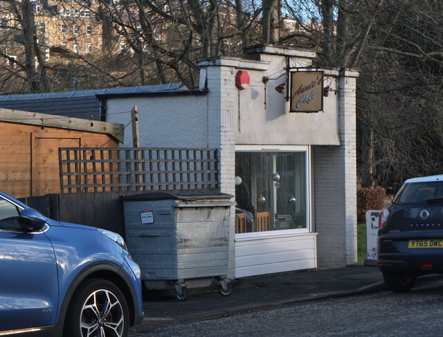
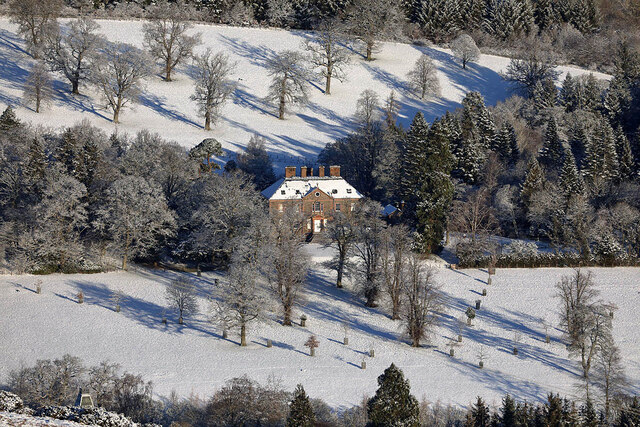
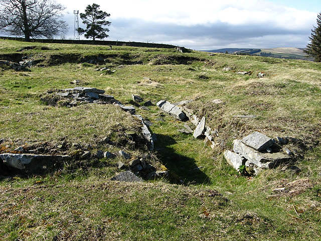
Buckholm Images

Images are sourced within 2km of 55.63801/-2.8271461 or Grid Reference NT4838. Thanks to Geograph Open Source API. All images are credited.

Rough grazing at Halkburn This is on the east side of the Halk Burn near Halkburn Farm.
Rough grazing at Halkburn
This is on the east side of the Halk Burn near Halkburn Farm.
Northern side of William Law Unlike the western side of the hill which rises steeply from the Gala Water, the north and east are more gentle. There is some heather, and grouse here.
Northern side of William Law
Unlike the western side of the hill which rises steeply from the Gala Water, the north and east are more gentle. There is some heather, and grouse here.
Halkburn Most of the square shown here, a mix of moorland and farmland taken from below the summit of William Law. The foreground is grazed by Luing cattle, who were just over the hill in the next square. There were some red grouse around as well. It was snowing gently, but only settling on the higher ground to the west.
Halkburn
Most of the square shown here, a mix of moorland and farmland taken from below the summit of William Law. The foreground is grazed by Luing cattle, who were just over the hill in the next square. There were some red grouse around as well. It was snowing gently, but only settling on the higher ground to the west.
A Larsen Trap and Fence Junction on the Bealach, William Law
Access road, Ladhope Moor Taken 16 years after <a href="https://www.geograph.org.uk/photo/114635">NT4939 : Ladhope Moor</a>.
Access road, Ladhope Moor
Taken 16 years after NT4939 : Ladhope Moor.
Buckholm View across to Meigle Hill, now without the trees at the top.
Buckholm
View across to Meigle Hill, now without the trees at the top.
Buckholm to Langshaw Road
Winter walking on Ladhope Moor
Annie's Cafe, Galashiels Cafe and takeaway on the A72 west of the town centre.
Annie's Cafe, Galashiels
Cafe and takeaway on the A72 west of the town centre.
Torwoodlee Mains Farm This telephoto shot was taken from Meigle Hill on a bitterly cold January day.
Torwoodlee Mains Farm
This telephoto shot was taken from Meigle Hill on a bitterly cold January day.
Torwoodlee House in January This three-storey Georgian mansion, which dates back to 1783, is the home to the Pringles of Torwoodlee. This telephoto shot was taken from Meigle Hill on a bitterly cold January day.
Torwoodlee House in January
This three-storey Georgian mansion, which dates back to 1783, is the home to the Pringles of Torwoodlee. This telephoto shot was taken from Meigle Hill on a bitterly cold January day.
Old alignment, A7
Old alignment, A7
Work starts on the Borders Rail Link The new railway will follow the route of the old Waverley Line
Work starts on the Borders Rail Link
The new railway will follow the route of the old Waverley Line
The road to Torwoodlee Mains Farm This farm road is accessed from the A72.
The road to Torwoodlee Mains Farm
This farm road is accessed from the A72.
Torwoodlee Mains Farm sign The sign is on the northwest side of the A72. For a wider view showing the farm road, see <a href="https://www.geograph.org.uk/photo/2374169">NT4637 : The road to Torwoodlee Mains Farm</a>.
Torwoodlee Mains Farm sign
The sign is on the northwest side of the A72. For a wider view showing the farm road, see NT4637 : The road to Torwoodlee Mains Farm.
Torwoodlee Tower Looking from a footpath above the tower a view into the ruin was possible.
Torwoodlee Tower
Looking from a footpath above the tower a view into the ruin was possible.
View from Buckholm Hill With the cow pasture in the foreground the Buckholm Cottages are situated.
View from Buckholm Hill
With the cow pasture in the foreground the Buckholm Cottages are situated.
Footpath from Buckholm Tower Coming from the tower ruin the paths leads along cow pastures to Buckholm cottages.
Footpath from Buckholm Tower
Coming from the tower ruin the paths leads along cow pastures to Buckholm cottages.
Show me another place!

Buckholm is located at Grid Ref: NT4838 (Lat: 55.63801, Lng: -2.8271461)

Unitary Authority: The Scottish Borders

Police Authority: The Lothians and Scottish Borders

What 3 Words

///removable.climate.dating. Near Galashiels, Scottish Borders

Nearby Locations

Buckholm

Related Wikis

Nearby Amenities

Located within 500m of 55.63801,-2.8271461
Buckholm
Place: locality
Lat/Long: 55.6391949/-2.825427
Parking
Source: Bing
Lat/Long: 55.6360401/-2.8259745
Power: pole
Lat/Long: 55.63882/-2.8339578
Power: pole
Lat/Long: 55.6387035/-2.832861
Power: pole
Lat/Long: 55.6385835/-2.8316686
Power: pole
Lat/Long: 55.6357937/-2.8251439
Power: pole
Lat/Long: 55.6353123/-2.8250796
Power: pole
Lat/Long: 55.6347036/-2.8250527
Power: pole
Lat/Long: 55.633992/-2.8249079
Communication Gsm-r: yes
Man Made: mast
Tower Type: communication
Lat/Long: 55.6364714/-2.8342
Power: pole
Lat/Long: 55.6362679/-2.8252427
Power: pole
Lat/Long: 55.6370178/-2.8252453
Power: pole
Lat/Long: 55.6375091/-2.8252362
Power: pole
Lat/Long: 55.6379889/-2.8252274
Power: pole
Lat/Long: 55.6384356/-2.8252198
Power: pole
Lat/Long: 55.6378596/-2.824016
Power: pole
Lat/Long: 55.6372592/-2.8262938
Power: pole
Lat/Long: 55.6371457/-2.8267825
Power: pole
Lat/Long: 55.6385577/-2.8312797
Power: pole
Lat/Long: 55.638654/-2.8302998
Power: pole
Lat/Long: 55.638937/-2.8274926
Power: pole
Lat/Long: 55.6388253/-2.828601
Power: pole
Lat/Long: 55.6387435/-2.8294118
The data included in this document is from www.openstreetmap.org. The data is made available under ODbL.

Have you been to Buckholm?

Leave your review of Buckholm below (or comments, questions and feedback).