Buckbury

Settlement in Worcestershire Malvern Hills

England

Buckbury

Bishops Walk, Forthampton The tree-lined Bishops Walk, the road approaching the village of Forthampton.
Bishops Walk, Forthampton Credit: Philip Halling

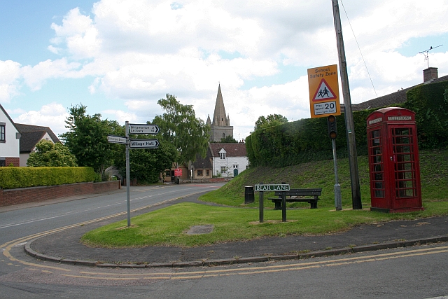
Buckbury is a small village located in the county of Worcestershire, in the West Midlands region of England. Situated approximately 10 miles southeast of the city of Worcester, Buckbury is a quintessential English countryside village known for its picturesque landscapes and charming character.

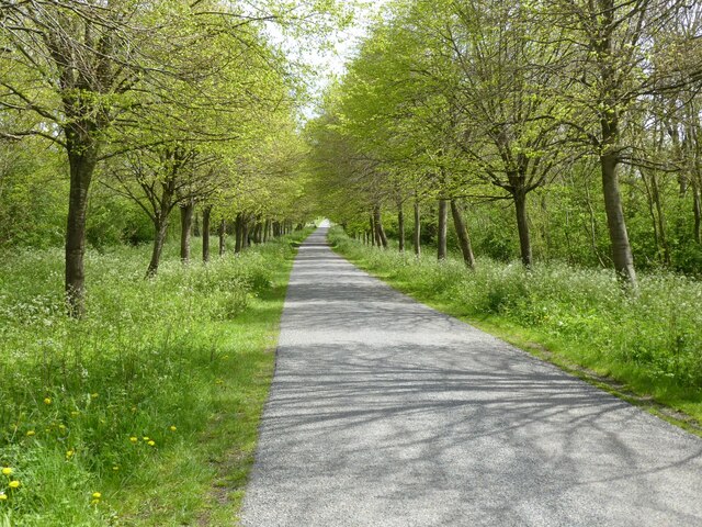
The village is nestled within the Malvern Hills Area of Outstanding Natural Beauty, offering residents and visitors alike stunning views of rolling hills, lush green fields, and meandering streams. The area is popular with hikers, nature enthusiasts, and those seeking a peaceful and tranquil retreat from the hustle and bustle of urban life.

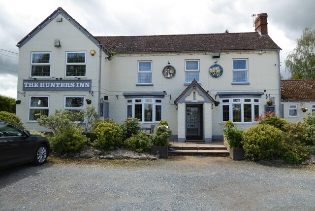
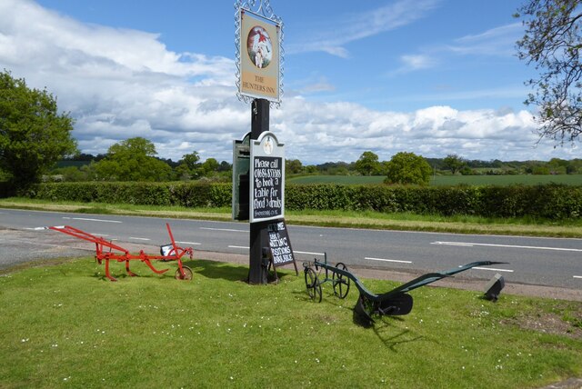
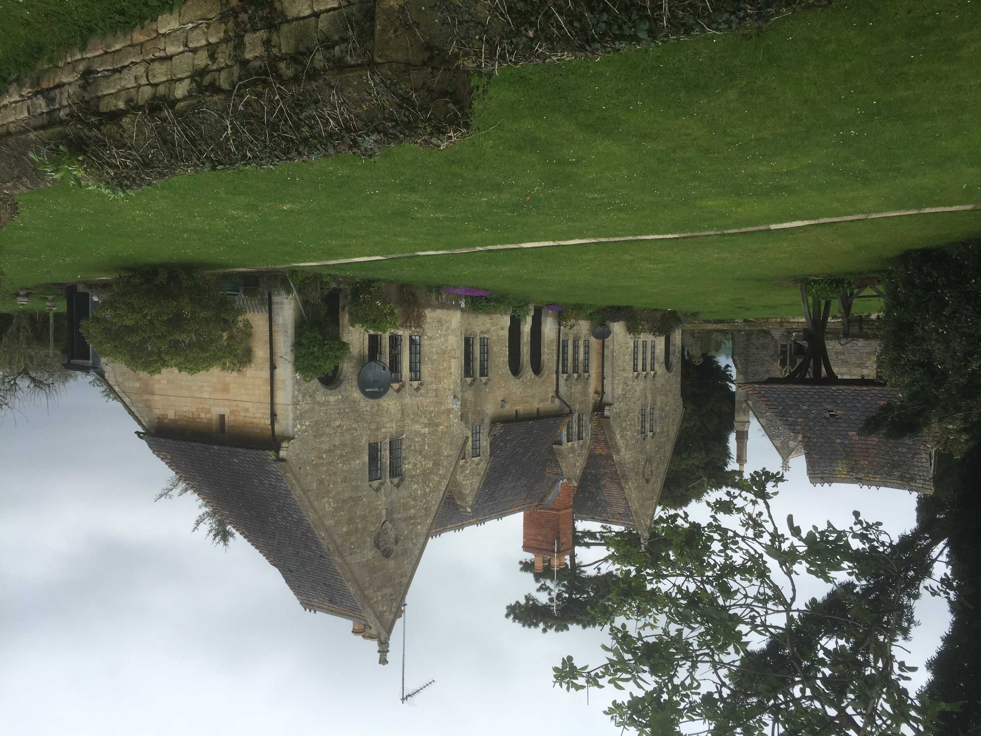
Despite its small size, Buckbury boasts a tight-knit community that takes pride in its heritage and traditions. The village is home to a historic church, St. Mary's, which dates back to the 12th century and serves as a focal point for religious and social gatherings. The village also has a local pub, The Buck Inn, where locals and visitors can enjoy traditional pub fare and a friendly atmosphere.

Buckbury benefits from its proximity to larger towns and cities, such as Worcester and Malvern, which provide a range of amenities including shopping centers, schools, and healthcare facilities. The village is well-connected to the rest of the region through a network of roads, making it easily accessible by car or public transportation.

Overall, Buckbury offers a tranquil and idyllic setting for those seeking a peaceful village lifestyle within the stunning Worcestershire countryside.

If you have any feedback on the listing, please let us know in the comments section below.
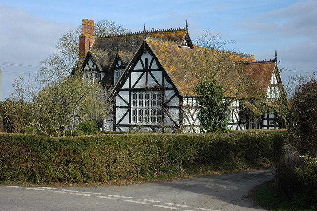
Buckbury Images

Images are sourced within 2km of 52.004183/-2.22504 or Grid Reference SO8434. Thanks to Geograph Open Source API. All images are credited.

Bishops Walk, Forthampton The tree-lined Bishops Walk, the road approaching the village of Forthampton.
Bishops Walk, Forthampton
The tree-lined Bishops Walk, the road approaching the village of Forthampton.
The Hunter's Inn The Hunter's Inn on the B4211 at Buckbury between Forthampton and Longdon.
The Hunter's Inn
The Hunter's Inn on the B4211 at Buckbury between Forthampton and Longdon.
Hunter's Inn sign The inn sign of the Hunter's Inn and a couple of old farm implements.
Hunter's Inn sign
The inn sign of the Hunter's Inn and a couple of old farm implements.
The village of Forthampton Here is the first photograph I took of Forthampton on my first visit to the village. The village, situated in northernmost Gloucestershire, is complete with many historic buildings that have listed status, and the countryside views are fantastic.
The village of Forthampton
Here is the first photograph I took of Forthampton on my first visit to the village. The village, situated in northernmost Gloucestershire, is complete with many historic buildings that have listed status, and the countryside views are fantastic.
Path to St. Mary the Virgin church (Forthampton) The path to Forthampton parish church is a track that becomes a dead end at No. 14-17 Church Row. There are many trees of different specimen in the church grounds.
Path to St. Mary the Virgin church (Forthampton)
The path to Forthampton parish church is a track that becomes a dead end at No. 14-17 Church Row. There are many trees of different specimen in the church grounds.
Stocks and whipping post at Forthampton Situated around thirty-five metres to the west of Forthampton parish church are the village stocks and whipping post. These wooden structures, surrounded by an old iron gate, were restored in 1990. The stocks and whipping post were grade II listed in January 1955.
Stocks and whipping post at Forthampton
Situated around thirty-five metres to the west of Forthampton parish church are the village stocks and whipping post. These wooden structures, surrounded by an old iron gate, were restored in 1990. The stocks and whipping post were grade II listed in January 1955.
St. Mary the Virgin church (Forthampton) Here is the parish church of St. Mary the Virgin in Forthampton, which stands on a knoll that has brilliant views to the countryside. The building was first built in the 13th century, and was restored in 1788. The church was altered from 1863-66 by William Burges, and the building was grade II* listed in January 1955.
St. Mary the Virgin church (Forthampton)
Here is the parish church of St. Mary the Virgin in Forthampton, which stands on a knoll that has brilliant views to the countryside. The building was first built in the 13th century, and was restored in 1788. The church was altered from 1863-66 by William Burges, and the building was grade II* listed in January 1955.
St. Mary the Virgin church (Bell tower | Forthampton) Here is the west bell tower of three stages at St. Mary the Virgin parish church, built in the 13th century.
St. Mary the Virgin church (Bell tower | Forthampton)
Here is the west bell tower of three stages at St. Mary the Virgin parish church, built in the 13th century.
Detail inside St. Mary the Virgin church (South porch | Forthampton) Situated above the doorway in the south porch is an eroded hood, with a segmental section forming an arc over the door with beast-head stops; this dates from the 12th century.
Detail inside St. Mary the Virgin church (South porch | Forthampton)
Situated above the doorway in the south porch is an eroded hood, with a segmental section forming an arc over the door with beast-head stops; this dates from the 12th century.
St. Mary the Virgin church (Font | Forthampton) Here is the octagonal alabaster font in the nave at Forthampton parish church, built in the 19th century.
St. Mary the Virgin church (Font | Forthampton)
Here is the octagonal alabaster font in the nave at Forthampton parish church, built in the 19th century.
St. Mary the Virgin church (Pews | Forthampton) The pews in the nave dates from the 19th century, except these pews in the west end consists of reused linenfold panels from the 15th century.
St. Mary the Virgin church (Pews | Forthampton)
The pews in the nave dates from the 19th century, except these pews in the west end consists of reused linenfold panels from the 15th century.
Entrance to St. Mary the Virgin church (Bell tower | Forthampton) The arch in the distance frames the east entrance to the west bell tower from the nave.
Entrance to St. Mary the Virgin church (Bell tower | Forthampton)
The arch in the distance frames the east entrance to the west bell tower from the nave.
St. Mary the Virgin church (Forthampton) Here is the interior of Forthampton parish church, which consists of a nave, chancel, north aisle and organ chamber.
St. Mary the Virgin church (Forthampton)
Here is the interior of Forthampton parish church, which consists of a nave, chancel, north aisle and organ chamber.
Pyrography inside St. Mary the Virgin church (Forthampton) This splendid pyrography (pokerwork/wood burning) work is situated in the south wall of the nave, and this dates from 1845. This was built as the dossal (reredos) in the east end of the chancel, but its use as a dossal was short-lived.
Pyrography inside St. Mary the Virgin church (Forthampton)
This splendid pyrography (pokerwork/wood burning) work is situated in the south wall of the nave, and this dates from 1845. This was built as the dossal (reredos) in the east end of the chancel, but its use as a dossal was short-lived.
St. Mary the Virgin church (North aisle | Forthampton) Here is the west end of the north aisle at Forthampton parish church, with a three-light stained-glass window in view.
St. Mary the Virgin church (North aisle | Forthampton)
Here is the west end of the north aisle at Forthampton parish church, with a three-light stained-glass window in view.
Window inside St. Mary the Virgin church (North aisle | Forthampton) This three-light stained-glass window is situated in the west end of the north aisle.
Window inside St. Mary the Virgin church (North aisle | Forthampton)
This three-light stained-glass window is situated in the west end of the north aisle.
St. Mary the Virgin church (North aisle | Forthampton) Here is the north aisle inside St. Mary the Virgin parish church, built from 1847-48 by Hamilton and Medland of Gloucester. The tracery in the upper part of the west entrance to the organ chamber looks neat.
St. Mary the Virgin church (North aisle | Forthampton)
Here is the north aisle inside St. Mary the Virgin parish church, built from 1847-48 by Hamilton and Medland of Gloucester. The tracery in the upper part of the west entrance to the organ chamber looks neat.
Ceiling inside St. Mary the Virgin church (Forthampton) The arch-braced roof in the north aisle dates from the nineteenth century, the century when the north aisle was built (1847-48).
Ceiling inside St. Mary the Virgin church (Forthampton)
The arch-braced roof in the north aisle dates from the nineteenth century, the century when the north aisle was built (1847-48).
Show me another place!

Buckbury is located at Grid Ref: SO8434 (Lat: 52.004183, Lng: -2.22504)

Administrative County: Worcestershire

District: Malvern Hills

Police Authority: West Mercia

What 3 Words

///weddings.leans.afternoon. Near Tewkesbury, Gloucestershire

Related Wikis

Forthampton

Forthampton is a village in Gloucestershire, England The village is located three miles from the market town of Tewkesbury and features "a great number...

Yorke Almshouses

The Yorke Almshouses, Nos. 14–17 Church Row, Forthampton, Gloucestershire, England, are a range of four almshouses designed by the architect William Burges...

Longdon, Worcestershire

Longdon is a village and a civil parish in the Malvern Hills District and council ward of the county of Worcestershire, England and lies about 5 km (3...

Bredon School

Bredon School, formerly Pull Court, is a private school in Bushley, Worcestershire, England. The house was built for the Reverend Canon E. C. Dowdeswell...

Bushley

Bushley is a small village and civil parish in the Malvern Hills district in Worcestershire, England. The church is dedicated to Saint Peter. At the 2021...

Pendock Church

Pendock Church is a redundant Anglican church standing to the southeast of the hamlet of Sledge Green in the parish of Pendock, Worcestershire, England...

Queenhill

Queenhill is a civil parish and hamlet in the Malvern Hills District of the county of Worcestershire, England. It is one of three parishes administered...

Old River Severn, Upper Lode

Old River Severn, Upper Lode (grid reference SO880331) is a 3.72-hectare (9.2-acre) biological Site of Special Scientific Interest in Gloucestershire,...

Nearby Amenities

Located within 500m of 52.004183,-2.22504
Pub
The Hunters Inn
Addr City: Tewkesbury
Addr Postcode: GL20 6AR
Addr Village: Longdon
Fhrs Id: 781863
Source Addr: FHRS Open Data
Lat/Long: 52.0029678/-2.2255273
Bus Stop
Longdon Hall
Naptan AtcoCode: 2000G646001
Naptan Bearing: NW
Naptan CommonName: Longdon Hall
Naptan Indicator: near
Naptan Landmark: opposite Wheypools
Naptan NaptanCode: wocdgmgm
Naptan Street: B4211
Naptan Verified: no
Source: naptan_import
Lat/Long: 52.0080431/-2.2284002
Post Box
Ref: GL20 335
Lat/Long: 52.0045801/-2.2181316
Post Box
Operator: Royal Mail
Post Box Type: wall
Ref: GL20 58
Royal Cypher: EVIIR
Royal Cypher Wikidata: Q33102324
Lat/Long: 52.0076334/-2.2280229
Historic: milestone
Lat/Long: 52.0014984/-2.2231007
Police Station Longdon
Power: pole
Transformer: distribution
Voltage Primary: 11000
Lat/Long: 52.0006934/-2.2206297
Power: pole
Lat/Long: 52.0012284/-2.2208597
Power: pole
Lat/Long: 52.0018922/-2.2211748
The Wytchfields
Power: pole
Transformer: distribution
Voltage Primary: 11000
Lat/Long: 52.0017981/-2.2232723
Power: pole
Lat/Long: 52.0021316/-2.2223228
Power: pole
Lat/Long: 52.0024446/-2.2214377
Upper Green
Power: pole
Transformer: distribution
Voltage Primary: 11000
Lat/Long: 52.0044974/-2.2185
Power: pole
Lat/Long: 52.0042563/-2.2193462
Power: pole
Lat/Long: 52.0033073/-2.2181379
Power: pole
Lat/Long: 52.0036256/-2.2190807
Power: pole
Lat/Long: 52.0040124/-2.2202361
Power: pole
Lat/Long: 52.0036314/-2.2210293
Power: pole
Lat/Long: 52.0032594/-2.2217931
Power: pole
Lat/Long: 52.0040165/-2.2221337
Power: pole
Lat/Long: 52.0047967/-2.2224784
Power: pole
Lat/Long: 52.005576/-2.2228163
Power: pole
Lat/Long: 52.0064635/-2.2232938
Power: pole
Lat/Long: 52.0069035/-2.2305505
Power: pole
Lat/Long: 52.0067252/-2.2289506
Wheypools
Power: pole
Transformer: distribution
Voltage Primary: 11000
Lat/Long: 52.0066748/-2.2272366
Power: pole
Lat/Long: 52.0070711/-2.2261611
Power: pole
Lat/Long: 52.0072709/-2.2247918
Power: pole
Lat/Long: 52.0074104/-2.2237712
Power: pole
Lat/Long: 52.0082128/-2.2242299
The data included in this document is from www.openstreetmap.org. The data is made available under ODbL.

Have you been to Buckbury?

Leave your review of Buckbury below (or comments, questions and feedback).