Buckabank

Settlement in Cumberland Carlisle

England

Buckabank

Road from Durdar to Dalston
Road from Durdar to Dalston Credit: Steven Brown

Buckabank is a small village located in the district of Cumberland, England. Situated in the northern part of the county, it is surrounded by picturesque countryside and is known for its tranquil atmosphere. With a population of around 300 residents, Buckabank is a close-knit community that offers a peaceful and idyllic rural lifestyle.

The village is characterized by its charming traditional cottages, many of which are built with local stone, giving the area a distinct rustic charm. The village center features a few essential amenities, including a local pub, a post office, and a small convenience store, providing residents with their daily needs.

Buckabank is nestled within stunning natural landscapes, making it an ideal location for outdoor enthusiasts. The nearby Solway Coast Area of Outstanding Natural Beauty offers breathtaking views of the coastline and provides numerous opportunities for hiking, birdwatching, and nature photography. Additionally, the village is situated close to the Lake District National Park, one of the most beautiful and popular national parks in the country.

The village enjoys good transport links, with easy access to major roads and public transportation services connecting it to nearby towns and cities. The larger towns of Carlisle and Penrith are within a short driving distance, providing residents with a wider range of amenities and services.

Overall, Buckabank in Cumberland is a charming and peaceful village, perfect for those seeking a tranquil countryside retreat while still being within reach of larger urban centers.

If you have any feedback on the listing, please let us know in the comments section below.

Buckabank Images

Images are sourced within 2km of 54.833964/-2.979074 or Grid Reference NY3749. Thanks to Geograph Open Source API. All images are credited.

Road from Durdar to Dalston
Greensyke House and the former Kingswood Education Centre The board at the beginning of the drive states that this is one of the Kingswood Education Centres (Kingswood being a leading provider of outdoor education and activity centres throughout the country). This particular establishment does not, however,  seem to be still on their books.The chimney pots belong to Greenssyke House, the main building of the centre.
Greensyke House and the former Kingswood Education Centre
The board at the beginning of the drive states that this is one of the Kingswood Education Centres (Kingswood being a leading provider of outdoor education and activity centres throughout the country). This particular establishment does not, however, seem to be still on their books.The chimney pots belong to Greenssyke House, the main building of the centre.
Bungalow at Hawksdale
Hawksdale Bridge Downstream side of Hawksdale Bridge over the River Caldew.
Hawksdale Bridge
Downstream side of Hawksdale Bridge over the River Caldew.
A sad tale of the Millennium Along with many communities, Dalston Parish Council inaugurated a number of public works to commemorate the new Millennium. These included the rebuilding of the White Bridge, a foot and cycle bridge over the River Caldew; and tree planting and the erection of a bench on the east bank.

In October 2010, it was discovered that 80 % of the foundations of the central pier had been eroded away by the river, and the bridge was promptly closed for safety reasons. The bench (the top of which can just be seen) rapidly became overgrown, being no longer readily accessible from  the village.

Hopefully there is a happy end to this story. It was planned to commence repairs in June 2011, shortly after this photograph was taken.
A sad tale of the Millennium
Along with many communities, Dalston Parish Council inaugurated a number of public works to commemorate the new Millennium. These included the rebuilding of the White Bridge, a foot and cycle bridge over the River Caldew; and tree planting and the erection of a bench on the east bank. In October 2010, it was discovered that 80 % of the foundations of the central pier had been eroded away by the river, and the bridge was promptly closed for safety reasons. The bench (the top of which can just be seen) rapidly became overgrown, being no longer readily accessible from the village. Hopefully there is a happy end to this story. It was planned to commence repairs in June 2011, shortly after this photograph was taken.
A sad tale of the Millennium Along with many communities, Dalston Parish Council inaugurated a number of public works to commemorate the new Millennium. These included the rebuilding of the White Bridge, a foot and cycle bridge over the River Caldew; and tree planting and the erection of a bench on the east bank.

In October 2010, it was discovered that 80 % of the foundations of the central pier had been eroded away by the river, and the bridge was promptly closed for safety reasons. The bench rapidly became overgrown, being no longer readily accessible from  the village.

It was planned to commence repairs in June 2011, shortly after this photograph was taken.
A sad tale of the Millennium
Along with many communities, Dalston Parish Council inaugurated a number of public works to commemorate the new Millennium. These included the rebuilding of the White Bridge, a foot and cycle bridge over the River Caldew; and tree planting and the erection of a bench on the east bank. In October 2010, it was discovered that 80 % of the foundations of the central pier had been eroded away by the river, and the bridge was promptly closed for safety reasons. The bench rapidly became overgrown, being no longer readily accessible from the village. It was planned to commence repairs in June 2011, shortly after this photograph was taken.
Greensyke An isolated cottage and barn near Dalston.
Greensyke
An isolated cottage and barn near Dalston.
Horse rider near Buckabank Farm The area to the south of Carlisle is criss-crossed by a network of straight lanes.
Horse rider near Buckabank Farm
The area to the south of Carlisle is criss-crossed by a network of straight lanes.
Grass fields near Dalston Land south of Carlisle appears to be mainly grazing land. Little sign of livestock, the cattle will be inside for the Winter.
Grass fields near Dalston
Land south of Carlisle appears to be mainly grazing land. Little sign of livestock, the cattle will be inside for the Winter.
Bridge restored! Once again the White Bridge is open (see <a href="https://www.geograph.org.uk/photo/2455212">NY3749 : A sad tale of the Millennium</a>).
Bridge restored!
Once again the White Bridge is open (see NY3749 : A sad tale of the Millennium).
The White Bridge Originally opened in 1899 and restored in 1999 for the Millennium. Severe erosion of the supporting pier led to its closure in 2010, but now thankfully repaired and reopened (see <a href="https://www.geograph.org.uk/photo/2455212">NY3749 : A sad tale of the Millennium</a>).
The White Bridge
Originally opened in 1899 and restored in 1999 for the Millennium. Severe erosion of the supporting pier led to its closure in 2010, but now thankfully repaired and reopened (see NY3749 : A sad tale of the Millennium).
By the White Bridge, Dalston The White Bridge over the River Caldew was originally opened in 1899 and restored in 1999 for the Millennium. Severe erosion of the supporting pier led to its closure in 2010, but now thankfully repaired and reopened (see <a href="https://www.geograph.org.uk/photo/2455212">NY3749 : A sad tale of the Millennium</a> and <a href="https://www.geograph.org.uk/photo/2455211">NY3749 : A sad tale of the Millennium</a>).
By the White Bridge, Dalston
The White Bridge over the River Caldew was originally opened in 1899 and restored in 1999 for the Millennium. Severe erosion of the supporting pier led to its closure in 2010, but now thankfully repaired and reopened (see NY3749 : A sad tale of the Millennium and NY3749 : A sad tale of the Millennium).
The Bridge End Inn, Dalston A late 18th century inn at the southern end of Dalston village.
The Bridge End Inn, Dalston
A late 18th century inn at the southern end of Dalston village.
Road at Pow Bank Looking south-westward.
Road at Pow Bank
Looking south-westward.
Dalston Methodist Church Viewed from the east.
Dalston Methodist Church
Viewed from the east.
Ordnance Survey Flush Bracket S8309 Located on a roadside building at Pow Bank.
For more detail see : <span class="nowrap"><a title="http://www.bench-marks.org.uk/bm13217" rel="nofollow ugc noopener" href="http://www.bench-marks.org.uk/bm13217">Link</a><img style="margin-left:2px;" alt="External link" title="External link - shift click to open in new window" src="https://s1.geograph.org.uk/img/external.png" width="10" height="10"/></span>
Ordnance Survey Flush Bracket S8309
Located on a roadside building at Pow Bank. For more detail see : LinkExternal link
The Gill Farm View from a field gate on Greensyke Lane.
The Gill Farm
View from a field gate on Greensyke Lane.
Houses at the former Greensyke Farm A recently built luxury home on the left, a restored Victorian mansion (Greensyke House) on the right. Redevelopment of the site for housing began in 2012.
During the 1990s Greensyke Farm was used as an annexe to Lime House School. From 2002 the site was occupied by the Kingswood Outdoor Education Centre (the subject of a protracted planning dispute) which closed in 2009.
For a view of the grounds in 2011, see <a href="https://www.geograph.org.uk/photo/2454046">NY3548 : Greensyke House and the former Kingswood Education Centre</a> .
Houses at the former Greensyke Farm
A recently built luxury home on the left, a restored Victorian mansion (Greensyke House) on the right. Redevelopment of the site for housing began in 2012. During the 1990s Greensyke Farm was used as an annexe to Lime House School. From 2002 the site was occupied by the Kingswood Outdoor Education Centre (the subject of a protracted planning dispute) which closed in 2009. For a view of the grounds in 2011, see NY3548 : Greensyke House and the former Kingswood Education Centre .
Show me another place!

Buckabank is located at Grid Ref: NY3749 (Lat: 54.833964, Lng: -2.979074)

Administrative County: Cumbria

District: Carlisle

Police Authority: Cumbria

What 3 Words

///solved.unions.shovels. Near Dalston, Cumbria

Nearby Locations

Buckabank

Related Wikis

Buckabank

Buckabank is a small village in the English county of Cumbria. It is situated on the B5299 road about 5 miles (8 km) south-south-west of Carlisle, and...
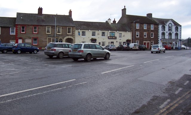
Dalston, Cumbria

Dalston is a large village and civil parish within Cumberland unitary authority area, Cumbria, and historically part of Cumberland. It is situated on the...

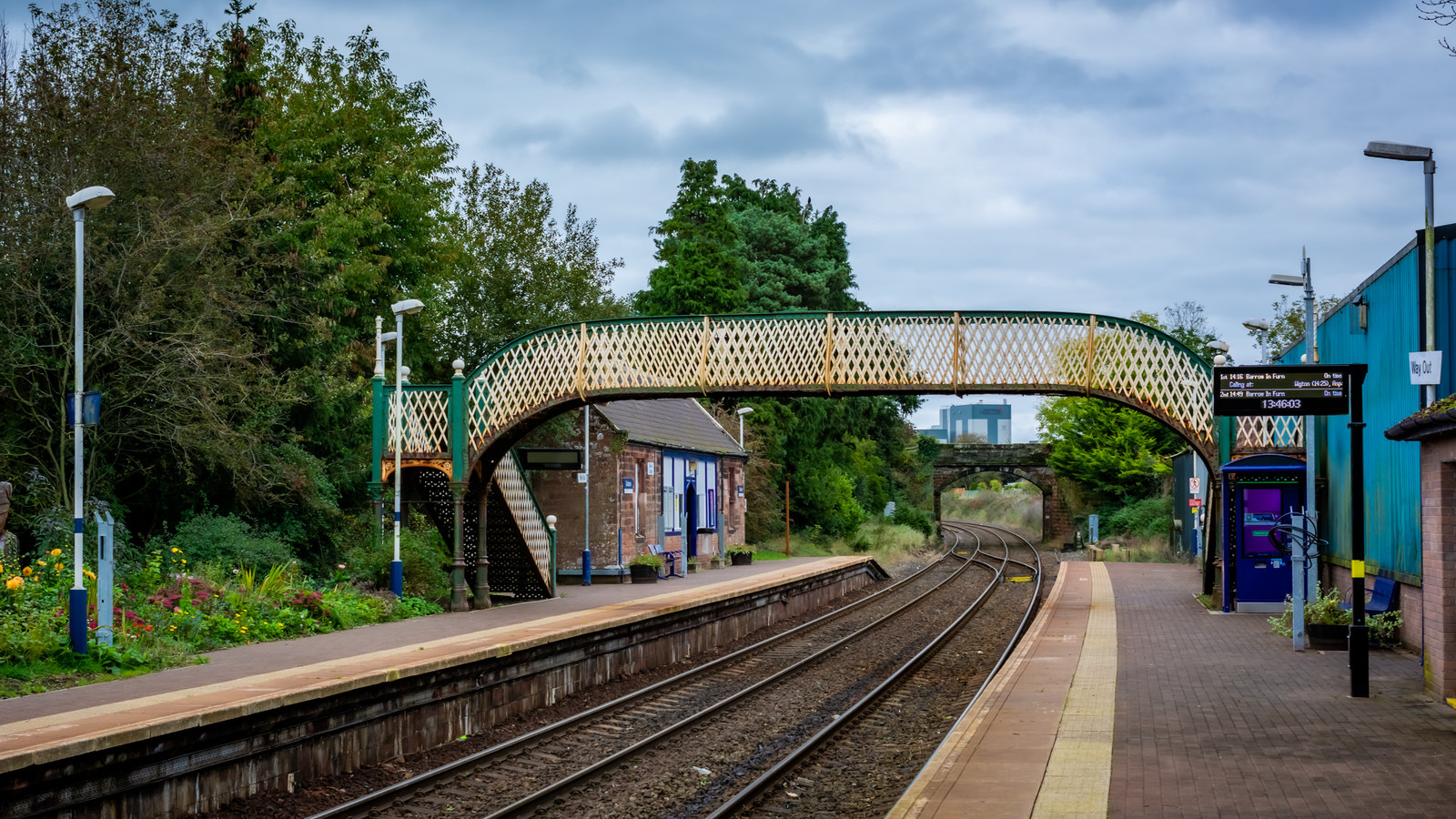
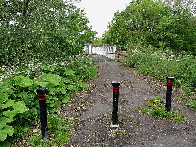
Dalston railway station (Cumbria)

Dalston railway station serves the village of Dalston near Carlisle in Cumbria, England. It is on the Cumbrian Coast Line, which runs between Carlisle...
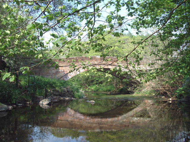
Roe Beck

Roe Beck also known as the River Roe in its lower reaches, is a beck that flows through Cumbria, England. It is a lower tributary of the River Caldew which...
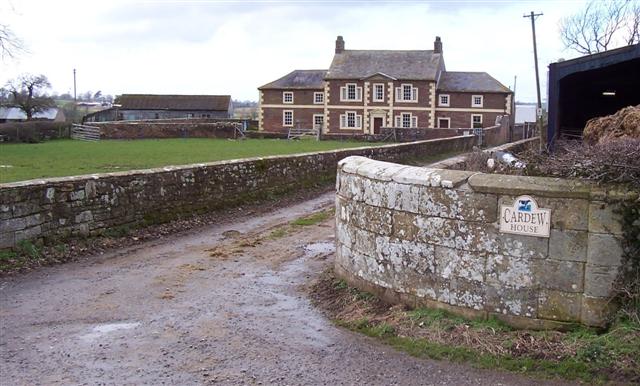
Cardew House

Cardew House is a country house at Cardew near Thursby in Cumbria. It is a Grade II listed building. == History == The house, originally known as Cardew...
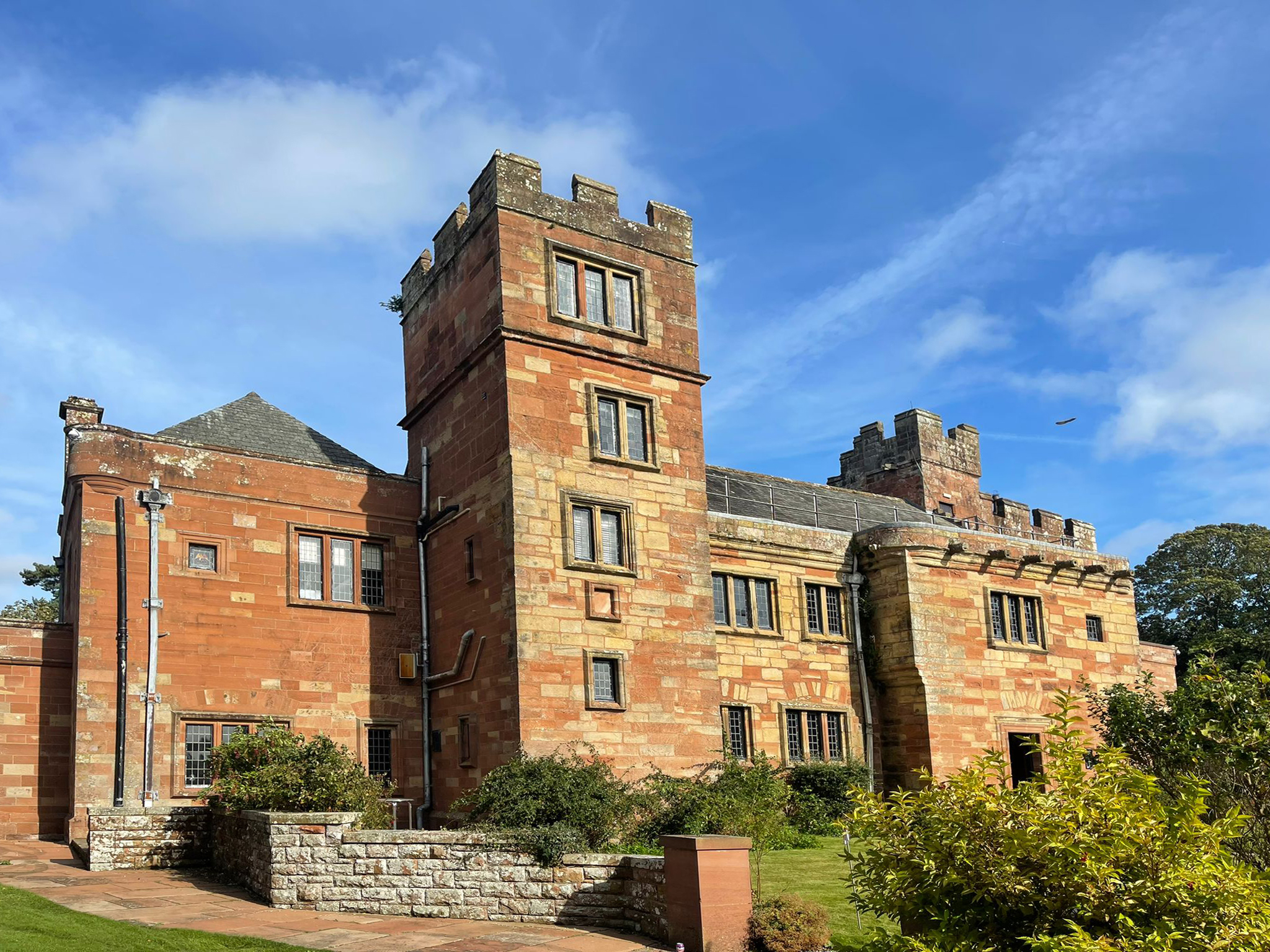
Dalston Hall

Dalston Hall is a fortified country house at Dalston in Cumbria, England. It is a Grade II* listed building. == History == Dalston Hall was built around...

Unthank, Dalston

Unthank is a village near Dalston in Cumbria, England. It is first mentioned in writing in 1332. == References == The geographic coordinates are from...

Cumdivock

Cumdivock is a hamlet in Cumbria, England. Ian Caruana unearthed several 17th-century Tyneside clay pipes at Cumdivock. == References == == External... ==

Nearby Amenities

Located within 500m of 54.833964,-2.979074
Buckabank
Place: hamlet
Source: npe
Wikidata: Q4982980
Lat/Long: 54.8324726/-2.9780242
Waterway: weir
Lat/Long: 54.8302072/-2.9769791
Bus Stop
Green Head (S bound)
Naptan AtcoCode: 090033151881
Naptan Bearing: S
Naptan CommonName: Green Head (S bound)
Naptan Indicator: opp
Naptan Landmark: Chase End
Naptan NaptanCode: cumaptjg
Naptan Street: B5299
Naptan Verified: no
Source: naptan_import
Lat/Long: 54.8338068/-2.9834554
Bus Stop
Green Head (N bound)
Naptan AtcoCode: 090033152645
Naptan Bearing: N
Naptan CommonName: Green Head (N bound)
Naptan Indicator: o/s
Naptan Landmark: no. 48
Naptan NaptanCode: cumaptpw
Naptan Street: B5299
Naptan Verified: no
Source: naptan_import
Lat/Long: 54.8343257/-2.9837483
Turning Circle
Source: survey
Lat/Long: 54.8314878/-2.9793412
Turning Circle
Lat/Long: 54.8339399/-2.982107
Turning Circle
Lat/Long: 54.8324445/-2.9807069
Green Head
Place: locality
Lat/Long: 54.8340044/-2.9860675
Barrier: yes
Lat/Long: 54.8354834/-2.974948
Power: pole
Lat/Long: 54.8330252/-2.9792278
Power: pole
Lat/Long: 54.8334802/-2.9784945
Power: pole
Lat/Long: 54.8362327/-2.9746512
Power: pole
Lat/Long: 54.8353786/-2.9733567
Power: pole
Lat/Long: 54.8348069/-2.971553
Power: pole
Lat/Long: 54.8318193/-2.9727201
Power: pole
Lat/Long: 54.8313127/-2.9739603
Power: pole
Lat/Long: 54.8304775/-2.9750614
Power: pole
Lat/Long: 54.8298894/-2.9758159
Power: pole
Lat/Long: 54.8296504/-2.9772047
The data included in this document is from www.openstreetmap.org. The data is made available under ODbL.

Have you been to Buckabank?

Leave your review of Buckabank below (or comments, questions and feedback).