Tixover

Civil Parish in Rutland

England

Tixover

Tixover church This isolated parish church stands on the north bank of the Welland at the end of a field road about 1 km outside the present site of the small Rutland village of Tixover. Seen here from the opposite, Northamptonshire, side of the river.
Tixover church Credit: Kevin Flynn

Tixover is a civil parish located in the county of Rutland, England. Situated approximately 3 miles east of Stamford, it covers an area of about 1.5 square miles and has a population of around 50 people. Tixover is a small, predominantly rural area that offers a tranquil and picturesque setting.

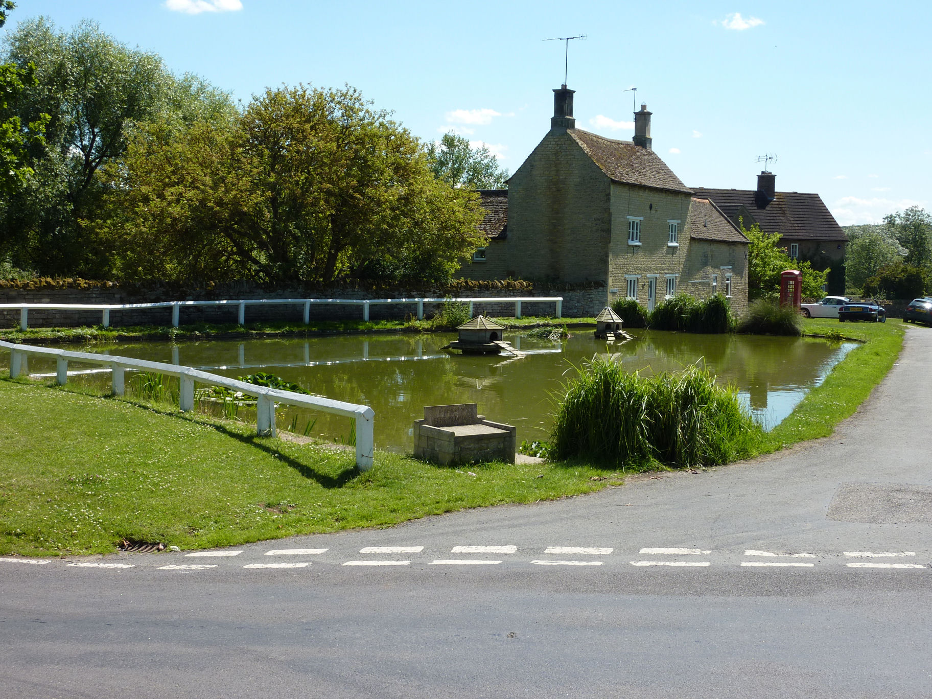
The parish is known for its beautiful countryside, with rolling hills, lush green fields, and a charming mix of woodland areas. It is surrounded by several other civil parishes, including Easton-on-the-Hill, Ketton, and Tinwell. The River Welland flows through the western edge of the parish, adding to the natural beauty of the area.

Tixover is characterized by a mix of agricultural land and residential properties. The village itself consists of a small number of houses, forming a close-knit community. There are no major local amenities within the parish, but residents have easy access to nearby towns and villages for their daily needs.

The area is also known for its historical significance, with evidence of human settlement dating back to Roman times. Tixover Manor, a Grade II listed building, is a notable landmark in the parish. The manor house, built in the 17th century, is an impressive architectural gem that adds to the charm and character of the area.

Overall, Tixover offers a peaceful and idyllic countryside living experience, making it an attractive place for those seeking a rural retreat in Rutland.

If you have any feedback on the listing, please let us know in the comments section below.
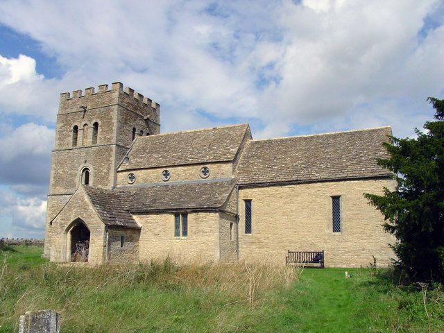
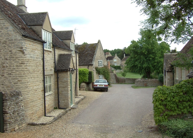
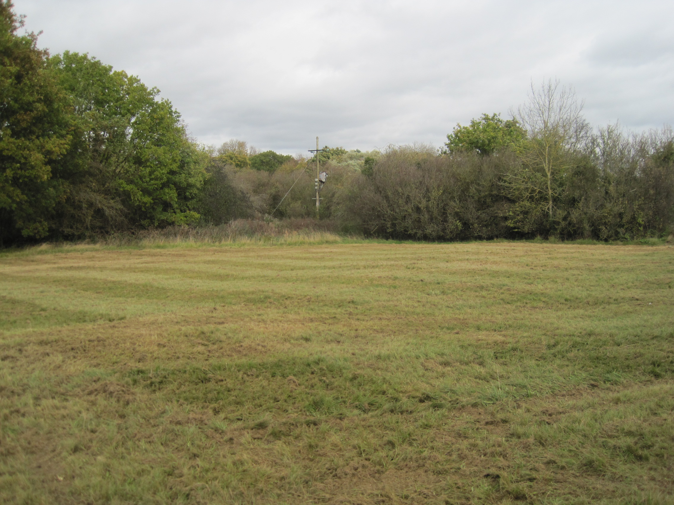
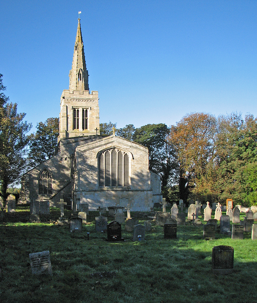
Tixover Images

Images are sourced within 2km of 52.597012/-0.563651 or Grid Reference SK9700. Thanks to Geograph Open Source API. All images are credited.

Tixover church This isolated parish church stands on the north bank of the Welland at the end of a field road about 1 km outside the present site of the small Rutland village of Tixover. Seen here from the opposite, Northamptonshire, side of the river.
Tixover church
This isolated parish church stands on the north bank of the Welland at the end of a field road about 1 km outside the present site of the small Rutland village of Tixover. Seen here from the opposite, Northamptonshire, side of the river.
Tixover Church This historic church has only a track leading to it. Although normally locked, a key can be obtained from a house in the village of Tixover.
Tixover Church
This historic church has only a track leading to it. Although normally locked, a key can be obtained from a house in the village of Tixover.
Track through Fineshade Wood The woods at Fineshade have a more open feel, and more deciduous trees than the nearby Wakerley Wood
Track through Fineshade Wood
The woods at Fineshade have a more open feel, and more deciduous trees than the nearby Wakerley Wood
Former railway bridge
Former railway bridge Looking WNW along the former trackbed.
Former railway bridge
Looking WNW along the former trackbed.
Church of St Luke, Tixover Finally got to see this lonely church. A long walk from the present village of Tixover, but perhaps there was an earlier village, close by, which has now disappeared? For history see <span class="nowrap"><a title="http://www.british-history.ac.uk/report.aspx?compid=66240" rel="nofollow ugc noopener" href="http://www.british-history.ac.uk/report.aspx?compid=66240">Link</a><img style="margin-left:2px;" alt="External link" title="External link - shift click to open in new window" src="https://s1.geograph.org.uk/img/external.png" width="10" height="10"/></span>
Church of St Luke, Tixover
Finally got to see this lonely church. A long walk from the present village of Tixover, but perhaps there was an earlier village, close by, which has now disappeared? For history see LinkExternal link
Church of St Luke, Tixover Looking up from the bank of the Welland. As is often the case, the church becoming obscured by unrestrained yew
Church of St Luke, Tixover
Looking up from the bank of the Welland. As is often the case, the church becoming obscured by unrestrained yew
Tixover: St Luke The church is a long way from the village, in the middle of fields on the southern edge of Rutland. The tower is 12th-century. For details, click <span class="nowrap"><a title="http://www.british-history.ac.uk/report.aspx?compid=66240" rel="nofollow ugc noopener" href="http://www.british-history.ac.uk/report.aspx?compid=66240">Link</a><img style="margin-left:2px;" alt="External link" title="External link - shift click to open in new window" src="https://s1.geograph.org.uk/img/external.png" width="10" height="10"/></span> .
Tixover: St Luke
The church is a long way from the village, in the middle of fields on the southern edge of Rutland. The tower is 12th-century. For details, click LinkExternal link .
Tixover: St Luke The church is a long way from the village, in the middle of wheatfields on the southern edge of Rutland. The tower is 12th-century. For details, click <span class="nowrap"><a title="http://www.british-history.ac.uk/report.aspx?compid=66240" rel="nofollow ugc noopener" href="http://www.british-history.ac.uk/report.aspx?compid=66240">Link</a><img style="margin-left:2px;" alt="External link" title="External link - shift click to open in new window" src="https://s1.geograph.org.uk/img/external.png" width="10" height="10"/></span> .
Tixover: St Luke
The church is a long way from the village, in the middle of wheatfields on the southern edge of Rutland. The tower is 12th-century. For details, click LinkExternal link .
Tixover: St Luke The church is a long way from the village, in the middle of fields on the southern edge of Rutland. The tower is 12th-century. For details, click <span class="nowrap"><a title="http://www.british-history.ac.uk/report.aspx?compid=66240" rel="nofollow ugc noopener" href="http://www.british-history.ac.uk/report.aspx?compid=66240">Link</a><img style="margin-left:2px;" alt="External link" title="External link - shift click to open in new window" src="https://s1.geograph.org.uk/img/external.png" width="10" height="10"/></span> .
Tixover: St Luke
The church is a long way from the village, in the middle of fields on the southern edge of Rutland. The tower is 12th-century. For details, click LinkExternal link .
Tixover: St Luke - the Norman tower According to Nikolaus Pevsner, the 12th-century tower's bell openings are "unusual and very beautiful...To the S one shafted window with a continuous zigzag inside the shafts and their arch."
Tixover: St Luke - the Norman tower
According to Nikolaus Pevsner, the 12th-century tower's bell openings are "unusual and very beautiful...To the S one shafted window with a continuous zigzag inside the shafts and their arch."
Tixover: St Luke - the Norman tower According to Nikolaus Pevsner, the bell-openings of the 12th-century tower are "unusual and very beautiful", the ones on the N side consisting of three arches on square piers.
Tixover: St Luke - the Norman tower
According to Nikolaus Pevsner, the bell-openings of the 12th-century tower are "unusual and very beautiful", the ones on the N side consisting of three arches on square piers.
Tixover: St Luke The substantial Norman tower and the view west, towards Barrowden and Wakerley, early on a perfect June evening.
Tixover: St Luke
The substantial Norman tower and the view west, towards Barrowden and Wakerley, early on a perfect June evening.
Tixover: St Luke - tower and churchyard wall The church is a long way from the village, in the middle of fields on the southern edge of Rutland. The tower is 12th-century. For details, click <span class="nowrap"><a title="http://www.british-history.ac.uk/report.aspx?compid=66240" rel="nofollow ugc noopener" href="http://www.british-history.ac.uk/report.aspx?compid=66240">Link</a><img style="margin-left:2px;" alt="External link" title="External link - shift click to open in new window" src="https://s1.geograph.org.uk/img/external.png" width="10" height="10"/></span> .
Tixover: St Luke - tower and churchyard wall
The church is a long way from the village, in the middle of fields on the southern edge of Rutland. The tower is 12th-century. For details, click LinkExternal link .
West from Tixover Church on a June evening The spire of Barrowden Church is on the horizon in the centre.
West from Tixover Church on a June evening
The spire of Barrowden Church is on the horizon in the centre.
Tixover: St Luke - tower and poppies The church is a long way from the village, in the middle of fields on the southern edge of Rutland. The tower is 12th-century. For details, click <span class="nowrap"><a title="http://www.british-history.ac.uk/report.aspx?compid=66240" rel="nofollow ugc noopener" href="http://www.british-history.ac.uk/report.aspx?compid=66240">Link</a><img style="margin-left:2px;" alt="External link" title="External link - shift click to open in new window" src="https://s1.geograph.org.uk/img/external.png" width="10" height="10"/></span> .
Tixover: St Luke - tower and poppies
The church is a long way from the village, in the middle of fields on the southern edge of Rutland. The tower is 12th-century. For details, click LinkExternal link .
Tixover: St Luke The church is a long way from the village, in the middle of fields on the southern edge of Rutland. The tower is 12th-century. For details, click <span class="nowrap"><a title="http://www.british-history.ac.uk/report.aspx?compid=66240" rel="nofollow ugc noopener" href="http://www.british-history.ac.uk/report.aspx?compid=66240">Link</a><img style="margin-left:2px;" alt="External link" title="External link - shift click to open in new window" src="https://s1.geograph.org.uk/img/external.png" width="10" height="10"/></span> . Nikolaus Pevsner described it as "grey", but the local limestone was anything but that on a lovely June evening.
Tixover: St Luke
The church is a long way from the village, in the middle of fields on the southern edge of Rutland. The tower is 12th-century. For details, click LinkExternal link . Nikolaus Pevsner described it as "grey", but the local limestone was anything but that on a lovely June evening.
Footpath begins to descend The footpath begins to bend and fall.
Footpath begins to descend
The footpath begins to bend and fall.
Show me another place!

Tixover is located at Grid Ref: SK9700 (Lat: 52.597012, Lng: -0.563651)

Unitary Authority: Rutland

Police Authority: Leicestershire

What 3 Words

///swinging.fewer.blazing. Near South Luffenham, Rutland

Nearby Locations

Tixover Tixover

Related Wikis

Nearby Amenities

Located within 500m of 52.597012,-0.563651
Tixover
Place: hamlet
Lat/Long: 52.5927969/-0.5616759
Power: pole
Lat/Long: 52.5953159/-0.5673569
Power: pole
Lat/Long: 52.5963324/-0.5633762
Power: pole
Lat/Long: 52.5967658/-0.558913
Power: pole
Lat/Long: 52.5948499/-0.5692451
Power: pole
Lat/Long: 52.5958959/-0.5651089
Power: pole
Lat/Long: 52.5955375/-0.5647334
Power: pole
Lat/Long: 52.5969191/-0.5573412
Power: pole
Lat/Long: 52.595619/-0.5662301
Power: pole
Lat/Long: 52.5966258/-0.5604258
Power: pole
Lat/Long: 52.5964693/-0.5619439
The data included in this document is from www.openstreetmap.org. The data is made available under ODbL.

Have you been to Tixover?

Leave your review of Tixover below (or comments, questions and feedback).