Bubnell

Settlement in Derbyshire Derbyshire Dales

England

Bubnell

River Derwent near Calver Both sides of this stretch of the river are lined by trees. There is quite a lot of white water below Calver Weir.
River Derwent near Calver Credit: Bill Boaden

Bubnell is a small village located in the district of Derbyshire, England. Situated within the Peak District National Park, it is surrounded by breathtaking natural beauty and scenic landscapes. Bubnell is part of the larger civil parish of Baslow and Bubnell, which also includes the neighboring village of Baslow.

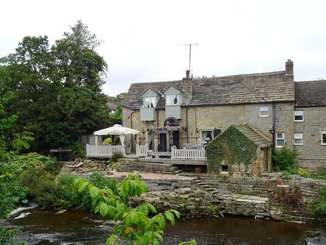
With a population of around 300 residents, Bubnell maintains a peaceful and close-knit community atmosphere. The village is characterized by its charming stone cottages, some of which date back several centuries, giving it a traditional English countryside feel.

One of the notable features of Bubnell is its proximity to Chatsworth House, a grand stately home and estate. Chatsworth House, which is just a short distance from the village, attracts tourists from all over the world with its stunning architecture, extensive gardens, and art collections.

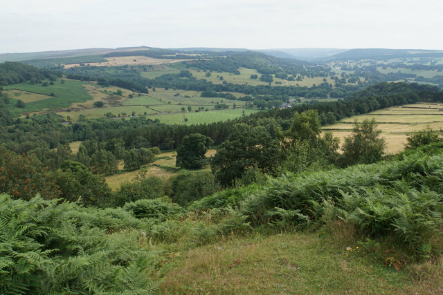
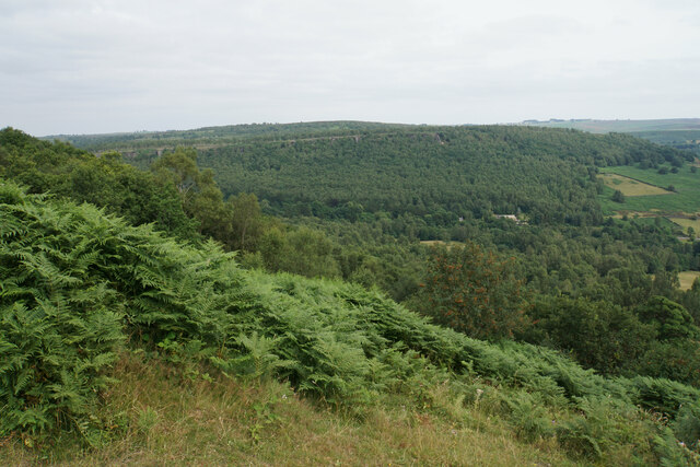
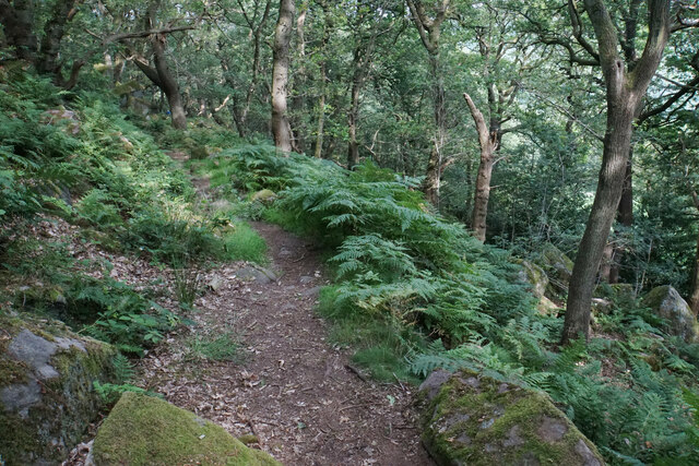
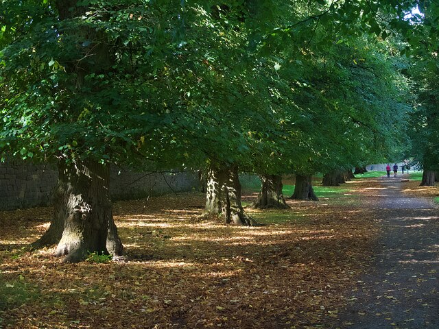
Bubnell also benefits from its location within the Peak District National Park, offering residents and visitors numerous opportunities for outdoor activities. The nearby Peak District landscape provides ample opportunities for hiking, cycling, and exploring the scenic surroundings.

Despite its small size, Bubnell has a community center that hosts a variety of events and activities throughout the year, bringing locals together and fostering a sense of community spirit.

In summary, Bubnell is a picturesque village nestled within the beauty of the Peak District National Park. With its historic charm, proximity to Chatsworth House, and access to stunning natural landscapes, Bubnell offers a tranquil and idyllic setting for its residents and visitors alike.

If you have any feedback on the listing, please let us know in the comments section below.
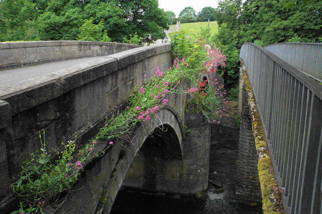
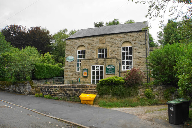
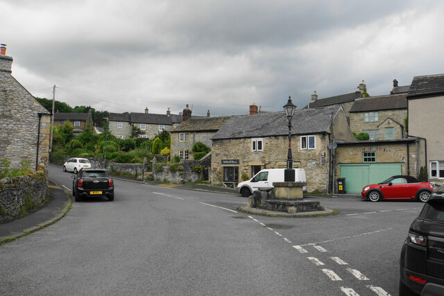
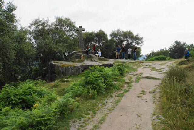
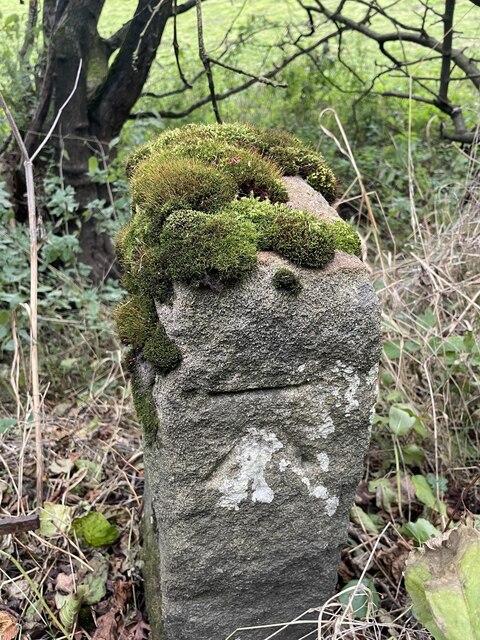
Bubnell Images

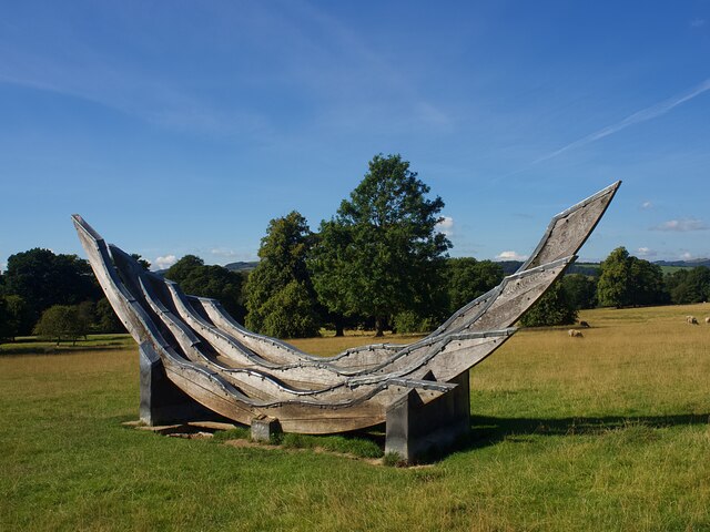
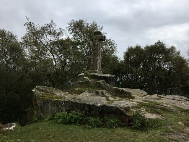
Images are sourced within 2km of 53.252184/-1.630598 or Grid Reference SK2472. Thanks to Geograph Open Source API. All images are credited.

River Derwent near Calver Both sides of this stretch of the river are lined by trees. There is quite a lot of white water below Calver Weir.
River Derwent near Calver
Both sides of this stretch of the river are lined by trees. There is quite a lot of white water below Calver Weir.
Bridges over the River Derwent The bridge on the left carried the old main road from Baslow before it was replaced by a new Calver Bridge. The bridge on the right is a footbridge.
Bridges over the River Derwent
The bridge on the left carried the old main road from Baslow before it was replaced by a new Calver Bridge. The bridge on the right is a footbridge.
Calver Methodist Church The inscription states that this was Jubilee Primitive Methodist Chapel dating from 1860.
Calver Methodist Church
The inscription states that this was Jubilee Primitive Methodist Chapel dating from 1860.
Lamp standard and mounting block in Calver The lamp and its base are Grade II listed, with its listing details here: <span class="nowrap"><a title="https://historicengland.org.uk/listing/the-list/list-entry/1088211" rel="nofollow ugc noopener" href="https://historicengland.org.uk/listing/the-list/list-entry/1088211">Link</a><img style="margin-left:2px;" alt="External link" title="External link - shift click to open in new window" src="https://s1.geograph.org.uk/img/external.png" width="10" height="10"/></span>.
The cottage behind the hair salon is also Grade II listed.
Lamp standard and mounting block in Calver
The lamp and its base are Grade II listed, with its listing details here: LinkExternal link. The cottage behind the hair salon is also Grade II listed.
Wellington's Monument Now that the trees have grown up, the monument no longer has the commanding views over the Derwent valley. There are often a lot of people around it.
Wellington's Monument
Now that the trees have grown up, the monument no longer has the commanding views over the Derwent valley. There are often a lot of people around it.
Blackstone Edge The top of the edge near Wellington's Monument with a view down the Derwent valley.
Blackstone Edge
The top of the edge near Wellington's Monument with a view down the Derwent valley.
Blackstone Edge The line of Gardom's Edge is prominent on the other side of Bar Brook, with Birchen Edge above that.
Blackstone Edge
The line of Gardom's Edge is prominent on the other side of Bar Brook, with Birchen Edge above that.
Path below Blackstone Edge Having battled through head-high ferns, this part of the path is a very pleasant descent through woodland.
Path below Blackstone Edge
Having battled through head-high ferns, this part of the path is a very pleasant descent through woodland.
Lady Wall Well Lady Wall Well is on a corner of Bar Road, an old packhorse way to the top of Baslow Edge. "bar" is an old word for a steeply-climbing horse road. From the top of Baslow Edge, the old road continues on towards Chesterfield, for a way, before disappearing under modern tarmac.
Lady Wall Well
Lady Wall Well is on a corner of Bar Road, an old packhorse way to the top of Baslow Edge. "bar" is an old word for a steeply-climbing horse road. From the top of Baslow Edge, the old road continues on towards Chesterfield, for a way, before disappearing under modern tarmac.
Derwent Aqueduct access gates and discharge well The Derwent Aqueduct was laid to bring water from the Derwent to Derby, Nottingham and Leicester. Its line is marked by these distinctive access gates and, in this case, a discharge well. The building, in the background and in a neighbouring grid square, is a valve house.
Derwent Aqueduct access gates and discharge well
The Derwent Aqueduct was laid to bring water from the Derwent to Derby, Nottingham and Leicester. Its line is marked by these distinctive access gates and, in this case, a discharge well. The building, in the background and in a neighbouring grid square, is a valve house.
Former flour mill Hodgkinson's Corn Mill became disused in the early 20th century.
Former flour mill
Hodgkinson's Corn Mill became disused in the early 20th century.
Plantation Cottage A holiday cottage on the Chatsworth Estate
Plantation Cottage
A holiday cottage on the Chatsworth Estate
Sculpture or horse jumping fence  A permanent feature in the parkland used, I believe, when horse events take place.
Sculpture or horse jumping fence
A permanent feature in the parkland used, I believe, when horse events take place.
An avenue of lime trees in Chatsworth Park
Wellington Monument Probably there’s many similar photos of this monument on the site, but it's worth posting photos taken from this angle to monitor the height of trees behind over time - when I was a wee lad we could see the memorial clearly from the A619 below, and it stood proud on one side of the valley with the Nelson memorial on the other. It isn’t visible from the road now.
Wellington Monument
Probably there’s many similar photos of this monument on the site, but it's worth posting photos taken from this angle to monitor the height of trees behind over time - when I was a wee lad we could see the memorial clearly from the A619 below, and it stood proud on one side of the valley with the Nelson memorial on the other. It isn’t visible from the road now.
Baslow, A619, Thirteen Bends BM on post

SK 2420 7155
Baslow, A619, Thirteen Bends
BM on post SK 2420 7155
Baslow, A619, Thirteen Bends OS Rivet on gatepost 

SK 2392 7152
Baslow, A619, Thirteen Bends
OS Rivet on gatepost SK 2392 7152
Pilsley, Top Road OS BM on gatepost

SK 2436 7093
Pilsley, Top Road
OS BM on gatepost SK 2436 7093
Show me another place!

Bubnell is located at Grid Ref: SK2472 (Lat: 53.252184, Lng: -1.630598)

Administrative County: Derbyshire

District: Derbyshire Dales

Police Authority: Derbyshire

What 3 Words

///zoos.cheaper.helped. Near Baslow, Derbyshire

Nearby Locations

Bubnell

Related Wikis

Baslow Hall

Baslow Hall is a Grade II listed building in Baslow, Derbyshire. == History == Baslow Hall, just off Calver Road, was built in 1907 to the designs of the...

Baslow

Baslow is a village in Derbyshire, England, in the Peak District, situated between Sheffield and Bakewell, just over 1 mile (1.6 km) north of Chatsworth...

St Anne's Church, Baslow

St. Anne’s Church, Baslow, is a Grade II* listed parish church in Baslow, England. == History == The church dates from the thirteenth century. It was subject...

Cliff College

Cliff College is a Christian theological college in Calver, Derbyshire, that teaches Biblical Theology at the undergraduate level and a number of mission...

Nearby Amenities

Located within 500m of 53.252184,-1.630598
Baslow (White Lodge Lane)
Bus: yes
Public Transport: stop_position
Lat/Long: 53.2505244/-1.626563
Fixme: Where does this path go to?
Lat/Long: 53.2495933/-1.6248438
Barrier: stile
Material: stone
Source: survey;gps
Stile: stepover
Lat/Long: 53.2497282/-1.6348429
Source: survey;gps
Lat/Long: 53.2554951/-1.6313605
Barrier: stile
Material: stone
Source: survey;gps
Stile: squeezer
Lat/Long: 53.2554292/-1.6312815
Bus Stop
Baslow (White Lodge Lane)
Bus: yes
Naptan AtcoCode: 1000DBCR3199
Naptan NaptanCode: dbsagptm
Public Transport: platform
Lat/Long: 53.2498807/-1.6264898
Baslow (White Lodge Lane)
Bus: yes
Public Transport: stop_position
Lat/Long: 53.2498934/-1.6263926
Bus Stop
Baslow (White Lodge Lane)
Bus: yes
Public Transport: platform
Lat/Long: 53.2505144/-1.6264755
Generator Method: photovoltaic
Generator Output Electricity: yes
Generator Source: solar
Generator Type: solar_photovoltaic_panel
Location: roof
Power: generator
Lat/Long: 53.2526819/-1.6245903
Generator Method: photovoltaic
Generator Output Electricity: yes
Generator Source: solar
Generator Type: solar_photovoltaic_panel
Location: roof
Power: generator
Lat/Long: 53.2515858/-1.6240163
Generator Method: photovoltaic
Generator Output Electricity: yes
Generator Source: solar
Generator Type: solar_photovoltaic_panel
Location: roof
Power: generator
Lat/Long: 53.2516693/-1.6232599
Generator Method: photovoltaic
Generator Output Electricity: yes
Generator Source: solar
Generator Type: solar_photovoltaic_panel
Location: roof
Power: generator
Lat/Long: 53.2514322/-1.6238641
Generator Method: photovoltaic
Generator Output Electricity: yes
Generator Source: solar
Generator Type: solar_photovoltaic_panel
Location: roof
Power: generator
Lat/Long: 53.2523561/-1.6294237
Location Transition: yes
Operator: National Grid Electricity Distribution
Power: pole
Lat/Long: 53.253773/-1.6300267
Operator: National Grid Electricity Distribution
Power: pole
Lat/Long: 53.255072/-1.6301541
Operator: National Grid Electricity Distribution
Power: pole
Lat/Long: 53.2562185/-1.6302922
Parking
Capacity: 4
Lat/Long: 53.255463/-1.6313546
The data included in this document is from www.openstreetmap.org. The data is made available under ODbL.

Have you been to Bubnell?

Leave your review of Bubnell below (or comments, questions and feedback).