Thorington

Civil Parish in Suffolk East Suffolk

England

Thorington

Old barn on a sunny spring day An old farm barn, reflected in the pond on a bright spring morning.
Old barn on a sunny spring day Credit: Tim Royall

Thorington is a civil parish located in the county of Suffolk, England. It is situated in the East Suffolk district and is part of the Waveney parliamentary constituency. The parish covers an area of approximately 8 square kilometers and has a population of around 200 residents.

The village of Thorington is nestled in the beautiful countryside of Suffolk, surrounded by agricultural fields, meadows, and woodlands. It is located about 6 miles south of the market town of Halesworth and 3 miles northwest of the coastal town of Southwold.

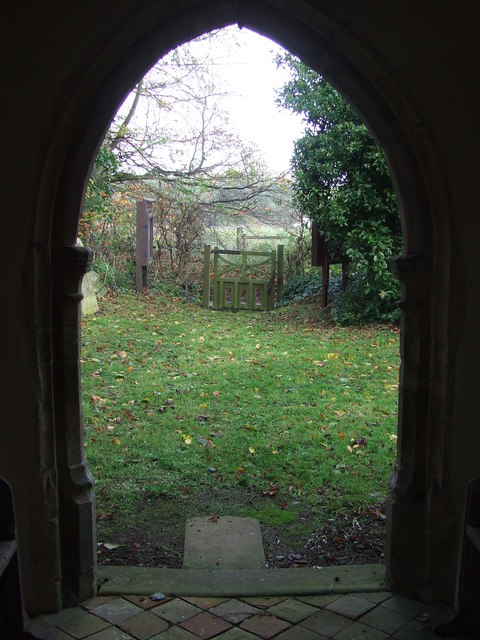
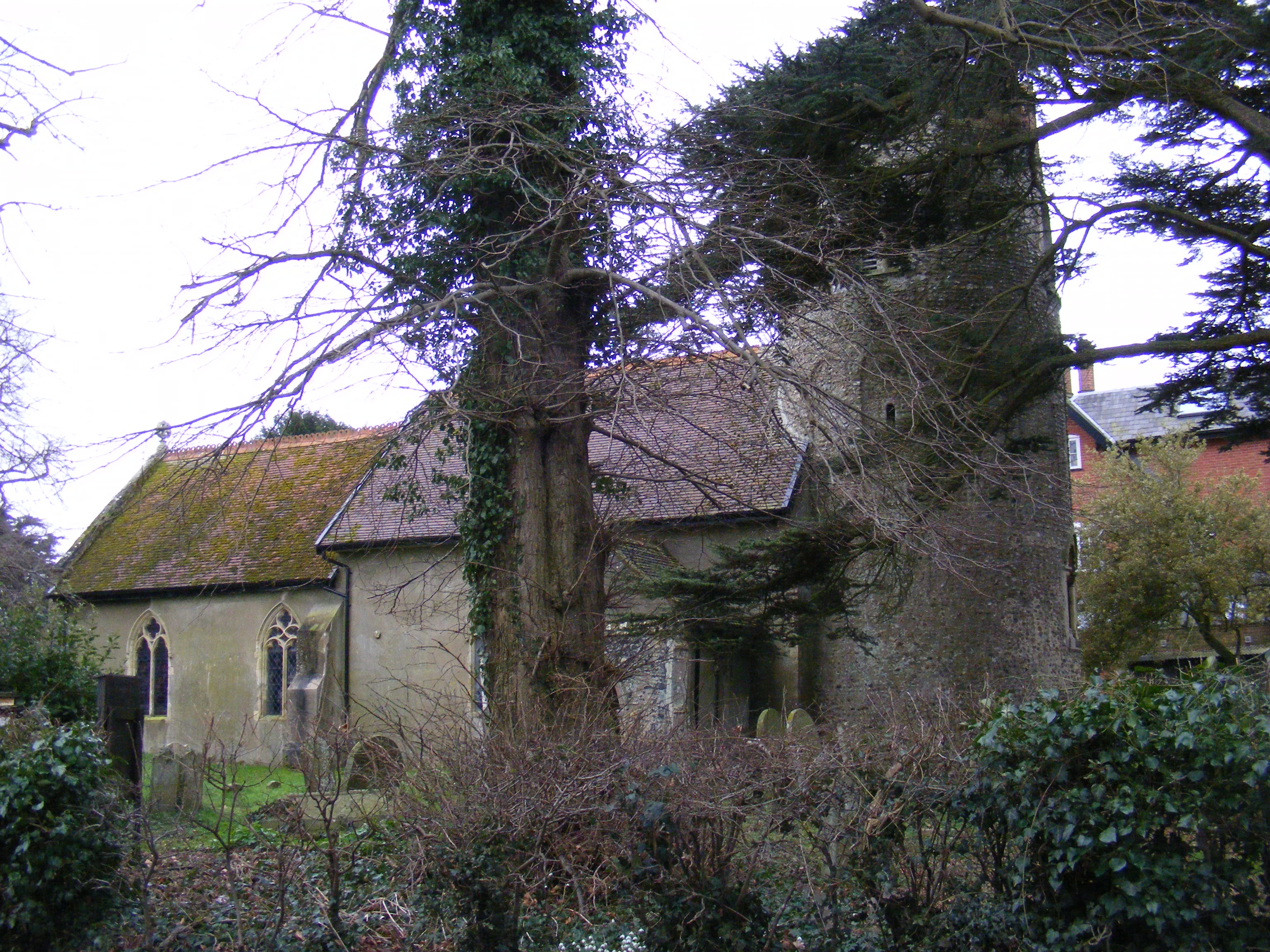
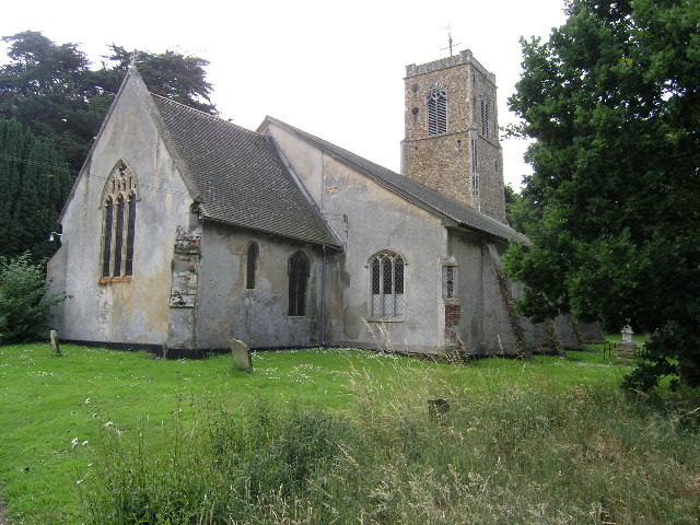
The village itself is small and quaint, with a scattering of traditional Suffolk cottages and farmhouses. The centerpiece of the village is the Church of St. Peter, a Grade II listed building that dates back to the 13th century. The church boasts a picturesque setting and is known for its impressive architecture and historic features.

Thorington offers a peaceful and rural lifestyle, with many residents being involved in farming and agricultural activities. The village has limited amenities, with no shops or pubs, but it benefits from its proximity to larger towns and villages where residents can access a wider range of services and facilities.

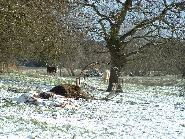
The parish is surrounded by natural beauty, with numerous walking paths and trails that allow residents and visitors to explore the stunning Suffolk countryside. The nearby coast offers opportunities for outdoor activities such as beach walks, birdwatching, and sailing.

In summary, Thorington is a charming and idyllic civil parish in Suffolk, known for its rural setting, historic church, and proximity to the beautiful Suffolk coastline.

If you have any feedback on the listing, please let us know in the comments section below.

Thorington Images

Images are sourced within 2km of 52.303198/1.553427 or Grid Reference TM4273. Thanks to Geograph Open Source API. All images are credited.

Old barn on a sunny spring day An old farm barn, reflected in the pond on a bright spring morning.
Old barn on a sunny spring day
An old farm barn, reflected in the pond on a bright spring morning.
Thorington, St Peter's church The benchmark is cut into a left cornerstone of the church porch and access.
Thorington, St Peter's church
The benchmark is cut into a left cornerstone of the church porch and access.
Thorington, St Peter's church There is a benchmark cut into a left cornerstone of the church porch and access.
Thorington, St Peter's church
There is a benchmark cut into a left cornerstone of the church porch and access.
Brook Farmhouse, Wenhaston with Mells Hamlet <span class="nowrap"><a title="https://historicengland.org.uk/listing/the-list/list-entry/1377269?section=official-list-entry" rel="nofollow ugc noopener" href="https://historicengland.org.uk/listing/the-list/list-entry/1377269?section=official-list-entry">Link</a><img style="margin-left:2px;" alt="External link" title="External link - shift click to open in new window" src="https://s1.geograph.org.uk/img/external.png" width="10" height="10"/></span>
Brook Farmhouse, Wenhaston with Mells Hamlet
Road junction at Blackheath
St. Peter's Church, Thorington <span class="nowrap"><a title="https://historicengland.org.uk/listing/the-list/list-entry/1030681?section=official-list-entry" rel="nofollow ugc noopener" href="https://historicengland.org.uk/listing/the-list/list-entry/1030681?section=official-list-entry">Link</a><img style="margin-left:2px;" alt="External link" title="External link - shift click to open in new window" src="https://s1.geograph.org.uk/img/external.png" width="10" height="10"/></span>
St. Peter's Church, Thorington
Footbridge And Path Footbridge and footpath near to Thorington, Suffolk.
Footbridge And Path
Footbridge and footpath near to Thorington, Suffolk.
Footpath Guide Post A choice of ways, footpath guide post near to Thorington, Suffolk.
Footpath Guide Post
A choice of ways, footpath guide post near to Thorington, Suffolk.
Pond And Sunshine Small pond in a field near to Thorington, Suffolk.
Pond And Sunshine
Small pond in a field near to Thorington, Suffolk.
Footpath Footpath and footpath sign near to Thorington, Suffolk.
Footpath
Footpath and footpath sign near to Thorington, Suffolk.
Derelict Cottages Derelict cottages near to Thorington, Suffolk.
Derelict Cottages
Derelict cottages near to Thorington, Suffolk.
Field And Path Looking north with footpath and field near to Thorington, Suffolk.
Field And Path
Looking north with footpath and field near to Thorington, Suffolk.
St Peter Thorington The village church of St Peter, Thorington, Suffolk for info on the church see <span class="nowrap"><a title="http://www.suffolkchurches.co.uk/thorington.htm" rel="nofollow ugc noopener" href="http://www.suffolkchurches.co.uk/thorington.htm">Link</a><img style="margin-left:2px;" alt="External link" title="External link - shift click to open in new window" src="https://s1.geograph.org.uk/img/external.png" width="10" height="10"/></span>. For other views of the church see <a title="https://www.geograph.org.uk/photo/4754036" href="https://www.geograph.org.uk/photo/4754036">Link</a> <a title="https://www.geograph.org.uk/photo/4754041" href="https://www.geograph.org.uk/photo/4754041">Link</a> <a title="https://www.geograph.org.uk/photo/4754043" href="https://www.geograph.org.uk/photo/4754043">Link</a>
St Peter Thorington
The village church of St Peter, Thorington, Suffolk for info on the church see LinkExternal link. For other views of the church see Link Link Link
View From The Porch View from the porch of St Peter, Thorington, Suffolk.  For other views of the church see <a title="https://www.geograph.org.uk/photo/4754031" href="https://www.geograph.org.uk/photo/4754031">Link</a>  <a title="https://www.geograph.org.uk/photo/4754041" href="https://www.geograph.org.uk/photo/4754041">Link</a> <a title="https://www.geograph.org.uk/photo/4754043" href="https://www.geograph.org.uk/photo/4754043">Link</a>
View From The Porch
View from the porch of St Peter, Thorington, Suffolk. For other views of the church see Link Link Link
Morning Sun Pulpit and sunlight at St Peter, Thorington, Suffolk.  For other views of the church see <a title="https://www.geograph.org.uk/photo/4754031" href="https://www.geograph.org.uk/photo/4754031">Link</a> <a title="https://www.geograph.org.uk/photo/4754036" href="https://www.geograph.org.uk/photo/4754036">Link</a>  <a title="https://www.geograph.org.uk/photo/4754043" href="https://www.geograph.org.uk/photo/4754043">Link</a>
Morning Sun
Pulpit and sunlight at St Peter, Thorington, Suffolk. For other views of the church see Link Link Link
War Memorial War memorial in the village church of St Peter, Thorington, Suffolk.  For other views of the church see <a title="https://www.geograph.org.uk/photo/4754031" href="https://www.geograph.org.uk/photo/4754031">Link</a> <a title="https://www.geograph.org.uk/photo/4754036" href="https://www.geograph.org.uk/photo/4754036">Link</a> <a title="https://www.geograph.org.uk/photo/4754041" href="https://www.geograph.org.uk/photo/4754041">Link</a> <a title="https://www.geograph.org.uk/photo/4754031" href="https://www.geograph.org.uk/photo/4754031">Link</a> <a title="https://www.geograph.org.uk/photo/4754036" href="https://www.geograph.org.uk/photo/4754036">Link</a> <a title="https://www.geograph.org.uk/photo/4754041" href="https://www.geograph.org.uk/photo/4754041">Link</a>
War Memorial
War memorial in the village church of St Peter, Thorington, Suffolk. For other views of the church see Link Link Link Link Link Link
Through Common Wood Footpath through Common Wood near to Blackheath, Suffolk.
Through Common Wood
Footpath through Common Wood near to Blackheath, Suffolk.
Footpath And Common Wood Footpath leading towards Common Wood near to Blackheath, Suffolk.
Footpath And Common Wood
Footpath leading towards Common Wood near to Blackheath, Suffolk.
Show me another place!

Thorington is located at Grid Ref: TM4273 (Lat: 52.303198, Lng: 1.553427)

Administrative County: Suffolk

District: East Suffolk

Police Authority: Suffolk

What 3 Words

///mammoth.worthy.segmented. Near Halesworth, Suffolk

Related Wikis

Church Farm Marshes

Church Farm Marshes is a 56 hectare nature reserve in Thorington in Suffolk. It is managed by the Suffolk Wildlife Trust.This site has areas of marshland...

Thorington

Thorington is a village and a civil parish in the hundred of Blything, in the East Suffolk district of the English county of Suffolk. It is located around...

Wenhaston

Wenhaston is a village situated to the south of the River Blyth in northeastern Suffolk, England. In 2018 it had an estimated population of 563. ��2�...

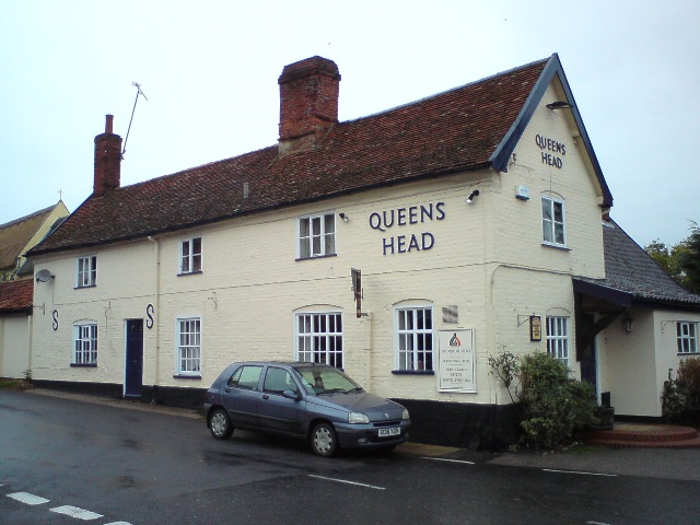
Queen's Head, Bramfield

The Queen's Head is a pub in Bramfield, Suffolk, England. The pub was formerly known as the "Skeltons". It is a Grade II listed building, which dates back...

Have you been to Thorington?

Leave your review of Thorington below (or comments, questions and feedback).