Brynybedd
Settlement in Caernarfonshire
Wales
Brynybedd

Brynybedd is a small hamlet located in the county of Caernarfonshire, Wales. It is situated in the picturesque countryside, surrounded by rolling hills and lush green fields. The hamlet is part of the community of Llanfihangel-y-Pennant, which lies approximately 10 miles southwest of the town of Caernarfon.
Brynybedd is known for its tranquility and natural beauty, making it an ideal destination for those seeking a peaceful retreat. The area is popular with hikers and nature enthusiasts, as it offers numerous walking trails that showcase the stunning Welsh countryside. Visitors can explore the nearby Moel Hebog mountain, which offers breathtaking panoramic views of the surrounding landscape.
In terms of amenities, Brynybedd is a small and quiet hamlet, lacking any major commercial establishments. However, the nearby town of Caernarfon provides a range of services and facilities, including shops, restaurants, and leisure activities.
The local community in Brynybedd is tight-knit and friendly, with a strong sense of community spirit. The hamlet is home to a small number of residents who take pride in maintaining the area's natural beauty and preserving its rural character.
Overall, Brynybedd offers a peaceful and idyllic setting for those looking to escape the hustle and bustle of city life. With its stunning natural surroundings and welcoming community, it is a place that truly captures the essence of rural Wales.
If you have any feedback on the listing, please let us know in the comments section below.
Brynybedd Images
Images are sourced within 2km of 53.052753/-3.894164 or Grid Reference SH7352. Thanks to Geograph Open Source API. All images are credited.


Brynybedd is located at Grid Ref: SH7352 (Lat: 53.052753, Lng: -3.894164)
Unitary Authority: Conwy
Police Authority: North Wales
Also known as: Bryn-y-Bedd
What 3 Words
///diplomats.quote.fallback. Near Blaenau-Ffestiniog, Gwynedd
Nearby Locations
Related Wikis
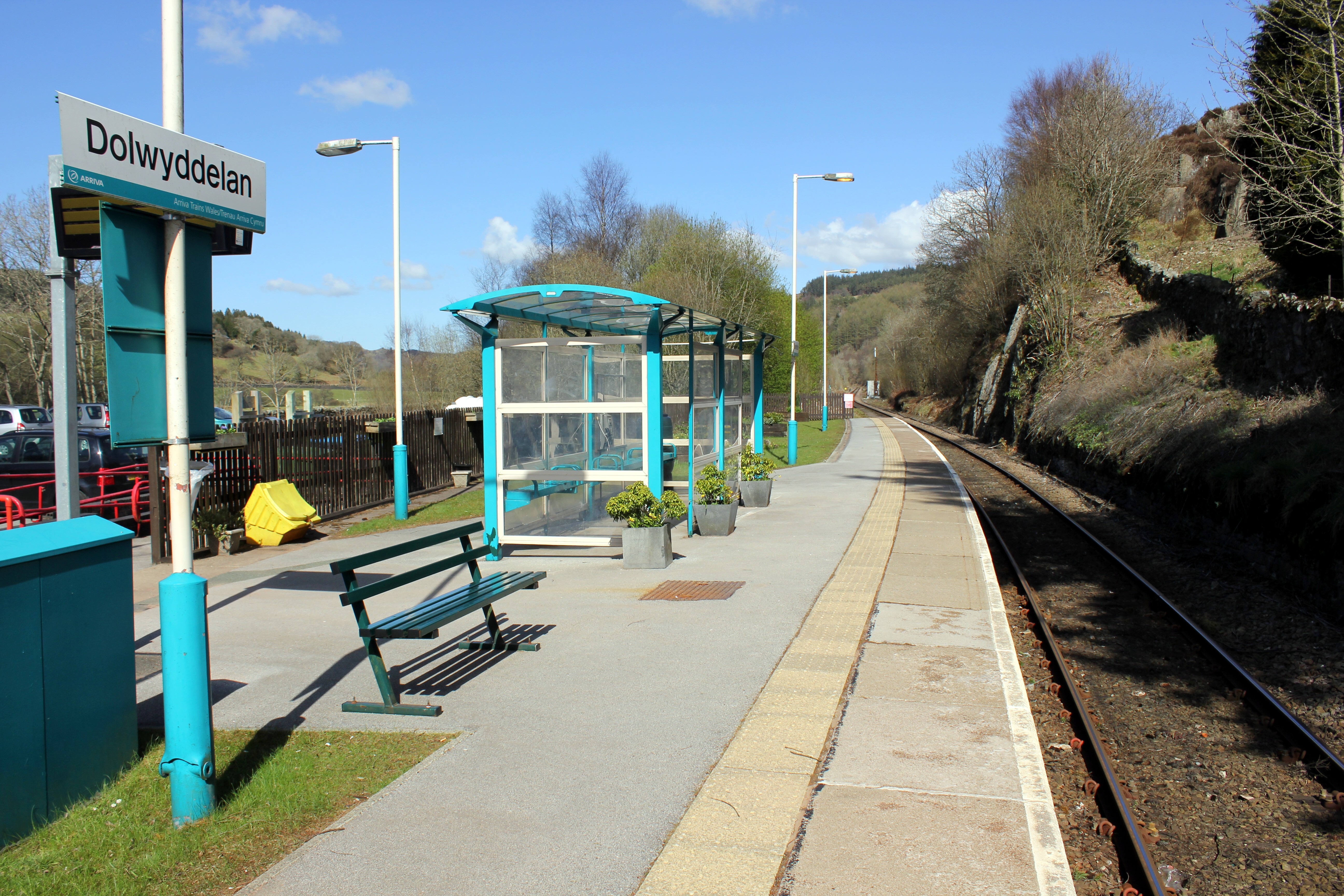
Dolwyddelan railway station
Dolwyddelan railway station is a passenger station in the Lledr Valley, Wales, on the Conwy Valley Line from Llandudno Junction to Blaenau Ffestiniog,...

Pentre Bont
Pentre Bont is a small village in the Dolwyddelan community, in the historic county of Caernarfonshire and county borough of Conwy. == References... ==
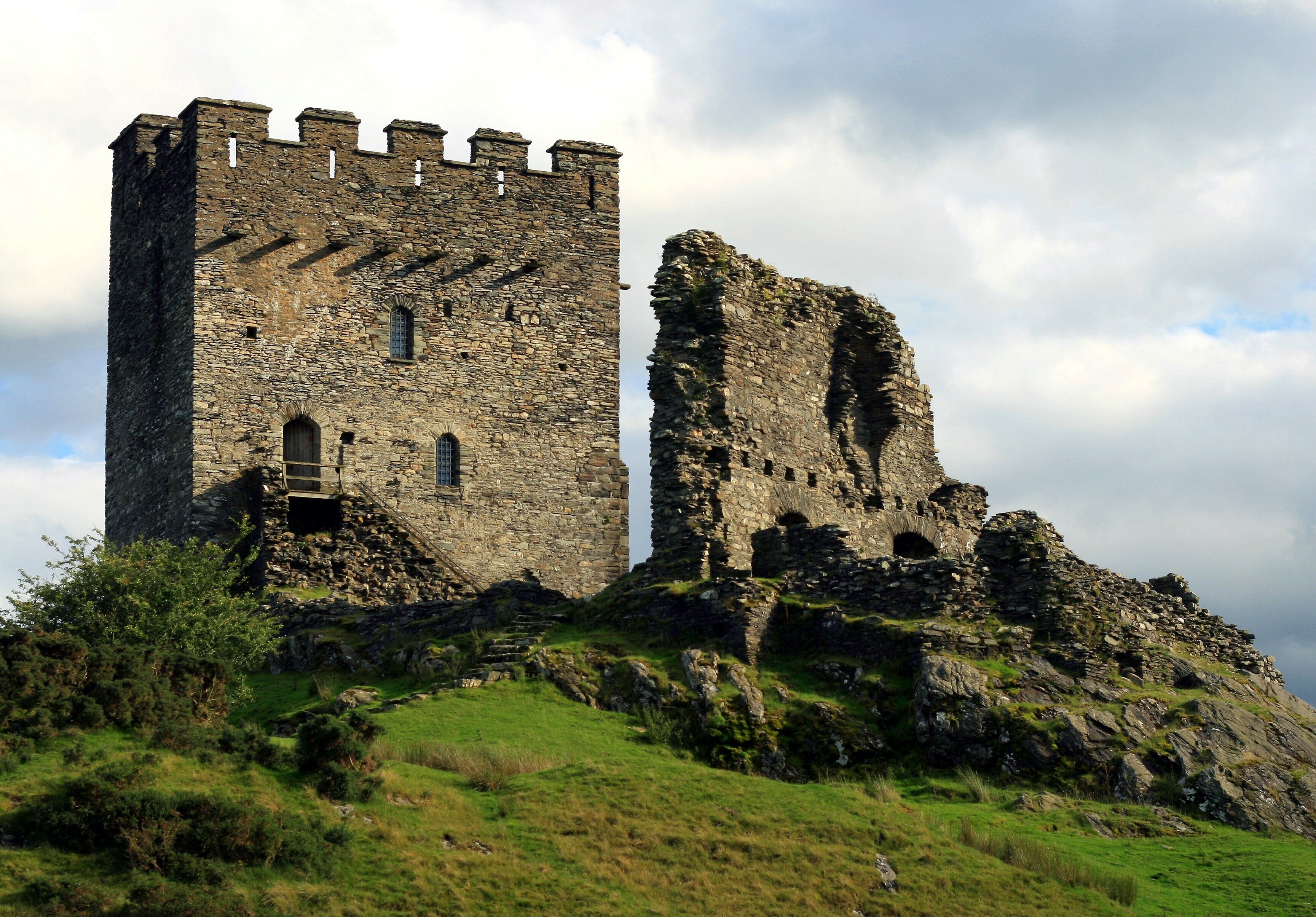
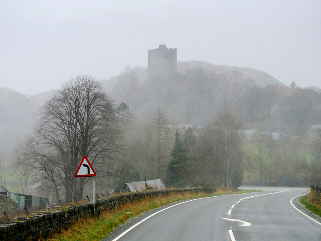
Dolwyddelan Castle
Dolwyddelan Castle ( dol-with-EL-an; Welsh: Castell Dolwyddelan; Welsh pronunciation: [kastɛɬ dɔlwɪð’ɛlan]) is a thirteenth-century castle located west...
Chwarel Ddu quarry
Chwarel Ddu quarry was the earliest slate quarry in the Lledr Valley. It was working before 1810, and continued in sporadic operation until the late 1920s...
Related Videos

Stylish Two Bedroom Holiday Cottage Near Betws y Coed | Neuadd-Dolwyddelan
This stylish two bedroom holiday cottage near Betws y Coed comes with a pretty garden terrace and big mountain views.

Stylish Two Bedroom Holiday Cottage Near Betws y Coed | Neuadd-Dolwyddelan | Bitesize
This stylish two bedroom holiday cottage near Betws y Coed comes with a pretty garden terrace and big mountain views.
cymru hiking
walking in wales,snowdonia.

Moel Siabod and Carnedd y Cribau
Sunday 27th March 2022 This was my first walk as part of a five-day trip away in Snowdonia. I'd spent my first night at Glan Aber ...
Nearby Amenities
Located within 500m of 53.052753,-3.894164Have you been to Brynybedd?
Leave your review of Brynybedd below (or comments, questions and feedback).