Bryn-uchel-uchaf

Settlement in Montgomeryshire

Wales

Bryn-uchel-uchaf

Old Milestone by the A470, Dolcorsllwyn, Glantwymyn Parish Machynlleth Chamfer by the A470, in parish of Glantwymyn (Powys District), Dolcorsllwyn, between road to Hall and Lodge, on verge, East side of road.

Inscription reads:- : MACHYNLLETH / 9 MILES / MALLWYD / 2½ / POOL 29 : 

Surveyed

Milestone Society National ID: MOT_MCWP09
Old Milestone by the A470, Dolcorsllwyn, Glantwymyn Parish Credit: Milestone Society

Bryn-uchel-uchaf is a small village located in Montgomeryshire, Wales. Situated in the picturesque Welsh countryside, the village is known for its stunning views of the surrounding hills and valleys. The name Bryn-uchel-uchaf translates to "highest high hill" in English, reflecting the village's elevated position.

The village is made up of a collection of traditional Welsh stone cottages, many of which date back to the 18th and 19th centuries. The village is home to a small population of around 100 residents, who enjoy a peaceful and close-knit community atmosphere.

Bryn-uchel-uchaf is surrounded by lush green fields and rolling hills, making it an ideal location for outdoor enthusiasts. There are numerous walking and hiking trails in the area, offering visitors the opportunity to explore the stunning Welsh countryside.

Despite its rural location, Bryn-uchel-uchaf is within easy reach of larger towns such as Newtown and Welshpool, where residents can find a range of amenities including shops, restaurants, and schools.

Overall, Bryn-uchel-uchaf is a charming and tranquil village that offers a peaceful retreat for those looking to escape the hustle and bustle of city life.

If you have any feedback on the listing, please let us know in the comments section below.

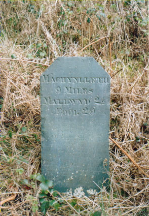
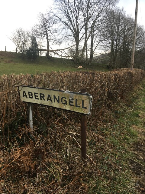
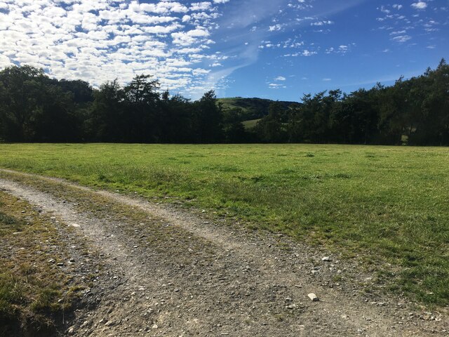
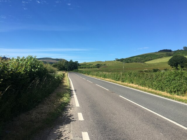
Bryn-uchel-uchaf Images

Images are sourced within 2km of 52.65749/-3.7016224 or Grid Reference SH8508. Thanks to Geograph Open Source API. All images are credited.

Old Milestone by the A470, Dolcorsllwyn, Glantwymyn Parish Machynlleth Chamfer by the A470, in parish of Glantwymyn (Powys District), Dolcorsllwyn, between road to Hall and Lodge, on verge, East side of road.

Inscription reads:- : MACHYNLLETH / 9 MILES / MALLWYD / 2½ / POOL 29 : 

Surveyed

Milestone Society National ID: MOT_MCWP09
Old Milestone by the A470, Dolcorsllwyn, Glantwymyn Parish
Machynlleth Chamfer by the A470, in parish of Glantwymyn (Powys District), Dolcorsllwyn, between road to Hall and Lodge, on verge, East side of road. Inscription reads:- : MACHYNLLETH / 9 MILES / MALLWYD / 2½ / POOL 29 : Surveyed Milestone Society National ID: MOT_MCWP09
Sign marking the village of Aberangell
Field near Cwm Llinau
A470 near Cwm Llinau
Flying the Turbines A hang glider comes into land on the plateau in front of the wind turbines.
Flying the Turbines
A hang glider comes into land on the plateau in front of the wind turbines.
River terrace view View of the drift features and river terraces of the Dovey Valley to the North West of Cwm Llinau
River terrace view
View of the drift features and river terraces of the Dovey Valley to the North West of Cwm Llinau
Track from A470
Track from A470
View towards Aberangell
View across valley from A470
Road off A470
Road off A470
Pasture beside the A470 Just to the south of Cwm Llinau, looking towards the village.
Pasture beside the A470
Just to the south of Cwm Llinau, looking towards the village.
Road Bridge Outside Aberhiriaeth B & B Looking northwards on the A470.
Road Bridge Outside Aberhiriaeth B & B
Looking northwards on the A470.
The A470 looking south from Cwm-Llinau
Farm Track in Cwm-Llinau For my walk this week, I chose one of complete contrast to the one described previously (see <a href="https://www.geograph.org.uk/photo/1083502">SH6918 : Access to the Mawddach Trail at Penmaenpool</a>). For a long time now, I've been eyeing a block of 'virgin' squares in the vicinity of Cwm-Llinau, about 9 miles north-east of Machynlleth and beside the main A470 road. Unfortunately, the bus service to the area is not very frequent, so this time I had to use the car to get there. I parked at the end of the public road from Cwm-Llinau at GR <a href="https://www.geograph.org.uk/gridref/SH856081">SH856081</a>, where there is room for one car on the verge.

The circular route that I took is about seven miles on tracks and public bridleways/footpaths, climbing about 1000', initially beside Afon Llinau, then through the upland bog and forestry area at Waun Llinau, emerging onto the ridge at Mynydd y Cemais (now a windfarm). My descent from Mynydd y Cemais was down a track on the steep scarp to Talyrnau farm and thence back to my start point.

If taking this walk, there are a few things to be aware of. The route through the bog at Waun Llinau is nicely waymarked, but even so, a lack of concentration can lead you to the wrong side of it, with the need to retrace your steps, or navigate across it (as I had to!). Also, the marked paths on Mynydd y Cemais are now pretty meaningless as they appear to have been subsumed into the windfarm track network. Another point to note, the farm area at Talyrnau is not walker friendly. There is no waymarking (that I could see), most gates on the right of way are permanently roped shut and one stile has barbed wire set across it.

Overall, a very enjoyable walk with some nice winter sunshine with frost on the ground all day (and a bitter east wind blowing across Mynydd y Cemais) and with some magnificent scenery. Navigational skills were tested and it was certainly an excellent way to blow away the Christmas cobwebs.
Farm Track in Cwm-Llinau
For my walk this week, I chose one of complete contrast to the one described previously (see SH6918 : Access to the Mawddach Trail at Penmaenpool). For a long time now, I've been eyeing a block of 'virgin' squares in the vicinity of Cwm-Llinau, about 9 miles north-east of Machynlleth and beside the main A470 road. Unfortunately, the bus service to the area is not very frequent, so this time I had to use the car to get there. I parked at the end of the public road from Cwm-Llinau at GR SH856081, where there is room for one car on the verge. The circular route that I took is about seven miles on tracks and public bridleways/footpaths, climbing about 1000', initially beside Afon Llinau, then through the upland bog and forestry area at Waun Llinau, emerging onto the ridge at Mynydd y Cemais (now a windfarm). My descent from Mynydd y Cemais was down a track on the steep scarp to Talyrnau farm and thence back to my start point. If taking this walk, there are a few things to be aware of. The route through the bog at Waun Llinau is nicely waymarked, but even so, a lack of concentration can lead you to the wrong side of it, with the need to retrace your steps, or navigate across it (as I had to!). Also, the marked paths on Mynydd y Cemais are now pretty meaningless as they appear to have been subsumed into the windfarm track network. Another point to note, the farm area at Talyrnau is not walker friendly. There is no waymarking (that I could see), most gates on the right of way are permanently roped shut and one stile has barbed wire set across it. Overall, a very enjoyable walk with some nice winter sunshine with frost on the ground all day (and a bitter east wind blowing across Mynydd y Cemais) and with some magnificent scenery. Navigational skills were tested and it was certainly an excellent way to blow away the Christmas cobwebs.
Walking through Mynydd y Cemais Windfarm Viewed while walking along the Mynydd y Cemais ridge. This is near the highest point of the ridge, which rises to about 430 metres. For more information about this walk, see <a href="https://www.geograph.org.uk/photo/1093960">SH8508 : Farm Track in Cwm-Llinau</a>.
Walking through Mynydd y Cemais Windfarm
Viewed while walking along the Mynydd y Cemais ridge. This is near the highest point of the ridge, which rises to about 430 metres. For more information about this walk, see SH8508 : Farm Track in Cwm-Llinau.
Cwmeidrol farm Viewed here from the track descending the steep scarp of Mynydd y Cemais. For more information about this walk, see <a href="https://www.geograph.org.uk/photo/1093960">SH8508 : Farm Track in Cwm-Llinau</a>.
Cwmeidrol farm
Viewed here from the track descending the steep scarp of Mynydd y Cemais. For more information about this walk, see SH8508 : Farm Track in Cwm-Llinau.
Descending towards Talyrnau Farm One of the caravan sites at Cwm Llinau is visible. For more information about this walk, see <a href="https://www.geograph.org.uk/photo/1093960">SH8508 : Farm Track in Cwm-Llinau</a>.
Descending towards Talyrnau Farm
One of the caravan sites at Cwm Llinau is visible. For more information about this walk, see SH8508 : Farm Track in Cwm-Llinau.
Trees in Cwm Afon Llinau Viewed from the track leading to Waun Llinau. For more information about this walk, see <a href="https://www.geograph.org.uk/photo/1093960">SH8508 : Farm Track in Cwm-Llinau</a>.
Trees in Cwm Afon Llinau
Viewed from the track leading to Waun Llinau. For more information about this walk, see SH8508 : Farm Track in Cwm-Llinau.
Show me another place!

Bryn-uchel-uchaf is located at Grid Ref: SH8508 (Lat: 52.65749, Lng: -3.7016224)

Unitary Authority: Powys

Police Authority: Dyfed Powys

What 3 Words

///plug.broth.punt. Near Cwm-Llinau, Powys

Related Wikis

Afon Angell

The Afon Angell is a river in Gwynedd, Mid Wales. The river flows eastwards from its source on the eastern flank of Mynydd Dolgoed, joining the Afon Dyfi...

Aberangell

Aberangell () is a village in Gwynedd, Wales. == Geography == Aberangell stands at the confluence of the Afon Angell and the Afon Dyfi, and lies within...

Aberangell railway station

Aberangell railway station was an intermediate railway station on the Mawddwy Railway which ran from Cemmaes Road to Dinas Mawddy in the Welsh county...

Cemmaes railway station

Cemmaes railway station was an intermediate railway station on the Mawddwy Railway which ran from Cemmaes Road to Dinas Mawddy in the Welsh county of...

Nearby Amenities

Located within 500m of 52.65749,-3.7016224
Place: farm
Lat/Long: 52.6571361/-3.7005011
SK53 Solar: missing_building
Building: yes
Fixme: building area needed
Lat/Long: 52.6562906/-3.7049246
SK53 Solar: missing_building
Building: yes
Fixme: building area needed
Lat/Long: 52.6598772/-3.7027735
Direction: 235
Generator Method: photovoltaic
Generator Output Electricity: yes
Generator Solar Modules: 12
Generator Source: solar
Generator Type: solar_photovoltaic_panel
Location: roof
Power: generator
Lat/Long: 52.6562729/-3.7049675
Direction: 190
Generator Method: photovoltaic
Generator Output Electricity: yes
Generator Solar Modules: 10
Generator Source: solar
Generator Type: solar_photovoltaic_panel
Location: roof
Power: generator
Lat/Long: 52.6598081/-3.7027969
Post Box
Post Box Type: lamp
Lat/Long: 52.6560604/-3.7050672
The data included in this document is from www.openstreetmap.org. The data is made available under ODbL.

Have you been to Bryn-uchel-uchaf?

Leave your review of Bryn-uchel-uchaf below (or comments, questions and feedback).