Tadmarton

Civil Parish in Oxfordshire Cherwell

England

Tadmarton

Grass field at Lower Tadmarton
Grass field at Lower Tadmarton Credit: Jonathan Thacker

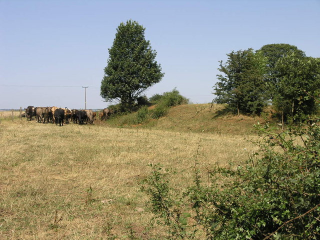
Tadmarton is a small civil parish located in Oxfordshire, England. Situated approximately three miles west of Banbury, it covers an area of about 1,500 acres. The parish is predominantly rural, characterized by rolling countryside, farmland, and scattered residential properties.

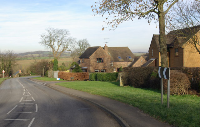
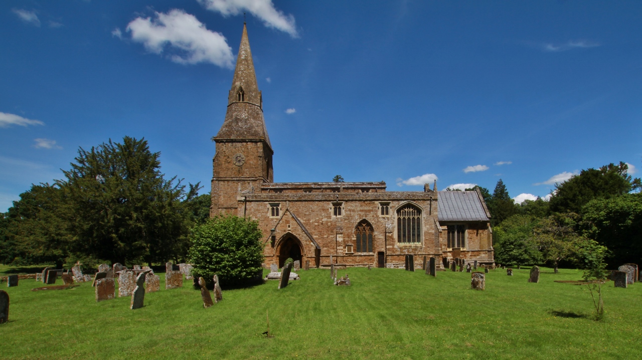
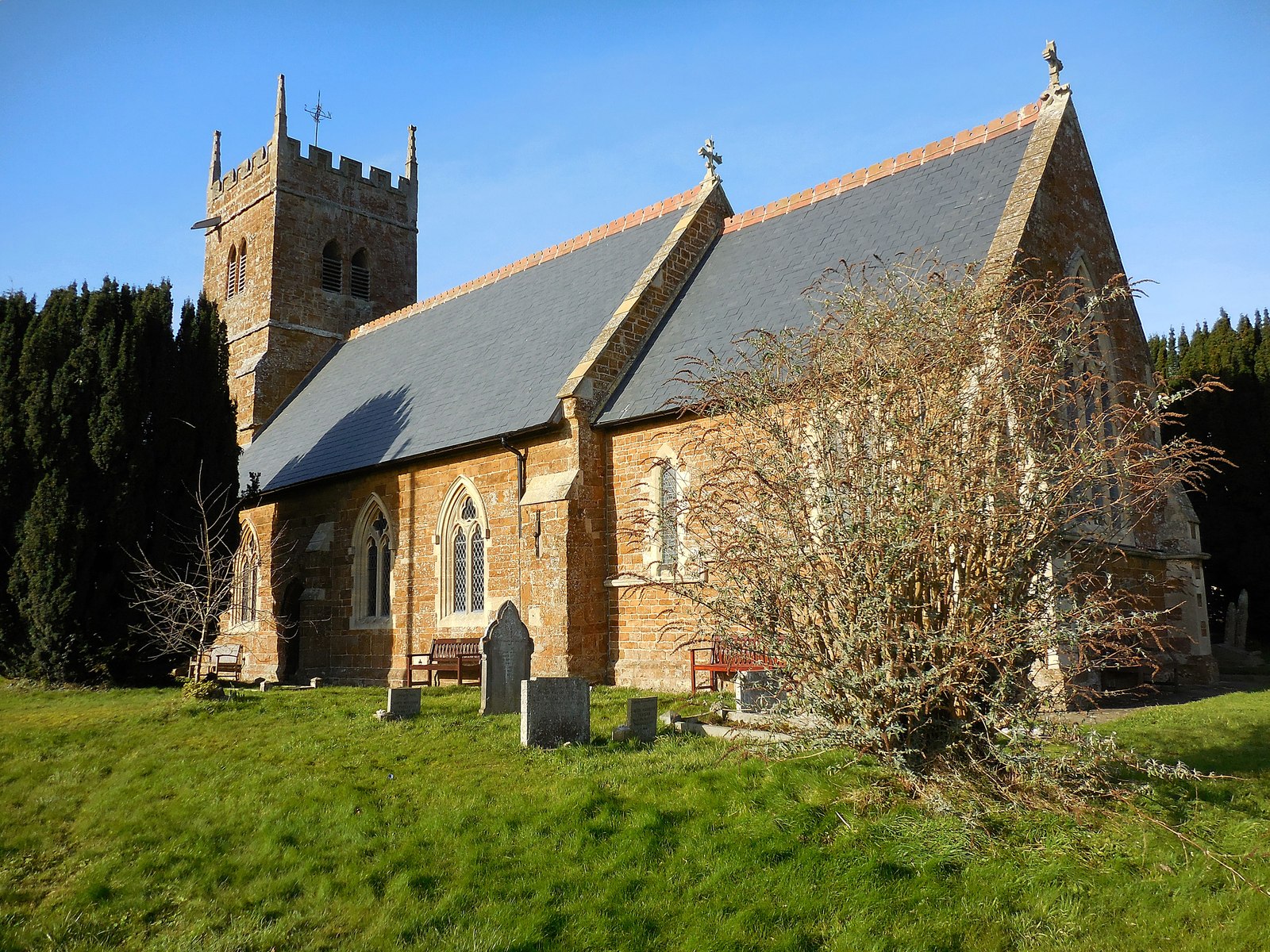
The village of Tadmarton itself is a picturesque settlement with a population of around 200 residents. It features a mix of traditional cottages and modern houses, giving it a charming and timeless ambiance. The centerpiece of the village is the St. Nicholas Church, a beautiful medieval structure dating back to the 13th century. The church is an important historical and architectural landmark within the parish.

Tadmarton benefits from its proximity to the larger town of Banbury, which provides a range of amenities and services for residents. The parish is well-connected to the surrounding areas by road, with the M40 motorway just a short drive away, offering convenient access to London and Birmingham.

The surrounding countryside offers numerous opportunities for outdoor activities and leisure pursuits. Residents and visitors can enjoy scenic walks and hikes, exploring the stunning landscape and taking in the tranquil beauty of the area.

In summary, Tadmarton is a small and idyllic civil parish in Oxfordshire, characterized by its rural setting, charming village, and historic church. It provides a peaceful and picturesque place to live, with easy access to nearby amenities and beautiful countryside for outdoor enthusiasts.

If you have any feedback on the listing, please let us know in the comments section below.

Tadmarton Images

Images are sourced within 2km of 52.030788/-1.420043 or Grid Reference SP3937. Thanks to Geograph Open Source API. All images are credited.

Grass field at Lower Tadmarton
Hollow Road, Lower Tadmarton Autumn colours just beginning to show.
Hollow Road, Lower Tadmarton
Autumn colours just beginning to show.
St. Nicholas, Tadmarton
Cattle and Fort The bump to the right of the cattle is the remains of an ancient fort.  A road passes over the top of the fort as it probably did when it was active.
Cattle and Fort
The bump to the right of the cattle is the remains of an ancient fort. A road passes over the top of the fort as it probably did when it was active.
Bridleway and Golf This access road to Tadmarton Heath Golf Club is also a bridleway.
Bridleway and Golf
This access road to Tadmarton Heath Golf Club is also a bridleway.
Bridleway to Tadmarton A bridleway follows the line of this hedge on its journey to Tadmarton.
Bridleway to Tadmarton
A bridleway follows the line of this hedge on its journey to Tadmarton.
B4035 west of Tadmarton The B4035 approaches Tadmarton from the west via a double bend past a small development of modern houses.
B4035 west of Tadmarton
The B4035 approaches Tadmarton from the west via a double bend past a small development of modern houses.
The Lampet Arms, Tadmarton Village pub on the B4035 Shipston on Stour - Banbury road.
The Lampet Arms, Tadmarton
Village pub on the B4035 Shipston on Stour - Banbury road.
Tadmarton View across fields to Tadmarton's fine Norman and medieval church.
Tadmarton
View across fields to Tadmarton's fine Norman and medieval church.
Home Farm, Tadmarton Farm in Tadmarton village. A herd of cows stands at the gate, presumably waiting to be milked.
Home Farm, Tadmarton
Farm in Tadmarton village. A herd of cows stands at the gate, presumably waiting to be milked.
Village end
Village end
A golden shadow? Actually rape, presumably not disturbed by machinery due to the proximity of the tree.
A golden shadow?
Actually rape, presumably not disturbed by machinery due to the proximity of the tree.
Field boundary west of Tadmarton
Road to Swalcliffe Lea
Field by Upper Lea Farm
Oxfordshire countryside Rolling Oxfordshire farmland near Tadmarton.
Oxfordshire countryside
Rolling Oxfordshire farmland near Tadmarton.
Farmland near Tadmarton View over an oilseed rape field to farmland around the village of Tadmarton.
Farmland near Tadmarton
View over an oilseed rape field to farmland around the village of Tadmarton.
Road into Lower Tadmarton Unclassified road to the south-west of Lower Tadmarton.
Road into Lower Tadmarton
Unclassified road to the south-west of Lower Tadmarton.
Show me another place!

Tadmarton is located at Grid Ref: SP3937 (Lat: 52.030788, Lng: -1.420043)

Administrative County: Oxfordshire

District: Cherwell

Police Authority: Thames Valley

What 3 Words

///fiction.dimension.fury. Near Bloxham, Oxfordshire

Nearby Locations

Tadmarton Tadmarton

Related Wikis

Banbury Rural District

Banbury was a rural district in Oxfordshire, England from 1894 to 1974. It was formed under the Local Government Act 1894 from the bulk of the Banbury...

Tadmarton

Tadmarton is a village and civil parish about 4 miles (6.4 km) west of Banbury, Oxfordshire. The 2011 Census recorded the parish's population as 541, which...
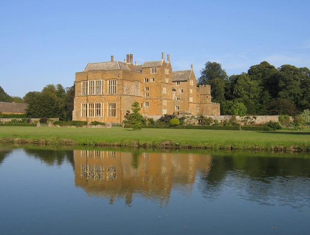
Broughton Castle

Broughton Castle is a medieval fortified manor house in the village of Broughton, which is about two miles south-west of Banbury in Oxfordshire, England...

Swalcliffe Park School

Swalcliffe Park School is a specialist residential and day school in Oxfordshire, England for boys aged 11–19 who have needs arising from their Autistic...

Swalcliffe

Swalcliffe is a village and civil parish about 5 miles (8 km) west of Banbury in Oxfordshire. The parish is about 2+1⁄2 miles (4 km) long north–south and...

Broughton, Oxfordshire

Broughton is a village and civil parish in northern Oxfordshire, England, about 2+1⁄2 miles (4 km) southwest of Banbury. The 2011 Census recorded the...

Milcombe

Milcombe is a village and civil parish about 5 miles (8 km) southwest of Banbury, Oxfordshire. Pronounced Mill-Comb-Bee. Milcombe is famous for its village...

Sibford

Sibford (or The Sibfords) is the collective name given to the villages of Sibford Gower, Sibford Ferris and Burdrop on the edge of the Cotswolds in north...

Nearby Amenities

Located within 500m of 52.030788,-1.420043
Bus Stop
Brookfield Rise
Bus: yes
Naptan AtcoCode: 340001477CNR
Naptan Bearing: S
Naptan CommonName: Brookfield Rise
Naptan Indicator: Outside
Naptan Landmark: Brookfield Rise
Naptan NaptanCode: oxfgmwga
Naptan Street: Main Street
Naptan Verified: no
Public Transport: platform
Source: naptan_import
Lat/Long: 52.0342/-1.4244003
Brookfield Rise
Naptan AtcoCode: 340004132OPP
Naptan Bearing: N
Naptan BusStopType: CUS
Naptan CommonName: Brookfield Rise
Naptan Indicator: Opposite
Naptan Landmark: Brookfield Rise
Naptan NaptanCode: oxfwtgat
Naptan Street: Main Street
Naptan Verified: no
Source: naptan_import
Lat/Long: 52.0340566/-1.4245042
Power: pole
Lat/Long: 52.0338653/-1.4149323
Power: pole
Lat/Long: 52.0331286/-1.4154783
Power: pole
Lat/Long: 52.0316716/-1.4152181
The data included in this document is from www.openstreetmap.org. The data is made available under ODbL.

Have you been to Tadmarton?

Leave your review of Tadmarton below (or comments, questions and feedback).