Sutton St Edmund
Civil Parish in Lincolnshire South Holland
England
Sutton St Edmund

Sutton St Edmund is a civil parish located in the county of Lincolnshire, England. It is situated approximately 8 miles southeast of the town of Spalding and covers an area of around 6 square miles. The parish is part of the South Holland district and is surrounded by flat agricultural land.
The village of Sutton St Edmund is the main settlement within the parish. It has a population of around 200 people and is known for its picturesque rural setting. The village is characterized by its traditional stone cottages and well-maintained gardens, giving it a quintessentially English charm.
There are a few amenities available within the village, including a local pub and a village hall. The pub serves as a social hub for residents and visitors, offering a place to relax and enjoy a drink or a meal. The village hall hosts various community events and activities throughout the year, such as craft fairs and charity fundraisers.
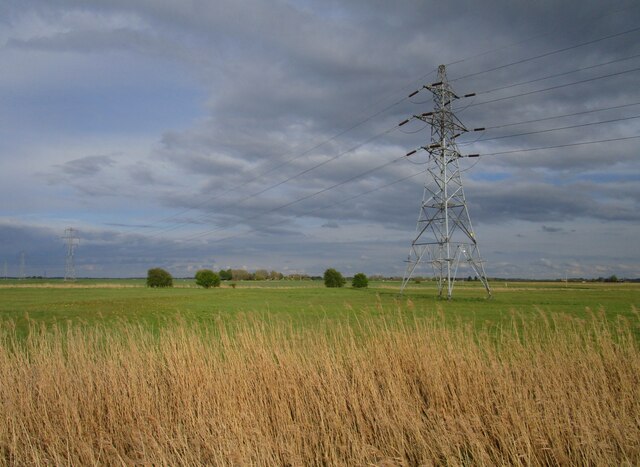
Sutton St Edmund is surrounded by fertile farmland, and agriculture plays a significant role in the local economy. The fields around the village are primarily used for arable farming, with crops like wheat, barley, and potatoes being cultivated.
Overall, Sutton St Edmund offers a peaceful and idyllic countryside setting, making it an attractive place to live for those seeking a rural lifestyle. Its close proximity to Spalding provides access to additional amenities and services, making it a convenient location for residents.
If you have any feedback on the listing, please let us know in the comments section below.
Sutton St Edmund Images
Images are sourced within 2km of 52.690574/0.017268 or Grid Reference TF3612. Thanks to Geograph Open Source API. All images are credited.


Sutton St Edmund is located at Grid Ref: TF3612 (Lat: 52.690574, Lng: 0.017268)
Administrative County: Lincolnshire
District: South Holland
Police Authority: Lincolnshire
What 3 Words
///boomer.different.form. Near Gedney Hill, Lincolnshire
Nearby Locations
Related Wikis
Sutton St Edmund
Sutton St Edmunds is a village and civil parish in the South Holland district of Lincolnshire, England, about 14 miles (23 km) south-east from the town...

Gedney Hill
Gedney Hill is a village and civil parish in South Holland district of Lincolnshire, England. The population of the civil parish at the 2011 census was...

The Museum of Technology
The Museum of Technology the History of Gadgets and Gizmos (formerly The Museum of Technology, The Great War and WWII) is a technology museum in Throckenholt...
Throckenholt
Throckenholt is a village in the civil parish of Sutton St Edmund (where the population is listed) in the South Holland district of Lincolnshire, England...

Parson Drove
Parson Drove is a fen village in the Isle of Ely, Cambridgeshire, England. A linear settlement, it is 6 miles (10 km) west of Wisbech, the nearest town...
FC Parson Drove
Football Club Parson Drove is a football club based in Parson Drove, Cambridgeshire, England. They are currently members of the Eastern Counties League...

Holbeach Drove
Holbeach Drove is a village in the South Holland district of Lincolnshire, England. It is situated approximately 5 miles (8 km) east from Crowland, and...
St John the Baptist's Church, Parson Drove
St John the Baptist's Church is a redundant Anglican church in the village of Parson Drove, Cambridgeshire, England. It is recorded in the National Heritage...
Nearby Amenities
Located within 500m of 52.690574,0.017268Have you been to Sutton St Edmund?
Leave your review of Sutton St Edmund below (or comments, questions and feedback).