Sutton Bridge
Civil Parish in Lincolnshire South Holland
England
Sutton Bridge

Sutton Bridge is a civil parish located in the county of Lincolnshire, England. Situated on the banks of the River Nene, it lies approximately 10 miles west of King's Lynn and 7 miles east of Long Sutton. The village itself has a population of around 2,500 people.
With its strategic position, Sutton Bridge has historically been an important crossing point over the river. The first bridge was built here in the 13th century, and it has continued to be a vital link between Lincolnshire and Norfolk ever since. Today, the village is connected to the A17 road, which provides easy access to nearby towns and cities.
In terms of amenities, Sutton Bridge offers a range of services to its residents. There are several local shops, including a supermarket, as well as a post office and a pharmacy. The village also has a primary school and a medical center, ensuring that basic needs are well catered for.
Sutton Bridge is known for its picturesque views of the river and surrounding countryside, making it a popular destination for tourists and nature lovers. The area is rich in wildlife, with birdwatching being a particularly popular activity. The nearby Sutton Bridge Golf Club offers a scenic course for enthusiasts.
Overall, Sutton Bridge is a charming village with a rich history and a strong sense of community. Its riverside location, combined with its amenities and natural beauty, make it an attractive place to live or visit in Lincolnshire.
If you have any feedback on the listing, please let us know in the comments section below.
Sutton Bridge Images
Images are sourced within 2km of 52.786112/0.208739 or Grid Reference TF4923. Thanks to Geograph Open Source API. All images are credited.


Sutton Bridge is located at Grid Ref: TF4923 (Lat: 52.786112, Lng: 0.208739)
Administrative County: Lincolnshire
District: South Holland
Police Authority: Lincolnshire
What 3 Words
///knees.judge.pots. Near Sutton Bridge, Lincolnshire
Nearby Locations
Related Wikis

Sutton Bridge
Sutton Bridge is a village and civil parish in the South Holland district of Lincolnshire, England. It is situated on the A17 road, 7 miles (11 km) north...

Cross Keys Bridge
Cross Keys Bridge is a swing bridge that carries the busy single carriageway A17 road which runs from Newark in Nottinghamshire to King's Lynn in Norfolk...
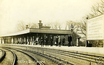
Sutton Bridge railway station
Sutton Bridge railway station was a station in Sutton Bridge, south Lincolnshire, England, which opened in the 19th century. It became part of the Midland...

RAF Sutton Bridge
Royal Air Force Sutton Bridge or more simply RAF Sutton Bridge is a former Royal Air Force station found next to the village of Sutton Bridge in the south...
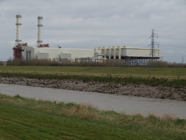
Sutton Bridge Power Station
Sutton Bridge Power Station is an 819 MW gas-fired power station in Sutton Bridge in the south-east of Lincolnshire in South Holland, England. It is situated...

Little Sutton, Lincolnshire
Little Sutton is a small civil parish, containing a few farms and a few houses, lying between the much larger parishes of Long Sutton and Sutton Bridge...
Walpole Cross Keys
Walpole Cross Keys is a village and civil parish in the English county of Norfolk. It covers an area of 4.03 km2 (1.56 sq mi) and had a population of 469...
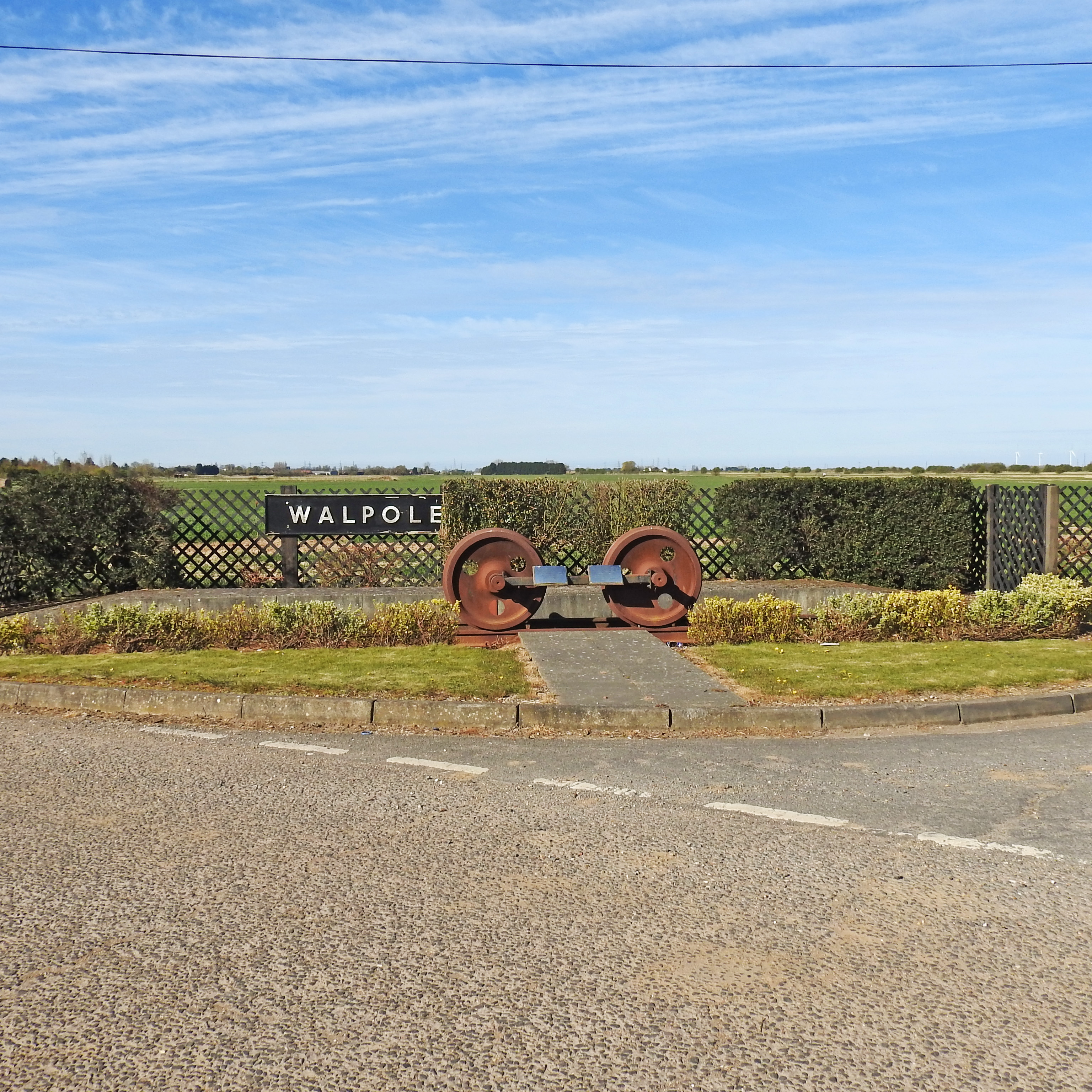
Walpole railway station (England)
Walpole railway station was a station in Norfolk. It is now disused. First opened in 1882, it was part of the Midland and Great Northern Joint Railway...
Nearby Amenities
Located within 500m of 52.786112,0.208739Have you been to Sutton Bridge?
Leave your review of Sutton Bridge below (or comments, questions and feedback).