Brynhoffnant

Settlement in Cardiganshire

Wales

Brynhoffnant

Ordnance Survey Cut Mark? This OS cut mark or poor copy, can be found on the north parapet of the bridge. It marked a point 129.700m above mean sea level.
Ordnance Survey Cut Mark? Credit: Adrian Dust

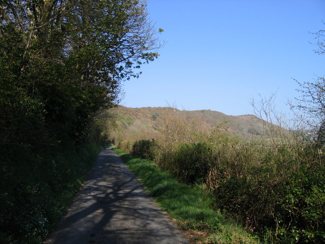
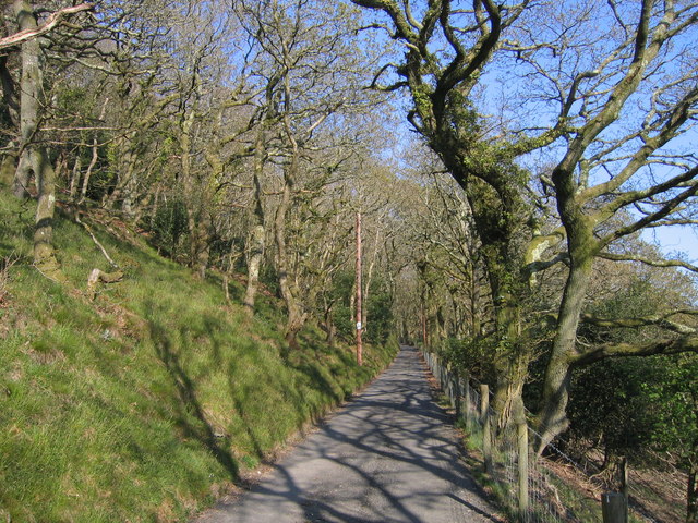
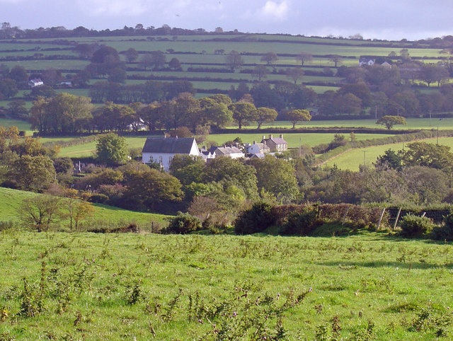
Brynhoffnant is a small village located in the county of Cardiganshire, Wales. Situated in the western part of the country, it lies about 10 miles south of the town of Cardigan. The village is nestled amidst the picturesque countryside, offering stunning views of the rolling hills and green meadows that characterize this region.

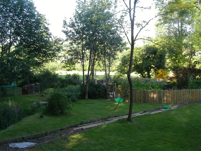
With a population of around 500 people, Brynhoffnant is a tight-knit community that exudes a peaceful and welcoming atmosphere. The village is primarily residential, consisting of a mix of traditional Welsh stone houses and more modern dwellings. It boasts a strong sense of community spirit, with various local events and gatherings organized throughout the year.

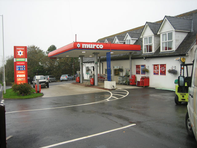
Despite its small size, Brynhoffnant offers a range of amenities to its residents. These include a village hall, a primary school, a post office, and a local pub. The surrounding countryside provides ample opportunities for outdoor activities such as hiking, cycling, and fishing, making it an attractive destination for nature enthusiasts.

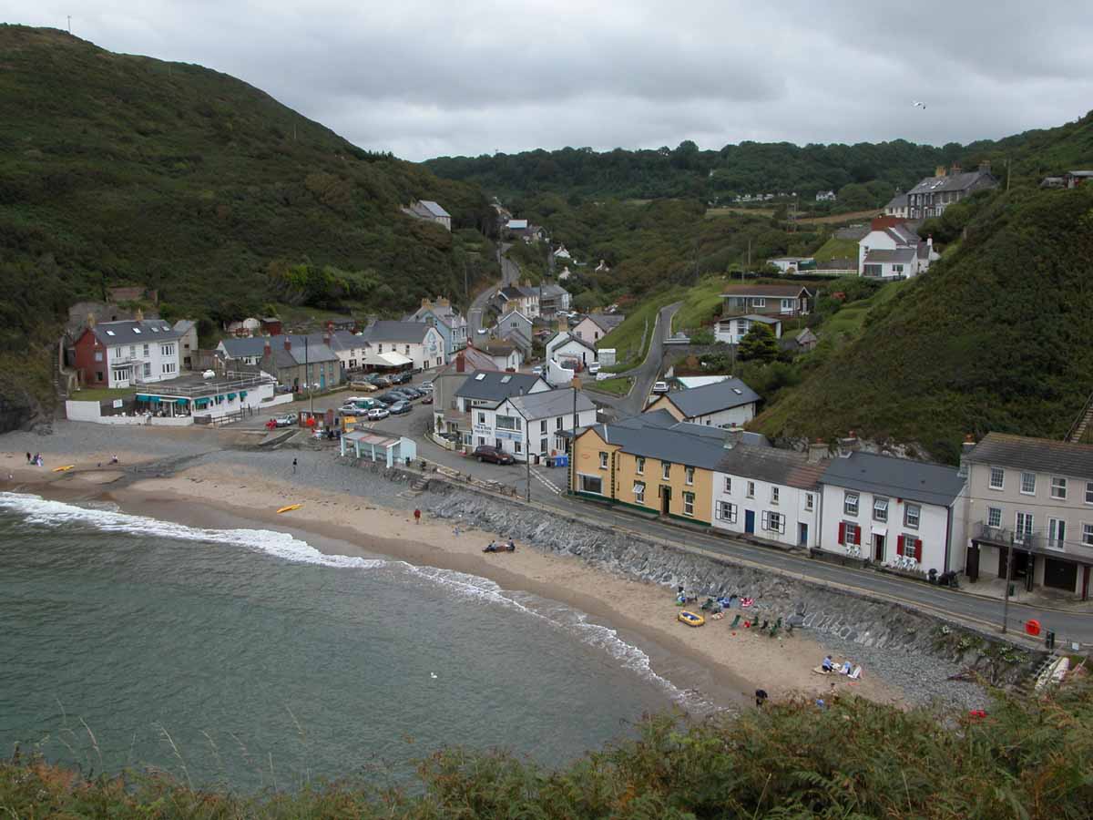
Cardigan Bay, a popular tourist destination, is within easy reach from Brynhoffnant. Visitors can enjoy the beautiful sandy beaches, explore the rugged coastline, or partake in water sports such as surfing and sailing.

Overall, Brynhoffnant is a charming village that offers a tranquil and picturesque setting, making it an idyllic place to live or visit for those seeking peace and natural beauty in the heart of Wales.

If you have any feedback on the listing, please let us know in the comments section below.

Brynhoffnant Images

Images are sourced within 2km of 52.134019/-4.437839 or Grid Reference SN3351. Thanks to Geograph Open Source API. All images are credited.

Ordnance Survey Cut Mark? This OS cut mark or poor copy, can be found on the north parapet of the bridge. It marked a point 129.700m above mean sea level.
Ordnance Survey Cut Mark?
This OS cut mark or poor copy, can be found on the north parapet of the bridge. It marked a point 129.700m above mean sea level.
Y Bryn a'r Bragdy Beer is brewed on-site here and there is also a restaurant.
Y Bryn a'r Bragdy
Beer is brewed on-site here and there is also a restaurant.
Churn Stand There is an Ordnance Survey rivet on the top of the stand. <a title="https://www.geograph.org.uk/photo/7446195" href="https://www.geograph.org.uk/photo/7446195">Link</a>
Churn Stand
There is an Ordnance Survey rivet on the top of the stand. Link
Ordnance Survey Rivet This OS rivet can be found on the top of the churn stand. It marks a point 242.873m above mean sea level. <a title="https://www.geograph.org.uk/photo/7446194" href="https://www.geograph.org.uk/photo/7446194">Link</a>
Ordnance Survey Rivet
This OS rivet can be found on the top of the churn stand. It marks a point 242.873m above mean sea level. Link
Ordnance Survey Cut Mark This OS cut mark can be found on the wall at the entrance to Cwm Bedw. It marks a point 186.093m above mean sea level.
Ordnance Survey Cut Mark
This OS cut mark can be found on the wall at the entrance to Cwm Bedw. It marks a point 186.093m above mean sea level.
A487 in Sarnau village
A487 at Brynhoffnant village boundary
New Inn New Inn Public House near Brynhoffnant
New Inn
New Inn Public House near Brynhoffnant
Church at Sarnau Former Parish Church at Sarnau, now in private ownership.
Church at Sarnau
Former Parish Church at Sarnau, now in private ownership.
Tree in Lake View of Wervil Grange Farm with tree in lake
Tree in Lake
View of Wervil Grange Farm with tree in lake
Lon gul uwchben Penmorfa / Narrow lane above Penmorfa Lon gul uwchben Penmorfa gyda Coed ar y chwith / Narrow lane above Penmorfa with trees on the left
Lon gul uwchben Penmorfa / Narrow lane above Penmorfa
Lon gul uwchben Penmorfa gyda Coed ar y chwith / Narrow lane above Penmorfa with trees on the left
Coed Derw, Allt Hoffnant / Oak Woodland, Allt Hoffnant Coed Derw ar Allt Hoffnant ger Brynhoffnant / Oak Woodland at Allt Hoffnant near Brynhoffnant
Coed Derw, Allt Hoffnant / Oak Woodland, Allt Hoffnant
Coed Derw ar Allt Hoffnant ger Brynhoffnant / Oak Woodland at Allt Hoffnant near Brynhoffnant
Start of bridleway into the mist This bridleway leads across pasture and down the slope to Pant yr Holiad.  Another view in the next square was taken in very different weather <a href="https://www.geograph.org.uk/photo/577646">SN3350 : What a difference a day makes!</a>.
Start of bridleway into the mist
This bridleway leads across pasture and down the slope to Pant yr Holiad. Another view in the next square was taken in very different weather SN3350 : What a difference a day makes!.
What a difference a day makes! Looking down towards Pant yr Holiad in very different weather from <a href="https://www.geograph.org.uk/photo/577635">SN3250 : Start of bridleway into the mist</a>.  In early October 2007, the weather here alternated between glorious bright sunny days and miserable damp drizzly ones - perhaps typical of the area?
What a difference a day makes!
Looking down towards Pant yr Holiad in very different weather from SN3250 : Start of bridleway into the mist. In early October 2007, the weather here alternated between glorious bright sunny days and miserable damp drizzly ones - perhaps typical of the area?
Filling station and general stores, Brynhoffnant Serving the coast road and local people, the town/village of Brynhoffnant centred around the staples of shop/filling station, pub and chapel.
Filling station and general stores, Brynhoffnant
Serving the coast road and local people, the town/village of Brynhoffnant centred around the staples of shop/filling station, pub and chapel.
Lunch-time lay-by on the coast road This is the road that follows the coast a few miles inland and forms an important artery roughly north-south through west Wales.  It also passes through a considerable number of villages on the way, for example Brynhoffnant in <a href="https://www.geograph.org.uk/gridref/SN3351">SN3351</a>.
Lunch-time lay-by on the coast road
This is the road that follows the coast a few miles inland and forms an important artery roughly north-south through west Wales. It also passes through a considerable number of villages on the way, for example Brynhoffnant in SN3351.
Boggy field by road junction Raindrops hanging from a metal gate, mists hanging in the trees: the next day the weather changed to glorious sun.
Boggy field by road junction
Raindrops hanging from a metal gate, mists hanging in the trees: the next day the weather changed to glorious sun.
Beech avenue to Bryn-Bedw Several farms in the area - see <a href="https://www.geograph.org.uk/gridref/SN3551">SN3551</a> - boasted impressive beech avenue drives.  Judging from the map, the farm Bryn-Bedw enjoys commanding views over a steep slope to the valley of the Afon Bedw below.
Beech avenue to Bryn-Bedw
Several farms in the area - see SN3551 - boasted impressive beech avenue drives. Judging from the map, the farm Bryn-Bedw enjoys commanding views over a steep slope to the valley of the Afon Bedw below.
Show me another place!

Brynhoffnant is located at Grid Ref: SN3351 (Lat: 52.134019, Lng: -4.437839)

Unitary Authority: Ceredigion

Police Authority: Dyfed Powys

What 3 Words

///variation.fresh.boating. Near Aberporth, Ceredigion

Nearby Locations

Brynhoffnant

Related Wikis

Brynhoffnant

Brynhoffnant is a small village in the community of Penbryn, Ceredigion, Wales, which is 70.4 miles (113.3 km) from Cardiff and 189.1 miles (304.3 km)...

Glasgoed, Ceredigion

Glasgoed is a small village in the community of Penbryn, Ceredigion, Wales, which is 69.5 miles (111.8 km) from Cardiff and 188.8 miles (303.8 km) from...

Pentre-gat

Pentre-gat is a small village in the community of Llangrannog, Ceredigion, Wales, which is 69.6 miles (112 km) from Swansea and 381 miles (302.3 km) from...

Pigeon's Ford

Pigeon's Ford is a hamlet in the community of Llangrannog, Ceredigion, Wales, which is 71.8 miles (115.5 km) from Cardiff and 189.9 miles (305.5 km) from...

Penmorfa

Penmorfa is the name of two villages in Wales. One is a small village in the community of Penbryn, Ceredigion, Wales. Penmorfa is represented in the Senedd...

Cwmcoednerth

Cwmcoednerth is a hamlet in the community of Penbryn, Ceredigion, Wales, which is 68.6 miles (110.4 km) from Cardiff and 188 miles (302.5 km) from London...

Glynarthen

Glynarthen is a small village located in Ceredigion, Wales. It is part of the community of Penbryn, along with the neighbouring villages of Brynhoffnant...

Llangrannog

Llangrannog (sometimes spelt as Llangranog) is both a village and a community in Ceredigion, Wales, 6 miles (10 km) southwest of New Quay. It lies in...

Nearby Amenities

Located within 500m of 52.134019,-4.437839
Pub
Y Bryn a'r Bragdy
Lat/Long: 52.1350979/-4.4394919
Bus Stop
Shelter: yes
Lat/Long: 52.134673/-4.4403479
Bus Stop
Shelter: yes
Lat/Long: 52.134676/-4.4407192
Brynhoffnant
Name Cy: Brynhoffnant
Place: village
Wikidata: Q15987291
Lat/Long: 52.135061/-4.4391444
Car Wash
Lat/Long: 52.13537/-4.4380568
Atm
Fixme: Precise location within store to be determined.
Lat/Long: 52.1356293/-4.4375901
Power: pole
Lat/Long: 52.1310464/-4.4324496
Power: pole
Lat/Long: 52.1308455/-4.4340107
Power: pole
Lat/Long: 52.1306973/-4.4351238
Power: pole
Lat/Long: 52.1305162/-4.4363603
Power: pole
Lat/Long: 52.1303268/-4.4377255
Power: pole
Lat/Long: 52.1301869/-4.4388038
Direction: SSE
Generator Method: photovoltaic
Generator Output Electricity: yes
Generator Solar Modules: 16
Generator Source: solar
Generator Type: solar_photovoltaic_panel
Location: roof
Power: generator
Lat/Long: 52.1357699/-4.4390532
Direction: SSE
Generator Method: photovoltaic
Generator Output Electricity: yes
Generator Solar Modules: 14
Generator Source: solar
Generator Type: solar_photovoltaic_panel
Location: roof
Power: generator
Lat/Long: 52.1351015/-4.4385409
Direction: 145
Generator Method: photovoltaic
Generator Output Electricity: yes
Generator Solar Modules: 6
Generator Source: solar
Generator Type: solar_photovoltaic_panel
Location: roof
Power: generator
Lat/Long: 52.1346203/-4.4394046
Direction: 145
Generator Method: photovoltaic
Generator Output Electricity: yes
Generator Solar Modules: 8
Generator Source: solar
Generator Type: solar_photovoltaic_panel
Location: roof
Power: generator
Lat/Long: 52.1346529/-4.4393215
Man Made: utility_pole
Lat/Long: 52.1334304/-4.4424292
Stop
Direction: backward
Lat/Long: 52.1354156/-4.4383991
Stop
Direction: forward
Lat/Long: 52.135282/-4.4386663
Give Way
Direction: forward
Lat/Long: 52.1354773/-4.4386036
The data included in this document is from www.openstreetmap.org. The data is made available under ODbL.

Have you been to Brynhoffnant?

Leave your review of Brynhoffnant below (or comments, questions and feedback).