Stanton

Civil Parish in Suffolk St Edmundsbury

England

Stanton

Stanton Primary School
Stanton Primary School Credit: Dave Thompson

Stanton is a civil parish located in the county of Suffolk, England. It is situated in the Mid Suffolk district, approximately 10 miles northeast of the town of Bury St Edmunds. The parish covers an area of about 8 square miles and is home to a population of around 1,200 residents.

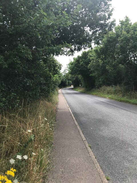
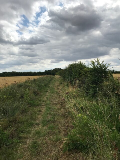
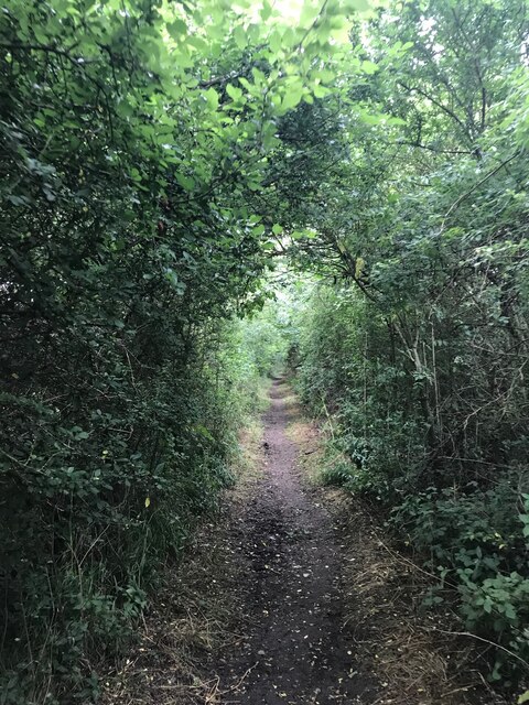
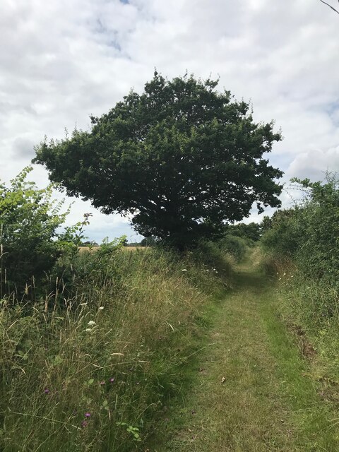
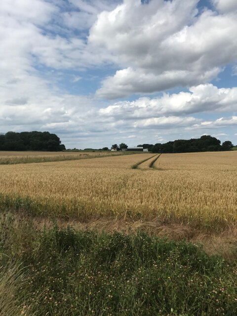
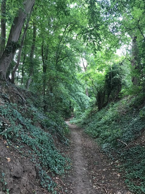
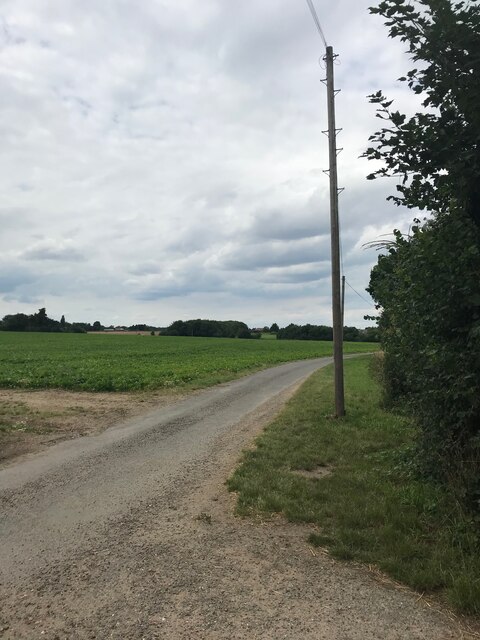
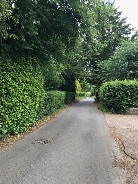
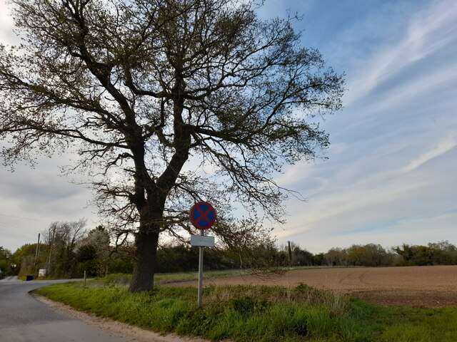
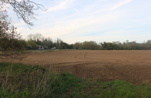
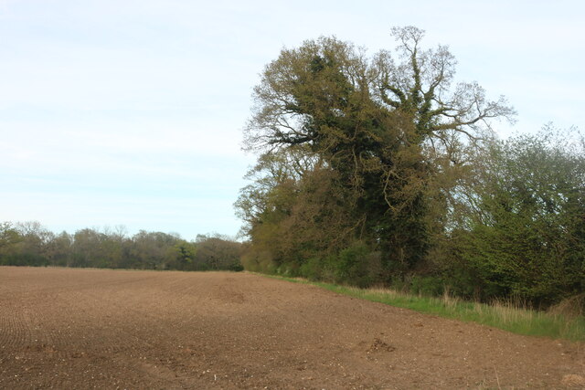
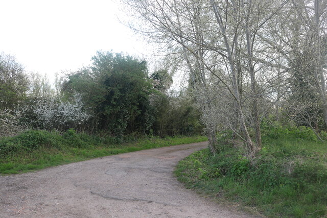
Stanton is known for its picturesque countryside, with rolling hills, meadows, and woodland areas surrounding the village. The landscape provides opportunities for outdoor activities such as hiking, cycling, and horse riding. The parish is also located near the River Gipping, which adds to the natural beauty of the area.

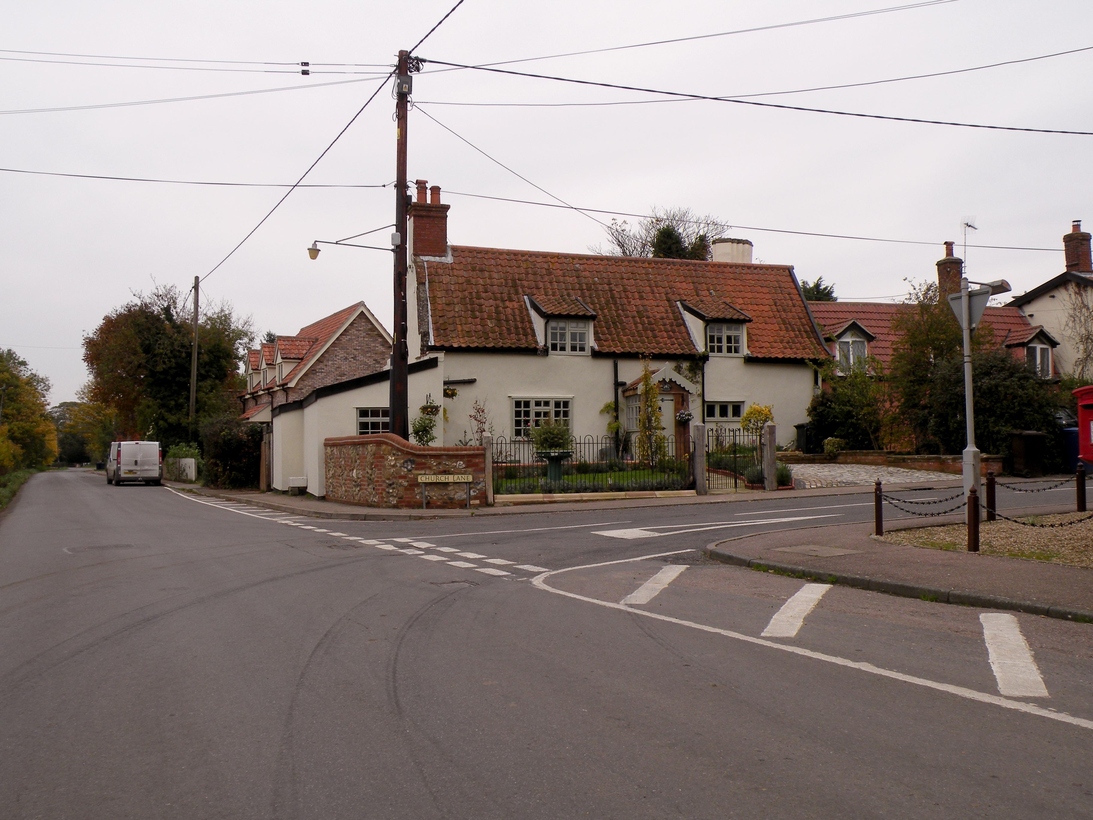
The village itself has a charming and traditional character, with many historic buildings and thatched cottages. The centerpiece of Stanton is the 15th-century St John the Baptist Church, which is a Grade I listed building. The church boasts beautiful architectural features and is a popular attraction for visitors.

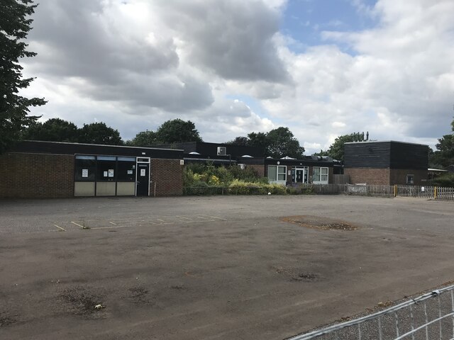
Stanton has a strong sense of community, with several local amenities and services available to its residents. These include a primary school, a village hall, a post office, and a local pub. The village also hosts various events throughout the year, such as fairs, festivals, and community gatherings.

Overall, Stanton offers a peaceful and idyllic setting for those looking to enjoy the beauty of the Suffolk countryside while still having access to necessary amenities and a close-knit community.

If you have any feedback on the listing, please let us know in the comments section below.

Stanton Images

Images are sourced within 2km of 52.31975/0.886171 or Grid Reference TL9672. Thanks to Geograph Open Source API. All images are credited.

Stanton Primary School
On Upthorpe Road
On Upthorpe Road
Bridleway near Upthorpe
Bridleway towards Potash Farm
On Posters Lane
On Posters Lane
On Packlose Lane
On Packlose Lane
On The Grundle
On The Grundle
On The Grundle
On The Grundle
On Wyken Road
On Wyken Road
Hepworth: Field Lane and power lines crossing it Called a 'lane' but really a farm track.
Hepworth: Field Lane and power lines crossing it
Called a 'lane' but really a farm track.
Stanton: Houses in Bobby's Way
Stanton: Looking towards the A143 from Barmingham Road
Stanton: Houses in Chare Road
Wyken Road, Stanton Looking towards Bury Road
Wyken Road, Stanton
Looking towards Bury Road
Wyken Road crossing Bury Road, Stanton
Field by Bury Road, Stanton
Track off Wyken Road, Stanton
Show me another place!

Stanton is located at Grid Ref: TL9672 (Lat: 52.31975, Lng: 0.886171)

Administrative County: Suffolk

District: St Edmundsbury

Police Authority: Suffolk

What 3 Words

///remake.snowstorm.tangent. Near Ixworth, Suffolk

Related Wikis

Stanton, Suffolk

Stanton is a village and civil parish in the West Suffolk district of Suffolk in eastern England, about nine miles north-east of Bury St Edmunds, on the...

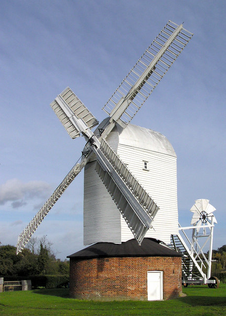
Upthorpe Mill, Stanton

Upthorpe Mill is a Grade II* listed post mill and scheduled monument at Stanton, Suffolk, England, which has been restored to working order. == History... ==

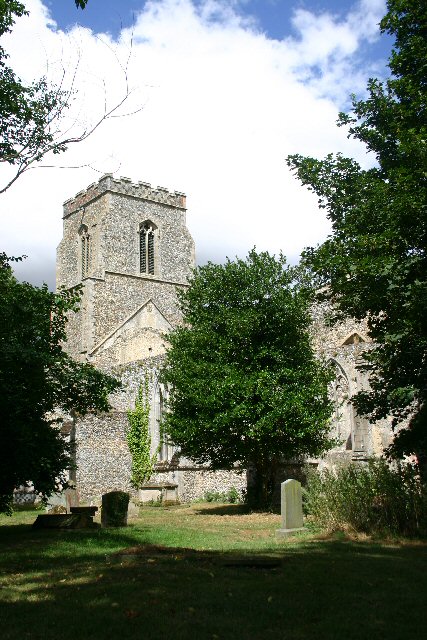
St John the Baptist's Church, Stanton

St John the Baptist's Church is a redundant Anglican church in the village of Stanton, Suffolk, England. It is recorded in the National Heritage List...

Stanton Woods

Stanton Woods is a 66.1-hectare (163-acre) biological Site of Special Scientific Interest south of Stanton in Suffolk.The site consists of several ancient...

Stanton Chare

Stanton Chare is a hamlet in West Suffolk district, Suffolk, England. It is near the large village of Stanton. The A143 road and B1111 road are nearby...

RAF Shepherds Grove

Royal Air Force Shepherds Grove or more simply RAF Shepherds Grove is a former Royal Air Force station located in Suffolk, active from 1943–44 to 1966...

Bardwell, Suffolk

Bardwell is a village and civil parish in the West Suffolk district of Suffolk, England. == Location == Bardwell is located about ten miles north-east...

Hepworth, Suffolk

Hepworth is a village and civil parish in the West Suffolk district of the English county of Suffolk. Nearby settlements include the villages of Stanton...

Nearby Amenities

Located within 500m of 52.31975,0.886171
Bus Stop
Memorial
Bus: yes
Naptan AtcoCode: 390050086
Naptan Bearing: E
Naptan CommonName: Memorial
Naptan Indicator: adj
Naptan Landmark: Memorial
Naptan NaptanCode: sufgdgwp
Naptan Street: Old Bury Road
Public Transport: platform
Shelter: yes
Source: naptan_import;survey
Lat/Long: 52.3238873/0.8839503
Bus Stop
Knoll Corner
Bus: yes
Naptan AtcoCode: 390050088
Naptan Bearing: E
Naptan CommonName: Knoll Corner
Naptan Indicator: adj
Naptan Landmark: Knoll Corner
Naptan NaptanCode: sufgdjad
Naptan Street: Upthorpe Road
Naptan Verified: no
Public Transport: platform
Source: naptan_import
Lat/Long: 52.3238386/0.8857497
Bus Stop
Knoll Corner
Bus: yes
Naptan AtcoCode: 390050089
Naptan Bearing: W
Naptan BusStopType: CUS
Naptan CommonName: Knoll Corner
Naptan Indicator: opp
Naptan Landmark: Knoll Corner
Naptan NaptanCode: sufgdjag
Naptan Street: Upthorpe Road
Naptan Verified: no
Public Transport: platform
Source: naptan_import
Lat/Long: 52.3238349/0.8853755
Blackbourne Middle School
Naptan AtcoCode: 390050090
Naptan Bearing: NW
Naptan BusStopType: CUS
Naptan CommonName: Blackbourne Middle School
Naptan Indicator: o/s
Naptan Landmark: Blackbourne Middle School
Naptan NaptanCode: sufgdjaj
Naptan Street: Upthorpe Road
Naptan Verified: no
Source: naptan_import
Lat/Long: 52.3225722/0.8889131
Post Box
Collection Times: Mo-Fr 16:30; Sa 11:30
Post Box Design: type_n
Post Box Mounting: pier
Post Box Type: lamp
Ref: IP31 2112
Royal Cypher: EIIR
Royal Cypher Wikidata: Q33102113
Lat/Long: 52.3227131/0.8846007
Turning Circle
Lat/Long: 52.3217133/0.8802097
Turning Circle
Lat/Long: 52.3228989/0.8828618
Turning Circle
Lat/Long: 52.3204653/0.8819989
Turning Circle
Lat/Long: 52.3220262/0.882544
Turning Circle
Lat/Long: 52.3209614/0.8810856
Turning Circle
Lat/Long: 52.323098/0.8850851
Turning Circle
Lat/Long: 52.3214264/0.8830543
Turning Circle
Lat/Long: 52.3197512/0.8831966
Turning Circle
Lat/Long: 52.3216923/0.8864324
Turning Circle
Lat/Long: 52.3228202/0.8863552
Crossing
Lat/Long: 52.3237856/0.8855983
Addr Postcode: IP31 2AW
Addr Street: Upthorpe Road
Man Made: windmill
Source Addr: FSA Food Hygiene Ratings Database
Lat/Long: 52.3223951/0.8911412
Palmers Bakery
Addr Postcode: IP31 2BP
Addr Street: The Street
Fhrs Id: 1674976
Shop: bakery
Source Addr: FSA Food Hygiene Ratings Database
Url: http://www.palmersbakery.co.uk/?page_id=74
Lat/Long: 52.323304/0.8844594
Historic: memorial
Lat/Long: 52.3239327/0.8841018
Waste Basket
Waste: dog_excrement
Lat/Long: 52.3212237/0.8849654
Fast Food
Stanton Fish & Chips
Addr Postcode: IP31 2BP
Addr Street: The Street
Cuisine: fish_and_chips
Fhrs Id: 1674645
Source Addr: FSA Food Hygiene Ratings Database
Lat/Long: 52.3235303/0.8843726
cuttinroom.com
Shop: hairdresser
Url: http://cuttinroom.com/
Lat/Long: 52.3234673/0.8839301
Crossing
Crossing: uncontrolled
Lat/Long: 52.3228427/0.8885634
Waste Basket
Lat/Long: 52.3239139/0.8838824
Bench
Lat/Long: 52.3239402/0.8838535
Entrance: main
Lat/Long: 52.3237175/0.885282
Crossing
Lat/Long: 52.3238148/0.8856982
Defibrillator
Defibrillator Location: On outside wall of bus shelter with clocktower, facing towards Upthorpe Road.
Emergency: defibrillator
Indoor: no
Ref: AAX38
Ref GB The Circuit: 011D2416-062A-479A-9365-AD7300BF25F7
Lat/Long: 52.3238045/0.885812
Waste Basket
Lat/Long: 52.3237978/0.8858418
Grit Bin
Lat/Long: 52.3238794/0.8858029
Grit Bin
Lat/Long: 52.3239658/0.883804
Waste Basket
Lat/Long: 52.3216035/0.8812787
Addr City: Bury St Edmunds
Addr Housenumber: 21
Addr Street: Honeymeade Close
Addr Village: Stanton
Lat/Long: 52.3209912/0.8823583
Addr City: Bury St Edmunds
Addr Housenumber: 20
Addr Street: Honeymeade Close
Addr Village: Stanton
Lat/Long: 52.3209157/0.882259
Addr City: Bury St Edmunds
Addr Housenumber: 14
Addr Street: Honeymeade Close
Addr Village: Stanton
Lat/Long: 52.3206895/0.882719
Addr City: Bury St Edmunds
Addr Housenumber: 13
Addr Street: Honeymeade Close
Addr Village: Stanton
Lat/Long: 52.3206149/0.8825889
Addr City: Bury St Edmunds
Addr Housenumber: 8
Addr Street: Honeymeade Close
Addr Village: Stanton
Lat/Long: 52.3201763/0.8828625
Addr City: Bury St Edmunds
Addr Housenumber: 5
Addr Street: Honeymeade Close
Addr Village: Stanton
Lat/Long: 52.3203108/0.8833668
Grit Bin
Lat/Long: 52.320005/0.8843122
Waste Basket
Waste: dog_excrement
Lat/Long: 52.3228265/0.8884053
Grit Bin
Lat/Long: 52.3228839/0.8882323
Grit Bin
Lat/Long: 52.3230204/0.8842653
Waste Basket
Waste: dog_excrement
Lat/Long: 52.3230454/0.8843075
The data included in this document is from www.openstreetmap.org. The data is made available under ODbL.

Have you been to Stanton?

Leave your review of Stanton below (or comments, questions and feedback).