St. John

Civil Parish in Cornwall

England

St. John

SW Coast Path between Tregantle Down & Freathy
SW Coast Path between Tregantle Down & Freathy Credit: Colin Park

St. John is a civil parish located in Cornwall, England. It is a small village situated in the eastern part of the county, near the town of Launceston. The parish covers an area of approximately 4 square miles and is home to a population of around 500 residents.

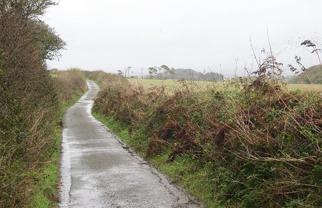
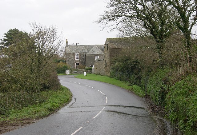
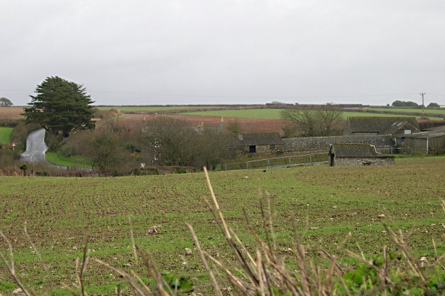
St. John is known for its picturesque countryside, with rolling hills and lush green fields surrounding the village. The parish is primarily rural, with a few scattered farms and residential properties. The village itself has a quaint and charming atmosphere, with a few small shops, a church, and a village hall.

The parish is well-connected by road, with the A30 running nearby providing easy access to nearby towns and cities. St. John is also situated close to the border with Devon, making it a popular choice for those looking to explore both counties.

Overall, St. John is a peaceful and idyllic rural community, perfect for those seeking a quiet and tranquil lifestyle in the heart of the Cornish countryside.

If you have any feedback on the listing, please let us know in the comments section below.
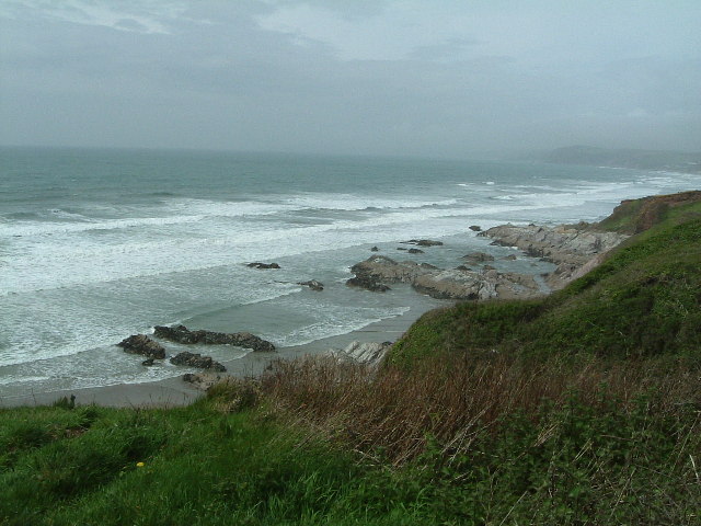
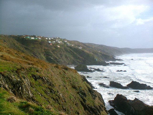
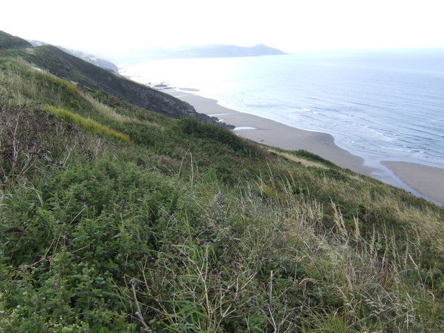
St. John Images

Images are sourced within 2km of 50.348594/-4.240822 or Grid Reference SX4052. Thanks to Geograph Open Source API. All images are credited.

SW Coast Path between Tregantle Down & Freathy
Clampet Lane A narrow lane through mixed agricultural land to the north of Whitsand Bay.
Clampet Lane
A narrow lane through mixed agricultural land to the north of Whitsand Bay.
Higher Tregantle Farm
Looking out to sea near Sharrow Point Sharrow Point juts out to sea on Whitsand Bay near Freathy.
For a similar view, but on a much sunnier day taken 7 years later - see <a href="https://www.geograph.org.uk/photo/2145314">SX3952 : Whitsand Bay looking west from Sharrow Point</a>
Looking out to sea near Sharrow Point
Sharrow Point juts out to sea on Whitsand Bay near Freathy. For a similar view, but on a much sunnier day taken 7 years later - see SX3952 : Whitsand Bay looking west from Sharrow Point
National Trust Coastline The turbulent sea at Sharrow Point
National Trust Coastline
The turbulent sea at Sharrow Point
Coastline near Freathy The dramatic coastline with Freathy perched on the cliffs.
Coastline near Freathy
The dramatic coastline with Freathy perched on the cliffs.
Freathy Beach Evening scene looking towards Looe
Freathy Beach
Evening scene looking towards Looe
Arable Land around Higher Tregantle Farm
The Grotto Beach at low tide, Freathy Looking down onto the Grotto Beach at low tide.
The Grotto Beach at low tide, Freathy
Looking down onto the Grotto Beach at low tide.
Sharrow Point at low tide, Freathy Sharrow Point at low tide along side The Grotto Beach.
Sharrow Point at low tide, Freathy
Sharrow Point at low tide along side The Grotto Beach.
Rocks at the base of Freathy Cliff A nice morning for walking the dogs along the beach.
Rocks at the base of Freathy Cliff
A nice morning for walking the dogs along the beach.
Top of Freathy Cliff - view eastwards Along Whitsand Bay towards Rame Head in the distance.
Top of Freathy Cliff - view eastwards
Along Whitsand Bay towards Rame Head in the distance.
Freathy Cliff - view westwards The roof of a holiday home halfway down the slope can just be seen, with the rocks of Sharrow point beyond.
Freathy Cliff - view westwards
The roof of a holiday home halfway down the slope can just be seen, with the rocks of Sharrow point beyond.
Whitsand Bay Cornwall  in the Winter Looking from the Military Road near Freathy towards Rame Head on a very cold and wet Friday afternoon just after 12 o'clock. There were surfers in the water to the right of me.
Whitsand Bay Cornwall in the Winter
Looking from the Military Road near Freathy towards Rame Head on a very cold and wet Friday afternoon just after 12 o'clock. There were surfers in the water to the right of me.
Whitsand Bay Surfers It was very cold wet and windy when I took this, however I think they were enjoying themselves. You don't have to always go to Newquay to surf.
Whitsand Bay Surfers
It was very cold wet and windy when I took this, however I think they were enjoying themselves. You don't have to always go to Newquay to surf.
Rocks nr Freathy
Rocks nr Freathy
Freathy in the distance On the coast road to Rame Head it will be much more crowded in the summer!
Freathy in the distance
On the coast road to Rame Head it will be much more crowded in the summer!
Looking west from the Coast road nr Freathy
Show me another place!

St. John is located at Grid Ref: SX4052 (Lat: 50.348594, Lng: -4.240822)

Unitary Authority: Cornwall

Police Authority: Devon & Cornwall

What 3 Words

///wheat.prompting.choppy. Near Millbrook, Cornwall

Nearby Locations

St. John Freathy

Related Wikis

Freathy

Freathy (Cornish: Frydhi) is a beach and coastal settlement on the Rame Peninsula in east Cornwall, England, United Kingdom.Freathy is accessible by the...

St John, Cornwall

St John (parish: Cornish: Pluwjowan, village: Cornish: S. Jowan) is a coastal civil parish and a village in south-east Cornwall, England, United Kingdom...

Millbrook, Cornwall

Millbrook (Cornish: Govermelin) is a civil parish and village in southeast Cornwall, England, United Kingdom. The village is situated on the Rame Peninsula...

All Saints Church, Millbrook

All Saints Church is a Church of England parish church in Millbrook, Cornwall, England, UK. It was built in 1893–95 and has been Grade II listed since...

Nearby Amenities

Located within 500m of 50.348594,-4.240822
Power: pole
Lat/Long: 50.3447227/-4.2374557
Power: pole
Lat/Long: 50.3450667/-4.2396954
Power: pole
Lat/Long: 50.3442947/-4.2395559
Power: pole
Lat/Long: 50.3447056/-4.2420504
Power: pole
Lat/Long: 50.3452156/-4.2428255
Power: pole
Lat/Long: 50.3461725/-4.2442954
Power: pole
Lat/Long: 50.347107/-4.2457277
Power: pole
Lat/Long: 50.3478892/-4.2469132
Power: pole
Lat/Long: 50.3487861/-4.2470285
Power: pole
Lat/Long: 50.3492893/-4.2470822
Power: pole
Lat/Long: 50.3502546/-4.2472592
Power: pole
Lat/Long: 50.3523733/-4.2382121
Power: pole
Lat/Long: 50.3517915/-4.2385393
Power: pole
Lat/Long: 50.351278/-4.2388451
Power: pole
Lat/Long: 50.3507423/-4.2386895
Power: pole
Lat/Long: 50.3501604/-4.2385018
Power: pole
Lat/Long: 50.3495391/-4.2382979
Power: pole
Lat/Long: 50.3487091/-4.2380646
Power: pole
Lat/Long: 50.3481014/-4.2378795
Power: pole
Lat/Long: 50.347398/-4.2376569
Power: pole
Lat/Long: 50.3466226/-4.2377052
Power: pole
Lat/Long: 50.3461262/-4.2376944
Power: pole
Lat/Long: 50.3453046/-4.2377776
The data included in this document is from www.openstreetmap.org. The data is made available under ODbL.

Have you been to St. John?

Leave your review of St. John below (or comments, questions and feedback).