Sonning

Civil Parish in Berkshire

England

Sonning

Passing a pub on the way to Sonning Church
Passing a pub on the way to Sonning Church Credit: Basher Eyre

Sonning is a civil parish located in the county of Berkshire, England. Situated on the banks of the River Thames, it is known for its picturesque beauty and historic significance. Sonning is located approximately 5 miles east of the town of Reading and spans an area of around 2 square miles.

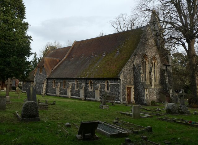
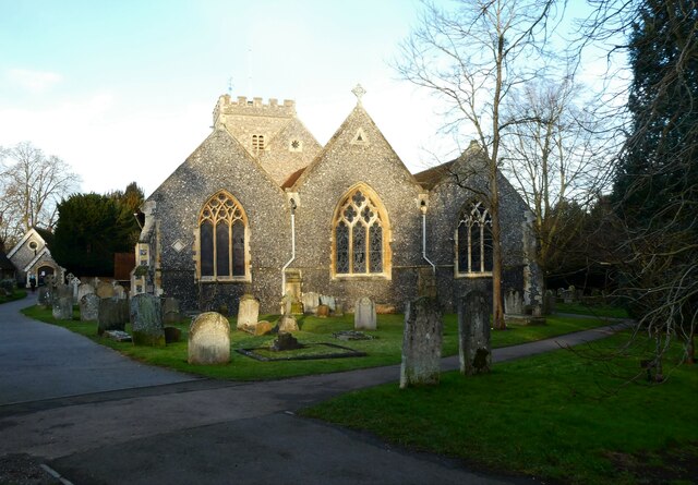
The village of Sonning is home to a population of approximately 1,000 residents. It boasts a rich history that dates back to the Roman times, with evidence of a Roman road passing through the area. The village is best known for its 12th-century parish church, St. Andrew's Church, which is a Grade I listed building and a prominent feature in the village.

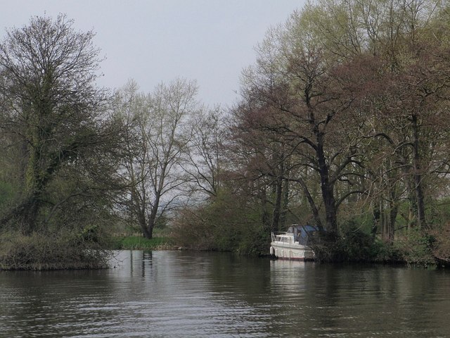
Sonning is a popular tourist destination due to its idyllic setting. The village offers stunning views of the River Thames, with several riverside walks and picnic spots available for visitors to enjoy. The Sonning Bridge, a striking Georgian structure, connects the village to the neighboring area of Sonning Eye.

In addition to its natural beauty, Sonning is also renowned for its cultural heritage. The village has been a popular residence for many notable figures throughout history, including the famous British author, George Orwell. The village has also attracted numerous celebrities, with several high-profile residents currently residing in the area.

Sonning offers a range of amenities for its residents and visitors, including a village hall, a primary school, a local pub, and several shops and restaurants. It is well-connected to the surrounding areas by road and rail, with the nearby Reading station providing access to major cities such as London and Oxford.

Overall, Sonning, Berkshire, is a charming and historic village that combines natural beauty with cultural significance, making it a desirable place to live and visit.

If you have any feedback on the listing, please let us know in the comments section below.
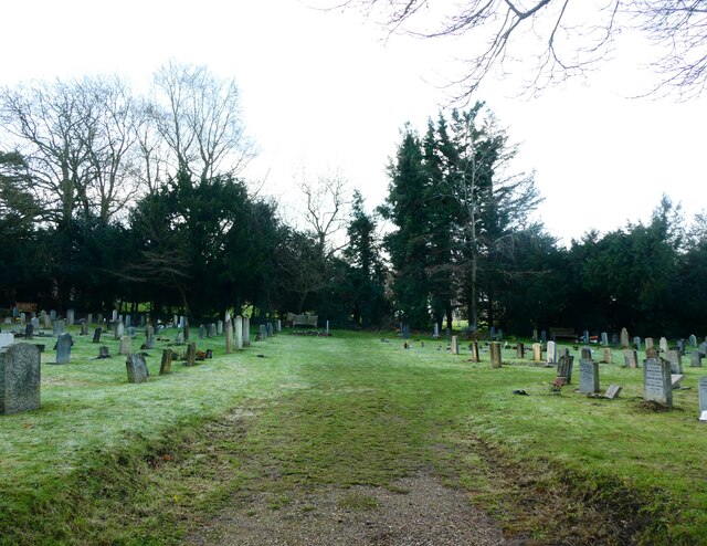
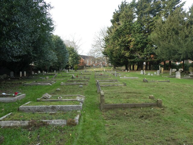
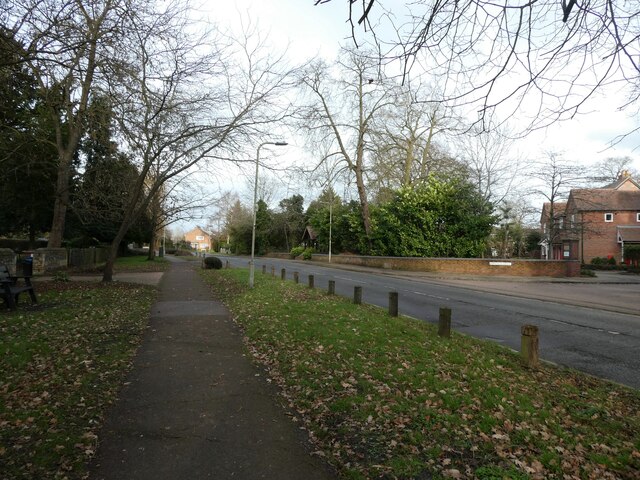
Sonning Images

Images are sourced within 2km of 51.471466/-0.906452 or Grid Reference SU7675. Thanks to Geograph Open Source API. All images are credited.

Passing a pub on the way to Sonning Church
St. John the Evangelist, Woodley: early February 2022
Parish Pump, Sonning: early February 2022
Pub seen from Sonning Churchyard
St Andrew, Sonning: early February 2022
Sonning Churchyard: early February 2022 (a)
Sonning Churchyard: early February 2022 (b) This is the grave of Private B Dark of the Royal Warwickshire Regiment who died on  24 August 1917
Sonning Churchyard: early February 2022 (b)
This is the grave of Private B Dark of the Royal Warwickshire Regiment who died on 24 August 1917
Sonning Churchyard: early February 2022 (c) This is the CWGC grave of Private A Ponting of the Royal Defence Corps who died on  13 September 1917.
Sonning Churchyard: early February 2022 (c)
This is the CWGC grave of Private A Ponting of the Royal Defence Corps who died on 13 September 1917.
Sonning Churchyard: early February 2022 (d)
St Andrew, Sonning: The St Sarik Room
St Andrew, Sonning: the parish hall
St. John the Evangelist, Woodley: churchyard
Looking north-northeast in Church Road
The finish at Woodley parkrun in Woodford Park Parkrun is a free timed 5k run which takes place in numerous locations at 9.00am every Saturday.
The finish at Woodley parkrun in Woodford Park
Parkrun is a free timed 5k run which takes place in numerous locations at 9.00am every Saturday.
War memorial at Woodley Green
Information panels adjacent to Woodley Green war memorial
Microsoft head office, Thames Valley Park
Forecourt on a Texaco fuel station on the A4 at Sonning
Show me another place!

Sonning is located at Grid Ref: SU7675 (Lat: 51.471466, Lng: -0.906452)

Unitary Authority: Wokingham

Police Authority: Thames Valley

What 3 Words

///flute.coasting.crumble. Near Sonning, Berkshire

Nearby Locations

Sonning

Related Wikis

Sonning Hill

Sonning Hill is a hill near the village of Sonning in Berkshire, England, close to the River Thames. Towards the Oxfordshire side of the main river channel...

Sonning

Sonning is a village and civil parish in Berkshire, England, on the River Thames, east of Reading. The village was described by Jerome K. Jerome in his...

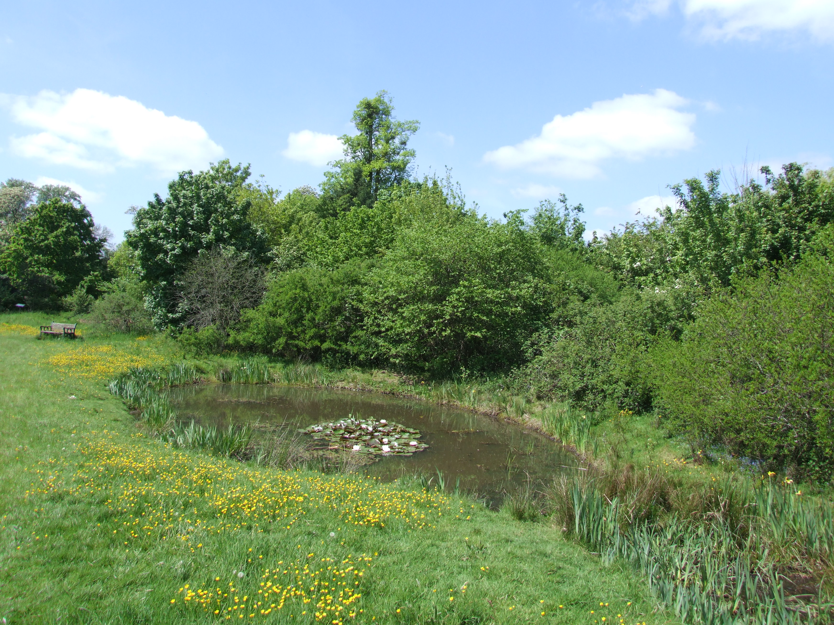
Ali's Pond Local Nature Reserve

Ali's Pond is a 0.4-hectare (0.99-acre) Local Nature Reserve in Sonning in Berkshire. It is owned by Sonning Parish Council and managed by the Friends...
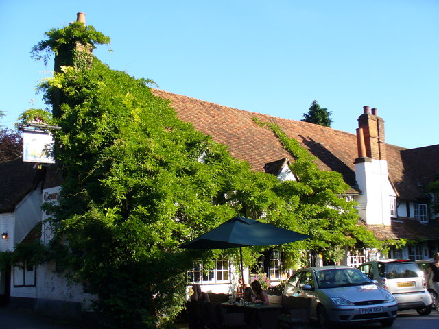
Bull Inn, Sonning

The Bull Inn, also known as The Bull at Sonning or just The Bull, is an historic public house — now also a restaurant and hotel — in the centre of the...

Nearby Amenities

Located within 500m of 51.471466,-0.906452
Mini Roundabout
Direction: clockwise
Lit: yes
Lat/Long: 51.4732873/-0.9070805
Crossing
Bicycle: yes
Crossing: traffic_signals
Crossing Island: yes
Crossing Ref: toucan
Kerb: lowered
Sloped Curb: yes
Tactile Paving: yes
Lat/Long: 51.4671635/-0.906105
Street Lamp
Lit: yes
Lat/Long: 51.4743776/-0.9107727
Crossing
Crossing: marked
Crossing Island: no
Crossing Ref: zebra
Tactile Paving: yes
Lat/Long: 51.4698814/-0.906994
Street Lamp
Lit: yes
Lat/Long: 51.4735021/-0.903872
Post Box
Collection Times: Mo-Fr 09:00, Sa 07:00
Post Box Mounting: brick_pillar
Post Box Type: wall
Ref: RG4 560D
Royal Cypher: GR
Royal Cypher Wikidata: Q33102273
Lat/Long: 51.472852/-0.9089415
Telephone
Defibrillator
Booth: K6
Check Date: 2021-09-12
Covered: booth
Defibrillator Location: inside red phone box outside Pearson Hall, Pearson Road, Sonning
Emergency: defibrillator
Indoor: no
Listed Status: Grade II
Man Made: telephone_box
Ref GB The Circuit: 5086B88D-0AE0-4CE1-89FC-AFC600B66A0C
Lat/Long: 51.4728399/-0.9088318
Bus Stop
Sonning Fire Station
Bench: no
Bin: yes
Lit: yes
Naptan AtcoCode: 035090360002
Naptan NaptanCode: wokdpdj
Shelter: yes
Tactile Paving: no
Lat/Long: 51.4728499/-0.9083298
Barrier: kissing_gate
Lat/Long: 51.4730676/-0.9127009
Sonning
Alt Name: Sonning-on-Thames
Alt Name Fr: Sonning-sur-Tamise
Is In: Berkshire
Place: village
Source: knowledge; wikipedia
Wikidata: Q588293
Wikipedia: en:Sonning
Lat/Long: 51.473589/-0.9099103
Bus Stop
Sonning High Street
Bench: no
Bin: no
Lit: no
Naptan AtcoCode: 035090340001
Naptan NaptanCode: wokdpaw
Route Ref: 129
Shelter: no
Source: survey
Tactile Paving: no
Wheelchair: limited
Wheelchair Description: Dipped kerb near stop. NOT step-free to opposite stop.
Lat/Long: 51.4726995/-0.9122927
Bus Stop
Sonning High Street
Bench: yes
Check Date Shelter: 2021-09-12
Lit: no
Naptan AtcoCode: 035090340002
Naptan NaptanCode: wokdpda
Route Ref: 129
Shelter: yes
Source: survey
Tactile Paving: no
Wheelchair: no
Wheelchair Description: Grass verge with kerb. NOT step-free to opposite stop.
Lat/Long: 51.4723195/-0.9128087
Traffic Calming: table
Lat/Long: 51.474021/-0.9092324
Turning Circle
Lat/Long: 51.4706331/-0.904343
Bus Stop
Sonning Fire Station
Bench: no
Bin: no
Check Date Shelter: 2021-09-12
Lit: no
Naptan AtcoCode: 035090360003
Naptan NaptanCode: wokdpdm
Route Ref: 126;128
Shelter: no
Tactile Paving: no
Lat/Long: 51.4727361/-0.9075239
Bus Stop
Sonning Fire Station
Bench: yes
Bin: yes
Check Date Shelter: 2021-09-12
Lit: no
Route Ref: 126;128
Shelter: yes
Tactile Paving: no
Lat/Long: 51.4727439/-0.9074505
Post Box
Collection Times: Mo-Fr 17:00, Sa 10:30
Drive Through: no
Operator: Royal Mail
Operator Wikidata: Q638098
Ref: RG4 357
Royal Cypher: GVIR
Royal Cypher Wikidata: Q33102169
Lat/Long: 51.4697938/-0.9066863
Waste Basket
Check Date: 2021-09-12
Lat/Long: 51.4727343/-0.907446
Street Lamp
Lit: yes
Lat/Long: 51.4739867/-0.9090188
Crossing
Crossing: unmarked
Kerb: lowered
Sloped Curb: yes
Lat/Long: 51.4674208/-0.9041514
Crossing
Bicycle: no
Crossing: uncontrolled
Crossing Island: yes
Kerb: raised
Sloped Curb: no
Source: survey
Wheelchair: no
Lat/Long: 51.4691689/-0.9013904
Crossing
Bicycle: no
Crossing: uncontrolled
Crossing Island: yes
Kerb: raised
Sloped Curb: no
Source: survey
Wheelchair: no
Lat/Long: 51.4692457/-0.901477
Waste Basket
Lat/Long: 51.4737022/-0.9113484
Crossing
Crossing: uncontrolled
Crossing Island: yes
Kerb: lowered
Sloped Curb: yes
Source: survey
Tactile Paving: no
Lat/Long: 51.467636/-0.9052584
Traffic Signals
Traffic Signals Direction: forward
Lat/Long: 51.4671387/-0.9061546
Traffic Signals
Traffic Signals Direction: backward
Lat/Long: 51.4671917/-0.9060533
Crossing
Crossing: uncontrolled
Crossing Island: yes
Kerb: lowered
Sloped Curb: yes
Source: survey
Tactile Paving: no
Lat/Long: 51.4675407/-0.9051551
Crossing
Bicycle: yes
Crossing: uncontrolled
Crossing Island: yes
Kerb: lowered
Sloped Curb: yes
Source: survey
Tactile Paving: no
Lat/Long: 51.4681921/-0.9050477
Crossing
Bicycle: yes
Crossing: uncontrolled
Crossing Island: yes
Kerb: lowered
Sloped Curb: yes
Source: survey
Tactile Paving: no
Lat/Long: 51.4681295/-0.905111
Bus Stop
Sonning Halt
Bench: yes
Bin: yes
Bus: yes
Lit: yes
Public Transport: platform
Shelter: yes
Source: Bing
Tactile Paving: no
Lat/Long: 51.4686175/-0.903215
Bus Stop
Source: Bing
Lat/Long: 51.4684166/-0.903066
Direction: 145
Generator Method: photovoltaic
Generator Output Electricity: yes
Generator Solar Modules: 8
Generator Source: solar
Generator Type: solar_photovoltaic_panel
Location: roof
Power: generator
Lat/Long: 51.4699008/-0.9031295
Direction: 145
Generator Method: photovoltaic
Generator Output Electricity: yes
Generator Solar Modules: 12
Generator Source: solar
Generator Type: solar_photovoltaic_panel
Location: roof
Power: generator
Lat/Long: 51.4698508/-0.9032993
Direction: SSE
Generator Method: photovoltaic
Generator Output Electricity: yes
Generator Solar Modules: 4
Generator Source: solar
Generator Type: solar_photovoltaic_panel
Location: roof
Power: generator
Lat/Long: 51.4696542/-0.9047324
Direction: SSE
Generator Method: photovoltaic
Generator Output Electricity: yes
Generator Solar Modules: 16
Generator Source: solar
Generator Type: solar_photovoltaic_panel
Location: roof
Power: generator
Lat/Long: 51.4705002/-0.9030292
Direction: 145
Generator Method: photovoltaic
Generator Output Electricity: yes
Generator Solar Modules: 12
Generator Source: solar
Generator Type: solar_photovoltaic_panel
Location: roof
Power: generator
Lat/Long: 51.469672/-0.9037602
Direction: 235
Generator Method: photovoltaic
Generator Output Electricity: yes
Generator Solar Modules: 5
Generator Source: solar
Generator Type: solar_photovoltaic_panel
Location: roof
Power: generator
Lat/Long: 51.4699132/-0.9032268
Direction: 125
Generator Method: photovoltaic
Generator Output Electricity: yes
Generator Solar Modules: 20
Generator Source: solar
Generator Type: solar_photovoltaic_panel
Location: roof
Power: generator
Lat/Long: 51.474979/-0.908272
Direction: 175
Generator Method: photovoltaic
Generator Output Electricity: yes
Generator Solar Modules: 7
Generator Source: solar
Generator Type: solar_photovoltaic_panel
Location: roof
Power: generator
Lat/Long: 51.4724884/-0.910326
The data included in this document is from www.openstreetmap.org. The data is made available under ODbL.

Have you been to Sonning?

Leave your review of Sonning below (or comments, questions and feedback).