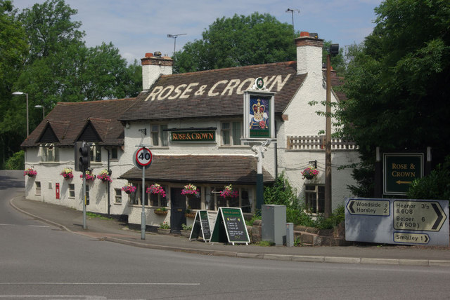
Smalley

Civil Parish in Derbyshire Amber Valley

England

Smalley

Derby Road The sunshine is casting heavy shadows across Derby Road on the edge of Heanor.
Derby Road Credit: Malcolm Neal

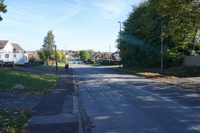
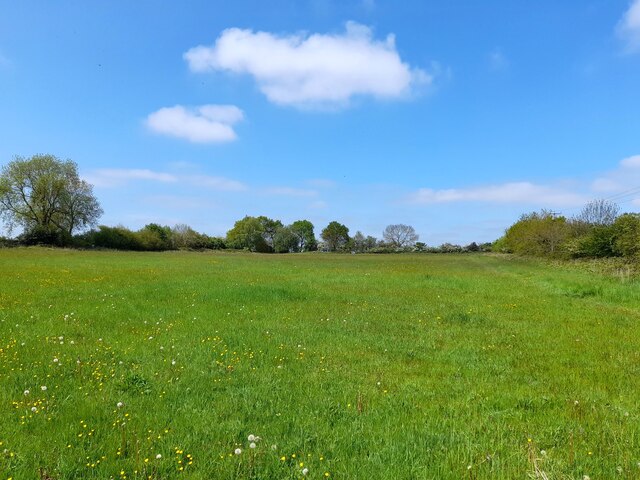
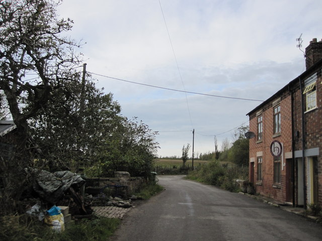
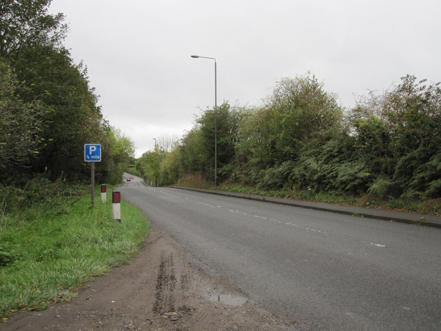
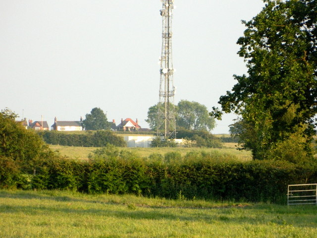
Smalley is a civil parish located in the Amber Valley district of Derbyshire, England. It is situated about 8 miles northeast of Derby city center and has a population of around 1,500 people. The parish covers an area of approximately 3 square miles and is surrounded by beautiful countryside, providing a tranquil and picturesque setting for its residents.

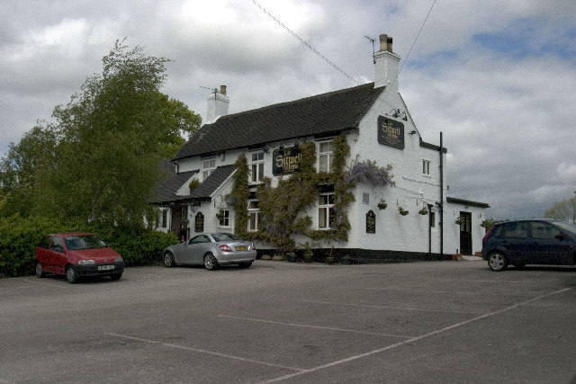
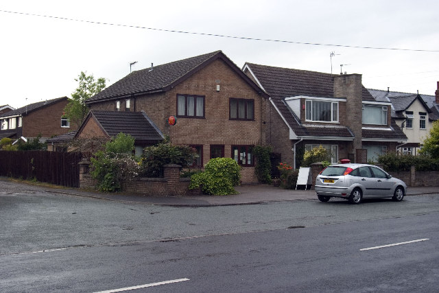
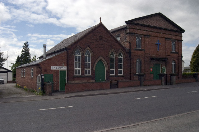
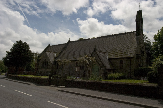
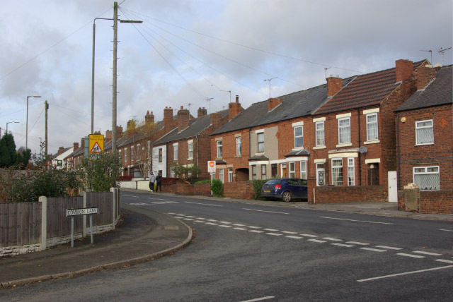
The village of Smalley is known for its quaint and charming character, with a mix of traditional stone-built cottages and more modern housing developments. The heart of the village is centered around the historic St. John the Baptist Church, which dates back to the 12th century and is a prominent landmark in the area.

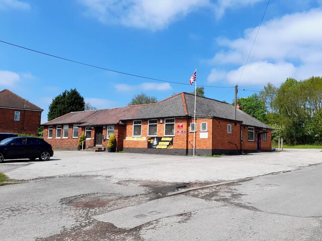
Smalley offers a range of amenities to its residents, including a primary school, local shops, and a village hall where various community events and activities take place. The parish is also well-served by public transportation, with regular bus services connecting it to nearby towns and cities.

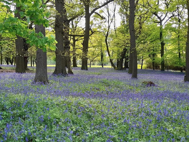
Nature lovers will appreciate the surrounding countryside, with ample opportunities for walking, cycling, and exploring the nearby Shipley Country Park. The area is also home to several nature reserves, providing habitats for a variety of wildlife.

Overall, Smalley offers a peaceful and friendly community atmosphere, with a range of amenities and access to beautiful countryside. It is an ideal place for those seeking a rural lifestyle while still being within easy reach of larger towns and cities.

If you have any feedback on the listing, please let us know in the comments section below.

Smalley Images

Images are sourced within 2km of 52.996778/-1.3878 or Grid Reference SK4144. Thanks to Geograph Open Source API. All images are credited.

Derby Road The sunshine is casting heavy shadows across Derby Road on the edge of Heanor.
Derby Road
The sunshine is casting heavy shadows across Derby Road on the edge of Heanor.
338 Top Club Stanley Common Ex-Service & Workmen's Club
338 Top Club
Stanley Common Ex-Service & Workmen's Club
Bluebells in the woods Right next to the busy A609, the woodland floor is carpeted with bluebells.
Bluebells in the woods
Right next to the busy A609, the woodland floor is carpeted with bluebells.
The Fallow Field Literally just an empty field, "Solely for the purpose of recreation", managed by Stanley & Stanley Common Parish Council.
The Fallow Field
Literally just an empty field, "Solely for the purpose of recreation", managed by Stanley & Stanley Common Parish Council.
Sitwell Arms Sitwell Arms Public House, Horsley Woodhouse/Woodside, Derbyshire. SK397441
Sitwell Arms
Sitwell Arms Public House, Horsley Woodhouse/Woodside, Derbyshire. SK397441
Horsley Woodhouse Post Office Horsley Woodhouse Post Office, A609, Horsley Woodhouse, Derbyshire, opposite the Central Methodist Church.
Horsley Woodhouse Post Office
Horsley Woodhouse Post Office, A609, Horsley Woodhouse, Derbyshire, opposite the Central Methodist Church.
Horsley Woodhouse Central Methodist Church Horsley Woodhouse Central Methodist Church, opposite Post Office, A609, Horsley Woodhouse, Derbyshire.
Horsley Woodhouse Central Methodist Church
Horsley Woodhouse Central Methodist Church, opposite Post Office, A609, Horsley Woodhouse, Derbyshire.
Horsley Woodhouse Church Horsley Woodhouse Church, A609, Horsley Woodhouse, Derbyshire SK396448
Horsley Woodhouse Church
Horsley Woodhouse Church, A609, Horsley Woodhouse, Derbyshire SK396448
Blackbirds Two day old chicks
Blackbirds
Two day old chicks
The Rose and Crown, Smalley This pub, with its name prominently emblazoned on its roof, has long been a landmark on the Derby - Heanor road where the A609 meets the A608.
The Rose and Crown, Smalley
This pub, with its name prominently emblazoned on its roof, has long been a landmark on the Derby - Heanor road where the A609 meets the A608.
Smalley Cross Long-established scooter and motorbike retailer at Smalley crossroads.
Smalley Cross
Long-established scooter and motorbike retailer at Smalley crossroads.
Post box at Smalley crossroads The postbox here is set into the wall of the Rose and Crown pub.
Post box at Smalley crossroads
The postbox here is set into the wall of the Rose and Crown pub.
Approaching sharp bend on Park Hall Lane
Approaching Smalley Crossroads on the A608
View towards Denby village From near Flamstead House Farm.
View towards Denby village
From near Flamstead House Farm.
Mast, Kidsleypark Farm
Flamstead House
Flamstead House
Redmoor Farm (Barden Farm)
Show me another place!

Smalley is located at Grid Ref: SK4144 (Lat: 52.996778, Lng: -1.3878)

Administrative County: Derbyshire

District: Amber Valley

Police Authority: Derbyshire

What 3 Words

///sweat.briefer.fortnight. Near Heanor, Derbyshire

Nearby Locations

Smalley Manchester Wood

Related Wikis

Smalley, Derbyshire

Smalley is a village on the main A608 Heanor to Derby road in Derbyshire in the East Midlands of England. The population of the civil parish as of the...

Amber Valley

Amber Valley is a local government district with borough status in the east of Derbyshire, England, taking its name from the River Amber. Its council is...

Stainsby House

Stainsby House is an architecturally notable house in Horsley Woodhouse, Derbyshire, England. It was designed by Nottingham architect David Shelley, and...

Horsley Woodhouse

Horsley Woodhouse is a village and civil parish in the Amber Valley district of Derbyshire, in the East Midlands of England. The population of the civil...

Heanor Gate Science College

Heanor Gate Spencer Academy is a medium-sized secondary academy school and specialist Science College located in Heanor in the Amber Valley district of...

Heanor railway station (Great Northern Railway)

Heanor railway station was a former railway station at Heanor in Derbyshire, England, opened in 1891. It was the terminus of the branch from Ilkeston on...

St Mary the Virgin's Church, Denby

St Mary the Virgin's Church, Denby is a Grade I listed parish church in the Church of England in Denby, Derbyshire. == History == The church dates from...

Stanley Common

Stanley Common is a village in the south-east of Derbyshire in the East Midlands of England.It is situated on the A609 main road between Ilkeston and Derby...

Nearby Amenities

Located within 500m of 52.996778,-1.3878
Smalley
Is In County: Derbyshire
Place: village
Wikidata: Q7543657
Wikipedia: en:Smalley, Derbyshire
Lat/Long: 52.9975851/-1.3927703
Power: substation
Source: survey
Voltage: 11000
Lat/Long: 53.0001917/-1.392406
Bus Stop
The Bell
Naptan AtcoCode: 1000DSMR4505
Naptan NaptanCode: dbsdjmtj
Public Transport: platform
Shelter: no
Lat/Long: 52.9965761/-1.3944927
Telephone
Booth: KX100
Operator: BT
Source: survey
Lat/Long: 52.9962581/-1.3944672
Bus Stop
Kerry Drive
Public Transport: platform
Shelter: yes
Lat/Long: 53.0000161/-1.3913229
Addr Country: GB
Addr Housenumber: 78a
Addr Street: Main Road
Source: survey
Lat/Long: 52.9963955/-1.3947265
Bus Stop
Dobholes Lane
Naptan AtcoCode: 1000DSMR4250
Naptan NaptanCode: dbsdjmpd
Public Transport: platform
Shelter: no
Lat/Long: 52.9983342/-1.394541
Bus Stop
Kerry Drive
Public Transport: platform
Shelter: yes
Lat/Long: 53.0000696/-1.3921888
Bench
Source: survey
Lat/Long: 52.9957375/-1.3944369
Noexit: yes
Lat/Long: 53.0001527/-1.392437
Post Box
Collection Times: Mo-Fr 16:00; Sa 11:00
Operator: Royal Mail
Post Box Type: pillar
Ref: DE7 271
Royal Cypher: EIIR
Royal Cypher Wikidata: Q33102113
Source: survey
Lat/Long: 52.9968967/-1.3942774
Bus Stop
The Bell
Naptan AtcoCode: 1000DSMR4506
Naptan NaptanCode: dbsdjmtm
Public Transport: platform
Shelter: yes
Lat/Long: 52.9965524/-1.3942804
Barrier: stile
Ele: 130.1431885
Steps: 1
Stile: stepover
Lat/Long: 52.9948627/-1.3902703
Ele: 133.9884033
Lat/Long: 52.9955595/-1.3904283
Ele: 139.2756348
Lat/Long: 52.9969898/-1.3907913
Ele: 139.7562256
Lat/Long: 52.9969338/-1.3911125
Power: tower
Source: Bing
Lat/Long: 52.9972289/-1.3807313
Ele: 133.0000000
Lat/Long: 52.9970927/-1.3904552
Barrier: stile
Steps: 1
Stile: stepover
Lat/Long: 52.997671/-1.389929
Ele: 140.0000000
Lat/Long: 52.999706/-1.3895252
Ele: 139.0000000
Lat/Long: 52.9997332/-1.3894975
Ele: 139.0000000
Lat/Long: 52.9997261/-1.3891047
Barrier: stile
Ele: 136.0000000
Steps: 1
Stile: stepover
Lat/Long: 52.9996886/-1.3839245
Ele: 128.0000000
Lat/Long: 52.9997117/-1.3823731
Bus Stop
Dobholes Lane
Public Transport: platform
Shelter: no
Lat/Long: 52.9988034/-1.3943876
Smalley Boys Endowed School Roll of Honour
Historic: memorial
Memorial: war_memorial
Lat/Long: 52.9970564/-1.394256
Entrance: main
Lat/Long: 52.996818/-1.3948322
Crossing
Crossing: traffic_signals
Source: survey
Lat/Long: 52.9969343/-1.3943767
Note: Three new houses here
Source: survey
Lat/Long: 52.9982381/-1.393652
Generator Method: photovoltaic
Generator Output Electricity: yes
Generator Source: solar
Generator Type: solar_photovoltaic_panel
Location: roof
Power: generator
Lat/Long: 52.9997493/-1.3899783
Generator Method: photovoltaic
Generator Output Electricity: yes
Generator Source: solar
Generator Type: solar_photovoltaic_panel
Location: roof
Power: generator
Lat/Long: 53.0007242/-1.3892085
The data included in this document is from www.openstreetmap.org. The data is made available under ODbL.

Have you been to Smalley?

Leave your review of Smalley below (or comments, questions and feedback).