Shipbourne

Civil Parish in Kent Tonbridge and Malling

England

Shipbourne

Dene Park car park, Puttenden Road
Dene Park car park, Puttenden Road Credit: Ron Lee

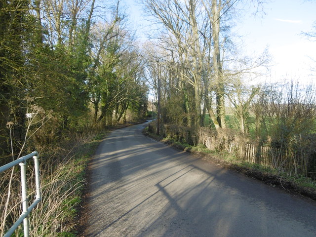
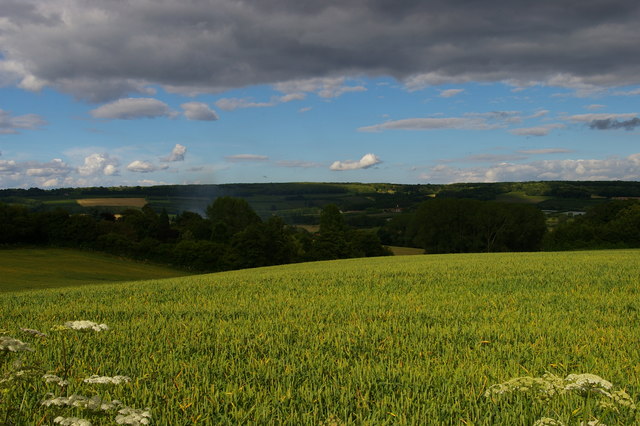
Shipbourne is a civil parish located in the county of Kent, in southeastern England. Situated about 5 miles southwest of the town of Sevenoaks, it is nestled in the picturesque Kent Downs, an Area of Outstanding Natural Beauty. The village is surrounded by rolling hills, lush green fields, and charming countryside, offering residents and visitors a tranquil and idyllic setting.

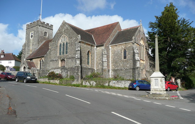
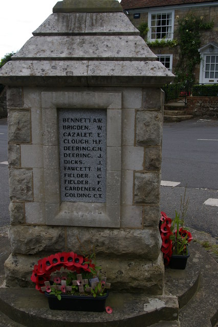
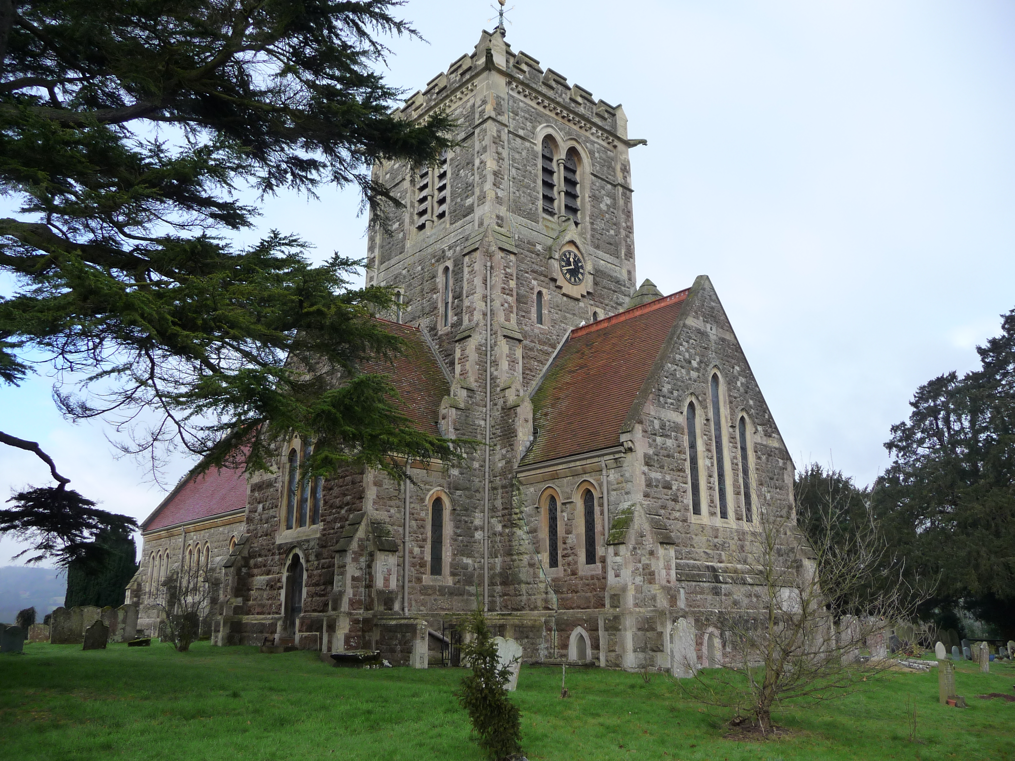
Shipbourne has a rich history that dates back many centuries. It is mentioned in the Domesday Book of 1086, and remnants of its Norman church, St. Giles, still stand today. The church is a prominent feature of the village, with its beautiful architecture and ancient graveyard.

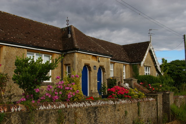
The village itself is small but vibrant, with a close-knit community. It has a handful of amenities, including a village hall, a primary school, and a local pub. Shipbourne is known for its strong sense of community spirit, with various events and activities organized throughout the year, such as the Shipbourne Farmers Market and the Shipbourne Festival.

In addition to its natural beauty and community spirit, Shipbourne offers easy access to several nearby attractions. The historic town of Sevenoaks is just a short drive away, with its shops, restaurants, and leisure facilities. Furthermore, the surrounding countryside is perfect for outdoor enthusiasts, with ample opportunities for walking, cycling, and exploring the stunning Kent Downs.

Overall, Shipbourne is a charming and picturesque village in the heart of the Kent countryside, offering a peaceful and welcoming environment to its residents and visitors.

If you have any feedback on the listing, please let us know in the comments section below.
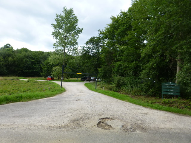
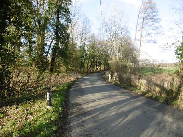
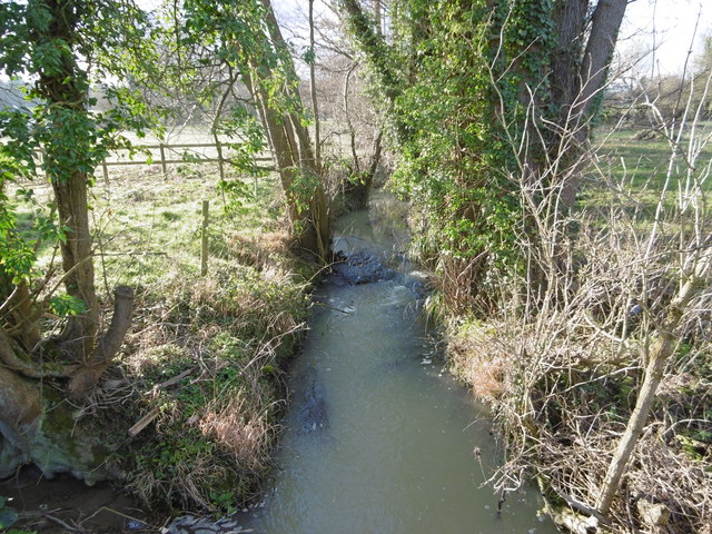
Shipbourne Images

Images are sourced within 2km of 51.245377/0.278173 or Grid Reference TQ5952. Thanks to Geograph Open Source API. All images are credited.

Dene Park car park, Puttenden Road
Plaxtol Church This church is unusual in having no dedication. It was built in 1649, but has 19C windows. It is listed, Grade II*. The war memorial is not yet listed.
Plaxtol Church
This church is unusual in having no dedication. It was built in 1649, but has 19C windows. It is listed, Grade II*. The war memorial is not yet listed.
Puttenden Road Puttenden Road crosses a small stream ahead on its way to Claygate and Puttenden Manor Farm.
Puttenden Road
Puttenden Road crosses a small stream ahead on its way to Claygate and Puttenden Manor Farm.
Stream seen from Puttenden Road Puttenden Road crosses this small stream near Hookwood Farm. See also <a title="https://www.geograph.org.uk/photo/4832679" href="https://www.geograph.org.uk/photo/4832679">Link</a>
Stream seen from Puttenden Road
Puttenden Road crosses this small stream near Hookwood Farm. See also Link
Puttenden Road Puttenden Road crosses a small stream here on its way to Claygate and Puttenden Manor Farm. See also <a title="https://www.geograph.org.uk/photo/4832681" href="https://www.geograph.org.uk/photo/4832681">Link</a>
Puttenden Road
Puttenden Road crosses a small stream here on its way to Claygate and Puttenden Manor Farm. See also Link
Plaxtol: view east off School Lane On the high ground across the valley are Mereworth Woods.
Plaxtol: view east off School Lane
On the high ground across the valley are Mereworth Woods.
Betenson Cottages, School Lane, Plaxtol
Plaxtol: cottages by the church
Plaxtol: names on the village war memorial The memorial shares some surnames - notably Cazalet, the local big family - with the memorial in the nearby village of Shipbourne.
Plaxtol: names on the village war memorial
The memorial shares some surnames - notably Cazalet, the local big family - with the memorial in the nearby village of Shipbourne.
Tree Lane, Plaxtol
Tree Lane, Plaxtol
Plaxtol War Memorial
Plaxtol Lane, Plaxtol
Plaxtol Parish Church
Plaxtol Village Sign
Church Hill, Plaxtol
Fingerpost, Plaxtol
Fingerpost, Plaxtol
The Street, Plaxtol
The Street, Plaxtol
The Street, Plaxtol
The Street, Plaxtol
Show me another place!

Shipbourne is located at Grid Ref: TQ5952 (Lat: 51.245377, Lng: 0.278173)

Administrative County: Kent

District: Tonbridge and Malling

Police Authority: Kent

What 3 Words

///output.aside.soils. Near Hadlow, Kent

Related Wikis

Shipbourne

Shipbourne ( SHIB-ərn) is a village and civil parish situated between the towns of Sevenoaks and Tonbridge, in the borough of Tonbridge and Malling in...

Fairlawne

Fairlawne is a Grade I listed house in Shipbourne, Kent, England, about 30 miles southeast of central London. The Fairlawne Estate is extensive and stretches...
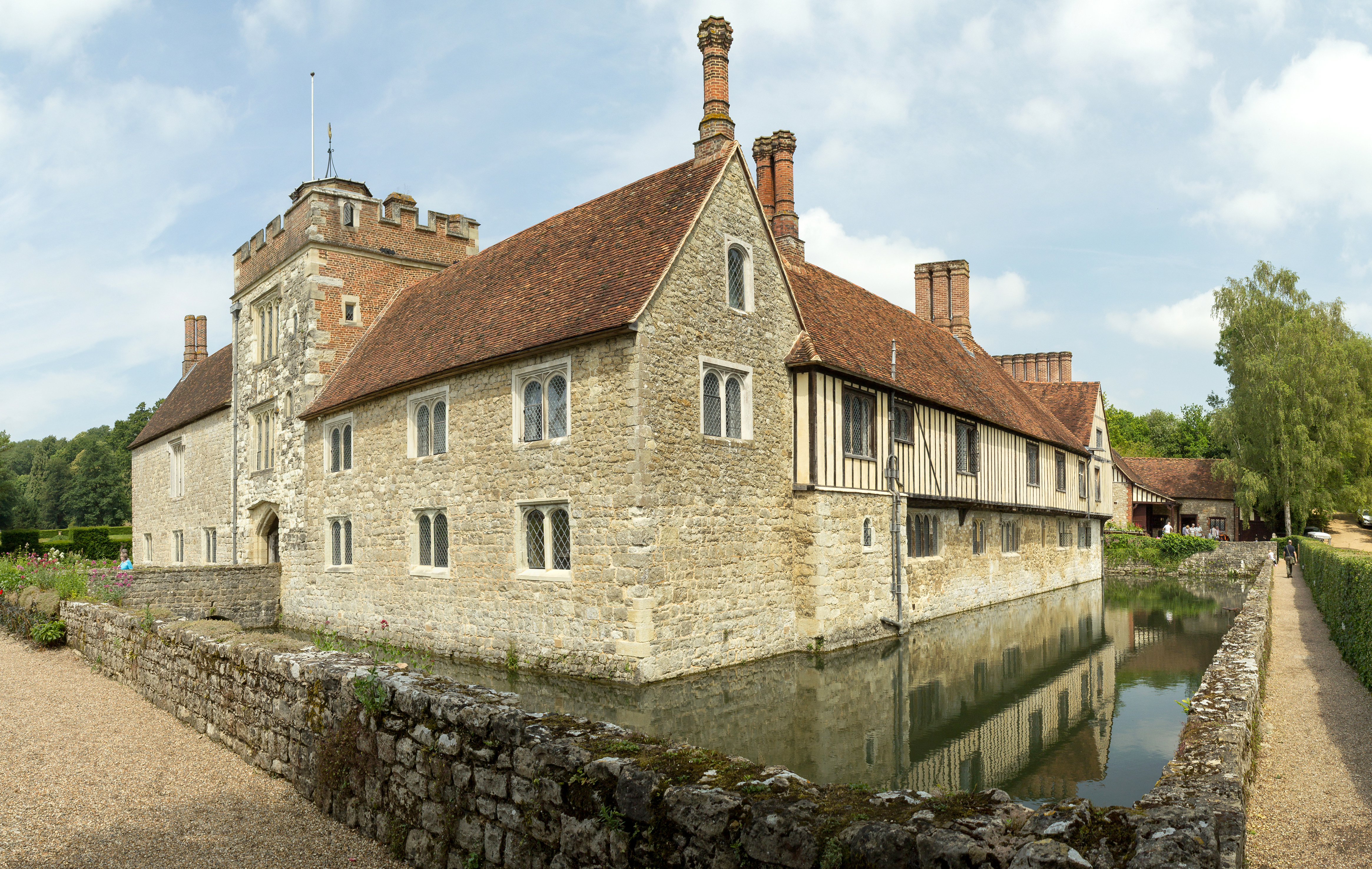
Ightham Mote

Ightham Mote (), at Ightham, is a medieval moated manor house in Kent, England. The architectural writer John Newman describes it as "the most complete...

Plaxtol

Plaxtol is a village and civil parish in the borough of Tonbridge and Malling in Kent, England. The village is located around 5 miles (8 km) north of Tonbridge...

Yopps Green

Yopps Green is a hamlet in the Tonbridge and Malling District, in the county of Kent, England. It is part of the small village of Plaxtol. == Location... ==

Thomas Delarue School

Thomas Delarue was a co-educational special secondary boarding school in Tonbridge, Kent, England that was established in 1955 and closed in 1989. It was...

Ivy Hatch Nature Reserve

Ivy Hatch Nature Reserve in Ivy Hatch, north of Tonbridge in Kent, is a 0.5-hectare (1.2-acre) reserve managed by the Kent Wildlife Trust.Several streams...

One Tree Hill and Bitchet Common

One Tree Hill and Bitchet Common is a 79.2-hectare (196-acre) biological Site of Special Scientific Interest east of Sevenoaks in Kent. It is in Kent Downs...

Nearby Amenities

Located within 500m of 51.245377,0.278173
Shipbourne
Created By: Potlatch 0.7b
Place: village
Source: npe
Lat/Long: 51.2453047/0.2785662
Pub
The Chaser
Wikidata: Q26643972
Lat/Long: 51.246672/0.2792614
Bus Stop
Church
Naptan AtcoCode: 2400A005540A
Naptan Bearing: E
Naptan CommonName: Church
Naptan Indicator: opp
Naptan Landmark: Ightham Road
Naptan NaptanCode: kntagwpa
Naptan Street: Upper Green Road
Naptan Verified: no
Public Transport: platform
Shelter: yes
Source: naptan_import
Lat/Long: 51.2469213/0.2803558
Barrier: stile
Foot: yes
Material: wood
Source: survey
Stile: stepover
Lat/Long: 51.2483658/0.2762986
Barrier: kissing_gate
Foot: yes
Lat/Long: 51.247208/0.2782049
Barrier: stile
Foot: yes
Material: wood
Source: survey
Stile: stepover
Lat/Long: 51.2482692/0.276377
Parking
Fee: no
Lat/Long: 51.2470366/0.2815139
Barrier: stile
Foot: yes
Material: wood
Source: survey
Stile: stepover
Lat/Long: 51.2472365/0.2781447
Post Box
Collection Times: Mo-Fr 16:30; Sa 09:00; Su off
Colour: red
Mapillary: 468227717622728
Post Box Mounting: pier
Post Box Type: lamp
Ref: TN11 115
Royal Cypher: EIIR
Royal Cypher Wikidata: Q33102113
Survey Date: 2020-10-27
Lat/Long: 51.2446031/0.2791145
Booth: K6
Covered: booth
Disused Amenity: telephone
Man Made: telephone_box
Tourism: information
Lat/Long: 51.2469001/0.2803247
The data included in this document is from www.openstreetmap.org. The data is made available under ODbL.

Have you been to Shipbourne?

Leave your review of Shipbourne below (or comments, questions and feedback).