Shelsley Walsh

Civil Parish in Worcestershire Malvern Hills

England

Shelsley Walsh

Shelsley Watermill (1), Shelsley Walsh This impressive three storey watermill is on a milling site dating back to 1308, although the brick shell of the current mill is just over 200 years old. However some of the internal machinery and the timber frame is believed to date from around 1700.  The mill was grinding animal feed up to about 1923, after which it was neglected and left to decay. The fortunate effect of that was that the equipment was left in situ. It has now been restored by the hard work of the volunteers of the Shelsley Water Mill Society, a registered charity, who have been working on the mill since about 2006. 

The mill is on land owned by the Winnington Estate, and in an area leased to the Midland Automobile Club. This is the group that runs the famous motor sports events at Shelsley Walsh, and from whom most of the mill society's volunteers are drawn. The mill is not normally open to the public, but the Society have a website which gives further details.

<a href="https://www.geograph.org.uk/photo/2408824">SO7263 : Shelsley Watermill (2) - waterwheel, Shelsley Walsh</a>.
<a href="https://www.geograph.org.uk/photo/2408846">SO7263 : Shelsley Watermill (3) - waterwheel, Shelsley Walsh</a>.
<a href="https://www.geograph.org.uk/photo/2935900">SO7263 : Shelsley Watermill (4) - waterwheel, Shelsley Walsh</a>.
<a href="https://www.geograph.org.uk/photo/2935917">SO7263 : Shelsley Watermill (5) - part of interior, Shelsley Walsh</a>.
<a href="https://www.geograph.org.uk/photo/2935942">SO7263 : Shelsley Watermill (6) - waterwheel, Shelsley Walsh</a>.
<a href="https://www.geograph.org.uk/photo/2935960">SO7263 : Shelsley Watermill (7) - waterwheel, Shelsley Walsh</a>.
<a href="https://www.geograph.org.uk/photo/2935987">SO7263 : Shelsley Watermill (8) - south end of  stable block, Shelsley Walsh</a>.
<a href="https://www.geograph.org.uk/photo/2936011">SO7263 : Shelsley Watermill (9) - part of interior of stable block, Shelsley Walsh</a>.
<a href="https://www.geograph.org.uk/photo/2936060">SO7263 : Shelsley Watermill (10) - stable block, Shelsley Walsh</a>.

Links to further photos, please see:- <a href="https://www.geograph.org.uk/photo/2937795">SO7263 : Shelsley Watermill (11) - stable block, Shelsley Walsh</a>.
Shelsley Watermill (1), Shelsley Walsh Credit: P L Chadwick

Shelsley Walsh is a civil parish located in the county of Worcestershire, England. It is situated in the Malvern Hills District, approximately 6 miles southwest of the city of Worcester. The parish covers an area of around 3 square miles and is home to a small population.

The village of Shelsley Walsh is known for being the site of one of the oldest motorsport venues in the world. Shelsley Walsh Hill Climb, which was established in 1905, is a popular attraction for motorsport enthusiasts and spectators alike. The hill climb course is set on the side of the Shelsley Walsh hill, and it has been hosting competitive motorsport events for over a century.

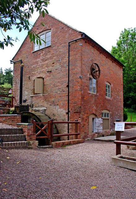
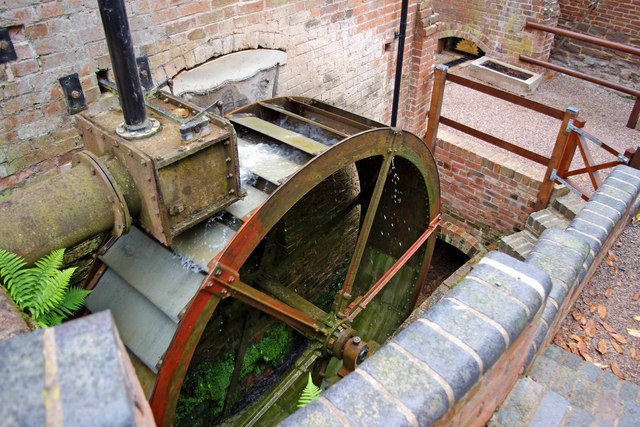
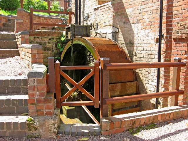
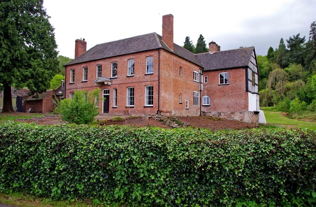
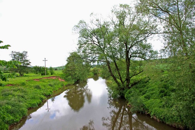
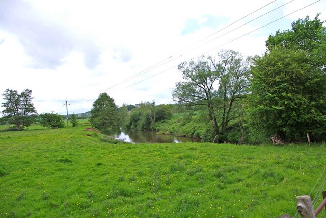
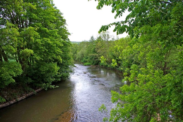
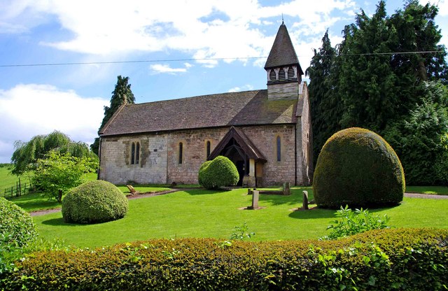
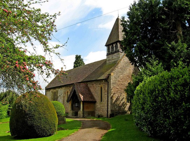
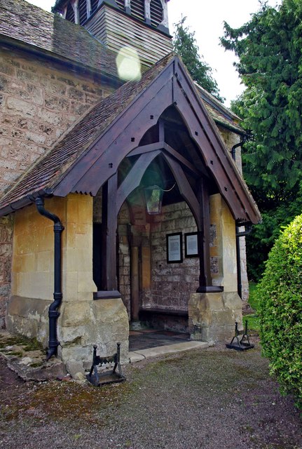
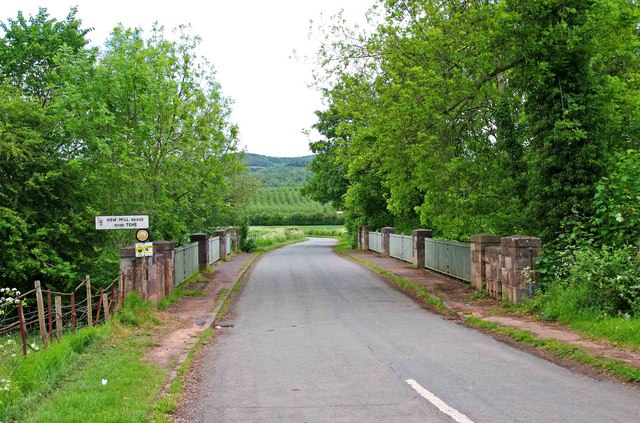
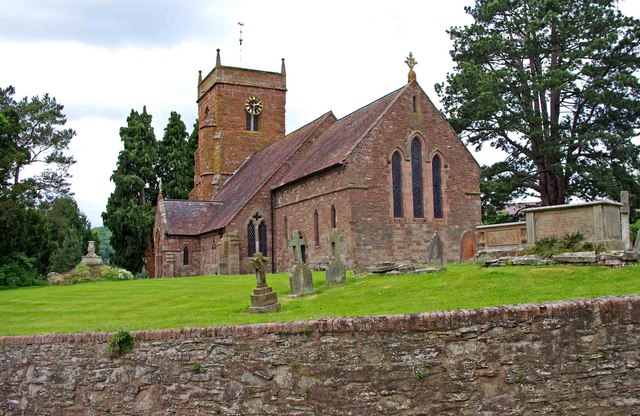
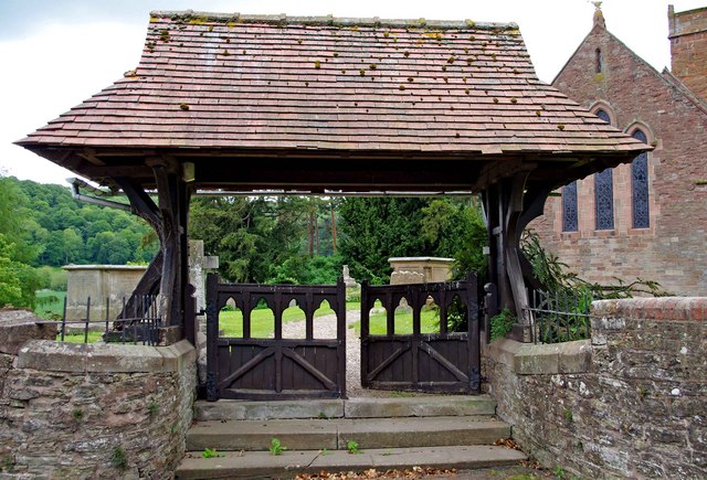
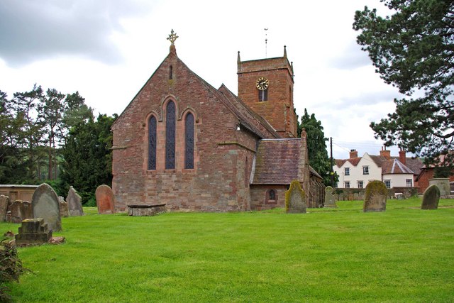
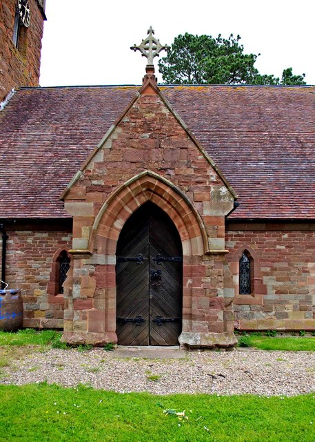
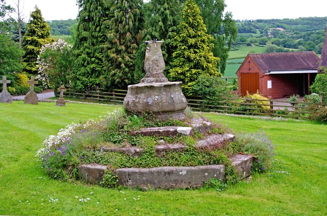
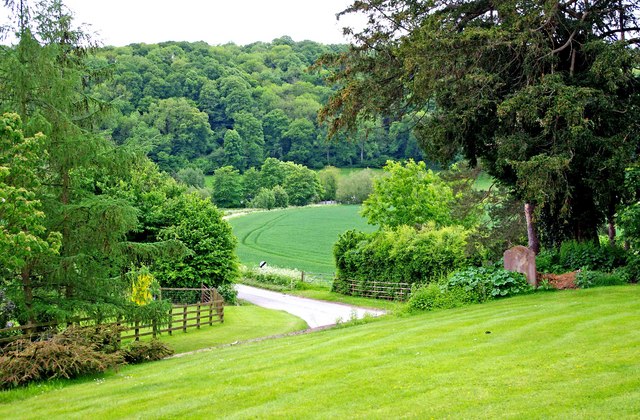
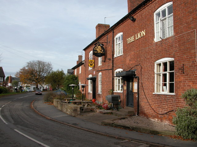
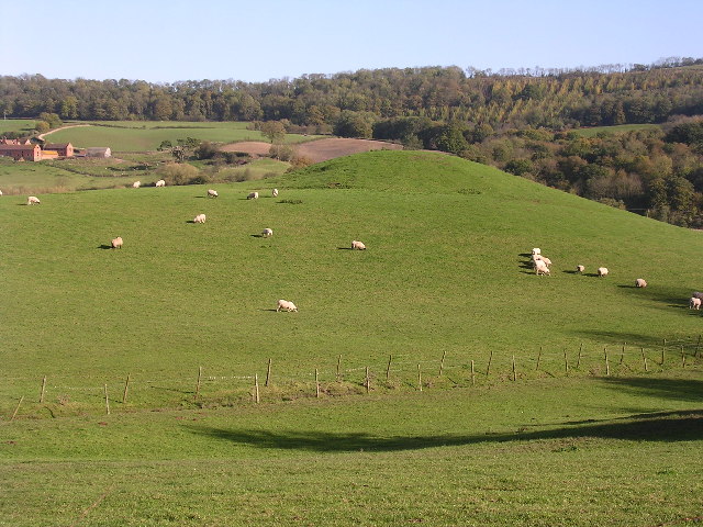
Aside from its motorsport heritage, Shelsley Walsh is also known for its picturesque countryside. The surrounding landscape features rolling hills, fields, and woodlands, making it an appealing destination for nature lovers and hikers. The village itself has a charming, rural character, with quaint cottages and historic buildings.

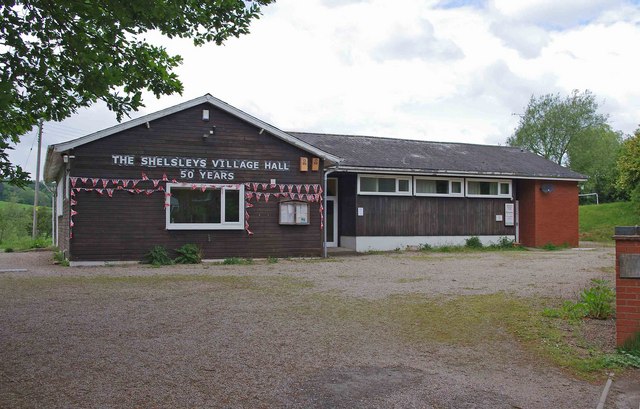
Shelsley Walsh offers limited amenities, with a small number of shops and services available to cater to the local population. However, its proximity to Worcester provides residents with access to a wider range of amenities and employment opportunities.

Overall, Shelsley Walsh is a peaceful and scenic civil parish that attracts visitors with its historic motorsport venue and beautiful countryside.

If you have any feedback on the listing, please let us know in the comments section below.

Shelsley Walsh Images

Images are sourced within 2km of 52.264227/-2.407508 or Grid Reference SO7262. Thanks to Geograph Open Source API. All images are credited.

Shelsley Watermill (1), Shelsley Walsh This impressive three storey watermill is on a milling site dating back to 1308, although the brick shell of the current mill is just over 200 years old. However some of the internal machinery and the timber frame is believed to date from around 1700.  The mill was grinding animal feed up to about 1923, after which it was neglected and left to decay. The fortunate effect of that was that the equipment was left in situ. It has now been restored by the hard work of the volunteers of the Shelsley Water Mill Society, a registered charity, who have been working on the mill since about 2006. 

The mill is on land owned by the Winnington Estate, and in an area leased to the Midland Automobile Club. This is the group that runs the famous motor sports events at Shelsley Walsh, and from whom most of the mill society's volunteers are drawn. The mill is not normally open to the public, but the Society have a website which gives further details.

<a href="https://www.geograph.org.uk/photo/2408824">SO7263 : Shelsley Watermill (2) - waterwheel, Shelsley Walsh</a>.
<a href="https://www.geograph.org.uk/photo/2408846">SO7263 : Shelsley Watermill (3) - waterwheel, Shelsley Walsh</a>.
<a href="https://www.geograph.org.uk/photo/2935900">SO7263 : Shelsley Watermill (4) - waterwheel, Shelsley Walsh</a>.
<a href="https://www.geograph.org.uk/photo/2935917">SO7263 : Shelsley Watermill (5) - part of interior, Shelsley Walsh</a>.
<a href="https://www.geograph.org.uk/photo/2935942">SO7263 : Shelsley Watermill (6) - waterwheel, Shelsley Walsh</a>.
<a href="https://www.geograph.org.uk/photo/2935960">SO7263 : Shelsley Watermill (7) - waterwheel, Shelsley Walsh</a>.
<a href="https://www.geograph.org.uk/photo/2935987">SO7263 : Shelsley Watermill (8) - south end of  stable block, Shelsley Walsh</a>.
<a href="https://www.geograph.org.uk/photo/2936011">SO7263 : Shelsley Watermill (9) - part of interior of stable block, Shelsley Walsh</a>.
<a href="https://www.geograph.org.uk/photo/2936060">SO7263 : Shelsley Watermill (10) - stable block, Shelsley Walsh</a>.

Links to further photos, please see:- <a href="https://www.geograph.org.uk/photo/2937795">SO7263 : Shelsley Watermill (11) - stable block, Shelsley Walsh</a>.
Shelsley Watermill (1), Shelsley Walsh
This impressive three storey watermill is on a milling site dating back to 1308, although the brick shell of the current mill is just over 200 years old. However some of the internal machinery and the timber frame is believed to date from around 1700. The mill was grinding animal feed up to about 1923, after which it was neglected and left to decay. The fortunate effect of that was that the equipment was left in situ. It has now been restored by the hard work of the volunteers of the Shelsley Water Mill Society, a registered charity, who have been working on the mill since about 2006. The mill is on land owned by the Winnington Estate, and in an area leased to the Midland Automobile Club. This is the group that runs the famous motor sports events at Shelsley Walsh, and from whom most of the mill society's volunteers are drawn. The mill is not normally open to the public, but the Society have a website which gives further details. SO7263 : Shelsley Watermill (2) - waterwheel, Shelsley Walsh. SO7263 : Shelsley Watermill (3) - waterwheel, Shelsley Walsh. SO7263 : Shelsley Watermill (4) - waterwheel, Shelsley Walsh. SO7263 : Shelsley Watermill (5) - part of interior, Shelsley Walsh. SO7263 : Shelsley Watermill (6) - waterwheel, Shelsley Walsh. SO7263 : Shelsley Watermill (7) - waterwheel, Shelsley Walsh. SO7263 : Shelsley Watermill (8) - south end of stable block, Shelsley Walsh. SO7263 : Shelsley Watermill (9) - part of interior of stable block, Shelsley Walsh. SO7263 : Shelsley Watermill (10) - stable block, Shelsley Walsh. Links to further photos, please see:- SO7263 : Shelsley Watermill (11) - stable block, Shelsley Walsh.
Shelsley Watermill (2) - waterwheel, Shelsley Walsh The present cast iron waterwheel was ordered from Turtons of Kidderminster in October 1851. It was restored in 2007, and now has a mixture of both old and new steel buckets.

More about the mill:- <a href="https://www.geograph.org.uk/photo/2408805">SO7263 : Shelsley Watermill (1), Shelsley Walsh</a>.
Shelsley Watermill (2) - waterwheel, Shelsley Walsh
The present cast iron waterwheel was ordered from Turtons of Kidderminster in October 1851. It was restored in 2007, and now has a mixture of both old and new steel buckets. More about the mill:- SO7263 : Shelsley Watermill (1), Shelsley Walsh.
Shelsley Watermill (3) - waterwheel, Shelsley Walsh This external overshot waterwheel dates from 1851, and was restored in 2007.

More about the mill:- <a href="https://www.geograph.org.uk/photo/2408805">SO7263 : Shelsley Watermill (1), Shelsley Walsh</a>.
Shelsley Watermill (3) - waterwheel, Shelsley Walsh
This external overshot waterwheel dates from 1851, and was restored in 2007. More about the mill:- SO7263 : Shelsley Watermill (1), Shelsley Walsh.
Court House, Shelsley Walsh This Grade II listed building is believed to have originally been a court or manor house, but has also served as a farmhouse. Originally it was surrounded by a moat. Parts date from the 16th century and other parts from the 17th, 18th & 19th centuries. There is some timber framing in the older parts. Photographed from the grounds of the nearby Shelsley Watermill.
Court House, Shelsley Walsh
This Grade II listed building is believed to have originally been a court or manor house, but has also served as a farmhouse. Originally it was surrounded by a moat. Parts date from the 16th century and other parts from the 17th, 18th & 19th centuries. There is some timber framing in the older parts. Photographed from the grounds of the nearby Shelsley Watermill.
River Teme looking northwest from New Mill Bridge, near Shelsley Beauchamp The River Teme (Afon Tefeidiad in Welsh) rises in Mid Wales, south of Newtown, Powys, and flows through Knighton, where it crosses into England, and continues to Ludlow in Shropshire. It then continues to the north of Tenbury Wells, on the Shropshire/Worcestershire border, and eventually joins the River Severn south of Worcester.
River Teme looking northwest from New Mill Bridge, near Shelsley Beauchamp
The River Teme (Afon Tefeidiad in Welsh) rises in Mid Wales, south of Newtown, Powys, and flows through Knighton, where it crosses into England, and continues to Ludlow in Shropshire. It then continues to the north of Tenbury Wells, on the Shropshire/Worcestershire border, and eventually joins the River Severn south of Worcester.
Meadows by the River Teme at New Mill Bridge, near Shelsley Beauchamp This locality was once an important ironworking area, although nothing visible remains. Today it's difficult to imagine this as an industrial site, as it is so peaceful and rural.
Meadows by the River Teme at New Mill Bridge, near Shelsley Beauchamp
This locality was once an important ironworking area, although nothing visible remains. Today it's difficult to imagine this as an industrial site, as it is so peaceful and rural.
River Teme looking east from New Mill Bridge, near Shelsley Beauchamp The river flows into the River Severn just south of Worcester.
River Teme looking east from New Mill Bridge, near Shelsley Beauchamp
The river flows into the River Severn just south of Worcester.
St. Andrew's Church (1), Shelsley Walsh Mainly constructed from local tufa, a variety of limestone. The nave is Norman, and the chancel 13th century, but with all windows renewed at a later date. There was what Pevsner & Brooks (Buildings of Worcestershire) described as a "distinctively quirky restoration" by George Truefitt in 1859. This resulted in the addition of the pyramid-roofed timber bell-turret and north porch. He was also responsible for painting the boarded ceiling light blue, with violet stars. Unfortunately the church was closed, so it wasn't possible to photograph this remarkable feature!

<a href="https://www.geograph.org.uk/photo/2412874">SO7262 : St. Andrew's Church (2), Shelsley Walsh</a>.
<a href="https://www.geograph.org.uk/photo/2412895">SO7262 : St. Andrew's Church (3) - north porch, Shelsley Walsh</a>.
St. Andrew's Church (1), Shelsley Walsh
Mainly constructed from local tufa, a variety of limestone. The nave is Norman, and the chancel 13th century, but with all windows renewed at a later date. There was what Pevsner & Brooks (Buildings of Worcestershire) described as a "distinctively quirky restoration" by George Truefitt in 1859. This resulted in the addition of the pyramid-roofed timber bell-turret and north porch. He was also responsible for painting the boarded ceiling light blue, with violet stars. Unfortunately the church was closed, so it wasn't possible to photograph this remarkable feature! SO7262 : St. Andrew's Church (2), Shelsley Walsh. SO7262 : St. Andrew's Church (3) - north porch, Shelsley Walsh.
St. Andrew's Church (2), Shelsley Walsh The church grounds are very attractive, and beautifully kept.

Other photos of the church:- <a href="https://www.geograph.org.uk/photo/2412843">SO7262 : St. Andrew's Church (1), Shelsley Walsh</a>.
St. Andrew's Church (2), Shelsley Walsh
The church grounds are very attractive, and beautifully kept. Other photos of the church:- SO7262 : St. Andrew's Church (1), Shelsley Walsh.
St. Andrew's Church (3) - north porch, Shelsley Walsh This porch was one of the additions made in 1859 by George Truefitt, as part of his "restoration" of the church. There is unfortunately a reflection from the camera lens iris in this photograph.

Other photos of the church:- <a href="https://www.geograph.org.uk/photo/2412843">SO7262 : St. Andrew's Church (1), Shelsley Walsh</a>.
St. Andrew's Church (3) - north porch, Shelsley Walsh
This porch was one of the additions made in 1859 by George Truefitt, as part of his "restoration" of the church. There is unfortunately a reflection from the camera lens iris in this photograph. Other photos of the church:- SO7262 : St. Andrew's Church (1), Shelsley Walsh.
New Mill Bridge near Shelsley Beauchamp This bridge carries a minor road to Shelsley Beauchamp across the River Teme. It was rebuilt in 1931 by the Worcestershire County Council. It is made of stone, with wrought-iron balustrades. New Mill doesn't seem to exist anymore. Possibly it was connected with the ironworking industry, which used to be around here long ago.
New Mill Bridge near Shelsley Beauchamp
This bridge carries a minor road to Shelsley Beauchamp across the River Teme. It was rebuilt in 1931 by the Worcestershire County Council. It is made of stone, with wrought-iron balustrades. New Mill doesn't seem to exist anymore. Possibly it was connected with the ironworking industry, which used to be around here long ago.
All Saints Church (2) - lychgate, Shelsley Beauchamp The lychgate dates from around 1887.

More photos of the church:- <a href="https://www.geograph.org.uk/photo/2412966">SO7362 : All Saints Church (1), Shelsley Beauchamp</a>.
All Saints Church (2) - lychgate, Shelsley Beauchamp
The lychgate dates from around 1887. More photos of the church:- SO7362 : All Saints Church (1), Shelsley Beauchamp.
All Saints Church (3), Shelsley Beauchamp The church has a medieval font, dating from the 12th or 13th century. Much else inside is Victorian.

More photos of the church:- <a href="https://www.geograph.org.uk/photo/2412966">SO7362 : All Saints Church (1), Shelsley Beauchamp</a>.
All Saints Church (3), Shelsley Beauchamp
The church has a medieval font, dating from the 12th or 13th century. Much else inside is Victorian. More photos of the church:- SO7362 : All Saints Church (1), Shelsley Beauchamp.
All Saints Church (4) - porch, Shelsley Beauchamp The porch with entrance door is on the south side of the church.

More photos of the church:- <a href="https://www.geograph.org.uk/photo/2412966">SO7362 : All Saints Church (1), Shelsley Beauchamp</a>.
All Saints Church (4) - porch, Shelsley Beauchamp
The porch with entrance door is on the south side of the church. More photos of the church:- SO7362 : All Saints Church (1), Shelsley Beauchamp.
All Saints Church (5) - remains of old cross, Shelsley Beauchamp All that remains of a 15th century cross, in the churchyard, is the octagonal stepped base. What is now on top of it, is a 17th century sundial, which is badly weathered. The original cross may have been removed or destroyed in the religious strife of the 16th and 17th centuries.

More photos of the church:- <a href="https://www.geograph.org.uk/photo/2412966">SO7362 : All Saints Church (1), Shelsley Beauchamp</a>.
All Saints Church (5) - remains of old cross, Shelsley Beauchamp
All that remains of a 15th century cross, in the churchyard, is the octagonal stepped base. What is now on top of it, is a 17th century sundial, which is badly weathered. The original cross may have been removed or destroyed in the religious strife of the 16th and 17th centuries. More photos of the church:- SO7362 : All Saints Church (1), Shelsley Beauchamp.
The road from Shelsley Beauchamp to New Mill Bridge This minor road was photographed from the churchyard of All Saints Church, Shelsley Beauchamp.
The road from Shelsley Beauchamp to New Mill Bridge
This minor road was photographed from the churchyard of All Saints Church, Shelsley Beauchamp.
The Shelsleys Village Hall, Shelsley Beauchamp The hall serves the residents of the three villages of Shelsley Beauchamp, Shelsley Kings and Shelsley Walsh. As can be seen, the hall has recently celebrated its 50th anniversary.
The Shelsleys Village Hall, Shelsley Beauchamp
The hall serves the residents of the three villages of Shelsley Beauchamp, Shelsley Kings and Shelsley Walsh. As can be seen, the hall has recently celebrated its 50th anniversary.
Show me another place!

Shelsley Walsh is located at Grid Ref: SO7262 (Lat: 52.264227, Lng: -2.407508)

Administrative County: Worcestershire

District: Malvern Hills

Police Authority: West Mercia

What 3 Words

///verve.skylights.marketing. Near Collington, Herefordshire

Related Wikis

Shelsley Walsh

Shelsley Walsh is a small village and civil parish in Worcestershire, England, on the western side of the River Teme. For administrative purposes it is...

Shelsley Beauchamp

Shelsley Beauchamp or Great Shelsley is a village and civil parish 9 miles (14 km) north west of Worcester, in the Malvern Hills district, in the county...

Shelsleys

The Shelsleys are a group of small villages in the Malvern Hills District in the county of Worcestershire, England. Situated on either wide of the Teme...

Clifton upon Teme

Clifton upon Teme is a village and civil parish in the Malvern Hills District in the county of Worcestershire, England. == Amenities == Named after the...

Ham Castle

Ham Castle (also known as Home or Homme Castle) is located in Worcestershire at the bottom of a wooded escarpment (and close to the River Teme), within...

Sapey Common

Sapey Common is a small village in Herefordshire, England, near the border with Worcestershire, 10 km (6.2 mi) north east of Bromyard . Although the area...

Woodbury Hill

Woodbury Hill is a hill near the village of Great Witley, about 5 miles (8 km) south-west of Stourport-on-Severn in Worcestershire, England. It is the...

Lower Sapey

Lower Sapey is a village and civil parish in the Malvern Hills District in the county of Worcestershire, England. Sapey Pritchard was in the upper division...

Nearby Amenities

Located within 500m of 52.264227,-2.407508
Bus Stop
Hill Climb
Bus: yes
Naptan AtcoCode: 2000G050200
Naptan Bearing: W
Naptan CommonName: Hill Climb
Naptan Indicator: adj
Naptan Landmark: The Barracks
Naptan NaptanCode: wocgatad
Naptan Verified: no
Public Transport: platform
Source: naptan_import
Lat/Long: 52.2655716/-2.4092111
Post Box
Collection Times: Mo-Fr 15:30; Sa 08:00
Post Box Type: lamp
Ref: WR6 277
Royal Cypher: EIIR
Royal Cypher Wikidata: Q33102113
Lat/Long: 52.2651452/-2.40685
Power: pole
Lat/Long: 52.2628113/-2.4014367
Power: pole
Lat/Long: 52.2684114/-2.4071693
Power: pole
Lat/Long: 52.2679977/-2.4065698
Power: pole
Lat/Long: 52.2674335/-2.4057484
Power: pole
Lat/Long: 52.2673063/-2.4039821
Power: pole
Lat/Long: 52.2652815/-2.4082965
Power: pole
Transformer: distribution
Voltage Primary: 11000
Lat/Long: 52.265018/-2.4087793
Power: pole
Lat/Long: 52.2655376/-2.4078231
Power: pole
Lat/Long: 52.2659931/-2.4068052
Power: pole
Lat/Long: 52.2663797/-2.405971
Power: pole
Lat/Long: 52.2668598/-2.404929
Power: pole
Lat/Long: 52.2664174/-2.4042839
Power: pole
Lat/Long: 52.2659701/-2.4036321
Power: pole
Lat/Long: 52.2653505/-2.4032445
Power: pole
Lat/Long: 52.2647357/-2.402865
Power: pole
Lat/Long: 52.2646791/-2.4002472
Power: pole
Lat/Long: 52.264423/-2.4012382
Power: pole
Lat/Long: 52.264116/-2.4024841
Power: pole
Lat/Long: 52.2634348/-2.4019343
The data included in this document is from www.openstreetmap.org. The data is made available under ODbL.

Have you been to Shelsley Walsh?

Leave your review of Shelsley Walsh below (or comments, questions and feedback).