Shawbury

Civil Parish in Shropshire

England

Shawbury

Sundial in the churchyard The sundial dates from the late 18th century, and was Grade II listed <span class="nowrap"><a title="https://britishlistedbuildings.co.uk/101055377-sundial-approximately-12-metres-to-north-west-of-tower-of-church-of-saint-mary-the-virgin-shawbury#.YXBlqRrMLIU" rel="nofollow ugc noopener" href="https://britishlistedbuildings.co.uk/101055377-sundial-approximately-12-metres-to-north-west-of-tower-of-church-of-saint-mary-the-virgin-shawbury#.YXBlqRrMLIU">Link</a><img style="margin-left:2px;" alt="External link" title="External link - shift click to open in new window" src="https://s1.geograph.org.uk/img/external.png" width="10" height="10"/></span> & <span class="nowrap"><a title="https://historicengland.org.uk/listing/the-list/list-entry/1055377" rel="nofollow ugc noopener" href="https://historicengland.org.uk/listing/the-list/list-entry/1055377">Link</a><img style="margin-left:2px;" alt="External link" title="External link - shift click to open in new window" src="https://s1.geograph.org.uk/img/external.png" width="10" height="10"/></span> in 1986.
Sundial in the churchyard Credit: Richard Law

Shawbury is a civil parish located in the county of Shropshire, England. Situated approximately 9 miles north-east of Shrewsbury, the parish covers an area of around 11 square miles.

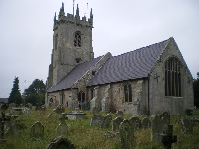
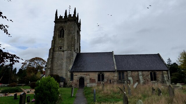
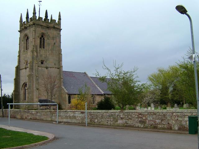
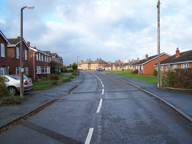
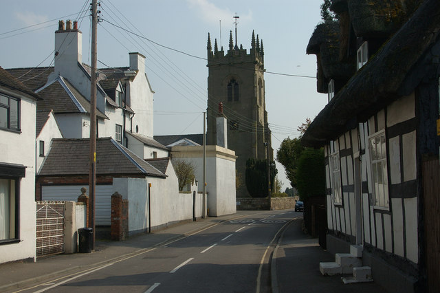
The village of Shawbury, which is the main settlement within the parish, is home to a population of around 2,800 residents. It is a picturesque village with a rich history dating back to the medieval period. The village features several historic buildings, including St Mary's Church, which dates back to the 12th century. The church's architecture is a mix of Norman and Gothic styles and is a popular attraction for visitors.

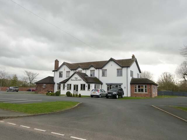
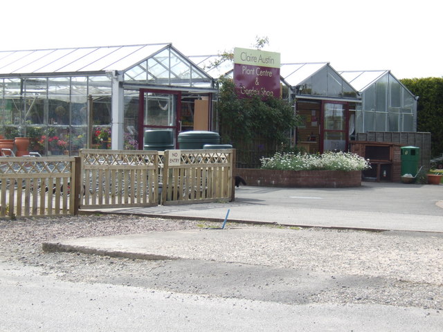
Shawbury is known for its strong sense of community and offers a range of amenities and services to its residents. The village has a primary school, a post office, a village hall, and a number of local shops and businesses. There are also several pubs and restaurants, providing options for dining and socializing.

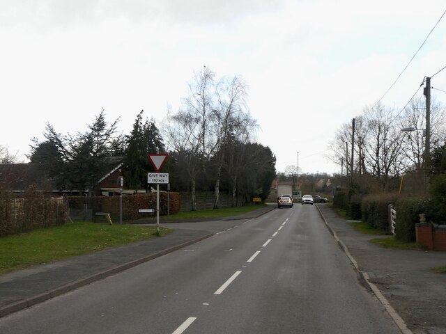
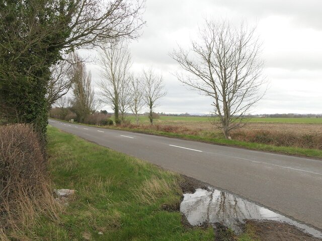
The village is well-connected to surrounding areas by road, with easy access to the A53 and A49. The nearest railway station is located in Shrewsbury, providing transportation links to other parts of the country.

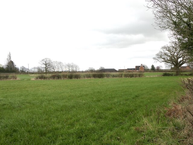
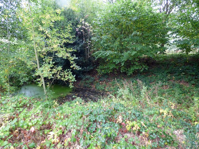
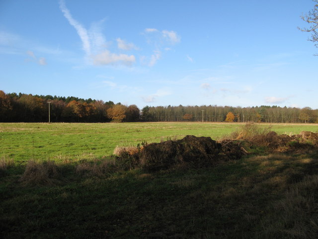
Shawbury is surrounded by beautiful countryside, making it an ideal location for outdoor enthusiasts. The area offers opportunities for walking, cycling, and exploring the nearby Shropshire Hills, an Area of Outstanding Natural Beauty.

Overall, Shawbury is a charming and vibrant village with a strong sense of community and a wealth of history and natural beauty to explore.

If you have any feedback on the listing, please let us know in the comments section below.

Shawbury Images

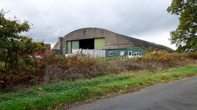
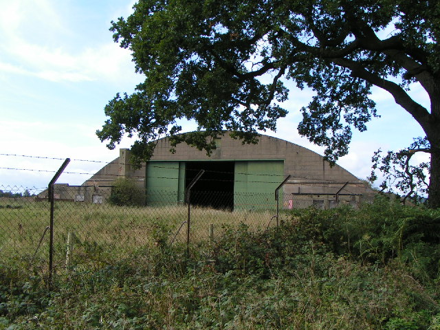
Images are sourced within 2km of 52.783531/-2.648429 or Grid Reference SJ5620. Thanks to Geograph Open Source API. All images are credited.

Sundial in the churchyard The sundial dates from the late 18th century, and was Grade II listed <span class="nowrap"><a title="https://britishlistedbuildings.co.uk/101055377-sundial-approximately-12-metres-to-north-west-of-tower-of-church-of-saint-mary-the-virgin-shawbury#.YXBlqRrMLIU" rel="nofollow ugc noopener" href="https://britishlistedbuildings.co.uk/101055377-sundial-approximately-12-metres-to-north-west-of-tower-of-church-of-saint-mary-the-virgin-shawbury#.YXBlqRrMLIU">Link</a><img style="margin-left:2px;" alt="External link" title="External link - shift click to open in new window" src="https://s1.geograph.org.uk/img/external.png" width="10" height="10"/></span> & <span class="nowrap"><a title="https://historicengland.org.uk/listing/the-list/list-entry/1055377" rel="nofollow ugc noopener" href="https://historicengland.org.uk/listing/the-list/list-entry/1055377">Link</a><img style="margin-left:2px;" alt="External link" title="External link - shift click to open in new window" src="https://s1.geograph.org.uk/img/external.png" width="10" height="10"/></span> in 1986.
Sundial in the churchyard
The sundial dates from the late 18th century, and was Grade II listed LinkExternal link & LinkExternal link in 1986.
The Church of St Mary the Virgin, Shawbury This splendid little church has parts that date back to the 12th century, with subsequent additions, alterations & renovations that took place through until the late 19th century. The font is thought to be 12th century, and there is one medieval coffin slab by the north door, and another to the south of the tower.
It was Grade I listed <span class="nowrap"><a title="https://britishlistedbuildings.co.uk/101055376-church-of-st-mary-the-virgin-shawbury#.YXBoBBrMLIU" rel="nofollow ugc noopener" href="https://britishlistedbuildings.co.uk/101055376-church-of-st-mary-the-virgin-shawbury#.YXBoBBrMLIU">Link</a><img style="margin-left:2px;" alt="External link" title="External link - shift click to open in new window" src="https://s1.geograph.org.uk/img/external.png" width="10" height="10"/></span> & <span class="nowrap"><a title="https://historicengland.org.uk/listing/the-list/list-entry/1055376" rel="nofollow ugc noopener" href="https://historicengland.org.uk/listing/the-list/list-entry/1055376">Link</a><img style="margin-left:2px;" alt="External link" title="External link - shift click to open in new window" src="https://s1.geograph.org.uk/img/external.png" width="10" height="10"/></span> in 1960.
The Church of St Mary the Virgin, Shawbury
This splendid little church has parts that date back to the 12th century, with subsequent additions, alterations & renovations that took place through until the late 19th century. The font is thought to be 12th century, and there is one medieval coffin slab by the north door, and another to the south of the tower. It was Grade I listed LinkExternal link & LinkExternal link in 1960.
Graveyard to the south of the church in Shawbury The village graveyard has been accepting burials for 900-odd years, as there is a 12th century coffin slab near the north door of the church, another of medieval age just south of the tower, and many to be found with 18th & 19th century dates on them.
Graveyard to the south of the church in Shawbury
The village graveyard has been accepting burials for 900-odd years, as there is a 12th century coffin slab near the north door of the church, another of medieval age just south of the tower, and many to be found with 18th & 19th century dates on them.
The Old Vicarage, Shawbury Formerly the Vicarage, and built in the late 18th century, then modified in the 19th. It was Grade II listed <span class="nowrap"><a title="https://britishlistedbuildings.co.uk/101366830-the-old-vicarage-shawbury#.YXBrBBrMLIU" rel="nofollow ugc noopener" href="https://britishlistedbuildings.co.uk/101366830-the-old-vicarage-shawbury#.YXBrBBrMLIU">Link</a><img style="margin-left:2px;" alt="External link" title="External link - shift click to open in new window" src="https://s1.geograph.org.uk/img/external.png" width="10" height="10"/></span> & <span class="nowrap"><a title="https://historicengland.org.uk/listing/the-list/list-entry/1366830" rel="nofollow ugc noopener" href="https://historicengland.org.uk/listing/the-list/list-entry/1366830">Link</a><img style="margin-left:2px;" alt="External link" title="External link - shift click to open in new window" src="https://s1.geograph.org.uk/img/external.png" width="10" height="10"/></span> in 1986.
The Old Vicarage, Shawbury
Formerly the Vicarage, and built in the late 18th century, then modified in the 19th. It was Grade II listed LinkExternal link & LinkExternal link in 1986.
Wytheford Road, Shawbury
The Fox and Hounds Describes itself as a "gastropub".
The Fox and Hounds
Describes itself as a "gastropub".
Off Wytheford Road, Shawbury
B5063, Wytheford Road
Church of Saint Mary the Virgin, Shawbury <span class="nowrap"><a title="https://historicengland.org.uk/listing/the-list/list-entry/1055376?section=official-list-entry" rel="nofollow ugc noopener" href="https://historicengland.org.uk/listing/the-list/list-entry/1055376?section=official-list-entry">Link</a><img style="margin-left:2px;" alt="External link" title="External link - shift click to open in new window" src="https://s1.geograph.org.uk/img/external.png" width="10" height="10"/></span>
Church of Saint Mary the Virgin, Shawbury
Overgrown Moated Site at Shawbury <span class="nowrap"><a title="https://historicengland.org.uk/listing/the-list/list-entry/1017238?section=official-list-entry" rel="nofollow ugc noopener" href="https://historicengland.org.uk/listing/the-list/list-entry/1017238?section=official-list-entry">Link</a><img style="margin-left:2px;" alt="External link" title="External link - shift click to open in new window" src="https://s1.geograph.org.uk/img/external.png" width="10" height="10"/></span>
Overgrown Moated Site at Shawbury
Aircraft Hangar near RAF Shawbury
Old Milepost by the A53, Shawbury Bridge, Shawbury Cast iron post by the A53, in parish of Shawbury (North Shropshire District), Shawbury Bridge; West side of bridge in village, by the road, on North side of road. Salop iron T-post, erected by the County Council in the 19th/20th century. 

Inscription reads:-
: WELLINGTON / 9 / MILES : : WEM / 6 / MI(LES) :

Grade II listed. 
List Entry Number: 1055413 <span class="nowrap"><a title="https://historicengland.org.uk/listing/the-list/list-entry/1055413" rel="nofollow ugc noopener" href="https://historicengland.org.uk/listing/the-list/list-entry/1055413">Link</a><img style="margin-left:2px;" alt="External link" title="External link - shift click to open in new window" src="https://s1.geograph.org.uk/img/external.png" width="10" height="10"/></span>

Milestone Society National ID: SA_WMWT06
Old Milepost by the A53, Shawbury Bridge, Shawbury
Cast iron post by the A53, in parish of Shawbury (North Shropshire District), Shawbury Bridge; West side of bridge in village, by the road, on North side of road. Salop iron T-post, erected by the County Council in the 19th/20th century. Inscription reads:- : WELLINGTON / 9 / MILES : : WEM / 6 / MI(LES) : Grade II listed. List Entry Number: 1055413 LinkExternal link Milestone Society National ID: SA_WMWT06
Shawbury Church The village Church of Shawbury Shropshire
Shawbury Church
The village Church of Shawbury Shropshire
Aircraft Hangar Situated on the outer perimeter of RAF Shawbury, near to Moreton Corbet Castle
Aircraft Hangar
Situated on the outer perimeter of RAF Shawbury, near to Moreton Corbet Castle
Claire Austin Plant Centre An upgrade of what was Shawbury Garden Centre on the A53 at Edgebolton. The owners are exhibiting at Chelsea Flower Show this week.
Claire Austin Plant Centre
An upgrade of what was Shawbury Garden Centre on the A53 at Edgebolton. The owners are exhibiting at Chelsea Flower Show this week.
South Shawbury
South Shawbury
Entrance To RAF Shawbury
Woodland in the sun. Woodland and a sunny day at Shawbury Heath.
Woodland in the sun.
Woodland and a sunny day at Shawbury Heath.
Show me another place!

Shawbury is located at Grid Ref: SJ5620 (Lat: 52.783531, Lng: -2.648429)

Unitary Authority: Shropshire

Police Authority: West Mercia

What 3 Words

///plodded.erupt.cyber. Near Shawbury, Shropshire

Nearby Locations

Shawbury

Related Wikis

Shawbury

Shawbury is a village and civil parish in Shropshire, England. The village is 8 miles (13 km) northeast of Shrewsbury and 12 miles (19 km) northwest of...

Defence Helicopter Flying School

The Defence Helicopter Flying School (DHFS) was a military flying school based at RAF Shawbury in Shropshire, England. The school, established in 1997...
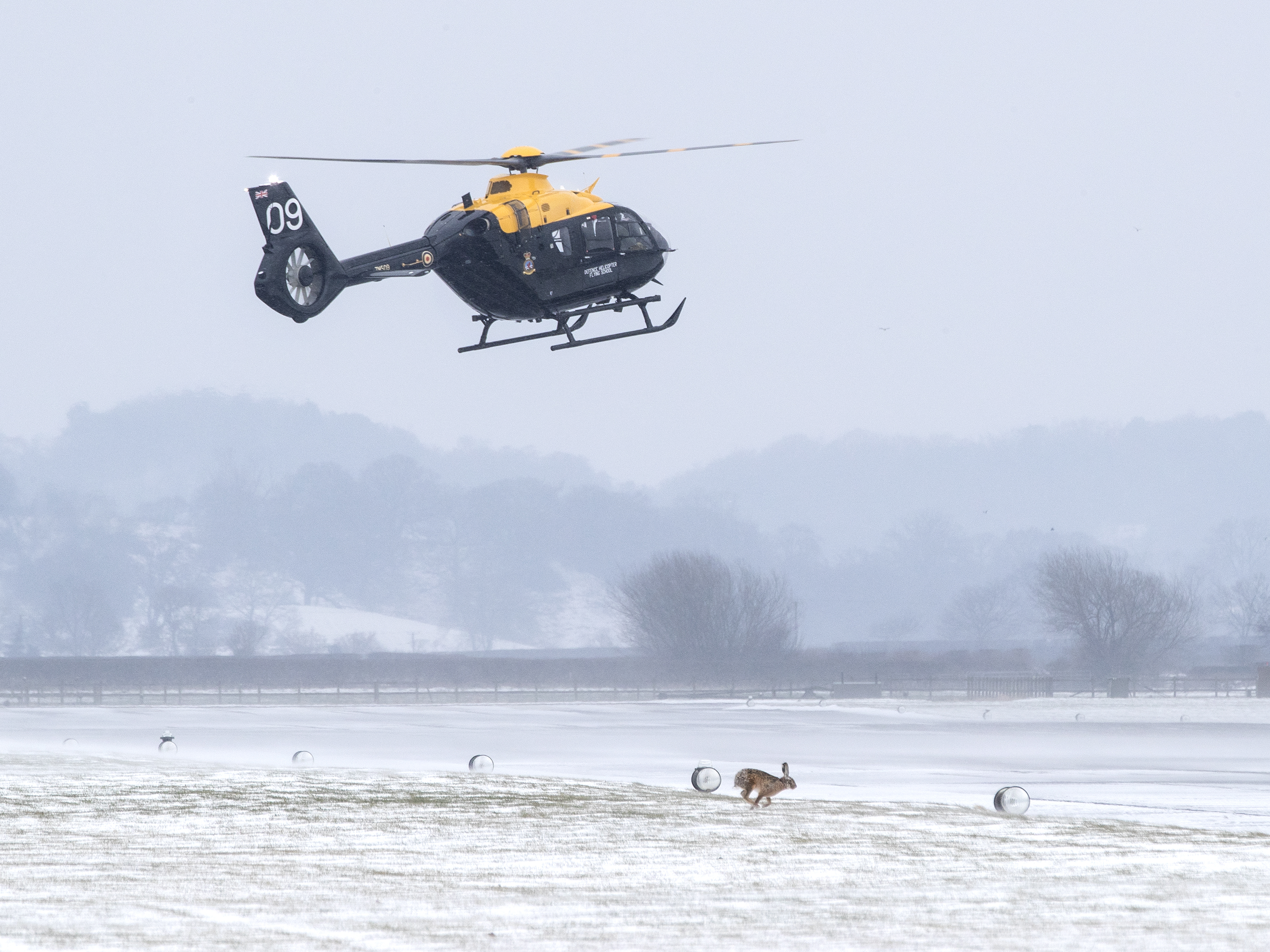
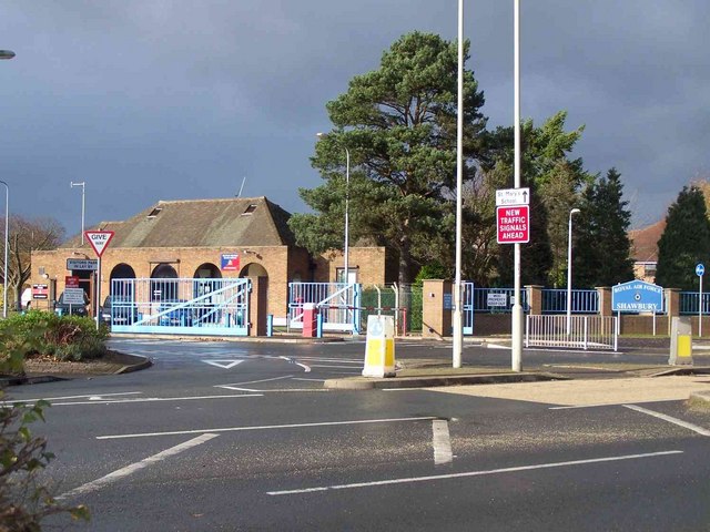
RAF Shawbury

Royal Air Force Shawbury, otherwise known as RAF Shawbury, is a Royal Air Force station near the village of Shawbury in Shropshire in the West Midlands...

Moreton Corbet

Moreton Corbet is a village and former civil parish, now in the parish of Moreton Corbet and Lee Brockhurst, in the Shropshire district, in the ceremonial...

Nearby Amenities

Located within 500m of 52.783531,-2.648429
Generator Method: photovoltaic
Generator Output Electricity: yes
Generator Source: solar
Generator Type: solar_photovoltaic_panel
Location: roof
Power: generator
Lat/Long: 52.7855809/-2.6481611
Generator Method: photovoltaic
Generator Output Electricity: yes
Generator Source: solar
Generator Type: solar_photovoltaic_panel
Location: roof
Power: generator
Lat/Long: 52.7865331/-2.6501834
Generator Method: photovoltaic
Generator Output Electricity: yes
Generator Source: solar
Generator Type: solar_photovoltaic_panel
Location: roof
Power: generator
Lat/Long: 52.7868097/-2.6440009
Generator Method: photovoltaic
Generator Output Electricity: yes
Generator Source: solar
Generator Type: solar_photovoltaic_panel
Location: roof
Power: generator
Lat/Long: 52.7866531/-2.6453581
Generator Method: photovoltaic
Generator Output Electricity: yes
Generator Source: solar
Generator Type: solar_photovoltaic_panel
Location: roof
Power: generator
Lat/Long: 52.7866872/-2.6453018
Generator Method: photovoltaic
Generator Output Electricity: yes
Generator Source: solar
Generator Type: solar_photovoltaic_panel
Location: roof
Power: generator
Lat/Long: 52.7866969/-2.6457658
Bench
Lat/Long: 52.7856704/-2.6540659
The data included in this document is from www.openstreetmap.org. The data is made available under ODbL.

Have you been to Shawbury?

Leave your review of Shawbury below (or comments, questions and feedback).