Shavington cum Gresty

Civil Parish in Cheshire

England

Shavington cum Gresty

The A500, Shavington New dual carriageway bypassing Shavington and Hough to the south of Crewe.
The A500, Shavington Credit: Andrew Smith

The requested URL returned error: 429 Too Many Requests

If you have any feedback on the listing, please let us know in the comments section below.

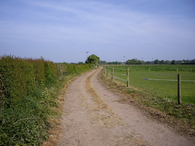
Shavington cum Gresty Images

Images are sourced within 2km of 53.067897/-2.440588 or Grid Reference SJ7052. Thanks to Geograph Open Source API. All images are credited.

The A500, Shavington New dual carriageway bypassing Shavington and Hough to the south of Crewe.
The A500, Shavington
New dual carriageway bypassing Shavington and Hough to the south of Crewe.
The Mornflake Oats plant, Crewe The company are sponsors of the town's football team.
The Mornflake Oats plant, Crewe
The company are sponsors of the town's football team.
Hough Common Hough. Hough Common from Cobbs Lane.
Hough Common
Hough. Hough Common from Cobbs Lane.
Hough - Cobbs Lane Hough. Cobbs Lane, from junction with Buck Lane.
Hough - Cobbs Lane
Hough. Cobbs Lane, from junction with Buck Lane.
Rail, road and foot The A500 dual carriageway bridge over the railway just to the south of Crewe station, with a freight train emerging. Since the construction of the new dual carriageway, the public footpath from Gresty Road in Crewe to Basford has been diverted to go under the railway bridge rather than over the A500 embankment around 200m west. The tower (left) carries lights to illuminate the adjacent Basford Hall Sorting Sidings
Rail, road and foot
The A500 dual carriageway bridge over the railway just to the south of Crewe station, with a freight train emerging. Since the construction of the new dual carriageway, the public footpath from Gresty Road in Crewe to Basford has been diverted to go under the railway bridge rather than over the A500 embankment around 200m west. The tower (left) carries lights to illuminate the adjacent Basford Hall Sorting Sidings
Pasture by Basford Hall Sorting Sidings Flat cattle pasture to the south of the city of Crewe, adjacent to the railway line and Basford Hall Sorting Sidings just south of Crewe station. A freight train is visible standing in the sidings (left). The tower is one of several carrying lights to illuminate the sidings. A stile on the public footpath from Gresty Road in Crewe to Basford is visible (foreground, centre left)
Pasture by Basford Hall Sorting Sidings
Flat cattle pasture to the south of the city of Crewe, adjacent to the railway line and Basford Hall Sorting Sidings just south of Crewe station. A freight train is visible standing in the sidings (left). The tower is one of several carrying lights to illuminate the sidings. A stile on the public footpath from Gresty Road in Crewe to Basford is visible (foreground, centre left)
Semis, Bedford Place, Crewe Semi-detached brown-brick houses, c1950s, on a quiet residential cul-de-sac south of Nantwich Road; probably a former council estate. Typical of the newer houses in this predominantly Victorian/Edwardian residential area
Semis, Bedford Place, Crewe
Semi-detached brown-brick houses, c1950s, on a quiet residential cul-de-sac south of Nantwich Road; probably a former council estate. Typical of the newer houses in this predominantly Victorian/Edwardian residential area
Gresty Brook Gresty Brook emerges from the southern side of Crewe into pasture by the Mornflakes Oats Plant
Gresty Brook
Gresty Brook emerges from the southern side of Crewe into pasture by the Mornflakes Oats Plant
Cheshire Cheese, Gresty, Shavington Large red-brick public house on a right-angle bend in Crewe Road (B5071), just south of Crewe
Cheshire Cheese, Gresty, Shavington
Large red-brick public house on a right-angle bend in Crewe Road (B5071), just south of Crewe
Farm buildings at Yew Tree Farm, near Crewe Several farms lie around Crewe Road (B5071), immediately to the south of the city of Crewe. These farm buildings on a right-angle bend show the typical features of the area, with circular windows, arched entrances and cross-shaped ventilation holes. The chimneys of the Mornflakes plant, visible across much of the square, can be seen in the distance (left)
Farm buildings at Yew Tree Farm, near Crewe
Several farms lie around Crewe Road (B5071), immediately to the south of the city of Crewe. These farm buildings on a right-angle bend show the typical features of the area, with circular windows, arched entrances and cross-shaped ventilation holes. The chimneys of the Mornflakes plant, visible across much of the square, can be seen in the distance (left)
Brook near Greenbank Farm The public footpath from Gresty Road to Basford crosses a small brook, a tributary of Gresty Brook. Between the fences (centre left) runs a track to Greenbank Farm (not a right of way). In the distance, from left to right, are Greenbank Farm outbuildings, Rail House by Crewe station & warehousing by Basford Hall Sorting Sidings
Brook near Greenbank Farm
The public footpath from Gresty Road to Basford crosses a small brook, a tributary of Gresty Brook. Between the fences (centre left) runs a track to Greenbank Farm (not a right of way). In the distance, from left to right, are Greenbank Farm outbuildings, Rail House by Crewe station & warehousing by Basford Hall Sorting Sidings
Mere by the railway line One of three small meres in marshy pasture adjacent to the railway line, near Basford Hall Sorting Sidings just outside Crewe. The surrounding vegetation includes marsh grass, reedmace and willow bushes. The tower (left) is one of a large number carrying lights to illuminate the sidings. View from the public footpath from Gresty Road (Crewe) to Basford
Mere by the railway line
One of three small meres in marshy pasture adjacent to the railway line, near Basford Hall Sorting Sidings just outside Crewe. The surrounding vegetation includes marsh grass, reedmace and willow bushes. The tower (left) is one of a large number carrying lights to illuminate the sidings. View from the public footpath from Gresty Road (Crewe) to Basford
Railway line south of Crewe Crewe-to-Stafford railway line immediately south of Basford Hall Sorting Sidings, south of Crewe station. A goods train waiting in sidings is in the foreground. View from underneath the A500 bridge on the public footpath between Gresty Road and Basford
Railway line south of Crewe
Crewe-to-Stafford railway line immediately south of Basford Hall Sorting Sidings, south of Crewe station. A goods train waiting in sidings is in the foreground. View from underneath the A500 bridge on the public footpath between Gresty Road and Basford
Lorries on the A500 The new route of the busy A500 dual carriageway, ascending the bridge over the Crewe-to-Stafford railway line. View from the embankment on the former route of the public footpath from Gresty Road to Basford (now diverted to go under the bridge)
Lorries on the A500
The new route of the busy A500 dual carriageway, ascending the bridge over the Crewe-to-Stafford railway line. View from the embankment on the former route of the public footpath from Gresty Road to Basford (now diverted to go under the bridge)
Footpath along farm road
White Hart at Hough
White Hart at Hough
Fields Near Cockshades Farm Looking towards the church
Footbridge over brook
Show me another place!

Shavington cum Gresty is located at Grid Ref: SJ7052 (Lat: 53.067897, Lng: -2.440588)

Unitary Authority: Cheshire East

Police Authority: Cheshire

What 3 Words

///insulated.kidney.dance. Near Weston, Cheshire

Nearby Locations

Shavington cum Gresty

Related Wikis

Crewe Alexandra F.C. Academy

The Crewe Alexandra F.C. Academy is the player development centre of English Football League club Crewe Alexandra F.C. Set up by manager Dario Gradi in...

Shavington cum Gresty

Shavington cum Gresty () is a civil parish in the unitary authority of Cheshire East and the ceremonial county of Cheshire, England. It lies to the south...

Basford, Cheshire

Basford is a hamlet and former civil parish, now in the parish of Weston and Crewe Green, in the unitary authority area of Cheshire East and the ceremonial...
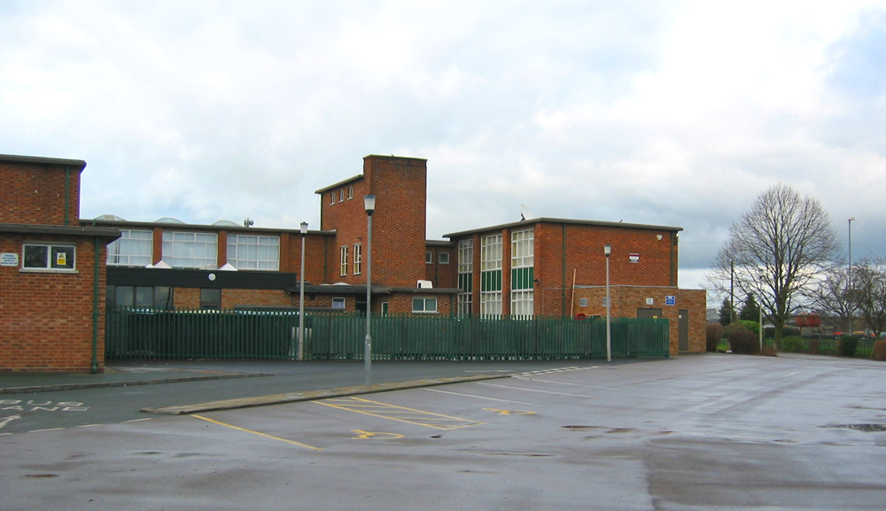
Shavington Academy

Shavington Academy (formerly Shavington High School) is a coeducational secondary school, located in Rope Lane, Shavington, Cheshire East, England. It...

Nearby Amenities

Located within 500m of 53.067897,-2.440588
Traffic Signals
Lat/Long: 53.0701064/-2.4422472
Pub
Shavington Social Club
Addr Housenumber: 116
Addr Postcode: CW2 5DL
Addr Street: Crewe Road
Fhrs Id: 936657
Source Addr: FHRS Open Data
Lat/Long: 53.0650231/-2.4441072
Turning Circle
Lat/Long: 53.0662502/-2.4438675
Bus Stop
Shavington, Crewe Road / Brook Avenue
Bus: yes
Naptan AtcoCode: 0600CR308
Naptan Bearing: NE
Naptan CommonName: Brook Avenue
Naptan Indicator: opp
Naptan Landmark: House number 125
Naptan LocalityName: Shavington
Naptan NaptanCode: chejpjd
Naptan PlusbusZoneRef: CREWE
Naptan ShortCommonName: Brook Avenue
Naptan Street: Crewe Road
Naptan Verified: no
Network: Cheshire East Council
Operator: Ansa Transport
Public Transport: platform
Source: naptan_import
Lat/Long: 53.0648349/-2.4445324
Bus Stop
Shavington, Crewe Road / Brook Avenue
Bus: yes
Naptan AtcoCode: 0600CR309
Naptan Bearing: SW
Naptan CommonName: Brook Avenue
Naptan Indicator: cnr
Naptan Landmark: House number 122
Naptan LocalityName: Shavington
Naptan NaptanCode: chejpjg
Naptan PlusbusZoneRef: CREWE
Naptan ShortCommonName: Brook Avenue
Naptan Street: Crewe Road
Naptan Verified: no
Network: Cheshire East Council
Operator: Ansa Transport
Public Transport: platform
Source: naptan_import
Lat/Long: 53.0650884/-2.444021
Bus Stop
Shavington, Weston Lane / Park Estate
Bus: yes
Naptan AtcoCode: 0600CR310
Naptan Bearing: NE
Naptan CommonName: Park Estate
Naptan Crossing: Park Estate
Naptan Indicator: cnr
Naptan Landmark: House number 13
Naptan LocalityName: Shavington
Naptan NaptanCode: chejpjm
Naptan PlusbusZoneRef: CREWE
Naptan ShortCommonName: Park Estate
Naptan Street: Weston Lane
Naptan Verified: no
Network: Cheshire East Council
Operator: Ansa Transport
Public Transport: platform
Source: naptan_import
Lat/Long: 53.0657338/-2.4397067
Bus Stop
Shavington, Weston Lane / Park Estate
Bus: yes
Naptan AtcoCode: 0600CR311
Naptan Bearing: W
Naptan BusStopType: CUS
Naptan CommonName: Park Estate
Naptan Crossing: Park Estate
Naptan Indicator: opp
Naptan Landmark: House number 32
Naptan LocalityName: Shavington
Naptan NaptanCode: chejpjp
Naptan PlusbusZoneRef: CREWE
Naptan ShortCommonName: Park Estate
Naptan Street: Weston Lane
Naptan Verified: no
Network: Cheshire East Council
Operator: Ansa Transport
Public Transport: platform
Source: naptan_import
Lat/Long: 53.0656363/-2.4396334
Bus Stop
Shavington, Crewe Road / Dodds Bank
Bus: yes
Naptan AtcoCode: 0600CR323
Naptan Bearing: S
Naptan CommonName: Dodds Bank
Naptan Crossing: Chestnut Avenue
Naptan Indicator: S-bound
Naptan Landmark: Dodds Bank
Naptan LocalityName: Shavington
Naptan NaptanCode: cheajtm
Naptan PlusbusZoneRef: CREWE
Naptan ShortCommonName: Dodds Bank
Naptan Street: Crewe Road
Naptan Verified: no
Network: Cheshire East Council
Operator: Ansa Transport
Public Transport: platform
Source: naptan_import
Lat/Long: 53.0668932/-2.4421959
Bus Stop
Shavington, Chestnut Avenue / Crewe Road
Bus: yes
Naptan AtcoCode: 0600CR324
Naptan Bearing: W
Naptan CommonName: Crewe Road
Naptan Crossing: Crewe Road
Naptan Indicator: nr
Naptan Landmark: House number 1A
Naptan LocalityName: Shavington
Naptan NaptanCode: chejpta
Naptan PlusbusZoneRef: CREWE
Naptan ShortCommonName: Crewe Road
Naptan Street: Chestnut Avenue
Naptan Verified: no
Network: Cheshire East Council
Operator: Ansa Transport
Public Transport: platform
Source: naptan_import
Lat/Long: 53.0669618/-2.4430771
Bus Stop
Shavington, Crewe Road / Dodds Bank
Bus: yes
Naptan AtcoCode: 0600CR347
Naptan Bearing: N
Naptan CommonName: Dodds Bank
Naptan Indicator: N-bound
Naptan Landmark: Dodds Bank
Naptan LocalityName: Shavington
Naptan NaptanCode: cheajwj
Naptan PlusbusZoneRef: CREWE
Naptan ShortCommonName: Dodds Bank
Naptan Street: Crewe Road
Naptan Verified: no
Network: Cheshire East Council
Operator: Ansa Transport
Public Transport: platform
Source: naptan_import
Lat/Long: 53.0679773/-2.4422686
Bus Stop
Shavington, Chestnut Avenue / Woodnoth Drive
Bus: yes
Naptan AtcoCode: 0600CR503
Naptan Bearing: SW
Naptan CommonName: Woodnoth Drive
Naptan Crossing: Woodnoth Drive
Naptan Indicator: cnr
Naptan Landmark: House number 62
Naptan LocalityName: Shavington
Naptan NaptanCode: chegptd
Naptan PlusbusZoneRef: CREWE
Naptan ShortCommonName: Woodnoth Drive
Naptan Street: Chestnut Avenue
Naptan Verified: no
Network: Cheshire East Council
Operator: Ansa Transport
Public Transport: platform
Source: naptan_import
Lat/Long: 53.0666664/-2.4475582
Shavington Farm
Place: farm
Source: Bing
Lat/Long: 53.065182/-2.4392251
Shavington Hall
Place: isolated_dwelling
Source: Bing
Lat/Long: 53.0676817/-2.4353739
Shavington House
Place: isolated_dwelling
Source: Bing
Lat/Long: 53.0692239/-2.4427354
Nisa Local
Addr Postcode: CW2 5AL
Addr Street: Crewe Road
Brand: Nisa Local
Brand Wikidata: Q16999069
Brand Wikipedia: en:Nisa (retailer)
Fhrs Id: 890362
Shop: convenience
Source Addr: FHRS Open Data
Lat/Long: 53.0661326/-2.442162
Bus Stop
Shavington, Chestnut Avenue / Woodnoth Drive
Bus: yes
Naptan AtcoCode: 0600CR19249
Naptan Bearing: NE
Naptan BusStopType: CUS
Naptan CommonName: Woodnoth Drive
Naptan Crossing: Woodnoth Drive
Naptan Indicator: opp
Naptan Landmark: Woodnoth Drive
Naptan LocalityName: Shavington
Naptan NaptanCode: cheagagd
Naptan ShortCommonName: Woodnoth Drive
Naptan Street: Chestnut Avenue
Network: Cheshire East Council
Operator: Ansa Transport
Public Transport: platform
Source: naptan_import
Lat/Long: 53.0667198/-2.4477891
Turning Circle
Lat/Long: 53.064267/-2.4430136
Turning Circle
Lat/Long: 53.0651148/-2.4454531
Parking
Access: customers
Parking: surface
Surface: asphalt
Lat/Long: 53.0718209/-2.443182
Crossing
Button Operated: yes
Crossing: traffic_signals
Crossing Island: no
Lat/Long: 53.0701383/-2.4419224
The data included in this document is from www.openstreetmap.org. The data is made available under ODbL.

Have you been to Shavington cum Gresty?

Leave your review of Shavington cum Gresty below (or comments, questions and feedback).