Bryn

Settlement in Monmouthshire

Wales

Bryn

Playing field, Pontllanfraith Leisure Centre Next to the flat field is Blackwood Police Station. The pylon of Chartist Bridge is beyond.
Playing field, Pontllanfraith Leisure Centre Credit: M J Roscoe

Bryn is a small village located in Monmouthshire, a county in southeastern Wales, United Kingdom. Situated in the rolling hills of the Welsh countryside, Bryn offers a picturesque setting with its lush green landscapes and charming rural atmosphere.

The village is home to a tight-knit community, consisting of approximately 500 residents. It is known for its peaceful and friendly environment, making it an ideal place for those seeking a quiet and close-knit community to settle down in. Despite its small size, Bryn offers a range of amenities and services to cater to the needs of its residents. These include a local pub, a small convenience store, and a primary school.

Nature enthusiasts will find plenty to explore in the surrounding area. Bryn is located near the Wye Valley, a designated Area of Outstanding Natural Beauty. This allows residents and visitors to enjoy scenic walks, hikes, and bike rides amidst stunning landscapes and breathtaking views.

For those interested in history and culture, nearby attractions include the historic town of Monmouth, which is just a short drive away. Monmouth is renowned for its medieval architecture, including the imposing Monmouth Castle and the picturesque Monnow Bridge.

Overall, Bryn offers a tranquil and idyllic setting for those looking to escape the hustle and bustle of city life. With its natural beauty, close-knit community, and convenient location, it is a desirable place to call home in Monmouthshire.

If you have any feedback on the listing, please let us know in the comments section below.
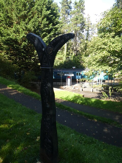
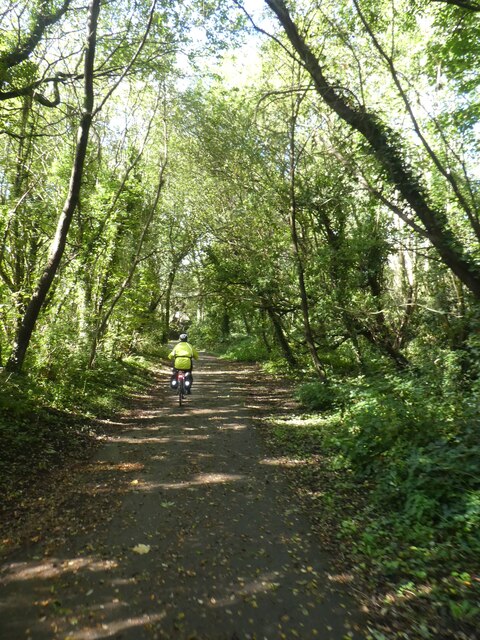
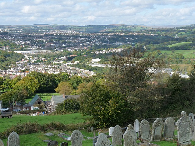
Bryn Images

Images are sourced within 2km of 51.648928/-3.2040055 or Grid Reference ST1695. Thanks to Geograph Open Source API. All images are credited.

Playing field, Pontllanfraith Leisure Centre Next to the flat field is Blackwood Police Station. The pylon of Chartist Bridge is beyond.
Playing field, Pontllanfraith Leisure Centre
Next to the flat field is Blackwood Police Station. The pylon of Chartist Bridge is beyond.
Line of trees by playing field, Pontllanfraith Leisure Centre Oak trees.
Line of trees by playing field, Pontllanfraith Leisure Centre
Oak trees.
Artwork in Sirhowy Valley Country Park There was no explanation of this metal arrow
Artwork in Sirhowy Valley Country Park
There was no explanation of this metal arrow
NCN47 south of Wyllie in Sirhowy Valley Country Park A 26 mile walk in the west of the former county of Gwent from the Aneurin Bevan Memorial, Tredegar to Tredegar House, Newport. The route follows the ridgeways and valley floors through three counties, mainly off road and never far from the Sirhowy or Ebbw Rivers or the Monmouthshire & Brecon Canal (Crumlin Arm). 
The route has been extended from Tredegar House south eastwards to join the Wales Coast Path at Lighthouse Road and follows the Path on the Wentlooge Levels as far as West Usk Lighthouse.
NCN47 south of Wyllie in Sirhowy Valley Country Park
A 26 mile walk in the west of the former county of Gwent from the Aneurin Bevan Memorial, Tredegar to Tredegar House, Newport. The route follows the ridgeways and valley floors through three counties, mainly off road and never far from the Sirhowy or Ebbw Rivers or the Monmouthshire & Brecon Canal (Crumlin Arm). The route has been extended from Tredegar House south eastwards to join the Wales Coast Path at Lighthouse Road and follows the Path on the Wentlooge Levels as far as West Usk Lighthouse.
NCN47 passing birch trees in Sirhowy Valley Country Park A 26 mile walk in the west of the former county of Gwent from the Aneurin Bevan Memorial, Tredegar to Tredegar House, Newport. The route follows the ridgeways and valley floors through three counties, mainly off road and never far from the Sirhowy or Ebbw Rivers or the Monmouthshire & Brecon Canal (Crumlin Arm). 
The route has been extended from Tredegar House south eastwards to join the Wales Coast Path at Lighthouse Road and follows the Path on the Wentlooge Levels as far as West Usk Lighthouse.
NCN47 passing birch trees in Sirhowy Valley Country Park
A 26 mile walk in the west of the former county of Gwent from the Aneurin Bevan Memorial, Tredegar to Tredegar House, Newport. The route follows the ridgeways and valley floors through three counties, mainly off road and never far from the Sirhowy or Ebbw Rivers or the Monmouthshire & Brecon Canal (Crumlin Arm). The route has been extended from Tredegar House south eastwards to join the Wales Coast Path at Lighthouse Road and follows the Path on the Wentlooge Levels as far as West Usk Lighthouse.
NCN47 north of Wyllie in Sirhowy Valley Country Park A 26 mile walk in the west of the former county of Gwent from the Aneurin Bevan Memorial, Tredegar to Tredegar House, Newport. The route follows the ridgeways and valley floors through three counties, mainly off road and never far from the Sirhowy or Ebbw Rivers or the Monmouthshire & Brecon Canal (Crumlin Arm). 
The route has been extended from Tredegar House south eastwards to join the Wales Coast Path at Lighthouse Road and follows the Path on the Wentlooge Levels as far as West Usk Lighthouse.
NCN47 north of Wyllie in Sirhowy Valley Country Park
A 26 mile walk in the west of the former county of Gwent from the Aneurin Bevan Memorial, Tredegar to Tredegar House, Newport. The route follows the ridgeways and valley floors through three counties, mainly off road and never far from the Sirhowy or Ebbw Rivers or the Monmouthshire & Brecon Canal (Crumlin Arm). The route has been extended from Tredegar House south eastwards to join the Wales Coast Path at Lighthouse Road and follows the Path on the Wentlooge Levels as far as West Usk Lighthouse.
The Halfway House, Gelligroes
Cycle route NCN47 by A472 north of Gelligroes The National Cycle Network is a network of cycle routes. It was created by the charity Sustrans <span class="nowrap"><a title="http://www.sustrans.org.uk/what-we-do/national-cycle-network" rel="nofollow ugc noopener" href="http://www.sustrans.org.uk/what-we-do/national-cycle-network">Link</a><img style="margin-left:2px;" alt="External link" title="External link - shift click to open in new window" src="https://s1.geograph.org.uk/img/external.png" width="10" height="10"/></span>  (Sustainable Transport), aided by a National Lottery grant.

Many routes aim to minimise contact with motor traffic, though 70% of them are on roads. In some cases the NCN uses pedestrian routes, disused railways, minor roads, canal towpaths, or traffic-calmed routes in towns and cities.
Cycle route NCN47 by A472 north of Gelligroes
The National Cycle Network is a network of cycle routes. It was created by the charity Sustrans LinkExternal link (Sustainable Transport), aided by a National Lottery grant. Many routes aim to minimise contact with motor traffic, though 70% of them are on roads. In some cases the NCN uses pedestrian routes, disused railways, minor roads, canal towpaths, or traffic-calmed routes in towns and cities.
Footbridge over A472
Village sign for Maesycwmmer The sign represents the disused railway viaduct across the valley
Village sign for Maesycwmmer
The sign represents the disused railway viaduct across the valley
Village map on west of Maesycwmmer Map of the village highlighting the shared path on the disused railway viaduct
Village map on west of Maesycwmmer
Map of the village highlighting the shared path on the disused railway viaduct
Shared path in woodland in Maesycwmmer The National Cycle Network is a network of cycle routes. It was created by the charity Sustrans <span class="nowrap"><a title="http://www.sustrans.org.uk/what-we-do/national-cycle-network" rel="nofollow ugc noopener" href="http://www.sustrans.org.uk/what-we-do/national-cycle-network">Link</a><img style="margin-left:2px;" alt="External link" title="External link - shift click to open in new window" src="https://s1.geograph.org.uk/img/external.png" width="10" height="10"/></span>  (Sustainable Transport), aided by a National Lottery grant.

Many routes aim to minimise contact with motor traffic, though 70% of them are on roads. In some cases the NCN uses pedestrian routes, disused railways, minor roads, canal towpaths, or traffic-calmed routes in towns and cities.
Shared path in woodland in Maesycwmmer
The National Cycle Network is a network of cycle routes. It was created by the charity Sustrans LinkExternal link (Sustainable Transport), aided by a National Lottery grant. Many routes aim to minimise contact with motor traffic, though 70% of them are on roads. In some cases the NCN uses pedestrian routes, disused railways, minor roads, canal towpaths, or traffic-calmed routes in towns and cities.
Wheel of Drams artwork, Maesycwmmer The National Cycle Network is a network of cycle routes. It was created by the charity Sustrans <span class="nowrap"><a title="http://www.sustrans.org.uk/what-we-do/national-cycle-network" rel="nofollow ugc noopener" href="http://www.sustrans.org.uk/what-we-do/national-cycle-network">Link</a><img style="margin-left:2px;" alt="External link" title="External link - shift click to open in new window" src="https://s1.geograph.org.uk/img/external.png" width="10" height="10"/></span>  (Sustainable Transport), aided by a National Lottery grant.

Many routes aim to minimise contact with motor traffic, though 70% of them are on roads. In some cases the NCN uses pedestrian routes, disused railways, minor roads, canal towpaths, or traffic-calmed routes in towns and cities.
Wheel of Drams artwork, Maesycwmmer
The National Cycle Network is a network of cycle routes. It was created by the charity Sustrans LinkExternal link (Sustainable Transport), aided by a National Lottery grant. Many routes aim to minimise contact with motor traffic, though 70% of them are on roads. In some cases the NCN uses pedestrian routes, disused railways, minor roads, canal towpaths, or traffic-calmed routes in towns and cities.
Maesycwmmer Viaduct, Maesycwmmer Shared path across the viaduct.  The railings have been designed to prevent people climbing on the parapet of the bridge
Maesycwmmer Viaduct, Maesycwmmer
Shared path across the viaduct. The railings have been designed to prevent people climbing on the parapet of the bridge
Maesycwmmer Viaduct, Maesycwmmer The National Cycle Network is a network of cycle routes. It was created by the charity Sustrans <span class="nowrap"><a title="http://www.sustrans.org.uk/what-we-do/national-cycle-network" rel="nofollow ugc noopener" href="http://www.sustrans.org.uk/what-we-do/national-cycle-network">Link</a><img style="margin-left:2px;" alt="External link" title="External link - shift click to open in new window" src="https://s1.geograph.org.uk/img/external.png" width="10" height="10"/></span>  (Sustainable Transport), aided by a National Lottery grant.

Many routes aim to minimise contact with motor traffic, though 70% of them are on roads. In some cases the NCN uses pedestrian routes, disused railways, minor roads, canal towpaths, or traffic-calmed routes in towns and cities.
Maesycwmmer Viaduct, Maesycwmmer
The National Cycle Network is a network of cycle routes. It was created by the charity Sustrans LinkExternal link (Sustainable Transport), aided by a National Lottery grant. Many routes aim to minimise contact with motor traffic, though 70% of them are on roads. In some cases the NCN uses pedestrian routes, disused railways, minor roads, canal towpaths, or traffic-calmed routes in towns and cities.
Hengoed, from Maesycwmmer Viaduct
Sustrans sign by NCN47, Hengoed The National Cycle Network is a network of cycle routes. It was created by the charity Sustrans <span class="nowrap"><a title="http://www.sustrans.org.uk/what-we-do/national-cycle-network" rel="nofollow ugc noopener" href="http://www.sustrans.org.uk/what-we-do/national-cycle-network">Link</a><img style="margin-left:2px;" alt="External link" title="External link - shift click to open in new window" src="https://s1.geograph.org.uk/img/external.png" width="10" height="10"/></span>  (Sustainable Transport), aided by a National Lottery grant.

Many routes aim to minimise contact with motor traffic, though 70% of them are on roads. In some cases the NCN uses pedestrian routes, disused railways, minor roads, canal towpaths, or traffic-calmed routes in towns and cities.
Sustrans sign by NCN47, Hengoed
The National Cycle Network is a network of cycle routes. It was created by the charity Sustrans LinkExternal link (Sustainable Transport), aided by a National Lottery grant. Many routes aim to minimise contact with motor traffic, though 70% of them are on roads. In some cases the NCN uses pedestrian routes, disused railways, minor roads, canal towpaths, or traffic-calmed routes in towns and cities.
Shared path in woodland south of Hengoed on NCN47 The National Cycle Network is a network of cycle routes. It was created by the charity Sustrans <span class="nowrap"><a title="http://www.sustrans.org.uk/what-we-do/national-cycle-network" rel="nofollow ugc noopener" href="http://www.sustrans.org.uk/what-we-do/national-cycle-network">Link</a><img style="margin-left:2px;" alt="External link" title="External link - shift click to open in new window" src="https://s1.geograph.org.uk/img/external.png" width="10" height="10"/></span>  (Sustainable Transport), aided by a National Lottery grant.

Many routes aim to minimise contact with motor traffic, though 70% of them are on roads. In some cases the NCN uses pedestrian routes, disused railways, minor roads, canal towpaths, or traffic-calmed routes in towns and cities.
Shared path in woodland south of Hengoed on NCN47
The National Cycle Network is a network of cycle routes. It was created by the charity Sustrans LinkExternal link (Sustainable Transport), aided by a National Lottery grant. Many routes aim to minimise contact with motor traffic, though 70% of them are on roads. In some cases the NCN uses pedestrian routes, disused railways, minor roads, canal towpaths, or traffic-calmed routes in towns and cities.
Show me another place!

Bryn is located at Grid Ref: ST1695 (Lat: 51.648928, Lng: -3.2040055)

Unitary Authority: Caerphilly

Police Authority: Gwent

What 3 Words

///register.undertook.stands. Near Hengoed, Caerphilly

Nearby Locations

Bryn Gelli-haf

Related Wikis

Pontllanfraith

Pontllanfraith (Welsh: Pontllanfraith [ˌpɔntɬanˈvraiθ]) is a large village and community located in the Sirhowy Valley in Caerphilly County Borough, Wales...

Islwyn (UK Parliament constituency)

Islwyn (Welsh pronunciation: [ˈɪslʊɨn]) is a constituency in Wales represented in the House of Commons of the Parliament of the United Kingdom. The area...

Islwyn (Senedd constituency)

Islwyn (Welsh pronunciation: [ˈɪslʊɨn]) is a constituency of the Senedd. It elects one Member of the Senedd by the first past the post method of election...
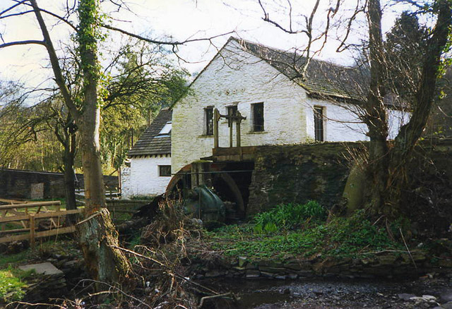
Gelligroes Mill

Gelligroes Mill is a water-powered corn mill in Pontllanfraith, Caerphilly county borough, South Wales, designated as a Grade II* listed building in 1962...

Nearby Amenities

Located within 500m of 51.648928,-3.2040055
Bench
Lat/Long: 51.6465092/-3.2092167
Sirhowy Junction
Historic Railway: junction
Railway: site
Lat/Long: 51.6477614/-3.198737
The Bryn
Name Cy: Y Bryn
Place: neighbourhood
Lat/Long: 51.6499854/-3.2029524
Power: pole
Lat/Long: 51.6451076/-3.2034105
Power: pole
Lat/Long: 51.6456303/-3.2037914
Power: pole
Lat/Long: 51.6469051/-3.2054597
Power: pole
Lat/Long: 51.6488282/-3.2096265
Power: pole
Lat/Long: 51.6496745/-3.2095957
Power: pole
Lat/Long: 51.6502087/-3.2081124
Power: pole
Lat/Long: 51.6512355/-3.2080668
Power: pole
Lat/Long: 51.6521907/-3.2087991
Barrier: yes
Foot: yes
Lat/Long: 51.6491771/-3.2092914
Direction: 275
Generator Method: photovoltaic
Generator Output Electricity: yes
Generator Solar Modules: 9
Generator Source: solar
Generator Type: solar_photovoltaic_panel
Location: roof
Power: generator
Lat/Long: 51.6491328/-3.2016537
Direction: WSW
Generator Method: photovoltaic
Generator Output Electricity: yes
Generator Solar Modules: 10
Generator Source: solar
Generator Type: solar_photovoltaic_panel
Location: roof
Power: generator
Lat/Long: 51.6502345/-3.202115
Direction: 195
Generator Method: photovoltaic
Generator Output Electricity: yes
Generator Solar Modules: 16
Generator Source: solar
Generator Type: solar_photovoltaic_panel
Location: roof
Power: generator
Lat/Long: 51.6497677/-3.2060498
Direction: 215
Generator Method: photovoltaic
Generator Output Electricity: yes
Generator Solar Modules: 13
Generator Source: solar
Generator Type: solar_photovoltaic_panel
Location: roof
Power: generator
Lat/Long: 51.6517131/-3.2055429
Direction: 215
Generator Method: photovoltaic
Generator Output Electricity: yes
Generator Solar Modules: 13
Generator Source: solar
Generator Type: solar_photovoltaic_panel
Location: roof
Power: generator
Lat/Long: 51.6529762/-3.2053417
Direction: 145
Generator Method: photovoltaic
Generator Output Electricity: yes
Generator Solar Modules: 13
Generator Source: solar
Generator Type: solar_photovoltaic_panel
Location: roof
Power: generator
Lat/Long: 51.6509526/-3.2034212
Direction: SE
Generator Method: photovoltaic
Generator Output Electricity: yes
Generator Solar Modules: 12
Generator Source: solar
Generator Type: solar_photovoltaic_panel
Location: roof
Power: generator
Lat/Long: 51.6508711/-3.2028526
Direction: SSE
Generator Method: photovoltaic
Generator Output Electricity: yes
Generator Solar Modules: 13
Generator Source: solar
Generator Type: solar_photovoltaic_panel
Location: roof
Power: generator
Lat/Long: 51.6508933/-3.2014615
Direction: S
Generator Method: photovoltaic
Generator Output Electricity: yes
Generator Solar Modules: 14
Generator Source: solar
Generator Type: solar_photovoltaic_panel
Location: roof
Power: generator
Lat/Long: 51.6522124/-3.1990975
Direction: 215
Generator Method: photovoltaic
Generator Output Electricity: yes
Generator Solar Modules: 16
Generator Source: solar
Generator Type: solar_photovoltaic_panel
Location: roof
Power: generator
Lat/Long: 51.6515234/-3.1991461
Direction: SSW
Generator Method: photovoltaic
Generator Output Electricity: yes
Generator Solar Modules: 16
Generator Source: solar
Generator Type: solar_photovoltaic_panel
Location: roof
Power: generator
Lat/Long: 51.6492237/-3.2020131
Direction: 95
Generator Method: photovoltaic
Generator Output Electricity: yes
Generator Solar Modules: 8
Generator Source: solar
Generator Type: solar_photovoltaic_panel
Location: roof
Power: generator
Lat/Long: 51.6491336/-3.2015625
Direction: SSE
Generator Method: photovoltaic
Generator Output Electricity: yes
Generator Solar Modules: 16
Generator Source: solar
Generator Type: solar_photovoltaic_panel
Location: roof
Power: generator
Lat/Long: 51.6485241/-3.1971549
Direction: 105
Generator Method: photovoltaic
Generator Output Electricity: yes
Generator Solar Modules: 12
Generator Source: solar
Generator Type: solar_photovoltaic_panel
Location: roof
Power: generator
Lat/Long: 51.6504916/-3.1980112
Direction: 145
Generator Method: photovoltaic
Generator Output Electricity: yes
Generator Solar Modules: 16
Generator Source: solar
Generator Type: solar_photovoltaic_panel
Location: roof
Power: generator
Lat/Long: 51.6514385/-3.1982714
The data included in this document is from www.openstreetmap.org. The data is made available under ODbL.

Have you been to Bryn?

Leave your review of Bryn below (or comments, questions and feedback).