Shadoxhurst

Civil Parish in Kent Ashford

England

Shadoxhurst

Looking north-northwest along Church Lane The white-painted, weather-boarded house, in the distance, is Quince Cottage -  a grade II listed building dating from the 18th century
<span class="nowrap"><a title="http://www.britishlistedbuildings.co.uk/en-181144-quince-cottage-shadoxhurst-kent#.VdIaTxuFPcc" rel="nofollow ugc noopener" href="http://www.britishlistedbuildings.co.uk/en-181144-quince-cottage-shadoxhurst-kent#.VdIaTxuFPcc">Link</a><img style="margin-left:2px;" alt="External link" title="External link - shift click to open in new window" src="https://s1.geograph.org.uk/img/external.png" width="10" height="10"/></span>
Looking north-northwest along Church Lane Credit: John Baker

Shadoxhurst is a civil parish located in the county of Kent, England. Situated approximately 10 miles south-west of the town of Ashford, it covers an area of around 7.5 square miles. Shadoxhurst is a predominantly rural parish with a population of around 1,200 people.

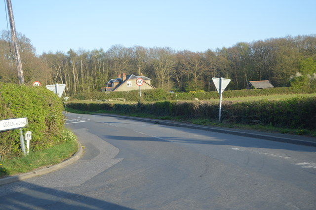
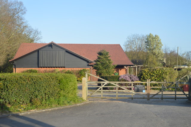
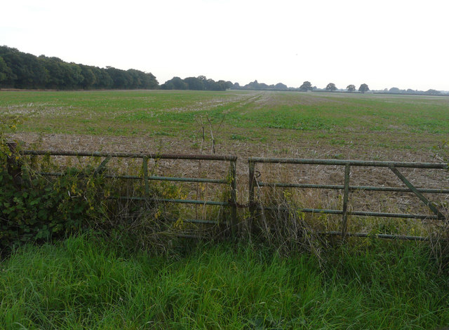
The parish is surrounded by beautiful countryside, comprising of rolling hills, farmland, and pockets of woodland. It offers a peaceful and idyllic setting for residents and visitors alike. The village itself is located in the heart of the parish and features a charming mix of historic and modern buildings.

Shadoxhurst is well-connected to neighboring towns and cities, with Ashford being the closest major transportation hub. The village benefits from good road links, including the A28, which provides easy access to Ashford, Canterbury, and the wider Kent area. The nearest railway station is in Ashford, offering regular services to London and other destinations.

The parish boasts a strong community spirit, with various community groups and organizations actively involved in the village's social and cultural life. It has a primary school, providing education for local children, and a village hall that hosts a range of events and activities.

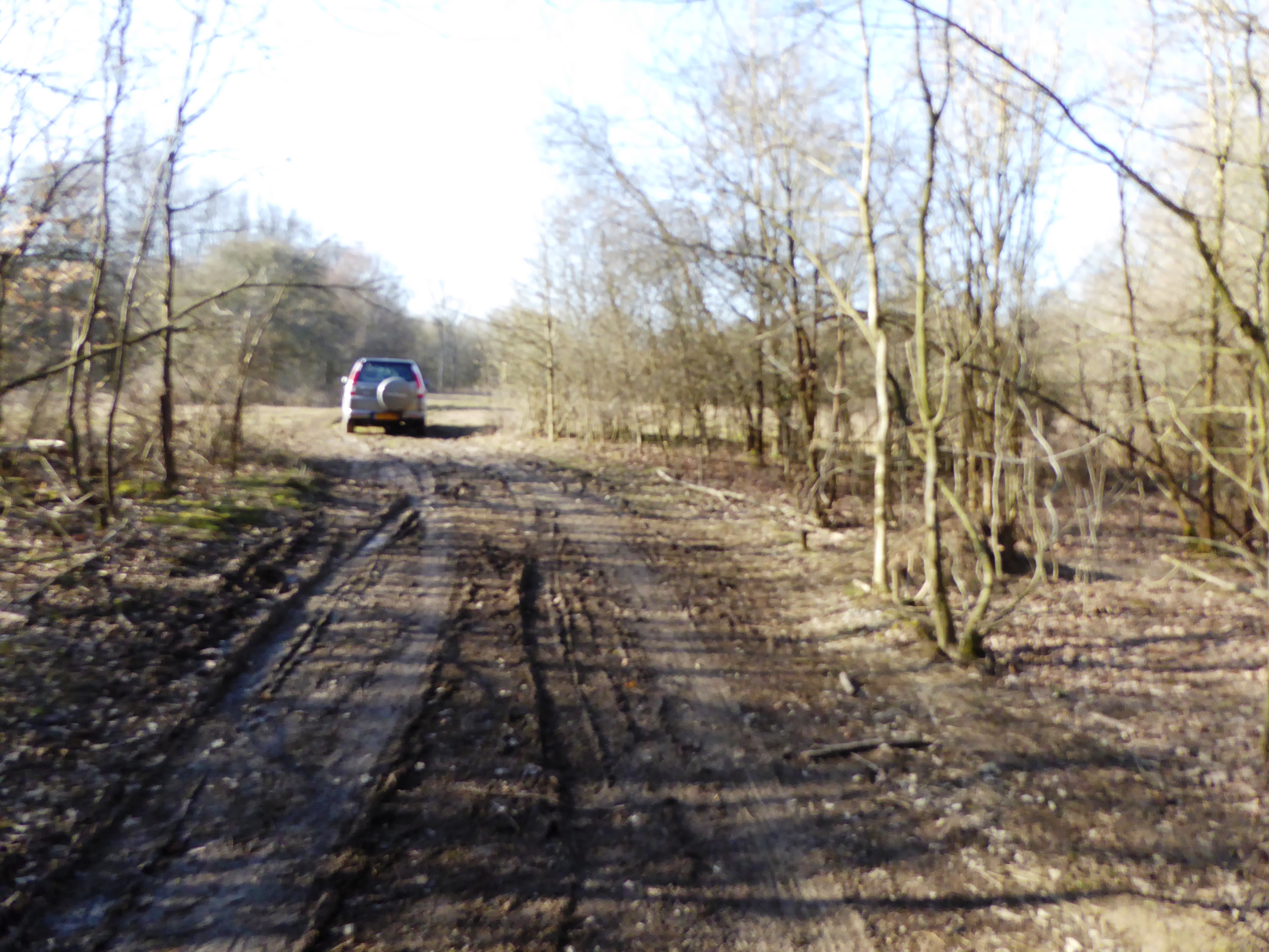
For outdoor enthusiasts, Shadoxhurst offers ample opportunities for walking, cycling, and exploring the surrounding countryside. The parish is also home to several farms and equestrian facilities, reflecting the area's agricultural heritage.

Overall, Shadoxhurst is a picturesque and welcoming civil parish, offering a tranquil rural escape while still being within easy reach of larger towns and cities.

If you have any feedback on the listing, please let us know in the comments section below.
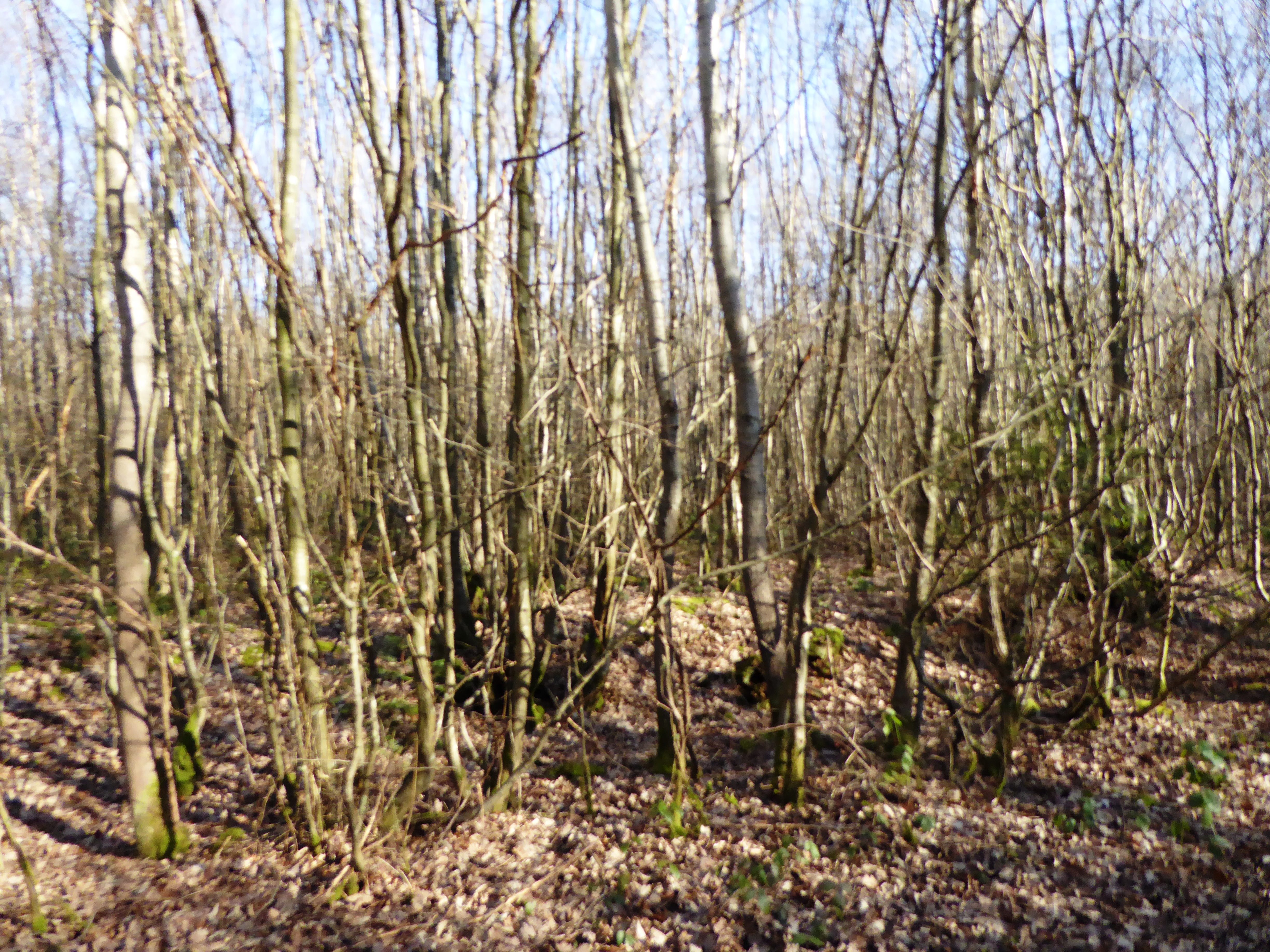
Shadoxhurst Images

Images are sourced within 2km of 51.102558/0.822923 or Grid Reference TQ9737. Thanks to Geograph Open Source API. All images are credited.

Looking north-northwest along Church Lane The white-painted, weather-boarded house, in the distance, is Quince Cottage -  a grade II listed building dating from the 18th century
<span class="nowrap"><a title="http://www.britishlistedbuildings.co.uk/en-181144-quince-cottage-shadoxhurst-kent#.VdIaTxuFPcc" rel="nofollow ugc noopener" href="http://www.britishlistedbuildings.co.uk/en-181144-quince-cottage-shadoxhurst-kent#.VdIaTxuFPcc">Link</a><img style="margin-left:2px;" alt="External link" title="External link - shift click to open in new window" src="https://s1.geograph.org.uk/img/external.png" width="10" height="10"/></span>
Looking north-northwest along Church Lane
The white-painted, weather-boarded house, in the distance, is Quince Cottage - a grade II listed building dating from the 18th century LinkExternal link
The rainy season? A lane off the Shadoxhurst Road
The rainy season?
A lane off the Shadoxhurst Road
Wymondham, Woodchurch Road Planning permission was granted by Ashford Borough Council under application number 15/00373/AS for the “demolition of existing dwelling and erection of four new dwellings and four double garages with access and fencing to road frontage”.

By July 2017, the site of the house had become a <a href="https://www.geograph.org.uk/photo/5486007">TQ9738 : Building site, Woodchurch Road</a>.
Wymondham, Woodchurch Road
Planning permission was granted by Ashford Borough Council under application number 15/00373/AS for the “demolition of existing dwelling and erection of four new dwellings and four double garages with access and fencing to road frontage”. By July 2017, the site of the house had become a TQ9738 : Building site, Woodchurch Road.
Shed and field near Frightsbridge Farm
Oak Fields, Woodchurch Road Compared with <a href="https://www.geograph.org.uk/photo/4607836">TQ9638 : Development of Shadoxhurst Garage site, Woodchurch Road</a>, the development, which was described in Ashford Borough Council’s planning application 14/00254/AS as the “erection of 17 new dwellings together with roads, access, sewers and external works”, is nearing completion.
Oak Fields, Woodchurch Road
Compared with TQ9638 : Development of Shadoxhurst Garage site, Woodchurch Road, the development, which was described in Ashford Borough Council’s planning application 14/00254/AS as the “erection of 17 new dwellings together with roads, access, sewers and external works”, is nearing completion.
Oak View Compared with <a href="https://www.geograph.org.uk/photo/4607836">TQ9638 : Development of Shadoxhurst Garage site, Woodchurch Road</a>, this is now the road into the development called Oak Fields, which was described in Ashford Borough Council’s planning application 14/00254/AS as the “erection of 17 new dwellings together with roads, access, sewers and external works”, is nearing completion.
Oak View
Compared with TQ9638 : Development of Shadoxhurst Garage site, Woodchurch Road, this is now the road into the development called Oak Fields, which was described in Ashford Borough Council’s planning application 14/00254/AS as the “erection of 17 new dwellings together with roads, access, sewers and external works”, is nearing completion.
Building site, Woodchurch Road This is where <a href="https://www.geograph.org.uk/photo/4884290">TQ9738 : Wymondham, Woodchurch Road</a> once stood. Planning permission was granted by Ashford Borough Council under application number 15/00373/AS for the “demolition of existing dwelling and erection of four new dwellings and four double garages with access and fencing to road frontage”.
Building site, Woodchurch Road
This is where TQ9738 : Wymondham, Woodchurch Road once stood. Planning permission was granted by Ashford Borough Council under application number 15/00373/AS for the “demolition of existing dwelling and erection of four new dwellings and four double garages with access and fencing to road frontage”.
House, Bromley Green
By Ashford Rd
By Ashford Rd
Sheep grazing
Sheep grazing
Bromley Green Rd
Bromley Green Rd
On Hamstreet Rd
On Hamstreet Rd
Farmland, Chilmington Green Road This will form part of a vast development, to be known as Chilmington Green, for which planning permission has been granted by Ashford Borough Council under application number 12/00400/AS. This is  an “outline application for a Comprehensive Mixed Use Development comprising: up to 5,750 residential units, in a mix of sizes, types and tenures; up to 10,000 m² (gross external floor space) of Class Bl use; up to 9,000 m² (gross external floor space) of Class Al to A5 uses; Education (including a secondary school of up to 8 ha and up to four primary schools of up to 2.1 ha each); Community Uses (class Dl) up to 7,000 m² (gross external floor space); Leisure Uses (class D2) up to 6,000 m² (gross external floor space); Provision of local recycling facilities; Provision of areas of formal and informal open space; Installation of appropriate utilities infrastructure as required to serve the development, including flood attenuation works, SUDS, water supply and wastewater infrastructure, gas supply, electricity supply (including substations), telecommunications infrastructure and renewable energy infrastructure (including CHP in the District Centre); Transport infrastructure, including provision of three accesses on to the A28, an access on to Coulter Road/Cuckoo Lane, other connections on to the local road network, and a network of internal roads, footpaths and cycle routes; New planting and landscaping, both within the Proposed Development and on its boundaries, and ecological enhancement works; and associated ground works where appearance, landscaping, layout and scale are reserved for future approval and where access is reserved for future approval with the exception of the three accesses on to the A28 and the access on to Coulter Road/Cuckoo Lane”.

Here, Stubbscross Wood lies to the left of the field.
Farmland, Chilmington Green Road
This will form part of a vast development, to be known as Chilmington Green, for which planning permission has been granted by Ashford Borough Council under application number 12/00400/AS. This is an “outline application for a Comprehensive Mixed Use Development comprising: up to 5,750 residential units, in a mix of sizes, types and tenures; up to 10,000 m² (gross external floor space) of Class Bl use; up to 9,000 m² (gross external floor space) of Class Al to A5 uses; Education (including a secondary school of up to 8 ha and up to four primary schools of up to 2.1 ha each); Community Uses (class Dl) up to 7,000 m² (gross external floor space); Leisure Uses (class D2) up to 6,000 m² (gross external floor space); Provision of local recycling facilities; Provision of areas of formal and informal open space; Installation of appropriate utilities infrastructure as required to serve the development, including flood attenuation works, SUDS, water supply and wastewater infrastructure, gas supply, electricity supply (including substations), telecommunications infrastructure and renewable energy infrastructure (including CHP in the District Centre); Transport infrastructure, including provision of three accesses on to the A28, an access on to Coulter Road/Cuckoo Lane, other connections on to the local road network, and a network of internal roads, footpaths and cycle routes; New planting and landscaping, both within the Proposed Development and on its boundaries, and ecological enhancement works; and associated ground works where appearance, landscaping, layout and scale are reserved for future approval and where access is reserved for future approval with the exception of the three accesses on to the A28 and the access on to Coulter Road/Cuckoo Lane”. Here, Stubbscross Wood lies to the left of the field.
Farmland, Chilmington Green Road This will form part of a vast development, to be known as Chilmington Green, for which planning permission has been granted by Ashford Borough Council under application number 12/00400/AS. This is  an “outline application for a Comprehensive Mixed Use Development comprising: up to 5,750 residential units, in a mix of sizes, types and tenures; up to 10,000 m² (gross external floor space) of Class Bl use; up to 9,000 m² (gross external floor space) of Class Al to A5 uses; Education (including a secondary school of up to 8 ha and up to four primary schools of up to 2.1 ha each); Community Uses (class Dl) up to 7,000 m² (gross external floor space); Leisure Uses (class D2) up to 6,000 m² (gross external floor space); Provision of local recycling facilities; Provision of areas of formal and informal open space; Installation of appropriate utilities infrastructure as required to serve the development, including flood attenuation works, SUDS, water supply and wastewater infrastructure, gas supply, electricity supply (including substations), telecommunications infrastructure and renewable energy infrastructure (including CHP in the District Centre); Transport infrastructure, including provision of three accesses on to the A28, an access on to Coulter Road/Cuckoo Lane, other connections on to the local road network, and a network of internal roads, footpaths and cycle routes; New planting and landscaping, both within the Proposed Development and on its boundaries, and ecological enhancement works; and associated ground works where appearance, landscaping, layout and scale are reserved for future approval and where access is reserved for future approval with the exception of the three accesses on to the A28 and the access on to Coulter Road/Cuckoo Lane”.

Here, the hedge, on the far side of the field, runs along the road called Long Length.
Farmland, Chilmington Green Road
This will form part of a vast development, to be known as Chilmington Green, for which planning permission has been granted by Ashford Borough Council under application number 12/00400/AS. This is an “outline application for a Comprehensive Mixed Use Development comprising: up to 5,750 residential units, in a mix of sizes, types and tenures; up to 10,000 m² (gross external floor space) of Class Bl use; up to 9,000 m² (gross external floor space) of Class Al to A5 uses; Education (including a secondary school of up to 8 ha and up to four primary schools of up to 2.1 ha each); Community Uses (class Dl) up to 7,000 m² (gross external floor space); Leisure Uses (class D2) up to 6,000 m² (gross external floor space); Provision of local recycling facilities; Provision of areas of formal and informal open space; Installation of appropriate utilities infrastructure as required to serve the development, including flood attenuation works, SUDS, water supply and wastewater infrastructure, gas supply, electricity supply (including substations), telecommunications infrastructure and renewable energy infrastructure (including CHP in the District Centre); Transport infrastructure, including provision of three accesses on to the A28, an access on to Coulter Road/Cuckoo Lane, other connections on to the local road network, and a network of internal roads, footpaths and cycle routes; New planting and landscaping, both within the Proposed Development and on its boundaries, and ecological enhancement works; and associated ground works where appearance, landscaping, layout and scale are reserved for future approval and where access is reserved for future approval with the exception of the three accesses on to the A28 and the access on to Coulter Road/Cuckoo Lane”. Here, the hedge, on the far side of the field, runs along the road called Long Length.
Land behind the King’s Head, Woodchurch Road Planning permission has been granted by Ashford Borough Council under application number 15/01496/AS for “residential development comprising 19 dwellings including 15 x 2 storey dwellings and  4 x 1 bedroom flats with associated infrastructure and services including garaging/provision for parking, open space, landscaping and a sustainable urban drainage system”. 

Two footpaths converge here and their routes, through the grass, have been marked out by the lengths of polythene affixed to small, wooden posts. The King’s Head is out of sight, as it is hidden by the two, large trees on the left.
Land behind the King’s Head, Woodchurch Road
Planning permission has been granted by Ashford Borough Council under application number 15/01496/AS for “residential development comprising 19 dwellings including 15 x 2 storey dwellings and 4 x 1 bedroom flats with associated infrastructure and services including garaging/provision for parking, open space, landscaping and a sustainable urban drainage system”. Two footpaths converge here and their routes, through the grass, have been marked out by the lengths of polythene affixed to small, wooden posts. The King’s Head is out of sight, as it is hidden by the two, large trees on the left.
Land behind the King’s Head, Woodchurch Road Planning permission has been granted by Ashford Borough Council under application number 15/01496/AS for “residential development comprising 19 dwellings including 15 x 2 storey dwellings and  4 x 1 bedroom flats with associated infrastructure and services including garaging/provision for parking, open space, landscaping and a sustainable urban drainage system”. 

A footpath has been marked out, through the grass, by lengths of polythene affixed to small, wooden posts. The King’s Head is out of sight, as it is hidden by the two, large trees to the left of the distant houses, at the end of the footpath.
Land behind the King’s Head, Woodchurch Road
Planning permission has been granted by Ashford Borough Council under application number 15/01496/AS for “residential development comprising 19 dwellings including 15 x 2 storey dwellings and 4 x 1 bedroom flats with associated infrastructure and services including garaging/provision for parking, open space, landscaping and a sustainable urban drainage system”. A footpath has been marked out, through the grass, by lengths of polythene affixed to small, wooden posts. The King’s Head is out of sight, as it is hidden by the two, large trees to the left of the distant houses, at the end of the footpath.
Farmland, Bethersden Road
Show me another place!

Shadoxhurst is located at Grid Ref: TQ9737 (Lat: 51.102558, Lng: 0.822923)

Administrative County: Kent

District: Ashford

Police Authority: Kent

What 3 Words

///bagpipes.sheep.package. Near Shadoxhurst, Kent

Related Wikis

Shadoxhurst

Shadoxhurst () is a civil parish and a village on the remnant forest the Kent Weald, near Ashford in Kent, England between the Greensand Ridge and Romney...

Alex Farm Pastures

Alex Farm Pastures is a 4.5-hectare (11-acre) biological Site of Special Scientific Interest south of Shadoxhurst in Kent.This site has unimproved neutral...

Stone Wood

Stone Wood is a nature reserve south-west of Shadoxhurst in Kent. It is managed by Kent Wildlife Trust (KWT).This site was clear felled in 1992 and left...

Ashford (UK Parliament constituency)

Ashford is a constituency in Kent created in 1885 and represented in the House of Commons of the UK Parliament since 1997 by Damian Green, a Conservative...

Nearby Amenities

Located within 500m of 51.102558,0.822923
Barrier: stile
Lat/Long: 51.1005192/0.8196023
Generator Method: photovoltaic
Generator Output Electricity: yes
Generator Solar Modules: 16
Generator Source: solar
Generator Type: solar_photovoltaic_panel
Location: roof
Power: generator
Lat/Long: 51.1032356/0.8164752
Generator Method: photovoltaic
Generator Output Electricity: yes
Generator Solar Modules: 8
Generator Source: solar
Generator Type: solar_photovoltaic_panel
Location: roof
Power: generator
Lat/Long: 51.1067639/0.8252661
Generator Method: photovoltaic
Generator Output Electricity: yes
Generator Source: solar
Generator Type: solar_photovoltaic_panel
Location: roof
Power: generator
Lat/Long: 51.1059244/0.8271785
Generator Method: photovoltaic
Generator Output Electricity: yes
Generator Source: solar
Generator Type: solar_photovoltaic_panel
Location: roof
Power: generator
Lat/Long: 51.1059741/0.8272415
Generator Method: photovoltaic
Generator Output Electricity: yes
Generator Source: solar
Generator Type: solar_photovoltaic_panel
Location: roof
Power: generator
Lat/Long: 51.1061602/0.8266179
Generator Method: photovoltaic
Generator Output Electricity: yes
Generator Source: solar
Generator Type: solar_photovoltaic_panel
Location: roof
Power: generator
Lat/Long: 51.1060456/0.8270471
The data included in this document is from www.openstreetmap.org. The data is made available under ODbL.

Have you been to Shadoxhurst?

Leave your review of Shadoxhurst below (or comments, questions and feedback).