Selsey

Civil Parish in Sussex Chichester

England

Selsey

Unnamed rife in Pagham Harbour, near Church Norton
Unnamed rife in Pagham Harbour, near Church Norton Credit: Jeff Gogarty

Selsey is a civil parish located in the county of Sussex, England. It is situated on the southern coast, approximately 8 miles west of Bognor Regis and 16 miles south of Chichester. The parish covers an area of around 12 square miles and has a population of approximately 10,000 people.

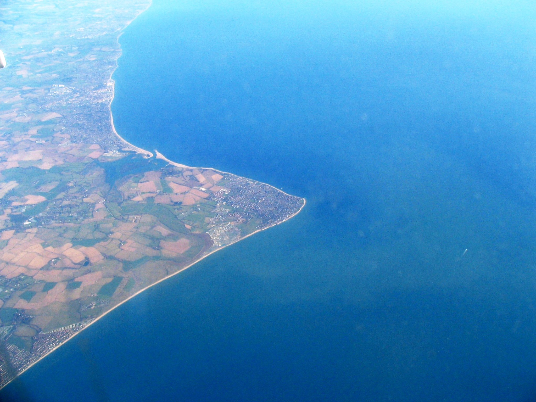
The town of Selsey is known for its long history, dating back to Roman times. It was once an island, connected to the mainland by a causeway that has since been replaced by a road. Selsey has been a fishing community for centuries, with fishing boats still operating from its shores today.

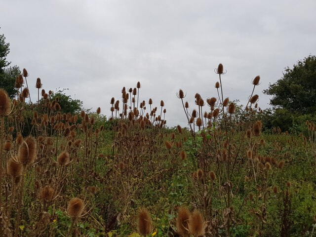
The town is also famous for its stunning coastline, which attracts many visitors. Selsey Bill, a headland at the southernmost point of the parish, offers breathtaking views and is a popular spot for birdwatching. The area is designated as a Site of Special Scientific Interest due to its rich biodiversity.

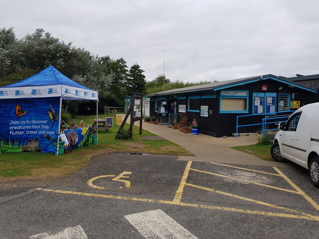
In terms of amenities, Selsey has a range of shops, pubs, and restaurants to cater to both residents and tourists. It also has primary and secondary schools, a health center, and a library. The town hosts various events throughout the year, including a carnival and a traditional bonfire night celebration.

Overall, Selsey is a charming coastal town with a rich history, beautiful scenery, and a thriving fishing community. It offers a peaceful and picturesque setting for both residents and visitors to enjoy.

If you have any feedback on the listing, please let us know in the comments section below.
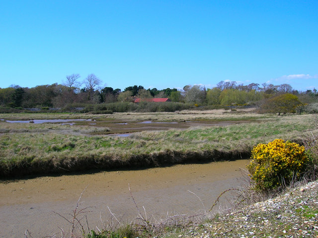
Selsey Images

Images are sourced within 2km of 50.744896/-0.781782 or Grid Reference SZ8694. Thanks to Geograph Open Source API. All images are credited.

Unnamed rife in Pagham Harbour, near Church Norton
Path around Pagham Harbour
Teasels near RSPB visitor centre Pagham Harbour Nature Reserve
RSPB visitor centre Pagham Harbour Nature Reserve
Across the fields to Coles Farm
The road to Church Norton
Ruined building at Pigeonhouse Farm, Church Norton
Lych gate at Church Norton
Chapel and cemetery at Church Norton
Font in St Wilfrid's Chapel, Church Norton
St Wilfrid's Chapel,  Church Norton This church is maintained by the Churches Conservation Trust. <span class="nowrap"><a title="https://www.visitchurches.org.uk/visit/church-listing/st-wilfrids-church-norton.html" rel="nofollow ugc noopener" href="https://www.visitchurches.org.uk/visit/church-listing/st-wilfrids-church-norton.html">Link</a><img style="margin-left:2px;" alt="External link" title="External link - shift click to open in new window" src="https://s1.geograph.org.uk/img/external.png" width="10" height="10"/></span>
St Wilfrid's Chapel, Church Norton
This church is maintained by the Churches Conservation Trust. LinkExternal link
Footpath sign and plaque, Rectory Lane, Church Norton
Thatched cottage on Rectory Lane, Church Norton
RC church in Selsey The Church of Our Lady of Mount Carmel and St Wilfred.
RC church in Selsey
The Church of Our Lady of Mount Carmel and St Wilfred.
Shops on Beach Road, Selsey
Lifeboat station, Selsey
House on Albion Road, Selsey
Sunnymead Drive, Selsey, West Sussex
Show me another place!

Selsey is located at Grid Ref: SZ8694 (Lat: 50.744896, Lng: -0.781782)

Administrative County: West Sussex

District: Chichester

Police Authority: Sussex

What 3 Words

///league.solutions.pure. Near Selsey, West Sussex

Nearby Locations

Selsey

Related Wikis

Selsey (electoral division)

Selsey is an electoral division of West Sussex in the United Kingdom, and returns one member to sit on West Sussex County Council. == Extent == The division...

The Academy, Selsey

The Academy Selsey, formerly the Manhood Community College and the Manhood Secondary Modern School, is an small co-educational non-selective academy for...

Selsey

Selsey () is a seaside town and civil parish, about eight miles (12 km) south of Chichester in West Sussex, England. Selsey lies at the southernmost point...

Selsey Beach railway station

Selsey Beach railway station served the town of Selsey, West Sussex, England, from 1898 to 1904 on the West Sussex Railway. == History == The station was...

Norton Priory, Church Norton

Norton Priory is the former rectory of St Wilfrid's Chapel, Church Norton, West Sussex. The building is claimed to be of mediaeval origin, but so altered...
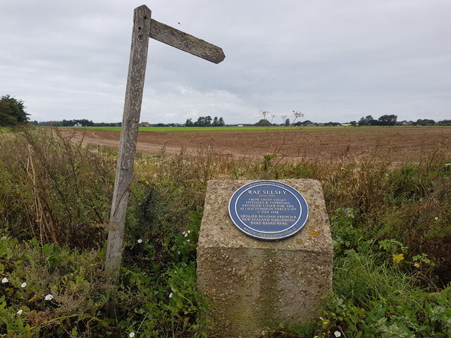
RAF Selsey

Royal Air Force Selsey or more simply RAF Selsey is a former Royal Air Force Advanced Landing Ground located 2 miles north east of Selsey, West Sussex...

Selsey F.C.

Selsey Football Club is a semi-professional football club based in Selsey, West Sussex, England. The club is a FA Chartered Standard Community club affiliated...

Chichester & Selsey Ladies F.C.

Selsey Women Football Club (formerly Chichester and Selsey Ladies and Youth Football Club) are a women's association football club based in Selsey, West...

Nearby Amenities

Located within 500m of 50.744896,-0.781782
Bus Stop
Norton Corner
Bus: yes
Naptan AtcoCode: 4400CH0026
Naptan Bearing: SW
Naptan CommonName: Norton Corner
Naptan Indicator: adj Rectory Lane
Naptan Landmark: Rectory Lane
Naptan NaptanCode: wsxagajm
Naptan Street: Chichester Road
Naptan Verified: no
Public Transport: platform
Source: naptan_import
Lat/Long: 50.7447706/-0.7792422
Bus Stop
Norton Corner
Bus: yes
Naptan AtcoCode: 4400CH0027
Naptan Bearing: NE
Naptan CommonName: Norton Corner
Naptan Indicator: opp Park Farm Barn
Naptan Landmark: Rectory Lane
Naptan NaptanCode: wsxagajp
Naptan Street: Chichester Road
Naptan Verified: no
Public Transport: platform
Source: naptan_import
Lat/Long: 50.7445599/-0.7797296
Bus Stop
Golf Links Lane
Bench: no
Bus: yes
Naptan AtcoCode: 4400CH0030
Naptan Bearing: NE
Naptan CommonName: Golf Links Lane
Naptan Indicator: adj Golf Links Lane
Naptan Landmark: Golf Links Lane
Naptan NaptanCode: wsxagama
Naptan Street: Chichester Road
Naptan Verified: no
Public Transport: platform
Shelter: no
Source: naptan_import
Lat/Long: 50.7408551/-0.7840778
Bus Stop
Golf Links Lane
Bench: no
Bus: yes
Naptan AtcoCode: 4400CH0031
Naptan Bearing: SW
Naptan CommonName: Golf Links Lane
Naptan Indicator: opp. Golf Links Lane
Naptan Landmark: Golf Links Lane
Naptan NaptanCode: wsxagamd
Naptan Street: Chichester Road
Naptan Verified: no
Public Transport: platform
Shelter: no
Source: naptan_import
Lat/Long: 50.7408001/-0.78398
Bus Stop
Coles Farm
Bus: yes
Naptan AtcoCode: 4400CH0037
Naptan Bearing: N
Naptan CommonName: Coles Farm
Naptan Indicator: adj Coles Farm
Naptan Landmark: Coles Farm
Naptan NaptanCode: wsxagapa
Naptan Street: Chichester Road
Naptan Verified: no
Public Transport: platform
Source: naptan_import
Lat/Long: 50.7480595/-0.7815665
Bus Stop
Coles Farm
Bus: yes
Naptan AtcoCode: 4400CH0038
Naptan Bearing: S
Naptan CommonName: Coles Farm
Naptan Indicator: opp. Coles Farm
Naptan Landmark: Coles Farm
Naptan NaptanCode: wsxagapd
Naptan Street: Chichester Road
Naptan Verified: no
Public Transport: platform
Source: naptan_import
Lat/Long: 50.7480756/-0.7813818
Bus Stop
Bus: yes
Public Transport: platform
Lat/Long: 50.7430938/-0.7812889
Coles Farm
Place: farm
Source: OS OpenData StreetView
Wikidata: Q26277191
Lat/Long: 50.7478402/-0.7819256
Addr Housename: Norton Corner
Source: OS OpenData StreetView
Lat/Long: 50.7469256/-0.7809673
Crossing
Crossing: unmarked
Crossing Island: no
Kerb: lowered
Lat/Long: 50.7408245/-0.7811368
Crossing
Crossing: unmarked
Lat/Long: 50.7422802/-0.7815804
Crossing
Crossing: unmarked
Lat/Long: 50.7423188/-0.7815783
Crossing
Crossing: unmarked
Lat/Long: 50.7420676/-0.7816823
Crossing
Crossing: unmarked
Lat/Long: 50.7420529/-0.7817244
Crossing
Crossing: uncontrolled
Crossing Island: no
Crossing Markings: zebra
Tactile Paving: no
Lat/Long: 50.7425464/-0.7807113
Crossing
Crossing: uncontrolled
Crossing Island: no
Crossing Markings: zebra
Tactile Paving: no
Lat/Long: 50.7427762/-0.7813124
Check Date: 2023-02-10
Shop: vacant
Lat/Long: 50.7424864/-0.7816013
Veterinary
Downland Veterinary Group
Addr City: Selsey
Addr Postcode: PO20 0FR
Addr Street: Chichester Road
Lat/Long: 50.7425519/-0.78169
Cafe
Costa
Addr City: Selsey
Addr Postcode: PO20 0FR
Addr Street: Wave Approach
Addr Unit: Unit 2
Brand: Costa
Brand Wikidata: Q608845
Brand Wikipedia: en:Costa Coffee
Cuisine: coffee_shop
Fhrs Authority: Chichester
Fhrs Id: 975408
Fhrs Local Authority Id: 17/00122/FOOD
Operator: Premiere Coffee Ltd T/A Costa
Outdoor Seating: yes
Phone: +44 1243 606430
Source: receipt from visit
Takeaway: yes
Lat/Long: 50.7424103/-0.7815315
The Wave
Artist Name: William Pye.
Artwork Type: sculpture
Material: metal
Tourism: artwork
Lat/Long: 50.7422009/-0.7824074
Bicycle Parking
Access: customers
Bicycle Parking: stands
Capacity: 15
Covered: yes
Fee: no
Lat/Long: 50.7428147/-0.7803588
Crossing
Crossing: uncontrolled
Crossing Island: no
Crossing Markings: zebra
Tactile Paving: no
Lat/Long: 50.7423701/-0.7807535
Crossing
Crossing: uncontrolled
Crossing Island: no
Crossing Markings: zebra
Tactile Paving: no
Lat/Long: 50.7422451/-0.7808737
Barrier: cycle_barrier
Bicycle: yes
Cycle Barrier: double
Cycle Barrier Installation: fixed
Foot: yes
Lat/Long: 50.7407681/-0.7839652
Loading Dock
Access: private
Lat/Long: 50.7422254/-0.7801072
Crossing
Crossing: uncontrolled
Crossing Island: no
Crossing Markings: zebra
Tactile Paving: no
Lat/Long: 50.7419625/-0.7807374
Kindergarten
The Pink Cottage Day Nursery
Addr City: Selsey
Addr Housename: The Elms
Addr Postcode: PO20 0NL
Addr Street: Chichester Road
Fhrs Authority: Chichester
Fhrs Id: 30230
Fhrs Local Authority Id: 09/00164/FOOD
Lat/Long: 50.7408465/-0.7834786
Communication Mobile Phone: yes
Man Made: mast
Source: survey
Tower Construction: tube
Tower Type: communication
Lat/Long: 50.742654/-0.7789292
The data included in this document is from www.openstreetmap.org. The data is made available under ODbL.

Have you been to Selsey?

Leave your review of Selsey below (or comments, questions and feedback).