Sefton

Civil Parish in Lancashire Sefton

England

Sefton

Lunt Meadows Nature Reserve
Lunt Meadows Nature Reserve Credit: Mike Pennington

Sefton is a civil parish located in the county of Lancashire, England. It is situated on the western coast, approximately 10 miles north of the city of Liverpool. The parish covers an area of about 19 square miles and is bordered by the River Alt to the east and the Irish Sea to the west.

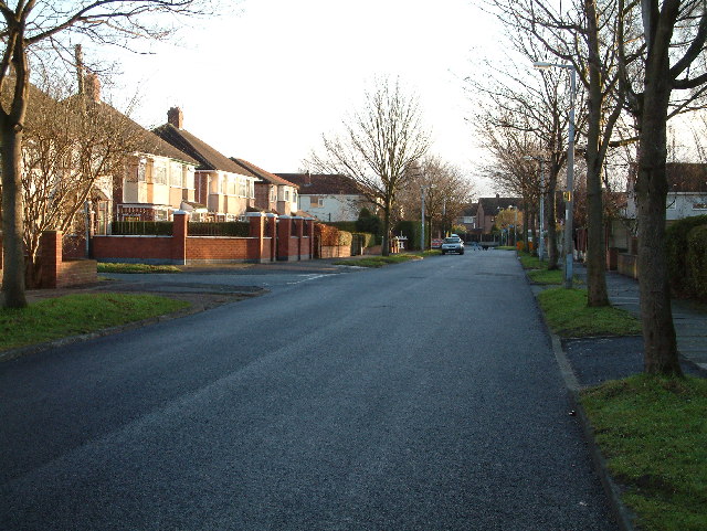
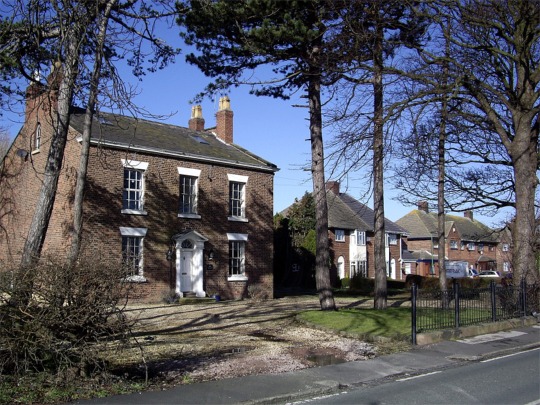
Sefton is predominantly a rural area, characterized by its picturesque countryside and agricultural landscapes. It is known for its wide open spaces, green fields, and quaint villages. The parish is home to a number of small hamlets and settlements, including Ince Blundell, Lunt, and Sefton Village, which give the area a charming rural atmosphere.

Historically, Sefton has been an important agricultural region, with farming playing a significant role in the local economy. However, in recent years, there has been a gradual shift towards more diversified industries and services.

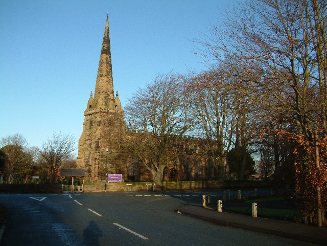
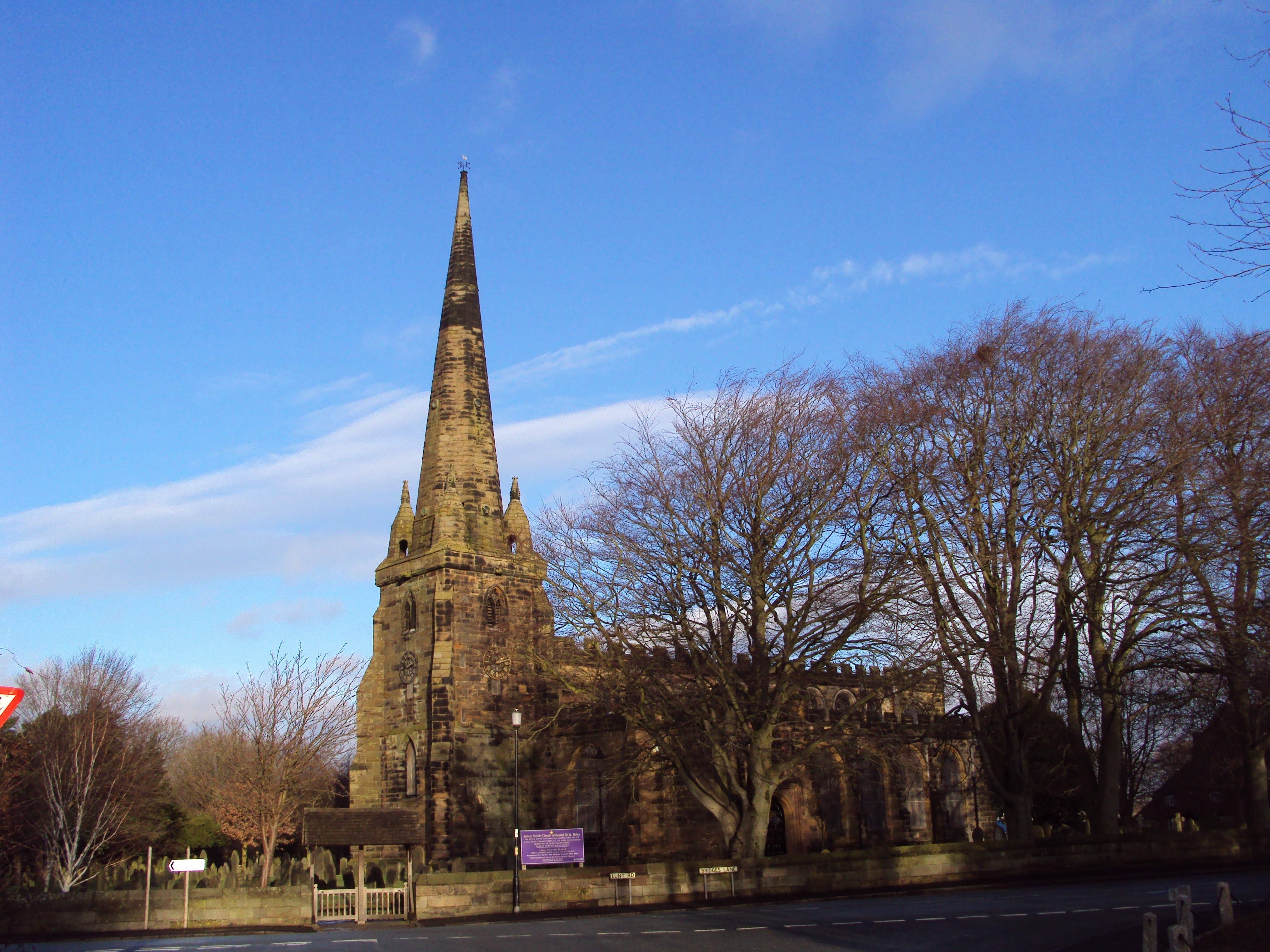
In addition to its natural beauty, Sefton offers several attractions for visitors. The area is home to the historic Sefton Parish Church, which dates back to the 12th century and is renowned for its architectural significance. There are also several nature reserves and parks in the parish, such as the Rimrose Valley Country Park and the Ainsdale Sand Dunes National Nature Reserve, which provide opportunities for outdoor activities and wildlife spotting.

Overall, Sefton, Lancashire, offers a peaceful and idyllic setting, ideal for those seeking a rural retreat or a taste of traditional English countryside life.

If you have any feedback on the listing, please let us know in the comments section below.

Sefton Images

Images are sourced within 2km of 53.502879/-2.973377 or Grid Reference SD3501. Thanks to Geograph Open Source API. All images are credited.

Lunt Meadows Nature Reserve
River Alt at Lunt Meadows
Little Egret (Egretta garzetta), Lunt Meadows
Shoveler (Spatula clypeata), Lunt Meadows
Peacock (Inachis io), Lunt Meadows
Greenfinch (Carduelis chloris), Lunt Meadows
Great Crested Grebe (Podiceps cristatus), Lunt Meadows
Common Whitethroat (Sylvia communis), Lunt Meadows
Parkhaven Large House now used as an epileptic home, run by Parkhaven Trust
Parkhaven
Large House now used as an epileptic home, run by Parkhaven Trust
Parkhaven Manor House now used as an epileptic home, run by the Parkhaven Trust.
Parkhaven
Manor House now used as an epileptic home, run by the Parkhaven Trust.
Old Racecourse Road This ordinary looking road in Maghull has some history to it, as its name would suggest. In fact this is where the first Grand National was held in 1836. It was won by The Duke ridden by Captain Martin Becher who the famous fence Becher's Brook was named after-won the race in 1836 and 1837. It moved  to Aintree in 1840.
Old Racecourse Road
This ordinary looking road in Maghull has some history to it, as its name would suggest. In fact this is where the first Grand National was held in 1836. It was won by The Duke ridden by Captain Martin Becher who the famous fence Becher's Brook was named after-won the race in 1836 and 1837. It moved to Aintree in 1840.
St  Helen's Better known as Sefton Church. First built around 1170 as a private chapel for the Molyneux family. Around 1320 the present tower was built, and the church was completed in the early 1500s.
St Helen's
Better known as Sefton Church. First built around 1170 as a private chapel for the Molyneux family. Around 1320 the present tower was built, and the church was completed in the early 1500s.
Sefton Mill Now used as a house, was a water powered corn-mill, part of the River Alt was diverted.
Sefton Mill
Now used as a house, was a water powered corn-mill, part of the River Alt was diverted.
The Punchbowl A very old pub in Sefton
The Punchbowl
A very old pub in Sefton
Sefton Church From Lunt
Sefton Church
From Lunt
Broad Farm Over Homer Green from Lunt Road.
Broad Farm
Over Homer Green from Lunt Road.
Show me another place!

Sefton is located at Grid Ref: SD3501 (Lat: 53.502879, Lng: -2.973377)

Administrative County: Merseyside

District: Sefton

Police Authority: Merseyside

What 3 Words

///moon.landscape.hilltop. Near Thornton, Merseyside

Related Wikis

Sefton, Merseyside

Sefton is a village and civil parish in the Metropolitan Borough of Sefton in Merseyside, England. Located to the south west of Maghull and to the north...

St Helen's Church, Sefton

St. Helen's is the Anglican parish church in the village of Sefton, Merseyside, England, and is an active church in the diocese of Liverpool, the archdeaconry...

Lunt

Lunt is a small village in the civil parish of Sefton, in the borough of Sefton in Merseyside, England, close to Sefton Village and to the west of Maghull...

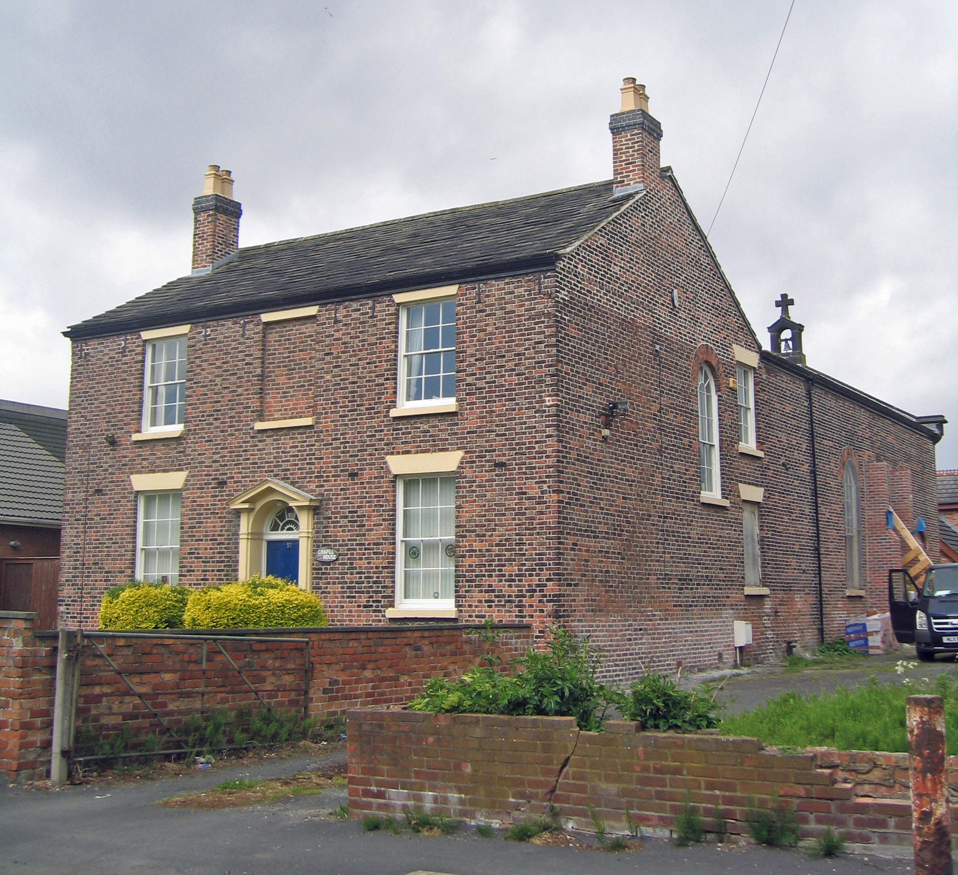
St Benet's Chapel, Netherton

St Benet's Chapel is a redundant Roman Catholic chapel in Chapel Lane, Netherton, Bootle, Merseyside, England. The chapel and the attached priest's house...

Netherton, Merseyside

Netherton is an area of the Metropolitan Borough of Sefton, in Merseyside, England. == Description == Netherton is stuated in the southern part of the...

Sefton and Maghull railway station

Sefton and Maghull railway station was a station located on the Southport & Cheshire Lines Extension Railway on Sefton Lane, Maghull, Merseyside, England...
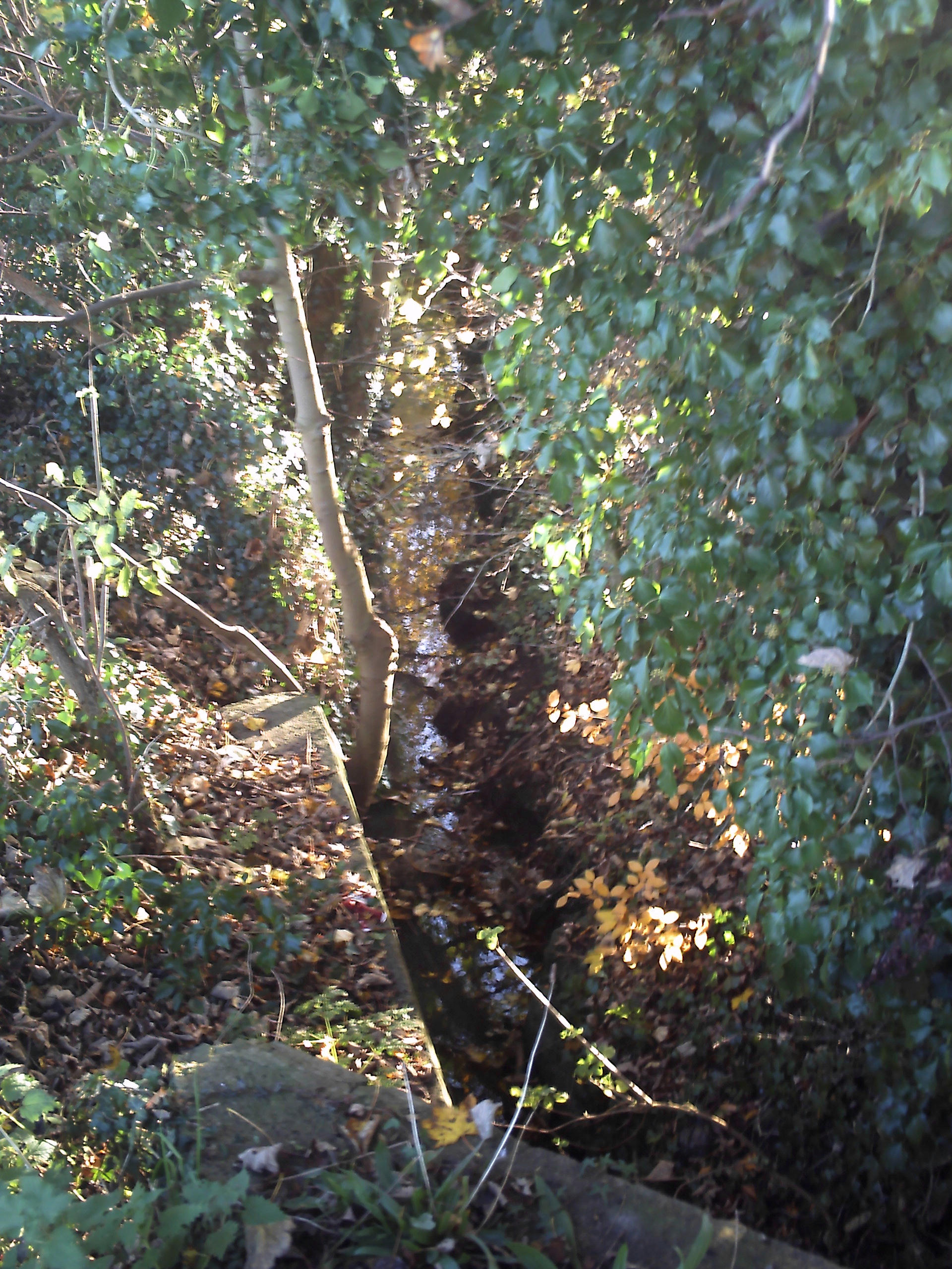
Maghull Brook

Maghull Brook is a minor river (brook) in Merseyside, England, that is a tributary to the River Alt in the Alt catchment. Located entirely in the Metropolitan...

Maghull High School

Maghull High School is one of three secondary schools in Maghull. == History == The school was established in 1982 by the merger of Ormonde Drive High...

Nearby Amenities

Located within 500m of 53.502879,-2.973377
Sefton
Place: village
Population: 855
Source: npe
Lat/Long: 53.5034122/-2.9714708
Bus Stop
SEFTON CHURCH
Bus: yes
Naptan AtcoCode: 2800S53042A
Naptan Bearing: E
Naptan CommonName: SEFTON CHURCH
Naptan Indicator: BRIDGES LANE/BRICKWALL LANE
Naptan Landmark: SEFTON MILL LANE O/S CHURCH
Naptan NaptanCode: mergajtp
Naptan Notes: No Notes
Naptan PlusbusZoneRef: LVRPLCH
Naptan ShortCommonName: Sefton Church
Naptan Street: BRIDGES LANE
Naptan Verified: no
Public Transport: platform
Source: naptan_import
Lat/Long: 53.5040057/-2.971136
Bus Stop
BRIDGES LANE/BRICKWALL LANE
Bus: yes
Naptan AtcoCode: 2800S53042B
Naptan Bearing: W
Naptan CommonName: BRIDGES LANE/BRICKWALL LANE
Naptan Indicator: BRIDGES LANE/BRICKWALL LANE
Naptan Landmark: OPP SEFTON MILL LANE OPP CHURCH
Naptan NaptanCode: mergajtw
Naptan Notes: No Notes
Naptan PlusbusZoneRef: LVRPLCH
Naptan ShortCommonName: Brickwall Ln
Naptan Street: BRIDGES LANE
Naptan Verified: no
Public Transport: platform
Source: naptan_import
Lat/Long: 53.5039333/-2.9711947
Turning Circle
Lat/Long: 53.5024392/-2.9720653
Turning Circle
Lat/Long: 53.5016228/-2.9738584
Turning Circle
Lat/Long: 53.5020303/-2.9713293
Turning Circle
Lat/Long: 53.5024065/-2.9739696
War Memorial
Historic: memorial
Lat/Long: 53.5039759/-2.971719
Saint Helen's Well
Historic: archaeological_site
Lat/Long: 53.5042853/-2.9748411
Crossing
Crossing: traffic_signals
Crossing Ref: puffin
Kerb: lowered
Tactile Paving: yes
Lat/Long: 53.5025539/-2.9731478
Historic: mill
Lat/Long: 53.50472/-2.9702034
The data included in this document is from www.openstreetmap.org. The data is made available under ODbL.

Have you been to Sefton?

Leave your review of Sefton below (or comments, questions and feedback).