Sefton Meadows

Downs, Moorland in Lancashire

England

Sefton Meadows

Damfield Meadows, Damfield Lane, Maghull New houses on the bank of the Leeds & Liverpool canal.
Damfield Meadows, Damfield Lane, Maghull Credit: Christine Johnstone

Sefton Meadows is a small village located in the county of Lancashire, England. Situated on the outskirts of the town of Maghull, it is known for its beautiful natural surroundings, which include downs and moorland.

The downs in Sefton Meadows are characterized by rolling hills and vast open spaces. The landscape is dotted with grassy fields, providing ample opportunities for outdoor activities such as picnicking, hiking, and dog walking. The downs are home to various species of wildlife, including birds, rabbits, and deer, making it a popular spot for nature enthusiasts.

Adjacent to the downs, Sefton Meadows boasts a picturesque moorland area. Moorland is a unique habitat consisting of vast expanses of heather and grasses. This type of terrain is perfect for birdwatching, with species such as curlews and lapwings frequently sighted. The moorland also provides a stunning backdrop for photographers and painters, especially during the summer months when the heather is in full bloom, painting the landscape in vibrant hues of purple and pink.

The village itself is small but charming, with a close-knit community and a few local amenities, including a primary school, a church, and a village hall. Sefton Meadows offers a peaceful and idyllic setting, allowing residents and visitors to escape the hustle and bustle of city life. With its downs and moorland, it is a haven for those seeking a connection with nature and a place to unwind in the tranquility of the Lancashire countryside.

If you have any feedback on the listing, please let us know in the comments section below.

Sefton Meadows Images

Images are sourced within 2km of 53.508041/-2.9682068 or Grid Reference SD3501. Thanks to Geograph Open Source API. All images are credited.

Damfield Meadows, Damfield Lane, Maghull New houses on the bank of the Leeds & Liverpool canal.
Damfield Meadows, Damfield Lane, Maghull
New houses on the bank of the Leeds & Liverpool canal.
Canalside houses on Damfield Lane, Maghull A boater's view.
Canalside houses on Damfield Lane, Maghull
A boater's view.
Looking north to Red Lion Bridge [no 13], Maghull Carrying Liverpool Road South over the Leeds & Liverpool canal.
Looking north to Red Lion Bridge [no 13], Maghull
Carrying Liverpool Road South over the Leeds & Liverpool canal.
Looking north towards Shaw's Swingbridge [no 14], Maghull Past the rear of shops and businesses on Liverpool Road North.
Looking north towards Shaw's Swingbridge [no 14], Maghull
Past the rear of shops and businesses on Liverpool Road North.
Shaw's Swingbridge [no 14] open for a boat Carrying Shop Lane across the Leeds & Liverpool canal.
Shaw's Swingbridge [no 14] open for a boat
Carrying Shop Lane across the Leeds & Liverpool canal.
Leeds & Liverpool canal, between bridges 14A and 15 Looking north in Maghull.
Leeds & Liverpool canal, between bridges 14A and 15
Looking north in Maghull.
Houses on Green Lane, Maghull On the east bank of the Leeds & Liverpool canal, at Methodist Swingbridge [no 15].
Houses on Green Lane, Maghull
On the east bank of the Leeds & Liverpool canal, at Methodist Swingbridge [no 15].
Methodist Swingbridge [no 15] starting to open for a boat Carrying Green Lane across the Leeds & Liverpool canal in Maghull.
Methodist Swingbridge [no 15] starting to open for a boat
Carrying Green Lane across the Leeds & Liverpool canal in Maghull.
Leeds & Liverpool canal, between bridges 15 and 16 Looking north at the northern end of Maghull.
Leeds & Liverpool canal, between bridges 15 and 16
Looking north at the northern end of Maghull.
Lunt Meadows Nature Reserve
River Alt at Lunt Meadows
Little Egret (Egretta garzetta), Lunt Meadows
Shoveler (Spatula clypeata), Lunt Meadows
Peacock (Inachis io), Lunt Meadows
Greenfinch (Carduelis chloris), Lunt Meadows
Great Crested Grebe (Podiceps cristatus), Lunt Meadows
Common Whitethroat (Sylvia communis), Lunt Meadows
Show me another place!

Sefton Meadows is located at Grid Ref: SD3501 (Lat: 53.508041, Lng: -2.9682068)

Unitary Authority: Sefton

Police Authority: Merseyside

What 3 Words

///remote.guards.available. Near Maghull, Merseyside

Related Wikis

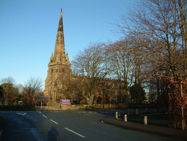
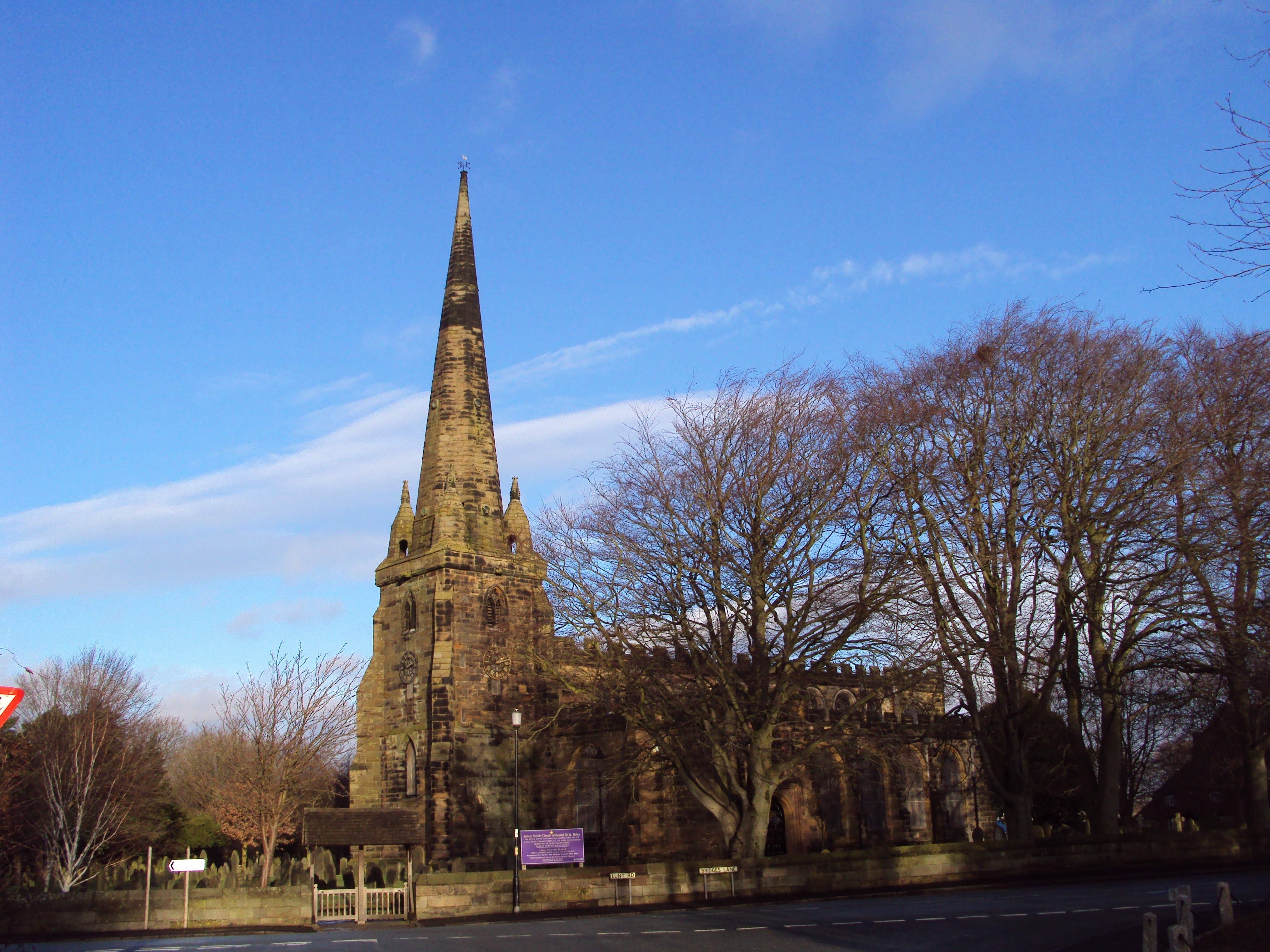
St Helen's Church, Sefton

St. Helen's is the Anglican parish church in the village of Sefton, Merseyside, England, and is an active church in the diocese of Liverpool, the archdeaconry...

Sefton, Merseyside

Sefton is a village and civil parish in the Metropolitan Borough of Sefton in Merseyside, England. Located to the south west of Maghull and to the north...

Sefton and Maghull railway station

Sefton and Maghull railway station was a station located on the Southport & Cheshire Lines Extension Railway on Sefton Lane, Maghull, Merseyside, England...
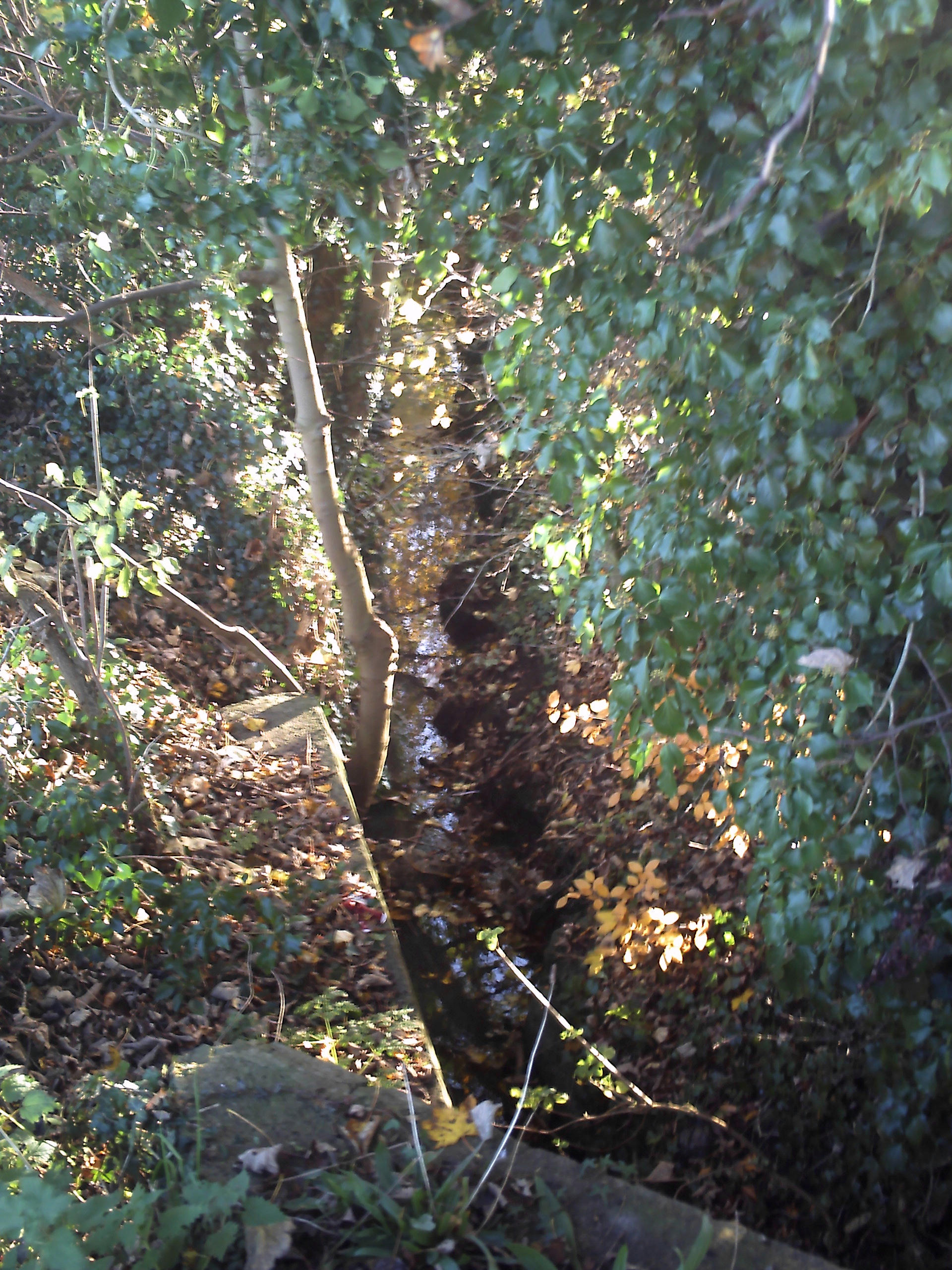
Maghull Brook

Maghull Brook is a minor river (brook) in Merseyside, England, that is a tributary to the River Alt in the Alt catchment. Located entirely in the Metropolitan...

Lunt

Lunt is a small village in the civil parish of Sefton, in the borough of Sefton in Merseyside, England, close to Sefton Village and to the west of Maghull...

Maghull High School

Maghull High School is one of three secondary schools in Maghull. == History == The school was established in 1982 by the merger of Ormonde Drive High...

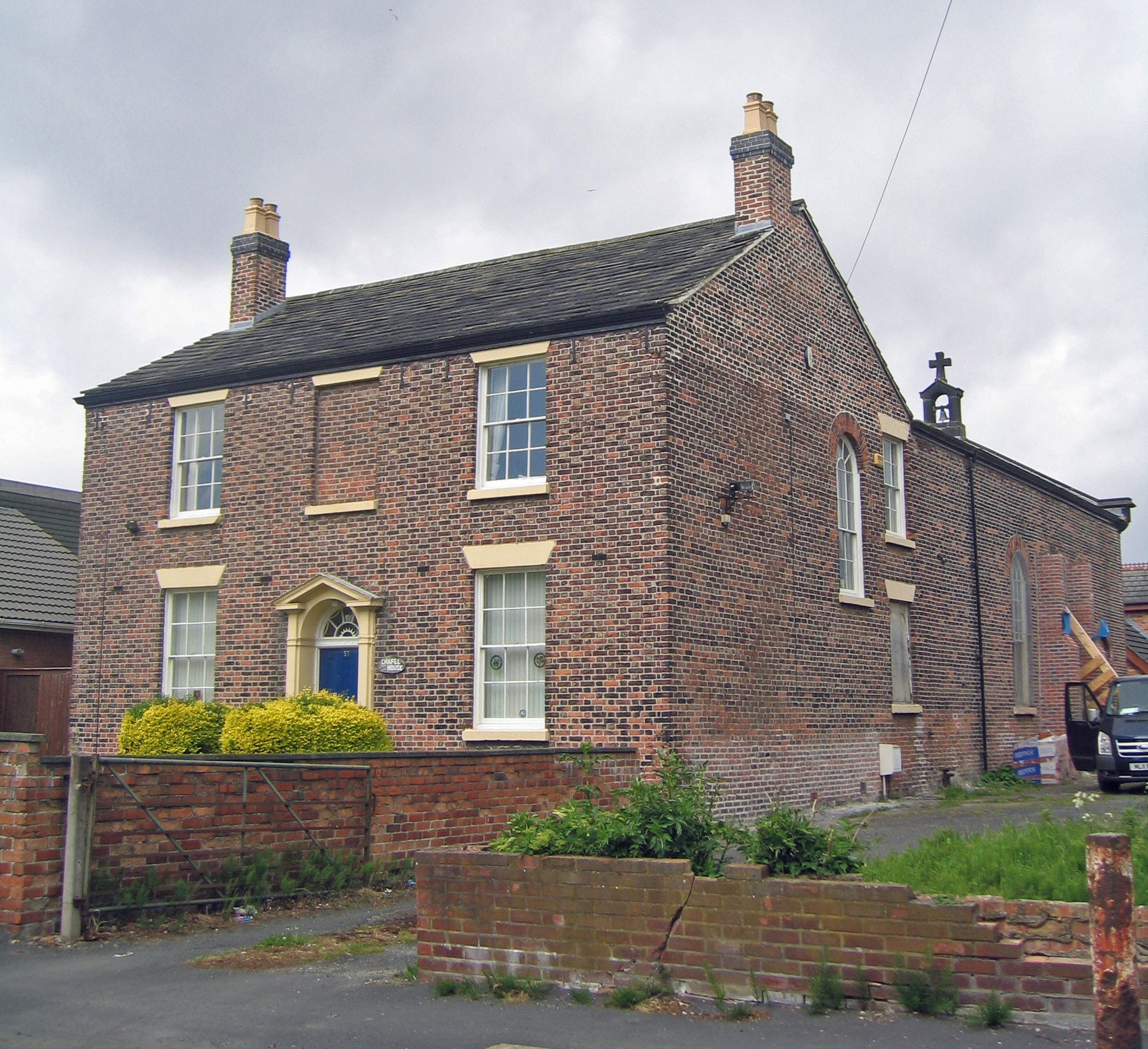
St Benet's Chapel, Netherton

St Benet's Chapel is a redundant Roman Catholic chapel in Chapel Lane, Netherton, Bootle, Merseyside, England. The chapel and the attached priest's house...

Netherton, Merseyside

Netherton is an area of the Metropolitan Borough of Sefton, in Merseyside, England. == Description == Netherton is stuated in the southern part of the...

Nearby Amenities

Located within 500m of 53.508041,-2.9682068
Bus Stop
SEFTON CHURCH
Bus: yes
Naptan AtcoCode: 2800S53042A
Naptan Bearing: E
Naptan CommonName: SEFTON CHURCH
Naptan Indicator: BRIDGES LANE/BRICKWALL LANE
Naptan Landmark: SEFTON MILL LANE O/S CHURCH
Naptan NaptanCode: mergajtp
Naptan Notes: No Notes
Naptan PlusbusZoneRef: LVRPLCH
Naptan ShortCommonName: Sefton Church
Naptan Street: BRIDGES LANE
Naptan Verified: no
Public Transport: platform
Source: naptan_import
Lat/Long: 53.5040057/-2.971136
Bus Stop
BRIDGES LANE/BRICKWALL LANE
Bus: yes
Naptan AtcoCode: 2800S53042B
Naptan Bearing: W
Naptan CommonName: BRIDGES LANE/BRICKWALL LANE
Naptan Indicator: BRIDGES LANE/BRICKWALL LANE
Naptan Landmark: OPP SEFTON MILL LANE OPP CHURCH
Naptan NaptanCode: mergajtw
Naptan Notes: No Notes
Naptan PlusbusZoneRef: LVRPLCH
Naptan ShortCommonName: Brickwall Ln
Naptan Street: BRIDGES LANE
Naptan Verified: no
Public Transport: platform
Source: naptan_import
Lat/Long: 53.5039333/-2.9711947
Bus Stop
SEFTON LANE/BRIDGES LANE
Bus: yes
Naptan AtcoCode: 2800S53043A
Naptan Bearing: W
Naptan CommonName: SEFTON LANE/BRIDGES LANE
Naptan Indicator: SEFTON LANE/BRIDGES LANE
Naptan Landmark: O/S FACTORY UNITS
Naptan NaptanCode: mergajwa
Naptan Notes: No Notes
Naptan PlusbusZoneRef: LVRPLCH
Naptan ShortCommonName: Sefton Ln
Naptan Street: SEFTON LANE
Naptan Verified: no
Public Transport: platform
Shelter: yes
Source: naptan_import
Lat/Long: 53.50779/-2.9615343
Bus Stop
SEFTON LANE/BRIDGES LANE
Bus: yes
Naptan AtcoCode: 2800S53043B
Naptan Bearing: NE
Naptan CommonName: SEFTON LANE/BRIDGES LANE
Naptan Indicator: SEFTON LANE/BRIDGES LANE
Naptan Landmark: BRIDGES LANE NR 40
Naptan NaptanCode: mergajwd
Naptan Notes: No Notes
Naptan PlusbusZoneRef: LVRPLCH
Naptan ShortCommonName: Sefton Ln
Naptan Street: SEFTON LANE
Naptan Verified: no
Public Transport: platform
Source: naptan_import
Lat/Long: 53.507737/-2.9621287
Shop: garden_centre
Source: OS_OpenData_StreetView
Lat/Long: 53.5084562/-2.9625552
Recycling
Sefton Meadows Household Waste Recycling Centre
Addr City: Maghull
Addr Postcode: L31 8BT
Addr Street: Sefton Lane
Opening Hours: Mo-Su 08:00-20:00
Operator: Veolia Environmental Services Merseyside & Halton Ltd
Operator Type: private
Owner: Sefton Council
Ownership: municipal
Recycling Type: centre
Website: https://sefton.gov.uk/bins-recycling/local-tips-and-recycling-centres.aspx
Wikidata: Q106094531
Lat/Long: 53.5091496/-2.9631089
Access: yes
Door: hinged
Entrance: gate
Wheelchair: limited
Lat/Long: 53.5055456/-2.9656605
Traffic Calming: hump
Lat/Long: 53.5096524/-2.9627138
Traffic Calming: hump
Lat/Long: 53.5090008/-2.9623503
Historic: mill
Lat/Long: 53.50472/-2.9702034
Barrier: bollard
Lat/Long: 53.5090346/-2.9623264
Barrier: bollard
Lat/Long: 53.5090714/-2.9623341
Barrier: bollard
Lat/Long: 53.5091052/-2.9623408
Barrier: bollard
Lat/Long: 53.5091415/-2.9623485
Barrier: bollard
Lat/Long: 53.5091766/-2.9623559
Barrier: bollard
Lat/Long: 53.5095234/-2.9624848
Barrier: bollard
Lat/Long: 53.5094915/-2.9624556
Barrier: bollard
Lat/Long: 53.5094592/-2.9624321
Barrier: bollard
Lat/Long: 53.5094263/-2.9624127
Barrier: bollard
Lat/Long: 53.5093892/-2.9624006
Barrier: bollard
Lat/Long: 53.5093529/-2.9623936
Barrier: bollard
Lat/Long: 53.5093182/-2.9623862
Barrier: bollard
Lat/Long: 53.5092823/-2.9623792
Barrier: bollard
Lat/Long: 53.5092482/-2.9623731
Barrier: bollard
Lat/Long: 53.5092115/-2.9623651
Traffic Calming: hump
Lat/Long: 53.5092827/-2.9624067
Noexit: yes
Lat/Long: 53.5090464/-2.9625981
The data included in this document is from www.openstreetmap.org. The data is made available under ODbL.

Have you been to Sefton Meadows?

Leave your review of Sefton Meadows below (or comments, questions and feedback).