Scarcliffe
Civil Parish in Derbyshire Bolsover
England
Scarcliffe

Scarcliffe is a civil parish located in the county of Derbyshire, England. Situated in the Bolsover district, the parish covers an area of approximately 5 square miles. It is nestled in the east of the county, bordered by the parishes of Palterton, Glapwell, and Bolsover. The village of Scarcliffe is the primary settlement within the parish.
Scarcliffe boasts a rich history dating back to the Domesday Book of 1086, where it was recorded as "Scarcliff." The village is known for its picturesque surroundings, with rolling hills and stunning countryside views. The area is predominantly rural, characterized by farmlands and open spaces.
The village itself features a mix of architectural styles, showcasing its long-standing heritage. It is home to several notable buildings, including the Grade II listed St. Leonard's Church, which dates back to the 13th century. The church is renowned for its distinctive octagonal spire and beautiful stained glass windows.
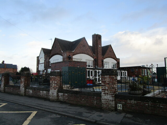
Despite its small size, Scarcliffe offers a range of amenities for its residents. These include a village hall, a primary school, and a local pub. The parish also benefits from its proximity to larger towns such as Bolsover and Chesterfield, which provide additional services and facilities.
Scarcliffe is well-connected to the surrounding areas via road networks, with the A632 passing through the parish. This allows for easy access to nearby towns and cities, including Mansfield and Sheffield.
Overall, Scarcliffe offers a tranquil and picturesque setting, making it an attractive place to live for those seeking a rural lifestyle with access to essential amenities and nearby urban centers.
If you have any feedback on the listing, please let us know in the comments section below.
Scarcliffe Images
Images are sourced within 2km of 53.209499/-1.273713 or Grid Reference SK4868. Thanks to Geograph Open Source API. All images are credited.


Scarcliffe is located at Grid Ref: SK4868 (Lat: 53.209499, Lng: -1.273713)
Administrative County: Derbyshire
District: Bolsover
Police Authority: Derbyshire
What 3 Words
///reacting.digests.powering. Near Glapwell, Derbyshire
Nearby Locations
Related Wikis

Bolsover Tunnel
Bolsover Tunnel is a disused and infilled twin-track railway tunnel between Carr Vale and Scarcliffe in Derbyshire, England. At 2,624 yd (1.5 mi; 2.4 km...
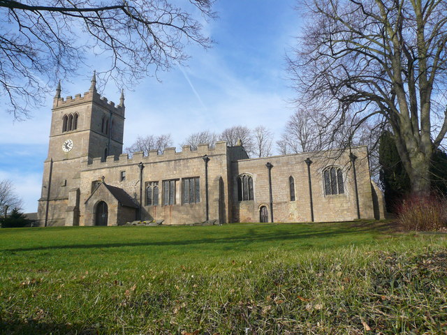
St Leonard's Church, Scarcliffe
St Leonard's Church, Scarcliffe, is a Grade II* listed parish church in the Church of England in Scarcliffe, Derbyshire. == History == The church dates...

Scarcliffe
Scarcliffe is a village and civil parish in the Bolsover district of Derbyshire, England. It is sometimes called Scarcliffe with Palterton. The population...
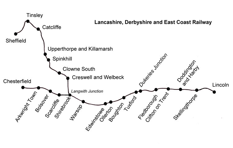
Scarcliffe railway station
Scarcliffe railway station is a former railway station in Scarcliffe, Derbyshire, England. == History == The line was opened by the Lancashire, Derbyshire...
Nearby Amenities
Located within 500m of 53.209499,-1.273713Have you been to Scarcliffe?
Leave your review of Scarcliffe below (or comments, questions and feedback).