Sandhurst

Civil Parish in Berkshire

England

Sandhurst

Yateley Looking southeast along the B3272 towards the roundabout almost mid-square.
Yateley Credit: Brendan and Ruth McCartney

Sandhurst is a civil parish and village located in the county of Berkshire, England. Situated about 33 miles west of London, it lies within the borough of Bracknell Forest. The village is surrounded by the towns of Crowthorne, Yateley, and Camberley, making it a part of the thriving commuter belt for people working in London and nearby major cities.

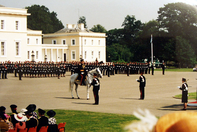
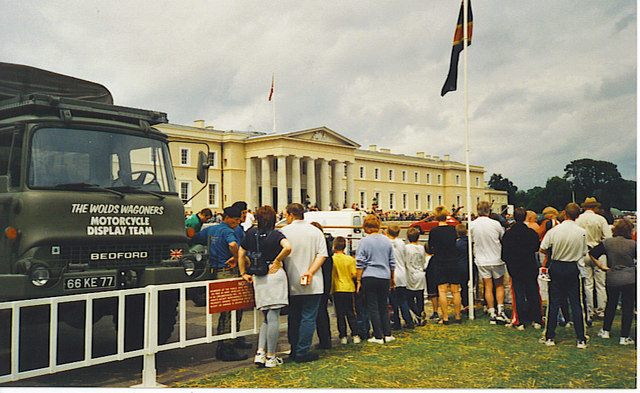
Sandhurst has a rich history, with origins dating back to the Saxon era. The village grew significantly in the 19th century when the Royal Military College, now known as the Royal Military Academy Sandhurst, was established. This prestigious military academy is renowned worldwide and has trained numerous military leaders and officers.

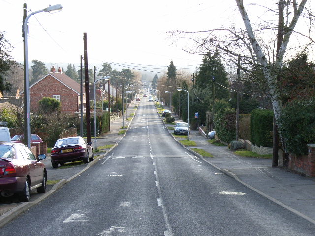
The village itself has a population of around 21,000 residents. It has a mix of residential areas, schools, and amenities, making it an attractive place to live for families and professionals alike. The Sandhurst Memorial Park, a large recreation area, provides ample space for outdoor activities and events.

Transportation in Sandhurst is convenient, with easy access to the M3 motorway and nearby railway stations, such as Sandhurst and Crowthorne. The village is also served by several bus routes, connecting it to surrounding towns and villages.

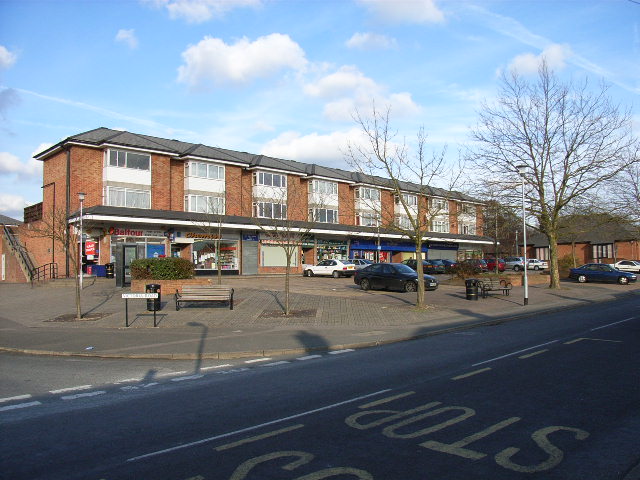
Sandhurst offers a range of amenities, including shops, restaurants, and pubs, providing residents with all the necessary conveniences. The local economy is diverse, with a mix of small businesses, retail, and service sectors.

Overall, Sandhurst is a picturesque village with a strong military heritage, offering a peaceful and attractive place to live within easy reach of major urban centers.

If you have any feedback on the listing, please let us know in the comments section below.

Sandhurst Images

Images are sourced within 2km of 51.349243/-0.786617 or Grid Reference SU8461. Thanks to Geograph Open Source API. All images are credited.

Yateley Looking southeast along the B3272 towards the roundabout almost mid-square.
Yateley
Looking southeast along the B3272 towards the roundabout almost mid-square.
Sandhurst The entrance to Lakeside Business Park, just south of Sandhurst Station.
Sandhurst
The entrance to Lakeside Business Park, just south of Sandhurst Station.
Sandhurst Royal Military Academy Graduation Day: Passing Out Parade for another batch of newly qualified young officers. At The Old College Parade Ground.   Aerial - <span class="nowrap"><a title="http://maps.google.co.uk/?t=h&ll=51.339935,-0.768474&spn=0.00311,0.007124&t=h" rel="nofollow ugc noopener" href="http://maps.google.co.uk/?t=h&ll=51.339935,-0.768474&spn=0.00311,0.007124&t=h">Link</a><img style="margin-left:2px;" alt="External link" title="External link - shift click to open in new window" src="https://s1.geograph.org.uk/img/external.png" width="10" height="10"/></span>
Sandhurst Royal Military Academy
Graduation Day: Passing Out Parade for another batch of newly qualified young officers. At The Old College Parade Ground. Aerial - LinkExternal link
Snaprails Park Snaprails Park, just to the west of Owlsmoor in Sandhurst.
Snaprails Park
Snaprails Park, just to the west of Owlsmoor in Sandhurst.
Blackwater River, Sandhurst The Blackwater River passing under the Guildford to Reading railway line between Sandhurst and Yateley.
Blackwater River, Sandhurst
The Blackwater River passing under the Guildford to Reading railway line between Sandhurst and Yateley.
Cambridge Road, Crowthorne
Broadmoor Farm
Broadmoor Farm
Heathland near Sandhurst Looking east beneath Edgebarrow Hill, part of the Wellington Estate.
Heathland near Sandhurst
Looking east beneath Edgebarrow Hill, part of the Wellington Estate.
Wildmoor Heath This is a BBOWT nature reserve <span class="nowrap"><a title="http://www.bbowt.org.uk/" rel="nofollow ugc noopener" href="http://www.bbowt.org.uk/">Link</a><img style="margin-left:2px;" alt="External link" title="External link - shift click to open in new window" src="https://s1.geograph.org.uk/img/external.png" width="10" height="10"/></span> consisting of heath and bog habitats. The western edge of Owlsmoor is behind.
Wildmoor Heath
This is a BBOWT nature reserve LinkExternal link consisting of heath and bog habitats. The western edge of Owlsmoor is behind.
Parade of shops, Owlsmoor Situated in Yeovil Road at the junction with Victoria Road.
Parade of shops, Owlsmoor
Situated in Yeovil Road at the junction with Victoria Road.
College Road, College Town Looking south down the road which runs in a perfectly straight line from one side of the grid-square to the other.
College Road, College Town
Looking south down the road which runs in a perfectly straight line from one side of the grid-square to the other.
Crowthorne Road, Sandhurst Looking south from the side of Edgebarrow Hill.
Crowthorne Road, Sandhurst
Looking south from the side of Edgebarrow Hill.
Wildmoor Heath Looking northeast across the heath which has a liberal scattering of pine and birch trees.
Wildmoor Heath
Looking northeast across the heath which has a liberal scattering of pine and birch trees.
Ammunition Store, Windsor Ride
Open Day at the Royal Military Academy Sandhurst opened its doors as well as its grounds. There were many army displays too eg "The Wolds Wagoners Motorcycle Display Team".
Open Day at the Royal Military Academy
Sandhurst opened its doors as well as its grounds. There were many army displays too eg "The Wolds Wagoners Motorcycle Display Team".
Waterloo Place, Crowthorne; the Iron Duke pub The home of the Duke of Wellington, Stratfield Saye, is not too far from Crowthorne and many of the roads etc in the village have an association with the Duke of Wellington. Hence "Waterloo Place" and "The Iron Duke".
The village is also home to the public school, Wellington College, and it was the establishment of this (with Broadmoor Mental hospital) that precipitated the enlargement of Crowthorne in the mid-late-1800s into a more substantial village or small town as it is today (2007).
Waterloo Place, Crowthorne; the Iron Duke pub
The home of the Duke of Wellington, Stratfield Saye, is not too far from Crowthorne and many of the roads etc in the village have an association with the Duke of Wellington. Hence "Waterloo Place" and "The Iron Duke". The village is also home to the public school, Wellington College, and it was the establishment of this (with Broadmoor Mental hospital) that precipitated the enlargement of Crowthorne in the mid-late-1800s into a more substantial village or small town as it is today (2007).
Sandhurst Yorktown Road (A321) and the main shopping part of Sandhurst.
The Reading to Guildford railway line is hidden by the trees in the distance.
In the opposite direction, the Royal Military Academy Sandhurst (RMAS) is just under two miles distant.
Sandhurst
Yorktown Road (A321) and the main shopping part of Sandhurst. The Reading to Guildford railway line is hidden by the trees in the distance. In the opposite direction, the Royal Military Academy Sandhurst (RMAS) is just under two miles distant.
Wildmoor Heath Marshland at Wildmoor Heath near Crowthorne.
Wildmoor Heath
Marshland at Wildmoor Heath near Crowthorne.
Show me another place!

Sandhurst is located at Grid Ref: SU8461 (Lat: 51.349243, Lng: -0.786617)

Unitary Authority: Bracknell Forest

Police Authority: Thames Valley

What 3 Words

///paramedic.wallet.superbly. Near Sandhurst, Berkshire

Nearby Locations

Sandhurst

Related Wikis

Sandhurst School

Sandhurst School is a coeducational secondary school and sixth form located in Sandhurst, Berkshire, England. The headteacher is Mr Gareth Croxon. ��2...

Sandhurst to Owlsmoor Bogs and Heaths

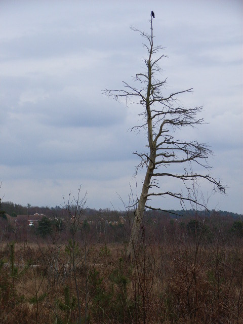
Sandhurst to Owlsmoor Bogs and Heaths is an 85.8-hectare (212-acre) biological Site of Special Scientific Interest (SSSI) on the northern outskirts of...

Sandhurst Town F.C.

Sandhurst Town Football Club is a semi-professional football club based in Sandhurst, Berkshire, England. Formed in 1910, the club plays at their temporary...

Bracknell Town F.C.

Bracknell Town Football Club is a football club based in Sandhurst, Berkshire, England. Affiliated to the Berks & Bucks Football Association and nicknamed...

Sandhurst, Berkshire

Sandhurst is a town and civil parish in the Bracknell Forest borough in Berkshire, England. It is in the south eastern corner of Berkshire, and is situated...

Owlsmoor

Owlsmoor is a suburb of Sandhurst in Berkshire, England, and part of the civil parish of Sandhurst. The settlement lies near to the A3095 road, and is...

Wildmoor Heath

Wildmoor Heath is a 91-hectare (220-acre) nature reserve south of Crowthorne in Berkshire. It is managed by the Berkshire, Buckinghamshire and Oxfordshire...

College Town, Berkshire

College Town is a suburb of Sandhurst. The settlement lies north of the A321 road and is approximately 0.5 miles (0.80 km) west of the Royal Military Academy...

Nearby Amenities

Located within 500m of 51.349243,-0.786617
Mini Roundabout
Direction: clockwise
Lat/Long: 51.3536349/-0.7855566
Mini Roundabout
Direction: clockwise
Lat/Long: 51.3525349/-0.7818906
College Town
Is In: Sandhurst, Berkshire, England
Place: suburb
Wikidata: Q5146566
Lat/Long: 51.3493089/-0.7795467
Crossing
Crossing: traffic_signals
Crossing Island: no
Crossing Ref: pelican
Lat/Long: 51.3453234/-0.7855559
Crossing
Bicycle: yes
Crossing: uncontrolled
Crossing Ref: zebra
Source: survey
Traffic Calming: hump
Lat/Long: 51.3498896/-0.782614
Pub
Rackstraw Farm
Operator: Whitbread
Source: local_knowledge
Toilets: yes
Toilets Wheelchair: yes
Wheelchair: yes
Lat/Long: 51.3457669/-0.7860069
Restaurant
Beefeater
Brand: Beefeater
Brand Wikidata: Q4879766
Cuisine: british
Operator: Whitbread
Website: https://www.beefeater.co.uk/en-gb/locations/berkshire/rackstraws-farm
Wheelchair: yes
Lat/Long: 51.3459388/-0.785771
Traffic Calming: hump
Lat/Long: 51.3464835/-0.7891543
Crossing
Crossing: unmarked
Crossing Island: no
Kerb: lowered
Sloped Curb: yes
Lat/Long: 51.3472606/-0.7907674
Bus Stop
Bench: no
Bin: yes
Bus: yes
Public Transport: platform
Shelter: yes
Lat/Long: 51.3461532/-0.7881631
Turning Circle
Lat/Long: 51.3476549/-0.7889875
Traffic Signals
Source: Bing
Traffic Signals Direction: forward
Lat/Long: 51.3449013/-0.7860075
Bus Stop
Bus: yes
Naptan AtcoCode: 0380D698O431
Naptan NaptanCode: bknajdw
Public Transport: platform
Wheelchair: yes
Lat/Long: 51.3456185/-0.7852855
Bus Stop
Bus: yes
Naptan AtcoCode: 0380D722O604
Naptan NaptanCode: bknajga
Public Transport: platform
Lat/Long: 51.347179/-0.7848673
Bus Stop
Bus: yes
Public Transport: platform
Lat/Long: 51.3468464/-0.7846204
Traffic Signals
Lat/Long: 51.3452322/-0.785955
Turning Circle
Lat/Long: 51.347888/-0.7875581
Turning Circle
Lat/Long: 51.3483705/-0.7882984
Traffic Signals
Lat/Long: 51.3448676/-0.7855103
Barrier: kissing_gate
Lat/Long: 51.3506863/-0.7883797
Post Box
Collection Times: Mo-Fr 09:00; Sa 07:00
Operator: Royal Mail
Operator Wikidata: Q638098
Post Box Type: pillar
Ref: GU47 22D
Royal Cypher: EIIR
Source: local_knowledge
Lat/Long: 51.3456277/-0.7907168
Bus Stop
Wellington Arms
Bench: yes
Bin: no
Bus: yes
Lit: yes
Public Transport: platform
Shelter: yes
Source: local_knowledge
Tactile Paving: yes
Lat/Long: 51.3458204/-0.7897766
Bus Stop
Bus: yes
Public Transport: platform
Source: local_knowledge
Lat/Long: 51.3453876/-0.7866834
Crossing
Crossing: unmarked
Kerb: no
Tactile Paving: no
Lat/Long: 51.3457019/-0.7871936
Traffic Signals
Source: Bing
Traffic Signals Direction: forward
Lat/Long: 51.344901/-0.7859003
Access: no
Barrier: bollard
Bicycle: yes
Bollard: fixed
Foot: yes
Lat/Long: 51.3466412/-0.7923405
Traffic Signals
Lat/Long: 51.3451858/-0.7854659
Barrier: cycle_barrier
Lat/Long: 51.3482112/-0.7888874
Crossing
Crossing: traffic_signals
Crossing Ref: pelican
Tactile Paving: yes
Lat/Long: 51.3449589/-0.7860046
Crossing
Crossing: traffic_signals
Crossing Ref: pelican
Tactile Paving: yes
Lat/Long: 51.3449383/-0.7858762
Crossing
Crossing: traffic_signals
Crossing Island: yes
Crossing Ref: pelican
Lat/Long: 51.3451479/-0.7854962
Crossing
Crossing: traffic_signals
Crossing Ref: pelican
Tactile Paving: yes
Lat/Long: 51.3452149/-0.785911
Crossing
Crossing: traffic_signals
Crossing Ref: pelican
Tactile Paving: yes
Lat/Long: 51.3450768/-0.7858997
Barrier: kerb
Kerb: lowered
Tactile Paving: no
Lat/Long: 51.345597/-0.790748
Barrier: cycle_barrier
Lat/Long: 51.349926/-0.782773
Barrier: cycle_barrier
Lat/Long: 51.349869/-0.7825243
Traffic Calming: hump
Lat/Long: 51.3478722/-0.7916322
Barrier: cycle_barrier
Lat/Long: 51.3473256/-0.7906875
Crossing
Crossing: unmarked
Kerb: lowered
Lat/Long: 51.3496884/-0.7826135
Barrier: cycle_barrier
Lat/Long: 51.3493319/-0.7817303
Barrier: cycle_barrier
Lat/Long: 51.3498284/-0.7823014
Crossing
Bicycle: yes
Crossing: unmarked
Kerb: lowered
Sloped Curb: yes
Lat/Long: 51.3496507/-0.7821526
Crossing
Crossing: unmarked
Kerb: lowered
Lat/Long: 51.3494247/-0.782883
Crossing
Crossing: unmarked
Kerb: lowered
Lat/Long: 51.34944/-0.7823328
Broadmoor Hospital Siren - Sandhurst School
Siren
Emergency: siren
Siren Purpose: escape
Lat/Long: 51.3500618/-0.7805754
Crossing
Lat/Long: 51.3450529/-0.7847592
Crossing
Crossing: unmarked
Kerb: no
Tactile Paving: no
Lat/Long: 51.3460734/-0.7882428
Traffic Calming: hump
Lat/Long: 51.3475623/-0.7911826
Crossing
Crossing: uncontrolled
Crossing Island: yes
Tactile Paving: yes
Lat/Long: 51.3461304/-0.7890389
Crossing
Crossing: uncontrolled
Crossing Island: yes
Lat/Long: 51.3461403/-0.7883529
Crossing
Crossing: uncontrolled
Crossing Island: yes
Tactile Paving: no
Lat/Long: 51.3462557/-0.7887819
Crossing
Crossing: uncontrolled
Crossing Island: yes
Kerb: lowered
Sloped Curb: yes
Source: Bing
Lat/Long: 51.3520014/-0.7876843
Crossing
Crossing: uncontrolled
Crossing Island: yes
Kerb: lowered
Sloped Curb: yes
Source: Bing
Lat/Long: 51.3520144/-0.7875934
Crossing
Crossing: uncontrolled
Crossing Island: yes
Kerb: lowered
Source: Bing
Lat/Long: 51.3474295/-0.7849384
Crossing
Crossing: uncontrolled
Crossing Island: yes
Kerb: lowered
Source: Bing
Lat/Long: 51.3474425/-0.7848548
Crossing
Crossing Island: yes
Kerb: lowered
Sloped Curb: yes
Source: Bing
Lat/Long: 51.3478259/-0.7851091
Crossing
Crossing Island: yes
Kerb: lowered
Sloped Curb: yes
Source: Bing
Lat/Long: 51.3478485/-0.785002
Crossing
Crossing: uncontrolled
Crossing Island: yes
Kerb: lowered
Sloped Curb: yes
Source: Bing
Lat/Long: 51.3524543/-0.7879391
Crossing
Crossing: uncontrolled
Crossing Island: yes
Kerb: lowered
Sloped Curb: yes
Source: Bing
Lat/Long: 51.3524708/-0.7878609
Traffic Calming: hump
Lat/Long: 51.3467144/-0.7898685
Barrier: bollard
Lat/Long: 51.3488253/-0.7903923
Bench
Lat/Long: 51.3500281/-0.7900986
Direction: 220
Generator Method: photovoltaic
Generator Output Electricity: yes
Generator Solar Modules: 16
Generator Source: solar
Generator Type: solar_photovoltaic_panel
Location: roof
Power: generator
Lat/Long: 51.3534462/-0.7870528
Direction: 215
Generator Method: photovoltaic
Generator Output Electricity: yes
Generator Solar Modules: 16
Generator Source: solar
Generator Type: solar_photovoltaic_panel
Location: roof
Power: generator
Lat/Long: 51.3481845/-0.7803607
Direction: 125
Generator Method: photovoltaic
Generator Output Electricity: yes
Generator Solar Modules: 10
Generator Source: solar
Generator Type: solar_photovoltaic_panel
Location: roof
Power: generator
Lat/Long: 51.3462317/-0.7829207
Direction: 115
Generator Method: photovoltaic
Generator Output Electricity: yes
Generator Solar Modules: 8
Generator Source: solar
Generator Type: solar_photovoltaic_panel
Location: roof
Power: generator
Lat/Long: 51.3530215/-0.7870486
Direction: 110
Generator Method: photovoltaic
Generator Output Electricity: yes
Generator Solar Modules: 12
Generator Source: solar
Generator Type: solar_photovoltaic_panel
Location: roof
Power: generator
Lat/Long: 51.352715/-0.7851845
Direction: 195
Generator Method: photovoltaic
Generator Output Electricity: yes
Generator Solar Modules: 23
Generator Source: solar
Generator Type: solar_photovoltaic_panel
Location: roof
Power: generator
Lat/Long: 51.3524201/-0.7853454
Direction: 235
Generator Method: photovoltaic
Generator Output Electricity: yes
Generator Solar Modules: 18
Generator Source: solar
Generator Type: solar_photovoltaic_panel
Location: roof
Power: generator
Lat/Long: 51.3484751/-0.7806489
Direction: 195
Generator Method: photovoltaic
Generator Output Electricity: yes
Generator Solar Modules: 17
Generator Source: solar
Generator Type: solar_photovoltaic_panel
Location: roof
Power: generator
Lat/Long: 51.3495037/-0.7847714
Direction: 190
Generator Method: photovoltaic
Generator Output Electricity: yes
Generator Solar Modules: 6
Generator Source: solar
Generator Type: solar_photovoltaic_panel
Location: roof
Power: generator
Lat/Long: 51.3502567/-0.7835725
Direction: 105
Generator Method: photovoltaic
Generator Output Electricity: yes
Generator Solar Modules: 12
Generator Source: solar
Generator Type: solar_photovoltaic_panel
Location: roof
Power: generator
Lat/Long: 51.3501938/-0.7831621
Direction: 190
Generator Method: photovoltaic
Generator Output Electricity: yes
Generator Solar Modules: 10
Generator Source: solar
Generator Type: solar_photovoltaic_panel
Location: roof
Power: generator
Lat/Long: 51.3502293/-0.783409
Direction: 190
Generator Method: photovoltaic
Generator Output Electricity: yes
Generator Solar Modules: 7
Generator Source: solar
Generator Type: solar_photovoltaic_panel
Location: roof
Source: generator
Lat/Long: 51.3525257/-0.7834786
Waterway: grating
Lat/Long: 51.3528829/-0.7886837
Waterway: grating
Lat/Long: 51.3520692/-0.7892977
Direction: 190
Generator Method: photovoltaic
Generator Output Electricity: yes
Generator Solar Modules: 5
Generator Source: solar
Generator Type: solar_photovoltaic_panel
Location: roof
Power: generator
Lat/Long: 51.3502265/-0.7833592
Direction: 190
Generator Method: photovoltaic
Generator Output Electricity: yes
Generator Solar Modules: 8
Generator Source: solar
Generator Type: solar_photovoltaic_panel
Location: roof
Power: generator
Lat/Long: 51.3501909/-0.7832657
Fixme: survey: solar panels?
Lat/Long: 51.3499232/-0.7820765
Direction: 190
Generator Method: photovoltaic
Generator Output Electricity: yes
Generator Solar Modules: 10
Generator Source: solar
Generator Type: solar_photovoltaic_panel
Location: roof
Power: generator
Lat/Long: 51.3507501/-0.7844965
Direction: 190
Generator Method: photovoltaic
Generator Output Electricity: yes
Generator Solar Modules: 12
Generator Source: solar
Generator Type: solar_photovoltaic_panel
Location: roof
Power: generator
Lat/Long: 51.351049/-0.7857166
Traffic Calming: hump
Lat/Long: 51.3521909/-0.7820035
Direction: 100
Generator Method: photovoltaic
Generator Output Electricity: yes
Generator Solar Modules: 12
Generator Source: solar
Generator Type: solar_photovoltaic_panel
Location: roof
Power: generator
Lat/Long: 51.3512901/-0.7831444
Direction: 210
Generator Method: photovoltaic
Generator Output Electricity: yes
Generator Solar Modules: 15
Generator Source: solar
Generator Type: solar_photovoltaic_panel
Location: roof
Power: generator
Lat/Long: 51.3456914/-0.7844043
Direction: 175
Generator Method: photovoltaic
Generator Output Electricity: yes
Generator Solar Modules: 14
Generator Source: solar
Generator Type: solar_photovoltaic_panel
Location: roof
Power: generator
Lat/Long: 51.3471544/-0.7842156
Direction: 120
Generator Method: photovoltaic
Generator Output Electricity: yes
Generator Solar Modules: 8
Generator Source: solar
Generator Type: solar_photovoltaic_panel
Location: roof
Power: generator
Lat/Long: 51.3463561/-0.7837716
Direction: 115
Generator Method: photovoltaic
Generator Output Electricity: yes
Generator Solar Modules: 60
Generator Source: solar
Generator Type: solar_photovoltaic_panel
Location: roof
Power: generator
Lat/Long: 51.3458983/-0.7853421
Direction: 130
Generator Method: photovoltaic
Generator Output Electricity: yes
Generator Solar Modules: 10
Generator Source: solar
Generator Type: solar_photovoltaic_panel
Location: roof
Power: generator
Lat/Long: 51.34714/-0.790041
Direction: 220
Generator Method: photovoltaic
Generator Output Electricity: yes
Generator Solar Modules: 12
Generator Source: solar
Generator Type: solar_photovoltaic_panel
Location: roof
Power: generator
Lat/Long: 51.3470543/-0.7902651
Direction: 105
Generator Method: photovoltaic
Generator Output Electricity: yes
Generator Solar Modules: 14
Generator Source: solar
Generator Type: solar_photovoltaic_panel
Location: roof
Power: generator
Lat/Long: 51.3483568/-0.7927538
Direction: 195
Generator Method: photovoltaic
Generator Output Electricity: yes
Generator Solar Modules: 16
Generator Source: solar
Generator Type: solar_photovoltaic_panel
Location: ground
Power: generator
Lat/Long: 51.3486497/-0.7932851
Direction: 125
Generator Method: photovoltaic
Generator Output Electricity: yes
Generator Solar Modules: 8
Generator Source: solar
Generator Type: solar_photovoltaic_panel
Location: roof
Power: generator
Lat/Long: 51.3476269/-0.788278
Direction: 215
Generator Method: photovoltaic
Generator Output Electricity: yes
Generator Solar Modules: 4
Generator Source: solar
Generator Type: solar_photovoltaic_panel
Location: roof
Power: generator
Lat/Long: 51.3476086/-0.7883333
Direction: 115
Generator Method: photovoltaic
Generator Output Electricity: yes
Generator Solar Modules: 12
Generator Source: solar
Generator Type: solar_photovoltaic_panel
Location: roof
Power: generator
Lat/Long: 51.3488335/-0.7909958
Direction: 225
Fixme: survey for panel count
Generator Method: photovoltaic
Generator Output Electricity: yes
Generator Solar Modules: 6
Generator Source: solar
Generator Type: solar_photovoltaic_panel
Location: roof
Power: generator
Lat/Long: 51.3463405/-0.7917753
Direction: 155
Fixme: survey for panel count
Generator Method: photovoltaic
Generator Output Electricity: yes
Generator Solar Modules: 12
Generator Source: solar
Generator Type: solar_photovoltaic_panel
Location: roof
Power: generator
Lat/Long: 51.3476655/-0.779912
Direction: 220
Generator Method: photovoltaic
Generator Output Electricity: yes
Generator Solar Modules: 3
Generator Source: solar
Generator Type: solar_photovoltaic_panel
Location: roof
Power: generator
Lat/Long: 51.3482699/-0.7875275
Turning Circle
Lat/Long: 51.3489703/-0.7880031
Barrier: kerb
Kerb: lowered
Tactile Paving: no
Lat/Long: 51.3450696/-0.7845695
Barrier: kerb
Kerb: lowered
Tactile Paving: yes
Lat/Long: 51.3499044/-0.7826789
Barrier: kerb
Kerb: lowered
Tactile Paving: yes
Lat/Long: 51.3498818/-0.7825801
Barrier: kerb
Kerb: raised
Lat/Long: 51.3494698/-0.7826529
Bus Stop
Bus: yes
Naptan AtcoCode: 0380D894O995
Naptan NaptanCode: bknajgm
Public Transport: platform
Source: Bing;Mapillary
Lat/Long: 51.3507473/-0.7823259
Bus Stop
Bus: yes
Public Transport: platform
Source: Mapillary
Lat/Long: 51.3495689/-0.782719
Barrier: kerb
Kerb: lowered
Tactile Paving: yes
Lat/Long: 51.3461554/-0.7890476
Barrier: kerb
Kerb: lowered
Tactile Paving: yes
Lat/Long: 51.346095/-0.7890266
Barrier: kerb
Kerb: lowered
Tactile Paving: no
Lat/Long: 51.3462498/-0.7889011
Barrier: kerb
Kerb: lowered
Tactile Paving: yes
Lat/Long: 51.3462613/-0.7886708
Barrier: kerb
Kerb: lowered
Tactile Paving: yes
Lat/Long: 51.3462547/-0.788803
Barrier: kerb
Kerb: lowered
Tactile Paving: yes
Lat/Long: 51.3462563/-0.7887696
Barrier: kerb
Kerb: lowered
Tactile Paving: yes
Lat/Long: 51.3461214/-0.7890358
Barrier: kerb
Kerb: lowered
Tactile Paving: yes
Lat/Long: 51.3461399/-0.7890422
Barrier: kerb
Kerb: lowered
Tactile Paving: yes
Lat/Long: 51.3461045/-0.7883582
Barrier: kerb
Kerb: lowered
Tactile Paving: yes
Lat/Long: 51.3461733/-0.7883487
Barrier: kerb
Kerb: lowered
Tactile Paving: yes
Lat/Long: 51.3461492/-0.7883518
Barrier: kerb
Kerb: lowered
Tactile Paving: yes
Lat/Long: 51.3461313/-0.7883543
Barrier: kerb
Kerb: lowered
Tactile Paving: yes
Lat/Long: 51.3452487/-0.7858753
Barrier: kerb
Kerb: lowered
Tactile Paving: yes
Lat/Long: 51.3451804/-0.7859475
Barrier: kerb
Kerb: lowered
Tactile Paving: yes
Lat/Long: 51.3451105/-0.785856
Barrier: kerb
Kerb: lowered
Tactile Paving: yes
Lat/Long: 51.3450398/-0.7859479
Barrier: kerb
Kerb: lowered
Tactile Paving: yes
Lat/Long: 51.3449587/-0.7860396
Barrier: kerb
Kerb: lowered
Tactile Paving: yes
Lat/Long: 51.3449593/-0.7859626
Barrier: kerb
Kerb: lowered
Tactile Paving: yes
Lat/Long: 51.3449552/-0.7859294
Barrier: kerb
Kerb: lowered
Tactile Paving: yes
Lat/Long: 51.344924/-0.785831
Barrier: kerb
Kerb: lowered
Tactile Paving: yes
Lat/Long: 51.3453085/-0.7855135
Barrier: kerb
Kerb: lowered
Tactile Paving: yes
Lat/Long: 51.3451764/-0.7855797
Barrier: kerb
Kerb: lowered
Tactile Paving: yes
Lat/Long: 51.3451652/-0.7855467
Barrier: kerb
Kerb: lowered
Tactile Paving: yes
Lat/Long: 51.3451565/-0.7855215
Barrier: kerb
Kerb: lowered
Tactile Paving: yes
Lat/Long: 51.3451202/-0.7854167
Communication 2G: yes
Communication 3G: yes
Communication 4G: yes
Man Made: antenna
Operator: EE and three
Lat/Long: 51.3532215/-0.7882629
Communication 2G: yes
Communication 3G: yes
Communication 4G: yes
Communication 4G+: yes
Man Made: antenna
Operator: EE and three Band 3
Lat/Long: 51.345232/-0.7863327
Communication 2G: yes
Communication 3G: yes
Communication 4G: yes
Man Made: antenna
Operator: EE
Lat/Long: 51.3508243/-0.7825752
Post Box
Operator: Royal Mail
Operator Wikidata: Q638098
Post Box Type: lamp
Lat/Long: 51.3475228/-0.7856651
Post Box
Collection Times: Mo-Fr 09:00; Sa 07:00
Operator: Royal Mail
Operator Wikidata: Q638098
Post Box Type: pillar
Ref: GU47 104D
Royal Cypher: EIIR
Wheelchair: yes
Lat/Long: 51.3525056/-0.786689
Post Box
Collection Times: Mo-Fr 09:00; Sa 07:00; Su off
Operator: Royal Mail
Operator Wikidata: Q638098
Post Box Type: lamp
Ref: GU47 112D
Royal Cypher: EIIR
Lat/Long: 51.3522472/-0.7892797
The data included in this document is from www.openstreetmap.org. The data is made available under ODbL.

Have you been to Sandhurst?

Leave your review of Sandhurst below (or comments, questions and feedback).