Salford
Civil Parish in Oxfordshire West Oxfordshire
England
Salford

Salford is a civil parish located in the county of Oxfordshire, England. Situated approximately 5 miles southeast of the city of Oxford, Salford covers an area of around 6 square miles. The parish is mainly rural, characterized by beautiful rolling hills and picturesque countryside.
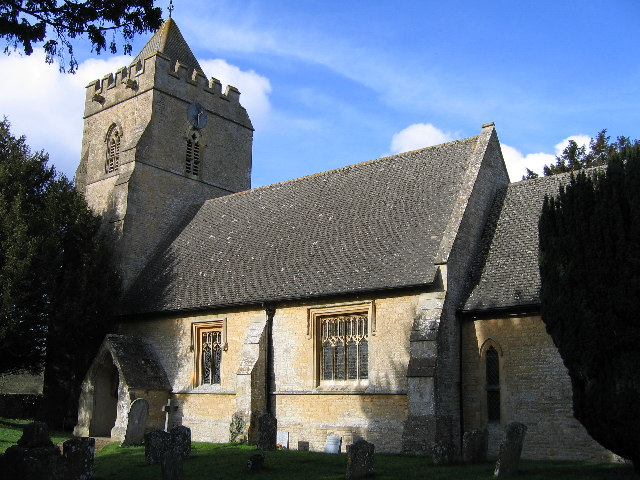
The village of Salford itself is small but charming, with a population of around 500 people. It features a mix of traditional stone-built cottages and more modern houses, providing a unique blend of architectural styles. The centerpiece of the village is the St. Mary’s Church, a historic building dating back to the 12th century, which adds to the village's character and heritage.
The parish is surrounded by an abundance of natural beauty, with vast fields, woodlands, and meadows offering scenic walks and opportunities for outdoor activities. The River Cherwell flows through the area, providing a tranquil spot for fishing and boating enthusiasts.
Despite its rural setting, Salford benefits from good transport links. The A4142 road runs nearby, connecting the village to Oxford and the wider motorway network. This proximity to Oxford allows residents to easily access a range of amenities, including schools, shops, and healthcare facilities.
Salford boasts a strong sense of community and has a village hall that serves as a hub for various social events and gatherings. The parish also hosts annual events such as summer fairs and music festivals, which contribute to the vibrant community spirit.
Overall, Salford, Oxfordshire is a peaceful and picturesque civil parish that offers a high quality of life, combining rural charm with convenient access to nearby urban amenities.
If you have any feedback on the listing, please let us know in the comments section below.
Salford Images
Images are sourced within 2km of 51.953879/-1.586153 or Grid Reference SP2828. Thanks to Geograph Open Source API. All images are credited.


![Rollright Brook north of Swailsford Bridge A small tributary of the River Evenlode which drains a catchment to the west of Chipping Norton.
The same view as <a href="https://www.geograph.org.uk/photo/1713915">SP2826 : Swailsford Bridge [2]</a> on a much colder day.](https://s0.geograph.org.uk/geophotos/07/36/30/7363004_264a5486.jpg)


Salford is located at Grid Ref: SP2828 (Lat: 51.953879, Lng: -1.586153)
Administrative County: Oxfordshire
District: West Oxfordshire
Police Authority: Thames Valley
What 3 Words
///shadows.elder.lilac. Near Chipping Norton, Oxfordshire
Nearby Locations
Related Wikis
Salford, Oxfordshire
Salford is a village and civil parish about 1+1⁄2 miles (2.4 km) west of Chipping Norton, Oxfordshire. The 2011 Census recorded the parish's population...

Little Rollright
Little Rollright is a hamlet and former civil parish, now in the parish of Rollright, in the West Oxfordshire district, in the county of Oxfordshire, England...

Cornwell, Oxfordshire
Cornwell is a small village and civil parish about 2.5 miles (4 km) west of Chipping Norton in the West Oxfordshire district of Oxfordshire, near the county...
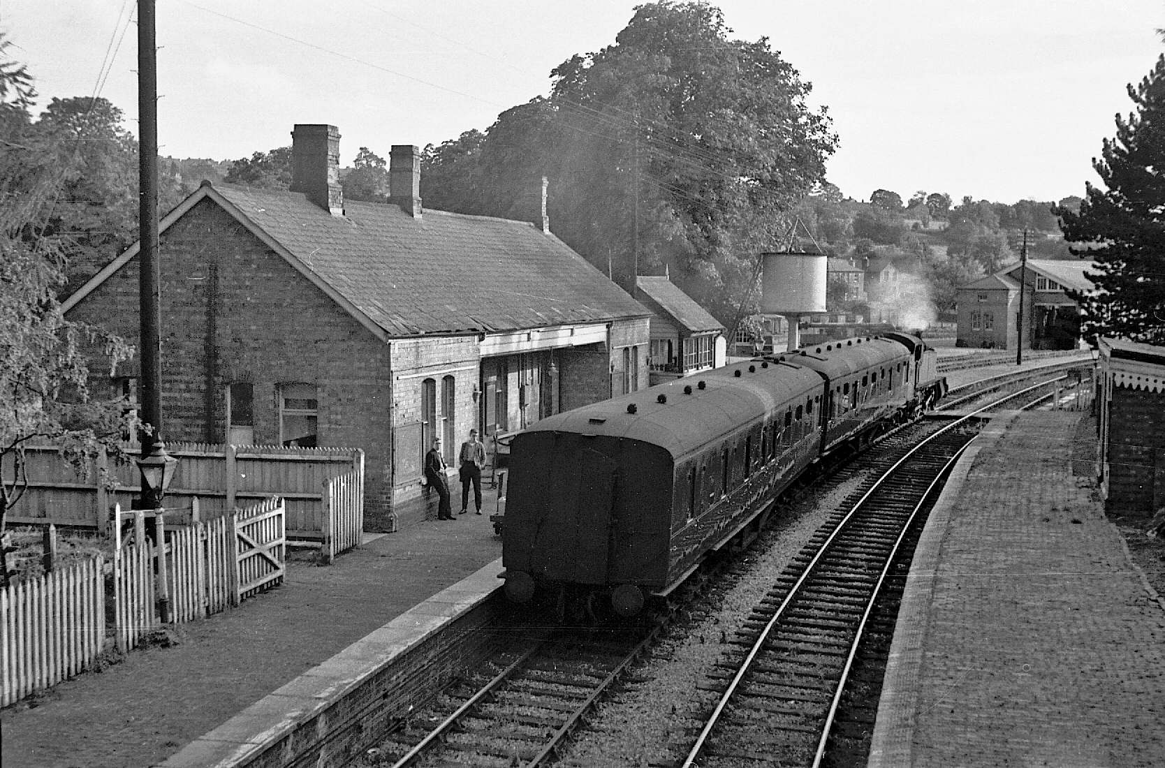
Chipping Norton railway station
Chipping Norton railway station served the town of Chipping Norton, Oxfordshire, England. The station had two platforms and a signal box. == History... ==
Nearby Amenities
Located within 500m of 51.953879,-1.586153Have you been to Salford?
Leave your review of Salford below (or comments, questions and feedback).