Rowston

Civil Parish in Lincolnshire North Kesteven

England

Rowston

Stubble field towards Digby Beck
Stubble field towards Digby Beck Credit: JThomas

Rowston is a civil parish located in the district of North Kesteven, in the county of Lincolnshire, England. It is situated approximately 9 miles south of the city of Lincoln.

The village of Rowston is small and rural, with a population of around 200 residents. It is surrounded by farmland and countryside, offering picturesque views and a peaceful atmosphere. The River Witham, one of Lincolnshire's major waterways, flows nearby, adding to the natural beauty of the area.

The village itself is made up of a mix of traditional stone cottages and more modern houses. There is a small village green, which serves as a focal point for the community and is often used for local events and gatherings. The parish also has a historic church, St. Peter's, which dates back to the 13th century and is known for its beautiful stained glass windows.

Although Rowston is a rural parish, it benefits from good transportation links. The A607 road runs through the village, providing easy access to nearby towns and cities. The village is also served by a local bus service, connecting residents to surrounding areas.

Despite its small size, Rowston has a strong sense of community. Residents take pride in their village and often come together to organize various social activities and events. There are also several local clubs and organizations, catering to different interests and age groups.

Overall, Rowston offers a peaceful and idyllic setting for those seeking a quiet rural lifestyle, while still providing easy access to amenities and nearby urban centers.

If you have any feedback on the listing, please let us know in the comments section below.
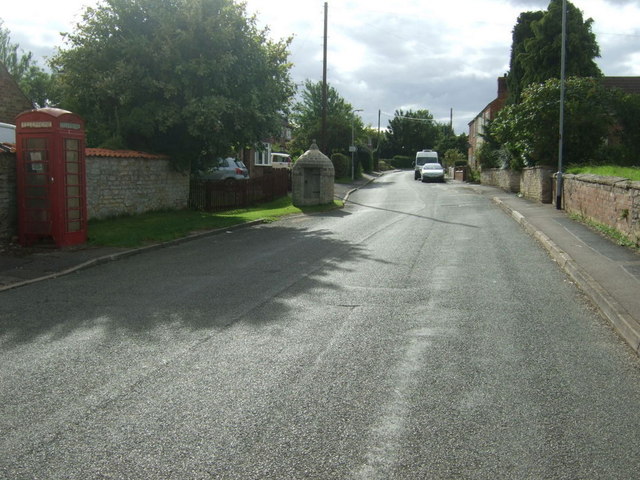
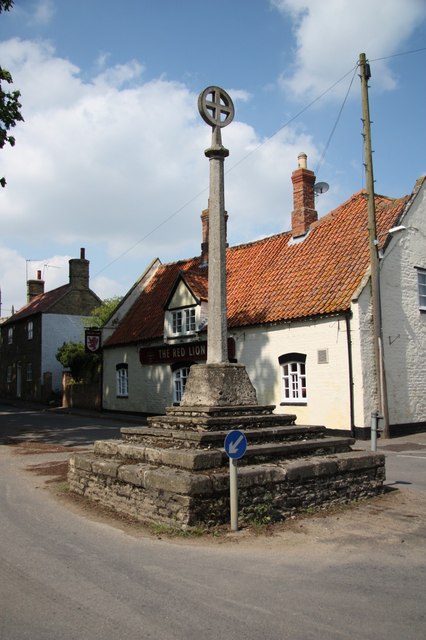
Rowston Images

Images are sourced within 2km of 53.093506/-0.382293 or Grid Reference TF0856. Thanks to Geograph Open Source API. All images are credited.

Stubble field towards Digby Beck
Silos near Digby Beck
Silos and farm building East of Digby.
Silos and farm building
East of Digby.
Minor road towards Digby  Heading south west.
Minor road towards Digby
Heading south west.
Railway towards Lincoln Looking north.
Railway towards Lincoln
Looking north.
Stubble field east of Digby
Minor road towards Digby
Houses on Station Road, Digby
Beck Street, Digby Looking west.
Beck Street, Digby
Looking west.
Digby Stores and Off Licence Was once also the Post Office.
On Beck Street.
Digby Stores and Off Licence
Was once also the Post Office. On Beck Street.
The Red Lion, Digby
The Red Lion, Digby
Sign for the Red Lion, Digby
Village cross, Digby Near the Red Lion public house.
Village cross, Digby
Near the Red Lion public house.
The Church of St Thomas a Becket, Digby
Church Street, Digby Looking west.
Church Street, Digby
Looking west.
Former Lock-up on Church Lane, Digby
Houses on Church Street, Digby
Road junction on Church Street, Digby Looking west.
Road junction on Church Street, Digby
Looking west.
Show me another place!

Rowston is located at Grid Ref: TF0856 (Lat: 53.093506, Lng: -0.382293)

Administrative County: Lincolnshire

District: North Kesteven

Police Authority: Lincolnshire

What 3 Words

///obstruct.moved.amplifier. Near Ruskington, Lincolnshire

Nearby Locations

Rowston Rowston

Related Wikis

Rowston

Rowston is a village and civil parish in the North Kesteven district of Lincolnshire, England, situated approximately 6 miles (10 km) north from the town...

Digby railway station

Digby railway station was a railway station in Digby, Lincolnshire, which was open between 1882 and 1961. == History == The railway line between Sleaford...

Kirkby Green

Kirkby Green is a small village in the civil parish of Scopwick, in the North Kesteven district of Lincolnshire, England. The village lies east from Scopwick...

Digby, Lincolnshire

Digby is a small village and civil parish in the district of North Kesteven, Lincolnshire, England. The village is in the vale of the Digby Beck watercourse...

Nearby Amenities

Located within 500m of 53.093506,-0.382293
Rowston
Is In: Lincolnshire, England, UK
Place: hamlet
Lat/Long: 53.0935185/-0.3823336
War Memorial
Naptan AtcoCode: 270002701552
Naptan Bearing: NE
Naptan BusStopType: CUS
Naptan CommonName: War Memorial
Naptan Indicator: opp
Naptan Landmark: War Memorial
Naptan Street: Main Street
Naptan Verified: no
Shelter: yes
Source: naptan_import
Lat/Long: 53.0931963/-0.3826983
War Memorial
Naptan AtcoCode: 270002701553
Naptan Bearing: SW
Naptan BusStopType: CUS
Naptan CommonName: War Memorial
Naptan Indicator: adj
Naptan Landmark: War Memorial
Naptan Street: Main Street
Naptan Verified: no
Source: naptan_import
Lat/Long: 53.0930421/-0.3825995
Rowston
Railway: level_crossing
Lat/Long: 53.0929704/-0.3768552
Rowston
Railway: level_crossing
Lat/Long: 53.0929698/-0.3769102
Telephone
Booth: K6
Covered: booth
Man Made: telephone_box
Old Phone: +44 1526 320111
Lat/Long: 53.0929341/-0.3827952
Historic: wayside_cross
Lat/Long: 53.0930244/-0.3825699
Barrier: stile
Steps: 1
Stile: stepover
Lat/Long: 53.0941985/-0.3830373
Turning Circle
Lat/Long: 53.0936531/-0.3798295
Power: pole
Lat/Long: 53.0957515/-0.387834
Power: pole
Lat/Long: 53.0949784/-0.3871045
Power: pole
Lat/Long: 53.0941682/-0.3863387
Power: pole
Lat/Long: 53.0935143/-0.3857171
Power: pole
Lat/Long: 53.0925503/-0.385642
Power: pole
Lat/Long: 53.0916821/-0.3855655
Power: pole
Lat/Long: 53.0907027/-0.3855166
Power: pole
Lat/Long: 53.0897813/-0.3854388
The data included in this document is from www.openstreetmap.org. The data is made available under ODbL.

Have you been to Rowston?

Leave your review of Rowston below (or comments, questions and feedback).