Risinghurst and Sandhills
Civil Parish in Oxfordshire Oxford
England
Risinghurst and Sandhills

Risinghurst and Sandhills is a civil parish located in Oxfordshire, England. It is situated on the eastern outskirts of the city of Oxford, just a few miles away from its city center. The parish covers an area encompassing the residential areas of Risinghurst and Sandhills.
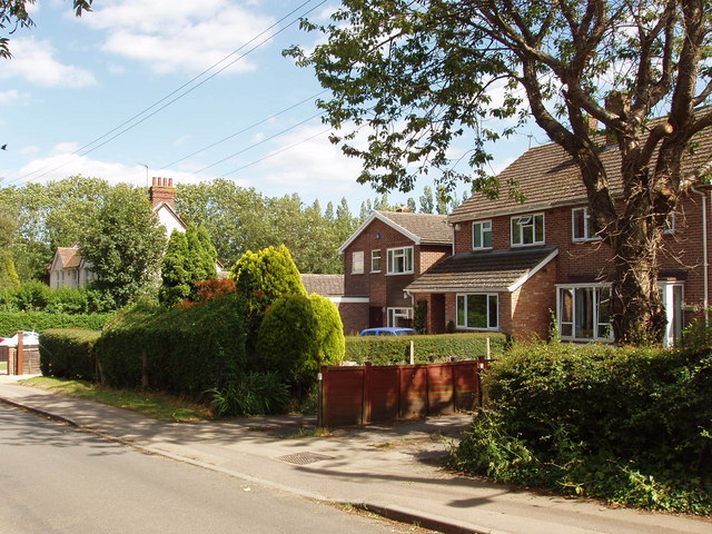
Risinghurst is a predominantly residential area that is known for its picturesque surroundings and tranquil atmosphere. The area is characterized by its well-maintained gardens, tree-lined streets, and a variety of housing options including detached houses, semi-detached houses, and apartment complexes. It offers a peaceful residential retreat away from the hustle and bustle of the city, while still being conveniently close to Oxford's amenities and attractions.
Sandhills, on the other hand, is a newer development within the parish that primarily consists of modern housing estates. The area offers a mix of housing types, including both affordable and luxury properties, making it attractive to a diverse range of residents. Sandhills benefits from its proximity to major transportation links, including the A40 road and the Thornhill Park and Ride facility, providing easy access to Oxford and other nearby towns and cities.
Both Risinghurst and Sandhills enjoy a range of local amenities, including shops, schools, and community centers. The area also benefits from its close proximity to Oxford, which offers a wide array of cultural, educational, and recreational opportunities. Overall, Risinghurst and Sandhills provide a desirable living environment for residents seeking a mix of peaceful countryside living and convenient access to urban amenities.
If you have any feedback on the listing, please let us know in the comments section below.
Risinghurst and Sandhills Images
Images are sourced within 2km of 51.758772/-1.190669 or Grid Reference SP5506. Thanks to Geograph Open Source API. All images are credited.


Risinghurst and Sandhills is located at Grid Ref: SP5506 (Lat: 51.758772, Lng: -1.190669)
Administrative County: Oxfordshire
District: Oxford
Police Authority: Thames Valley
What 3 Words
///wiping.part.shirt. Near Cowley, Oxfordshire
Nearby Locations
Related Wikis

Risinghurst
Risinghurst is an outlying residential area of Oxford, England, just outside the Eastern Bypass Road which forms part of the Oxford ring road. It is about...
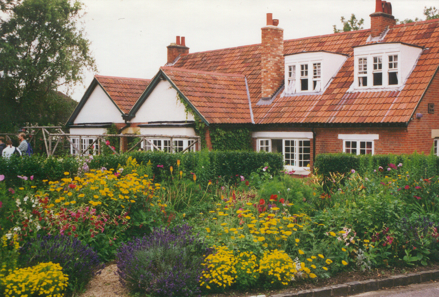
The Kilns
The Kilns, also known as C. S. Lewis House, is the house in Risinghurst, Oxford, England, where the author C. S. Lewis wrote all of his Narnia books and...
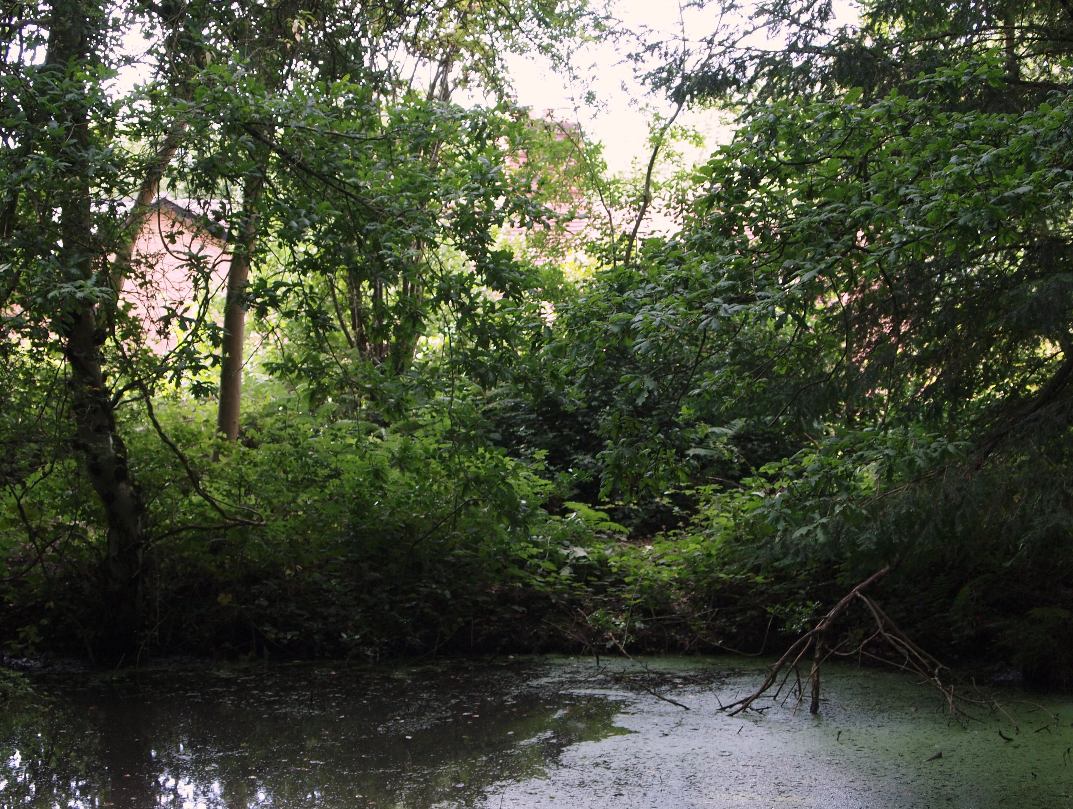
CS Lewis Nature Reserve
CS Lewis Nature Reserve is a 3-hectare (7.4-acre) nature reserve in Risinghurst, a suburb of Oxford in Oxfordshire. It is managed by the Berkshire, Buckinghamshire...

Risinghurst and Sandhills
Risinghurst and Sandhills is a civil parish in the city of Oxford, Oxfordshire, England. It consists of Risinghurst and Sandhills, two areas in the east...
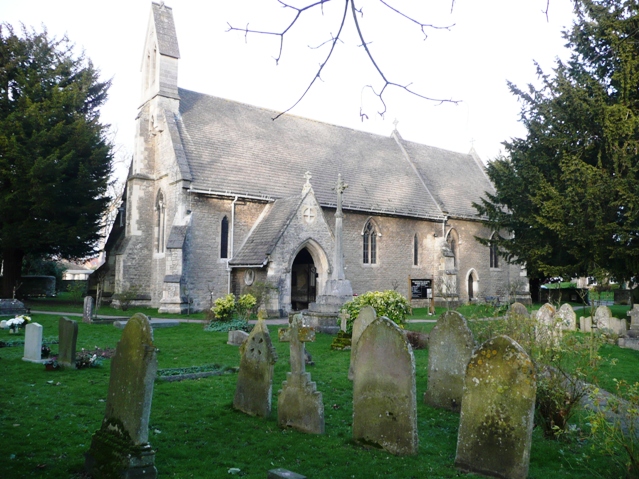
Holy Trinity Church, Headington Quarry
Holy Trinity Church, Headington Quarry, is located in the district of Headington Quarry, Oxford, England. It is an active Anglican parish church in the...
Headington Quarry
Headington Quarry is a residential district of Oxford, England, located east of Headington and west of Risinghurst, just inside the Oxford ring road in...

Brasenose Wood and Shotover Hill
Brasenose Wood and Shotover Hill is a 109.2-hectare (270-acre) biological Site of Special Scientific Interest on the eastern outskirts of Oxford in Oxfordshire...
Old Road, Oxford
Old Road is a long street in Headington, east Oxford, England, extending into Oxfordshire as a road east of Oxford, to Littleworth near Wheatley. It is...
Nearby Amenities
Located within 500m of 51.758772,-1.190669Have you been to Risinghurst and Sandhills?
Leave your review of Risinghurst and Sandhills below (or comments, questions and feedback).