Ringway

Civil Parish in Cheshire Manchester

England

Ringway

Hill summit & trig point near Meadowlands Near centre of square
Hill summit & trig point near Meadowlands Credit: Chris Shaw

Ringway is a civil parish located in the county of Cheshire, England. Situated approximately 10 miles south of Manchester city center, Ringway is a predominantly rural area with a small population of around 300 residents. It is part of the wider borough of Trafford.

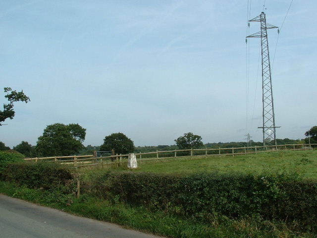
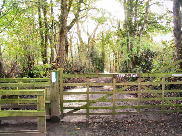
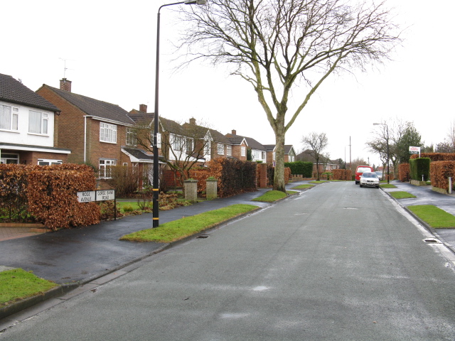
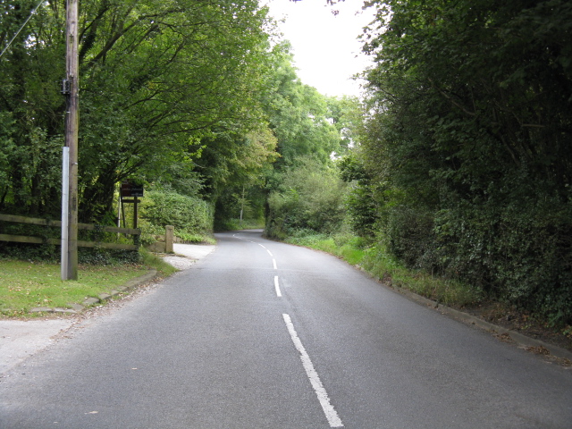
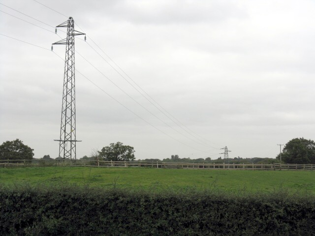
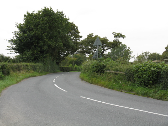
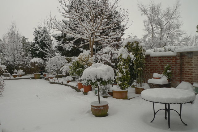
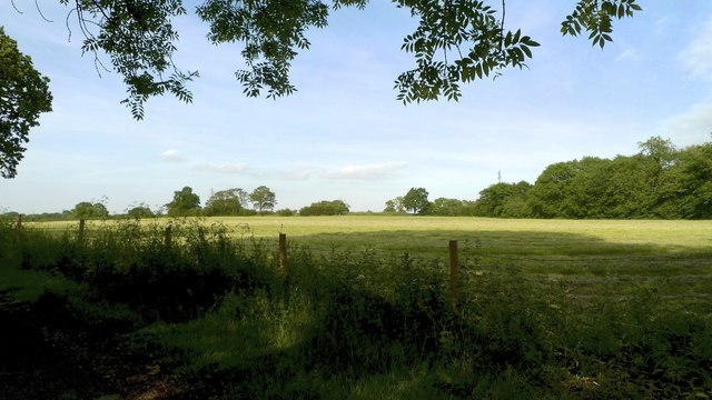
The parish is known for its picturesque countryside, characterized by rolling hills, open fields, and farmland. The landscape is dotted with charming cottages and farmhouses, giving the area a distinct rural charm. Ringway is surrounded by several other civil parishes, including Hale Barns, Ashley, and Mobberley.

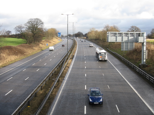
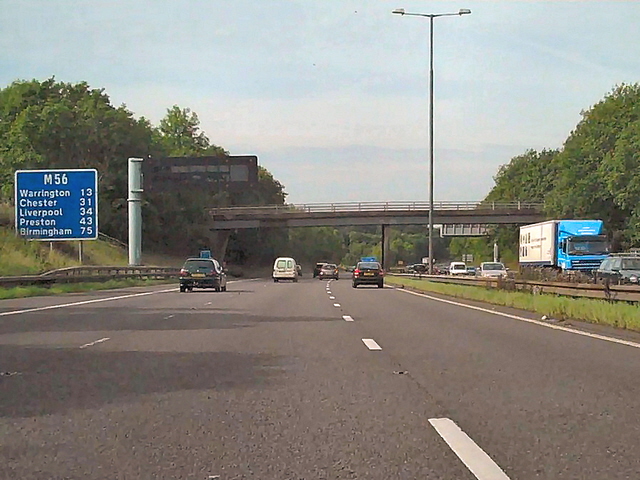
Despite its rural setting, Ringway has good transport connections. The area is well-connected to major roads, with the A538 running through the parish, providing easy access to Manchester Airport, which is just a few miles away. The M56 motorway is also nearby, offering convenient links to Manchester, Chester, and the wider motorway network.

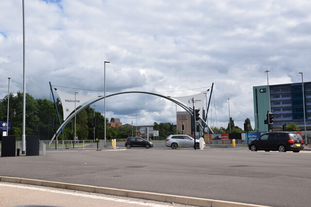
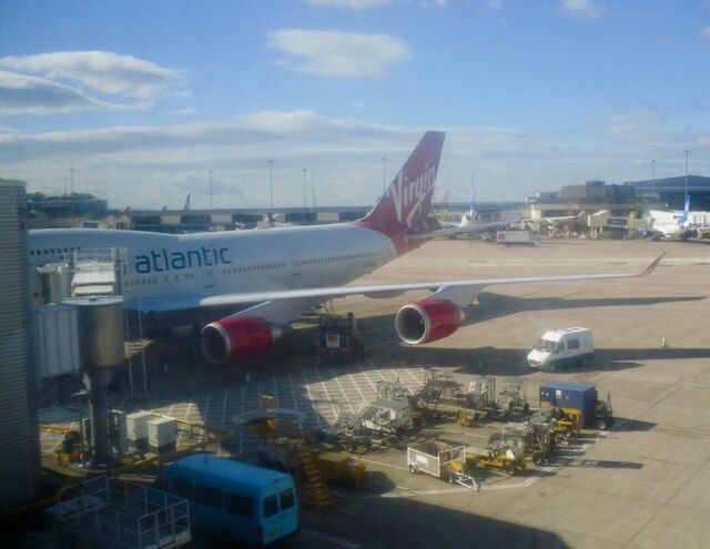
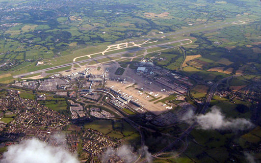
Ringway is home to Manchester Airport, one of the busiest airports in the UK and an important transport hub for the region. The airport contributes significantly to the local economy and provides employment opportunities for many residents in the area.

In addition to its natural beauty, Ringway is also known for its golf courses. The Ringway Golf Club, founded in 1908, offers a challenging 18-hole course set amidst the rolling countryside. The club attracts golf enthusiasts from both the local area and further afield.

Overall, Ringway is a tranquil and picturesque civil parish, offering a rural escape within close proximity to urban amenities and transport links.

If you have any feedback on the listing, please let us know in the comments section below.

Ringway Images

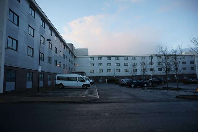
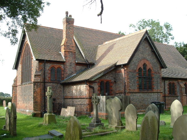
Images are sourced within 2km of 53.35782/-2.284845 or Grid Reference SJ8184. Thanks to Geograph Open Source API. All images are credited.

Hill summit & trig point near Meadowlands Near centre of square
Hill summit & trig point near Meadowlands
Near centre of square
Sunnybank Wood The entrance to this private wood which, in conjunction with the Forestry Commission, is open to the pedestrian public.
Sunnybank Wood
The entrance to this private wood which, in conjunction with the Forestry Commission, is open to the pedestrian public.
Footbridge over the Bollin at Thorns Green
Hale Barns - Carrwood, looking north The eastern end of this rather exclusive road in one of Manchester's most desirable suburbs. The white van is a tradesman's, naturally.
Hale Barns - Carrwood, looking north
The eastern end of this rather exclusive road in one of Manchester's most desirable suburbs. The white van is a tradesman's, naturally.
The Name Changes Ridge Road becomes Gorse Bank Road at a seemingly arbitrary point along this suburban road.
The Name Changes
Ridge Road becomes Gorse Bank Road at a seemingly arbitrary point along this suburban road.
M56 Nearing Junction 6
Mill Lane Near Castle Mill Farm
Power Lines At Meadowlands
Mill Lane At Meadowlands
Winter arrives in Hale Barns An unusual sight after 10 years of mild winters. Many young children may never before have been able to build a snowman.
Winter arrives in Hale Barns
An unusual sight after 10 years of mild winters. Many young children may never before have been able to build a snowman.
The morning after the night before - Hale Barns, Cheshire No one expected to awake to this. The garden table registered six inches of virgin snow overnight.
The morning after the night before - Hale Barns, Cheshire
No one expected to awake to this. The garden table registered six inches of virgin snow overnight.
Farmland near Meadowlands, Ashley, Cheshire
M56, Warburton Green The bridge connects Chapel Lane at Warburton Green with Sunbank Lane at Halebank.
M56, Warburton Green
The bridge connects Chapel Lane at Warburton Green with Sunbank Lane at Halebank.
"Welcome to Manchester Airport" The archway on the approach to Terminals 1 and 3.
"Welcome to Manchester Airport"
The archway on the approach to Terminals 1 and 3.
Manchester Airport Manchester Airport lies approximately 8½ miles to the south west of Manchester city centre. It is the largest, and busiest, airport in the UK outside the London area. The airport comprises three terminals and a goods terminal and provides flights to over 200 destinations. It is the only British airport other than London Heathrow to operate two runways over 3,000 m (9,843 ft) in length. 

The airport officially opened (as Ringway Airport) in 1938. During the war, it was called RAF Ringway and, between 1975 and 1986, Manchester International Airport. It is owned and managed by the Manchester Airports Group (MAG) which is a holding company owned by the ten metropolitan borough councils of Greater Manchester. The airport has good transport links and is served by the M56 motorway and by Manchester Airport railway station which provides extensive rail connections. The Metrolink tramway extension opened in November 2014, providing a tram link between the airport and the city centre.
Manchester Airport
Manchester Airport lies approximately 8½ miles to the south west of Manchester city centre. It is the largest, and busiest, airport in the UK outside the London area. The airport comprises three terminals and a goods terminal and provides flights to over 200 destinations. It is the only British airport other than London Heathrow to operate two runways over 3,000 m (9,843 ft) in length. The airport officially opened (as Ringway Airport) in 1938. During the war, it was called RAF Ringway and, between 1975 and 1986, Manchester International Airport. It is owned and managed by the Manchester Airports Group (MAG) which is a holding company owned by the ten metropolitan borough councils of Greater Manchester. The airport has good transport links and is served by the M56 motorway and by Manchester Airport railway station which provides extensive rail connections. The Metrolink tramway extension opened in November 2014, providing a tram link between the airport and the city centre.
Premier Inn Manchester Airport Taken from the fourth floor of Premier Inn Runger Lane Manchester Airport.
Premier Inn Manchester Airport
Taken from the fourth floor of Premier Inn Runger Lane Manchester Airport.
Premier Inn Manchester Airport
Holiday Inn Express Manchester Airport
Show me another place!

Ringway is located at Grid Ref: SJ8184 (Lat: 53.35782, Lng: -2.284845)

Administrative County: Greater Manchester

District: Manchester

Police Authority: Greater Manchester

What 3 Words

///unlucky.type.unsettled. Near Ringway, Manchester

Nearby Locations

Ringway

Related Wikis

1985 Manchester Airport disaster

The 1985 Manchester Airport disaster occurred when British Airtours Flight 28M (officially known as Flight 328), an international passenger flight, en...

RAF Ringway

Royal Air Force Ringway or more simply RAF Ringway is a former Royal Air Force satellite station in Ringway, Cheshire, England, near Manchester. It was...

History of Manchester Airport

The origins of Manchester Airport in England, UK, date back to the 1930s. Construction started on Ringway on 28 November 1935 and it opened partly in June...

Manchester Airport

Manchester Airport (IATA: MAN, ICAO: EGCC) is an international airport in Ringway, Manchester, England, 7.5 nautical miles (13.9 km; 8.6 mi) south-west...

Ringway, Manchester

Ringway is a civil parish on the southern border of Manchester, England. Historically in Cheshire, it is the only civil parish in the city of Manchester...

Central Landing Establishment

The Central Landing Establishment was the Second World War British development centre for airborne warfare at RAF Ringway airfield near Manchester. �...

Cotterill Clough Nature Reserve

Cotterill Clough is a 5.6-hectare (14-acre) nature reserve near Manchester Airport. It is managed by the Cheshire Wildlife Trust and lies within a larger...

Manchester Airport station

Manchester Airport station is a railway, tram, bus and coach station at Manchester Airport, England which opened at the same time as the second air terminal...

Nearby Amenities

Located within 500m of 53.35782,-2.284845
Traffic Signals
Lat/Long: 53.3581032/-2.2900386
Barrier: kissing_gate
Lat/Long: 53.3598719/-2.2904789
Bus Stop
Manchester Airport, Wilmslow Road / opposite Sunbank Lane
Bus: yes
Naptan AtcoCode: 1800SB41271
Naptan Bearing: N
Naptan CommonName: Wilmslow Road/Sunbank Lane
Naptan Indicator: Nr Grass Land
Naptan Landmark: NR GRASS LAND
Naptan NaptanCode: mangwjtm
Naptan PlusbusZoneRef: MNCRPIC
Naptan ShortCommonName: Sunbank Lane
Naptan Street: WILMSLOW ROAD
Naptan Verified: no
Network: TfGM
Operator: TfGM
Public Transport: platform
Source: naptan_import
Lat/Long: 53.3585447/-2.2904778
Bus Stop
Manchester Airport, Wilmslow Road / near Sunbank Lane
Bus: yes
Naptan AtcoCode: 1800SB41651
Naptan Bearing: S
Naptan CommonName: Wilmslow Road/Sunbank Lane
Naptan Indicator: Nr Grass Land
Naptan Landmark: NR GRASS LAND
Naptan NaptanCode: mangwmaj
Naptan PlusbusZoneRef: MNCRPIC
Naptan ShortCommonName: Sunbank Lane
Naptan Street: WILMSLOW ROAD
Naptan Verified: no
Network: TfGM
Operator: TfGM
Public Transport: platform
Source: naptan_import
Lat/Long: 53.3568975/-2.2899037
Bus Stop
Manchester Airport, Argosy Drive / at World Freight Terminal
Bus: yes
Naptan AtcoCode: 1800SB05741
Naptan Bearing: NE
Naptan CommonName: Argosy Drive/Cargo Centre
Naptan Indicator: Cargo West Side
Naptan Landmark: Cargo Centre
Naptan NaptanCode: mangpjtg
Naptan PlusbusZoneRef: MNCRPIC
Naptan ShortCommonName: Cargo Centre
Naptan Street: ARGOSY DRIVE
Naptan Verified: no
Network: TfGM
Operator: TfGM
Public Transport: platform
Source: naptan_import
Lat/Long: 53.3609247/-2.2858536
Barrier: lift_gate
Designation: Little West
Lat/Long: 53.3602643/-2.2861217
Little West
Barrier: lift_gate
Designation: Little West
Lat/Long: 53.360368/-2.2861663
Barrier: lift_gate
Lat/Long: 53.3573286/-2.2914492
Aeroway: holding_position
Ref: A4
Lat/Long: 53.3557597/-2.2800042
Bus Stop
Manchester Airport, Wilmslow Old Road / outside Airport Viewing Park
Bench: yes
Bus: yes
Covered: yes
Naptan AtcoCode: 1800SJ08741
Naptan NaptanCode: MANTDTPA
Network: TfGM
Operator: TfGM
Public Transport: platform
Shelter: yes
Lat/Long: 53.3547842/-2.2844345
Barrier: block
Lat/Long: 53.3613222/-2.2826232
Barrier: block
Lat/Long: 53.3612566/-2.2822906
Aeroway: holding_position
Ref: D2
Lat/Long: 53.3578457/-2.2786892
Aeroway: holding_position
Ref: D1
Lat/Long: 53.3554337/-2.2791146
Aeroway: holding_position
Ref: C2
Lat/Long: 53.356994/-2.2774574
Aeroway: holding_position
Ref: D3
Lat/Long: 53.3597449/-2.2783588
Aeroway: holding_position
Ref: P4
Lat/Long: 53.3582534/-2.2775969
Barrier: lift_gate
Lat/Long: 53.3545004/-2.2844239
Leisure: picnic_table
Lat/Long: 53.3533607/-2.2839458
Leisure: picnic_table
Lat/Long: 53.353825/-2.2835113
Traffic Signals
Lat/Long: 53.3582235/-2.2903037
Traffic Signals
Traffic Signals: signal
Lat/Long: 53.3574788/-2.2904158
Crossing
Crossing: uncontrolled
Crossing Markings: yes
Crossing Signals: no
Kerb: lowered
Tactile Paving: yes
Lat/Long: 53.3575105/-2.2903534
Crossing
Crossing: uncontrolled
Crossing Markings: yes
Crossing Signals: no
Kerb: lowered
Tactile Paving: yes
Lat/Long: 53.3573757/-2.2902778
Crossing
Crossing: uncontrolled
Crossing Markings: yes
Crossing Signals: no
Kerb: lowered
Tactile Paving: yes
Lat/Long: 53.3572096/-2.2902805
M&S Simply Food
Brand: M&S Simply Food
Brand Wikidata: Q714491
Brand Wikipedia: en:Marks & Spencer
Contact Website: https://www.marksandspencer.com/stores/airport-city-bp-925
Shop: convenience
Lat/Long: 53.3569248/-2.290943
Fuel
BP
Brand: BP
Brand Wikidata: Q152057
Operator: BP
Lat/Long: 53.3570399/-2.2907133
Sage Parts
Addr City: Manchester
Addr Postcode: M90 5UZ
Lat/Long: 53.3582144/-2.2832304
Traffic Signals
Traffic Signals: signal
Lat/Long: 53.3574831/-2.2898975
Traffic Signals
Traffic Signals: signal
Lat/Long: 53.357229/-2.290129
Cafe
Costa
Addr City: Altrincham
Addr Housename: Airport City
Addr Postcode: WA15 0AF
Addr Street: Sunbank Lane
Addr Unit: 2A
Brand: Costa
Brand Wikidata: Q608845
Cuisine: coffee_shop
Fhrs Id: 1174788
Takeaway: yes
Lat/Long: 53.3567959/-2.291246
Give Way
Direction: forward
Lat/Long: 53.3546814/-2.2830817
Crossing
Crossing: uncontrolled
Crossing Markings: yes
Crossing Signals: no
Kerb: lowered
Tactile Paving: yes
Lat/Long: 53.3573026/-2.2902648
Traffic Signals
Traffic Signals: signal
Lat/Long: 53.3574859/-2.2900066
Traffic Signals
Traffic Signals: signal
Lat/Long: 53.3571788/-2.2902539
Traffic Signals
Traffic Signals: signal
Lat/Long: 53.357377/-2.2903567
Crossing
Crossing: marked
Crossing Island: no
Crossing Markings: yes
Tactile Paving: no
Lat/Long: 53.3543244/-2.2848351
Parking Space
Capacity: 13
Parking Space: disabled
Lat/Long: 53.3541111/-2.2836327
Access: permit
Barrier: lift_gate
Lat/Long: 53.3577952/-2.2881131
Access: permit
Barrier: lift_gate
Lat/Long: 53.3578955/-2.2883246
Crossing
Lat/Long: 53.3577336/-2.2886037
Crossing
Lat/Long: 53.3578781/-2.2885518
Crossing
Lat/Long: 53.3573233/-2.2887492
Crossing
Lat/Long: 53.3574635/-2.2886993
Crossing
Lat/Long: 53.3576003/-2.2886506
Crossing
Lat/Long: 53.3570507/-2.2888462
Crossing
Lat/Long: 53.3571875/-2.2887976
Crossing
Lat/Long: 53.3567772/-2.2889436
Crossing
Lat/Long: 53.3569123/-2.2888955
Crossing
Lat/Long: 53.3565031/-2.2890411
Crossing
Lat/Long: 53.3566392/-2.2889927
Crossing
Lat/Long: 53.356227/-2.2891394
Crossing
Lat/Long: 53.3563656/-2.2890901
Crossing
Lat/Long: 53.3559986/-2.2896247
Crossing
Lat/Long: 53.3561354/-2.289576
Crossing
Lat/Long: 53.3557243/-2.2897223
Crossing
Lat/Long: 53.3558617/-2.2896734
Crossing
Lat/Long: 53.3554505/-2.2898197
Crossing
Lat/Long: 53.3555871/-2.2897711
Crossing
Lat/Long: 53.3551765/-2.2899173
Crossing
Lat/Long: 53.3553143/-2.2898682
Crossing
Lat/Long: 53.3550397/-2.289966
Crossing
Lat/Long: 53.3577948/-2.2875069
Crossing
Lat/Long: 53.3576392/-2.2875644
Crossing
Lat/Long: 53.357518/-2.2879816
Bus Stop
Bus: yes
Public Transport: platform
Shelter: yes
Lat/Long: 53.3575541/-2.2877577
Bus Stop
Bus: yes
Public Transport: platform
Shelter: yes
Lat/Long: 53.3561905/-2.2893161
Runway Visitor Park
Addr City: Altrincham
Addr Postcode: M90 1QX
Addr Street: Sunbank Lane
Contact Email: runwayvisitorpark.enquiries@manairport.co.uk
Description: Fee for parking & tours
Fee: no
Phone: +44 161 489 3932
Start Date: 1997
Tourism: attraction
Website: https://www.runwayvisitorpark.co.uk/
Lat/Long: 53.3539875/-2.2845452
Barrier: lift_gate
Lat/Long: 53.3594377/-2.2879098
Crossing
Crossing: uncontrolled
Crossing Markings: yes
Lat/Long: 53.3574833/-2.2901571
Crossing
Crossing: uncontrolled
Crossing Markings: yes
Lat/Long: 53.3574397/-2.2900072
Crossing
Crossing: uncontrolled
Crossing Markings: yes
Lat/Long: 53.3574409/-2.2898982
Crossing
Crossing: uncontrolled
Crossing Markings: yes
Lat/Long: 53.3581312/-2.2897863
Crossing
Crossing: uncontrolled
Crossing Markings: yes
Lat/Long: 53.3582148/-2.2898767
Traffic Signals
Lat/Long: 53.3582177/-2.2900767
The data included in this document is from www.openstreetmap.org. The data is made available under ODbL.

Have you been to Ringway?

Leave your review of Ringway below (or comments, questions and feedback).