Redmile

Civil Parish in Leicestershire Melton

England

Redmile

The Windmill, Redmile The village's other pub, The Peacock, famous for its food, closed several years ago.
The Windmill, Redmile Credit: Tim Heaton

Redmile is a small civil parish located in the county of Leicestershire, in the East Midlands region of England. It is situated approximately 15 miles northeast of the city of Leicester and about 4 miles south of the market town of Bingham in Nottinghamshire. The parish covers an area of around 1.5 square miles.

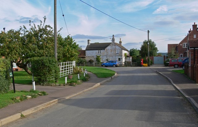
With a population of just over 300 people, Redmile is a rural community that offers a peaceful and picturesque setting. The village is surrounded by beautiful countryside, characterized by rolling hills, meadows, and farmland. It is known for its scenic views and is popular among nature enthusiasts and walkers.

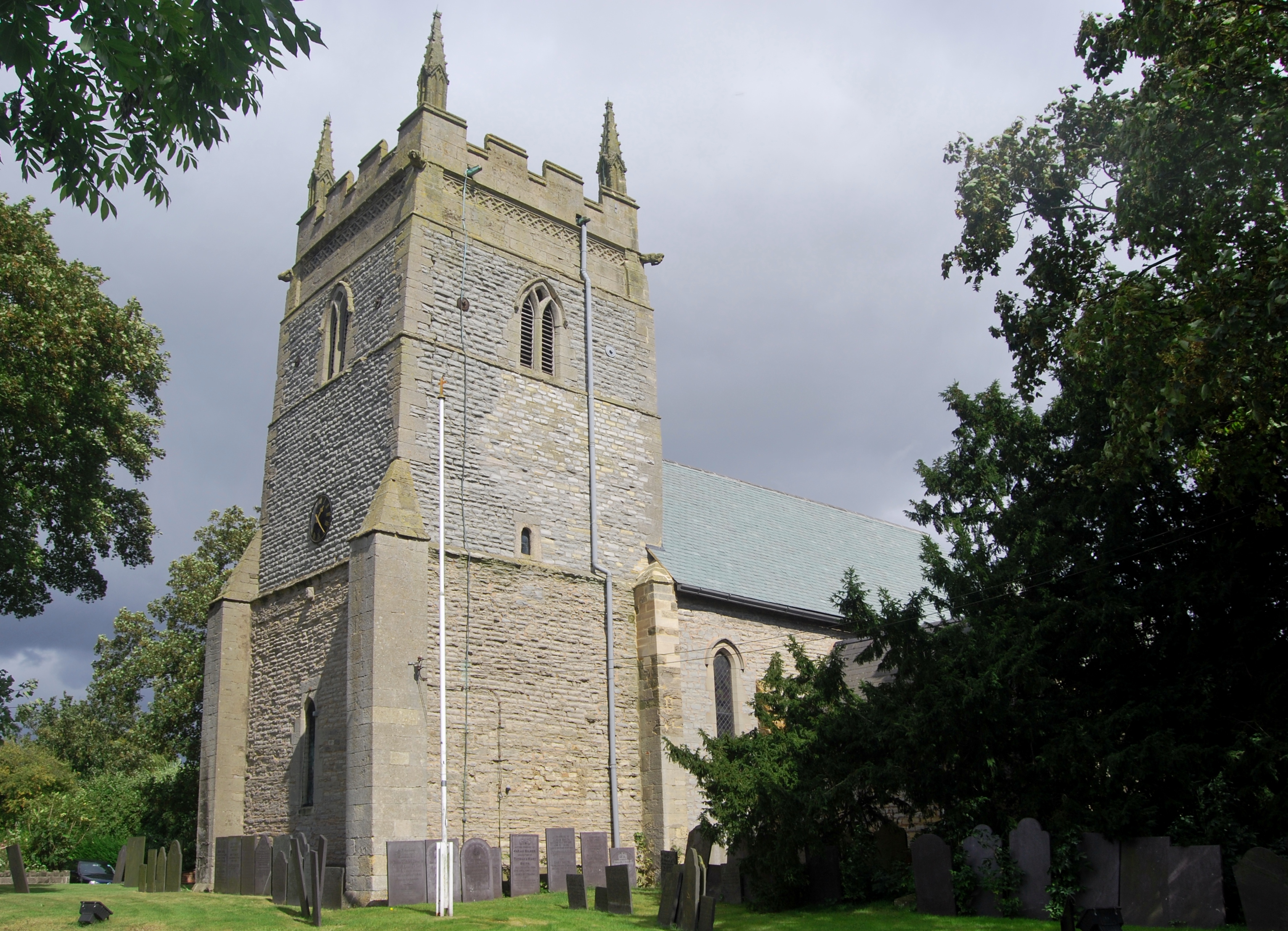
Redmile has a rich history dating back centuries, with evidence of Roman and Saxon settlements found in the area. The village itself features a mix of architectural styles, including traditional cottages and farmhouses, as well as more modern buildings.

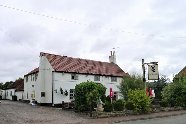
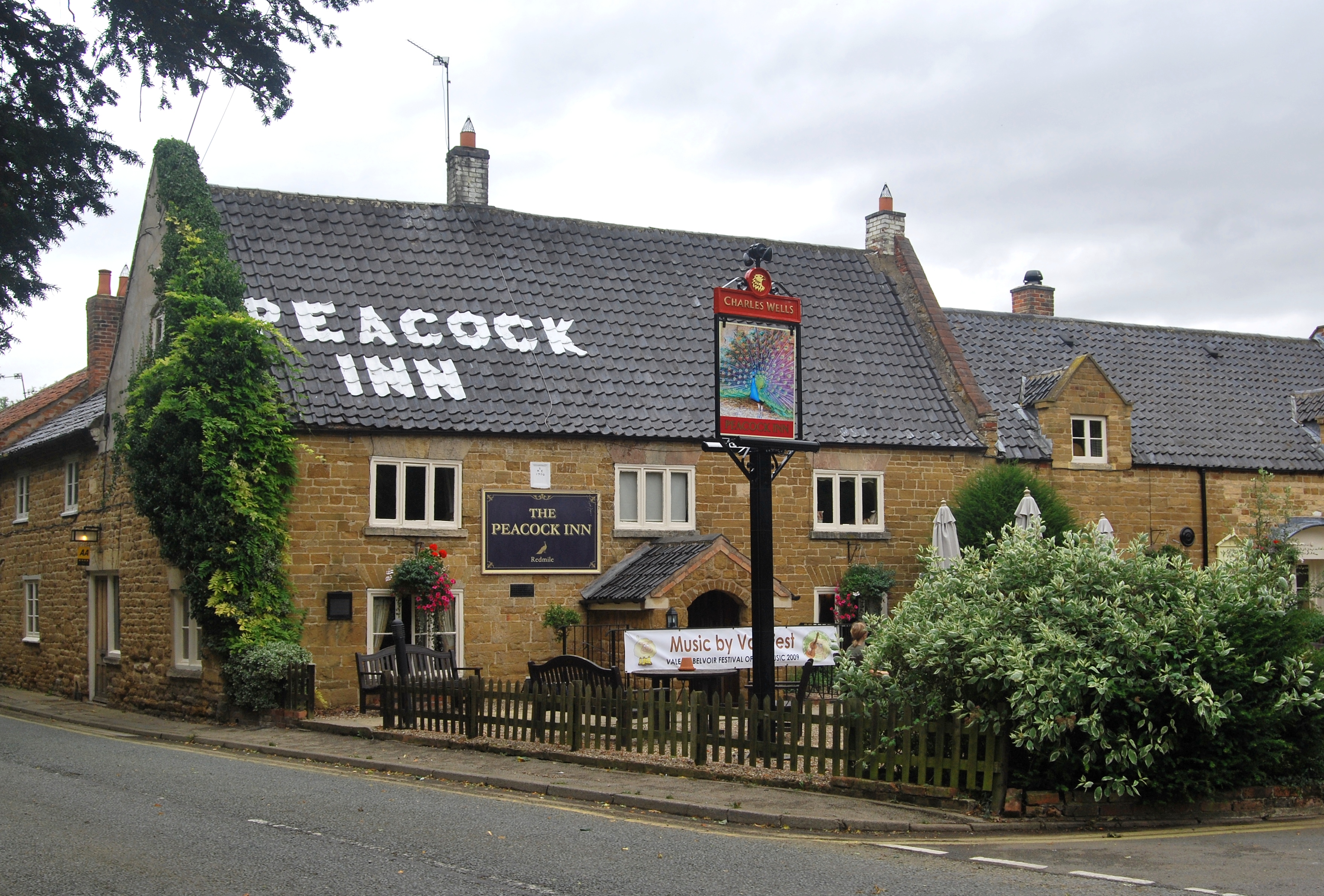
Despite its small size, Redmile has a strong sense of community. The parish has a village hall that serves as a hub for various social and recreational activities. There is also a local pub, providing a gathering place for residents and visitors to enjoy a drink or a meal.

Overall, Redmile offers a tranquil and close-knit community, ideal for those seeking a rural lifestyle in a picturesque English countryside setting.

If you have any feedback on the listing, please let us know in the comments section below.

Redmile Images

Images are sourced within 2km of 52.901611/-0.832803 or Grid Reference SK7834. Thanks to Geograph Open Source API. All images are credited.

The Windmill, Redmile The village's other pub, The Peacock, famous for its food, closed several years ago.
The Windmill, Redmile
The village's other pub, The Peacock, famous for its food, closed several years ago.
Headstones, Church of St Peter, Redmile A partly worn 'Belvoir Angel' on the left. On the right, the headstone for James Handley (with detaails and 'Belvoir Angel' on the reverse) with the inscription:
This World is a City full
Of Crooked Streets
beneath it a Market place
Where all men meet
If life were Marchandice
That Men could buy
Rich Men Would ever live
And poor Men die
<span class="nowrap"><a title="http://www.redmilearchive.freeuk.com/handley.html" rel="nofollow ugc noopener" href="http://www.redmilearchive.freeuk.com/handley.html">Link</a><img style="margin-left:2px;" alt="External link" title="External link - shift click to open in new window" src="https://s1.geograph.org.uk/img/external.png" width="10" height="10"/></span>
Headstones, Church of St Peter, Redmile
A partly worn 'Belvoir Angel' on the left. On the right, the headstone for James Handley (with detaails and 'Belvoir Angel' on the reverse) with the inscription: This World is a City full Of Crooked Streets beneath it a Market place Where all men meet If life were Marchandice That Men could buy Rich Men Would ever live And poor Men die LinkExternal link
Playground, Main Street, Redmile Recently refurbished with a grant from the Landfill Communities Fund <span class="nowrap"><a title="https://www.granthamjournal.co.uk/news/village-delighted-with-revamped-childrens-play-park-9072067/" rel="nofollow ugc noopener" href="https://www.granthamjournal.co.uk/news/village-delighted-with-revamped-childrens-play-park-9072067/">Link</a><img style="margin-left:2px;" alt="External link" title="External link - shift click to open in new window" src="https://s1.geograph.org.uk/img/external.png" width="10" height="10"/></span>
Playground, Main Street, Redmile
Recently refurbished with a grant from the Landfill Communities Fund LinkExternal link
Barkestone Trig Point Flush Bracket S1750 Knocked over and repaired according to local dog walker.
Barkestone Trig Point Flush Bracket S1750
Knocked over and repaired according to local dog walker.
Church of Saint Peter and Saint Paul, Barkestone Grade II* listed, mainly 14thC with tower (and presumably the plain octagonal spire) rebuilt 1840.
Church of Saint Peter and Saint Paul, Barkestone
Grade II* listed, mainly 14thC with tower (and presumably the plain octagonal spire) rebuilt 1840.
Church of Saint Peter and Saint Paul, Barkestone Grade II* listed, mainly 14thC with tower (and presumably the plain octagonal spire) rebuilt 1840.
Church of Saint Peter and Saint Paul, Barkestone
Grade II* listed, mainly 14thC with tower (and presumably the plain octagonal spire) rebuilt 1840.
OS Cut Mark: - Barkestone-le-Vale, St John's Church <span class="nowrap"><a title="https://www.bench-marks.org.uk/bm70985" rel="nofollow ugc noopener" href="https://www.bench-marks.org.uk/bm70985">Link</a><img style="margin-left:2px;" alt="External link" title="External link - shift click to open in new window" src="https://s1.geograph.org.uk/img/external.png" width="10" height="10"/></span>
OS Cut Mark: - Barkestone-le-Vale, St John's Church
Location of OS Cut Mark: - Barkestone-le-Vale, St John's Church <span class="nowrap"><a title="https://www.bench-marks.org.uk/bm70985" rel="nofollow ugc noopener" href="https://www.bench-marks.org.uk/bm70985">Link</a><img style="margin-left:2px;" alt="External link" title="External link - shift click to open in new window" src="https://s1.geograph.org.uk/img/external.png" width="10" height="10"/></span>
Location of OS Cut Mark: - Barkestone-le-Vale, St John's Church
Footpath onto the Vale of Belvoir The path from the top of the Belvoir Escarpment emerging onto the Vale of Belvoir
Footpath onto the Vale of Belvoir
The path from the top of the Belvoir Escarpment emerging onto the Vale of Belvoir
Long Lane Part of an almost 4 mile, very straight (and very fast) route along the south-east edge of the Vale of Belvoir. Might be assumed to be of Roman origin; but is not on  Margary's map (Roman roads in Britain volume 1. Ivan D Margary, Phoennix House, 1957).
The footpath (right) leads to Barkestone-le-Vale.
Long Lane
Part of an almost 4 mile, very straight (and very fast) route along the south-east edge of the Vale of Belvoir. Might be assumed to be of Roman origin; but is not on Margary's map (Roman roads in Britain volume 1. Ivan D Margary, Phoennix House, 1957). The footpath (right) leads to Barkestone-le-Vale.
The Chequers Village Hub, Barkeston-le-Vale The former Chequers Inn was purchased in 2019 for the village to use as a Community Hub <span class="nowrap"><a title="http://www.barkestonevillagehub.org/" rel="nofollow ugc noopener" href="http://www.barkestonevillagehub.org/">Link</a><img style="margin-left:2px;" alt="External link" title="External link - shift click to open in new window" src="https://s1.geograph.org.uk/img/external.png" width="10" height="10"/></span>
The Chequers Village Hub, Barkeston-le-Vale
The former Chequers Inn was purchased in 2019 for the village to use as a Community Hub LinkExternal link
Footpath entering Barkestone-le-Vale
Footpath to Barkestone-le-Vale The path starts at Belvoir Castle
Footpath to Barkestone-le-Vale
The path starts at Belvoir Castle
Dandelion season in the Vale of Belvoir
Woodside Farm At the south-east edge of the Vale of Belvoir, with the Belvoir escarpment rising behind.
Woodside Farm
At the south-east edge of the Vale of Belvoir, with the Belvoir escarpment rising behind.
Byway to Redmile The spire of St Peter's, Redmile is visible on the middle horizon
Byway to Redmile
The spire of St Peter's, Redmile is visible on the middle horizon
Byway and footpath to Redmile The spire of St Peter's, Redmile on the right horizon.
Byway and footpath to Redmile
The spire of St Peter's, Redmile on the right horizon.
Main Road leaving Redmile Crossing The Grimmer, a small stream draining part of the Vale of Belvoir. The Survey of English Place-Names suggests that the name derives from 'grima' = a boundary marker, as part of the stream's course forms a parish boundary <span class="nowrap"><a title="http://epns.nottingham.ac.uk/browse/id/53285cbfb47fc40adf000238-The+Grimmer" rel="nofollow ugc noopener" href="http://epns.nottingham.ac.uk/browse/id/53285cbfb47fc40adf000238-The+Grimmer">Link</a><img style="margin-left:2px;" alt="External link" title="External link - shift click to open in new window" src="https://s1.geograph.org.uk/img/external.png" width="10" height="10"/></span>
Main Road leaving Redmile
Crossing The Grimmer, a small stream draining part of the Vale of Belvoir. The Survey of English Place-Names suggests that the name derives from 'grima' = a boundary marker, as part of the stream's course forms a parish boundary LinkExternal link
Show me another place!

Redmile is located at Grid Ref: SK7834 (Lat: 52.901611, Lng: -0.832803)

Administrative County: Leicestershire

District: Melton

Police Authority: Leicestershire

What 3 Words

///insurers.leaky.feed. Near Bottesford, Leicestershire

Nearby Locations

Redmile Barkestone-le-Vale

Related Wikis

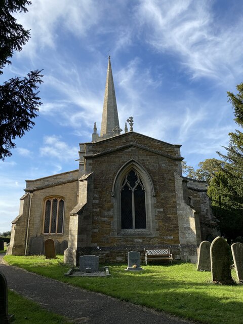
Church of St Peter and St Paul, Barkestone-le-Vale

The Church of St Peter and St Paul is a church in Barkestone-le-Vale, Leicestershire, England. It is a Grade II* listed building. == History == The church...

Barkestone-le-Vale

Barkestone-le-Vale is a village and (as just "Barkestone") a former civil parish, now in the parish of Redmile, in the Melton district, in the north east...

Redmile

Redmile is an English village and civil parish in the Melton district of Leicestershire, about ten miles (16 km) north of Melton Mowbray and seven miles...

Redmile railway station

Redmile railway station served the villages of Redmile and Barkestone-le-Vale, Nottinghamshire and also Belvoir Castle. It was on the Great Northern and...

Plungar

Plungar is a village and former civil parish, now in the parish of Redmile, and the Melton district of Leicestershire, England. It is about 9 miles (14...

Grantham Canal SSSI

Grantham Canal SSSI is a 9.5-hectare (23-acre) biological Site of Special Scientific Interest which runs along a stretch of the Grantham Canal and its...

Vale of Belvoir

The Vale of Belvoir ( BEE-vər) covers adjacent areas of Leicestershire, Nottinghamshire and Lincolnshire, England. The name derives from the Norman-French...

Granby, Nottinghamshire

Granby is a small village in the Rushcliffe district of Nottinghamshire, England. It lies in the Vale of Belvoir. == Toponymy == The place-name Granby...

Nearby Amenities

Located within 500m of 52.901611,-0.832803
Barrier: stile
Steps: 1
Stile: stepover
Lat/Long: 52.9039803/-0.8267835
Barrier: stile
Ele: 38
Steps: 2
Stile: stepover
Lat/Long: 52.9040083/-0.8268332
Ele: 41.9428711
Lat/Long: 52.9042564/-0.8284013
Ele: 42.9041748
Lat/Long: 52.904369/-0.8308636
Ele: 45
Lat/Long: 52.9049597/-0.8329296
Ele: 45
Lat/Long: 52.9050322/-0.8330458
Passing Place
Lat/Long: 52.902603/-0.8369402
Passing Place
Lat/Long: 52.9036313/-0.8380767
Barrier: stile
Steps: 1
Stile: stepover
Lat/Long: 52.9058504/-0.834466
Barrier: stile
Steps: 1
Stile: stepover
Lat/Long: 52.9050302/-0.8327735
The data included in this document is from www.openstreetmap.org. The data is made available under ODbL.

Have you been to Redmile?

Leave your review of Redmile below (or comments, questions and feedback).