Rede

Civil Parish in Suffolk St Edmundsbury

England

Rede

Broomagefield wood. Walking a footpath near Rede.
Broomagefield wood. Credit: steven ruffles

Rede is a civil parish located in the county of Suffolk, England. Situated in the eastern region of the country, it falls within the district of West Suffolk. The parish covers an area of approximately 5 square miles and is home to a small population.

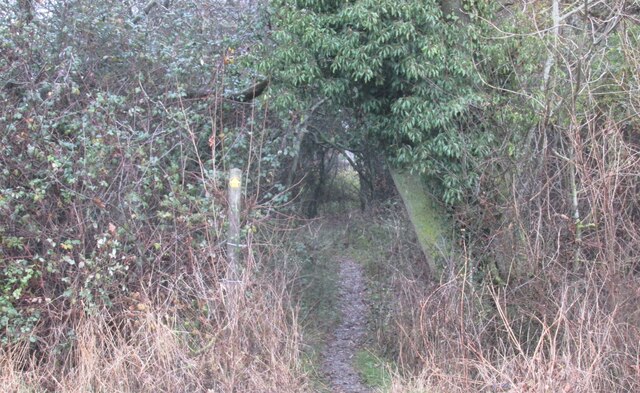
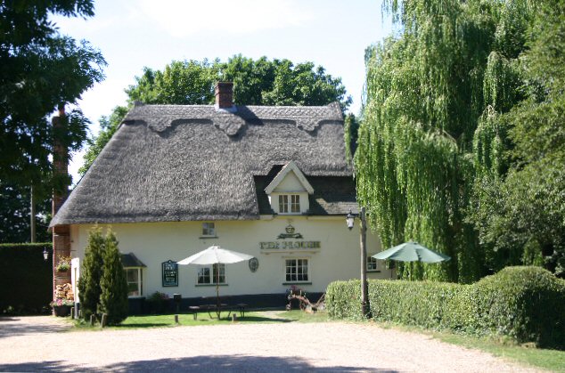
The village of Rede, after which the parish is named, lies in the heart of the area. It is a picturesque and traditional English village, with a charming mix of thatched cottages and more modern homes. Rede is surrounded by beautiful countryside, offering residents and visitors ample opportunities for outdoor activities such as hiking, cycling, and birdwatching.

The parish is primarily rural, with much of the land being used for agricultural purposes. There are several farms dotted throughout the area, contributing to the local economy and providing a picturesque backdrop to the village.

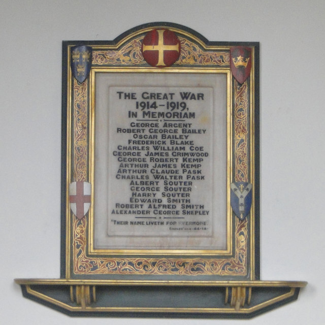
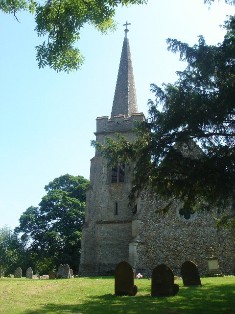
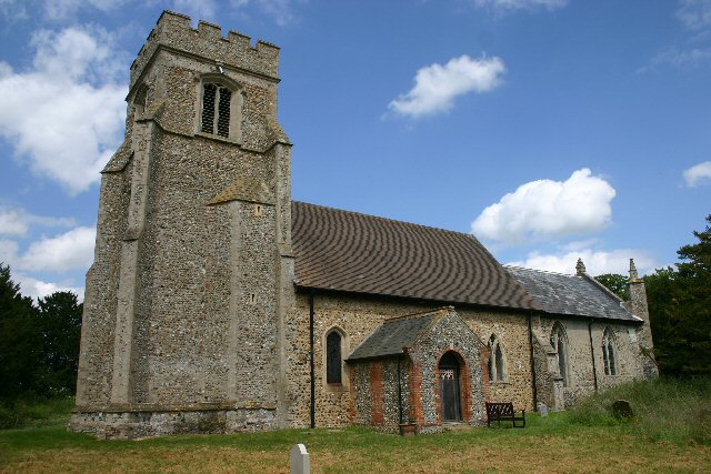
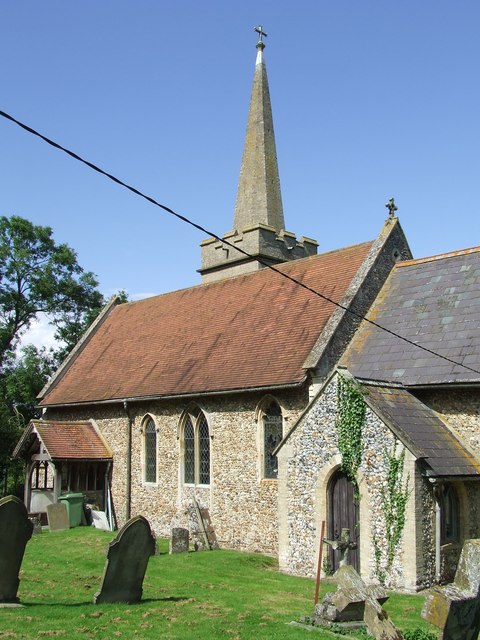
Despite its small size, Rede has a strong sense of community. The village has a small primary school, a parish church, and a village hall that serves as a hub for local events and gatherings. There are also a handful of amenities including a pub, a post office, and a few shops, catering to the basic needs of the residents.

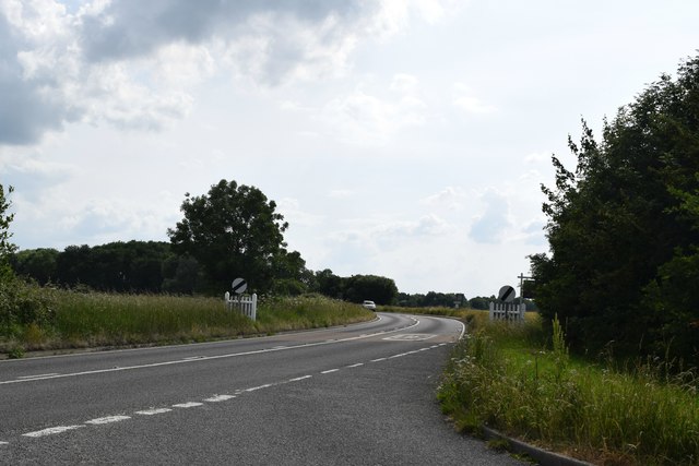
Rede is well-connected to the surrounding areas by road, making it easily accessible for commuters or those wanting to explore the nearby towns and cities. Overall, Rede offers a peaceful and idyllic countryside setting, making it an attractive place to live or visit for those seeking a quieter way of life.

If you have any feedback on the listing, please let us know in the comments section below.

Rede Images

Images are sourced within 2km of 52.175354/0.633695 or Grid Reference TL8056. Thanks to Geograph Open Source API. All images are credited.

Broomagefield wood. Walking a footpath near Rede.
Broomagefield wood.
Walking a footpath near Rede.
Footpath through hedge near Rede hole. Taken on a walk to Suffolk's highest ground
Footpath through hedge near Rede hole.
Taken on a walk to Suffolk's highest ground
All Saints church, Rede. Colourful cottages beside the church.
All Saints church, Rede.
Colourful cottages beside the church.
Chedburgh War Memorial The memorial is housed in the 'church' for which there is no keyholder. This image was taken through a (thankfully clean) south window.
The memorial bears 19 names of those lost in WW1. No losses are recorded for WW2.
Chedburgh War Memorial
The memorial is housed in the 'church' for which there is no keyholder. This image was taken through a (thankfully clean) south window. The memorial bears 19 names of those lost in WW1. No losses are recorded for WW2.
Field of rye grass, Chedburgh
Road leading to mast The location at the camera position is reckoned to be the Suffolk county top.
Road leading to mast
The location at the camera position is reckoned to be the Suffolk county top.
Walkers along bridleway between fields The pair are heading south-west between fields close to Gatesbury's Farm.
Walkers along bridleway between fields
The pair are heading south-west between fields close to Gatesbury's Farm.
Bury Road, Chedburgh The older part of the village is off to the left.
Bury Road, Chedburgh
The older part of the village is off to the left.
A143 west of Chedburgh Taken from the end of The Street at its junction with the A143.
A143 west of Chedburgh
Taken from the end of The Street at its junction with the A143.
RAF Chedburgh station memorial Opening in September 1942, Chedburgh was one of the earliest operational wartime airfields in Suffolk, it was a satellite bomber station for nearby RAF Stradishall.
Various Units were stationed at RAF Chedburgh in its short history.
620 Squadron was formed at RAF Chedburgh on 17 June 1943 as a heavy bomber squadron equipped with the Short Stirling. It was a part of No.3 Group of RAF Bomber Command and carried out night 61 operations, bombing and minelaying missions until November 1943 when it was transferred to No 38 Group. 
No. 23 Heavy Glider Maintenance Section
No. 214 Squadron RAF flying Handley Page Type O/100 and 400 bombers.
No. 218 Squadron RAF flying Short Sterlings as a transport Unit.
No. 301 Squadron RAF flying Handley Page Halifaxs until they were disbanded in December 1946 
No. 304 Squadron RAF  flying Halifax Mk C.8 unarmed transports and was disbanded a few months later on 18 December 1946.
No. 1653 Heavy Conversion Unit RAF
RAF Chedburgh station memorial
Opening in September 1942, Chedburgh was one of the earliest operational wartime airfields in Suffolk, it was a satellite bomber station for nearby RAF Stradishall. Various Units were stationed at RAF Chedburgh in its short history. 620 Squadron was formed at RAF Chedburgh on 17 June 1943 as a heavy bomber squadron equipped with the Short Stirling. It was a part of No.3 Group of RAF Bomber Command and carried out night 61 operations, bombing and minelaying missions until November 1943 when it was transferred to No 38 Group. No. 23 Heavy Glider Maintenance Section No. 214 Squadron RAF flying Handley Page Type O/100 and 400 bombers. No. 218 Squadron RAF flying Short Sterlings as a transport Unit. No. 301 Squadron RAF flying Handley Page Halifaxs until they were disbanded in December 1946 No. 304 Squadron RAF flying Halifax Mk C.8 unarmed transports and was disbanded a few months later on 18 December 1946. No. 1653 Heavy Conversion Unit RAF
RAF Chedburgh station memorial RAF Chedburgh station memorial
Opening in September 1942, Chedburgh was one of the earliest operational wartime airfields in Suffolk, it was a satellite bomber station for nearby RAF Stradishall.
Various Units were stationed at RAF Chedburgh in its short history.
620 Squadron was formed at RAF Chedburgh on 17 June 1943 as a heavy bomber squadron equipped with the Short Stirling. It was a part of No.3 Group of RAF Bomber Command and carried out night 61 operations, bombing and minelaying missions until November 1943 when it was transferred to No 38 Group.
No. 23 Heavy Glider Maintenance Section
No. 214 Squadron RAF flying Handley Page Type O/100 and 400 bombers.
No. 218 Squadron RAF flying Short Sterlings as a transport Unit.
No. 301 Squadron RAF flying Handley Page Halifaxs until they were disbanded in December 1946
No. 304 Squadron RAF flying Halifax Mk C.8 unarmed transports and was disbanded a few months later on 18 December 1946.
No. 1653 Heavy Conversion Unit RAF
RAF Chedburgh station memorial
RAF Chedburgh station memorial Opening in September 1942, Chedburgh was one of the earliest operational wartime airfields in Suffolk, it was a satellite bomber station for nearby RAF Stradishall. Various Units were stationed at RAF Chedburgh in its short history. 620 Squadron was formed at RAF Chedburgh on 17 June 1943 as a heavy bomber squadron equipped with the Short Stirling. It was a part of No.3 Group of RAF Bomber Command and carried out night 61 operations, bombing and minelaying missions until November 1943 when it was transferred to No 38 Group. No. 23 Heavy Glider Maintenance Section No. 214 Squadron RAF flying Handley Page Type O/100 and 400 bombers. No. 218 Squadron RAF flying Short Sterlings as a transport Unit. No. 301 Squadron RAF flying Handley Page Halifaxs until they were disbanded in December 1946 No. 304 Squadron RAF flying Halifax Mk C.8 unarmed transports and was disbanded a few months later on 18 December 1946. No. 1653 Heavy Conversion Unit RAF
Chedburgh village sign The sign depicts an Avro Lancaster of the type based at RAF Chedburgh during World War II.  Below and on the ground, are a pair of heavy horses ploughing the fertile clay soil and a wheatsheaf standing in a field. It is the result of their yearlong labours and symbolic of the agricultural heritage of the parish. <a title="https://www.geograph.org.uk/photo/6767890" href="https://www.geograph.org.uk/photo/6767890">Link</a>
The sign replaced an earlier version <a title="https://www.geograph.org.uk/photo/4291589" href="https://www.geograph.org.uk/photo/4291589">Link</a> with the same theme.
Chedburgh village sign
The sign depicts an Avro Lancaster of the type based at RAF Chedburgh during World War II. Below and on the ground, are a pair of heavy horses ploughing the fertile clay soil and a wheatsheaf standing in a field. It is the result of their yearlong labours and symbolic of the agricultural heritage of the parish. Link The sign replaced an earlier version Link with the same theme.
Chedburgh village sign The sign depicts an Avro Lancaster of the type based at RAF Chedburgh during World War II.  Below and on the ground, are a pair of heavy horses ploughing the fertile clay soil and a wheatsheaf standing in a field. It is the result of their yearlong labours and symbolic of the agricultural heritage of the parish. <a title="https://www.geograph.org.uk/photo/6767889" href="https://www.geograph.org.uk/photo/6767889">Link</a>
The sign replaced an earlier version <a title="https://www.geograph.org.uk/photo/4291589" href="https://www.geograph.org.uk/photo/4291589">Link</a> with the same theme.
Chedburgh village sign
The sign depicts an Avro Lancaster of the type based at RAF Chedburgh during World War II. Below and on the ground, are a pair of heavy horses ploughing the fertile clay soil and a wheatsheaf standing in a field. It is the result of their yearlong labours and symbolic of the agricultural heritage of the parish. Link The sign replaced an earlier version Link with the same theme.
Entrance to Chedburgh village Chedburgh is a small village five miles south-west of Bury St Edmunds. A former Bomber Command airfield to the south of the village has been turned into industrial units.
Entrance to Chedburgh village
Chedburgh is a small village five miles south-west of Bury St Edmunds. A former Bomber Command airfield to the south of the village has been turned into industrial units.
Chedburgh Church All Saints' church, next to Chedburgh Hall, but a mile or so away from the main village, as is the case in many Suffolk villages.
Chedburgh Church
All Saints' church, next to Chedburgh Hall, but a mile or so away from the main village, as is the case in many Suffolk villages.
Suffolk's county top This mast, at Elms Farm, sits astride Suffolk's highest point, at 420 feet.
Suffolk's county top
This mast, at Elms Farm, sits astride Suffolk's highest point, at 420 feet.
Elms Farm, Depden This farm is situated some 200 metres from Suffolk's highest point.
Elms Farm, Depden
This farm is situated some 200 metres from Suffolk's highest point.
Footpath to Rede This path starts at the highest point in Suffolk and heads east, past Great Wood (here on the right), to Rede.
Footpath to Rede
This path starts at the highest point in Suffolk and heads east, past Great Wood (here on the right), to Rede.
Show me another place!

Rede is located at Grid Ref: TL8056 (Lat: 52.175354, Lng: 0.633695)

Administrative County: Suffolk

District: St Edmundsbury

Police Authority: Suffolk

What 3 Words

///fats.ranted.trappings. Near Glemsford, Suffolk

Nearby Locations

Rede

Related Wikis

Rede, Suffolk

Rede is a village and civil parish in the West Suffolk district of Suffolk in eastern England. Its location is situated South East of Chedburgh. In 1887...

RAF Chedburgh

Royal Air Force Chedburgh or more simply RAF Chedburgh is a former Royal Air Force satellite station located near Bury St Edmunds, Suffolk, UK. The Bury...

Newmarket Ridge

The Newmarket Ridge or East Anglian Ridge is a ridge starting north-west of Hertford, Hertfordshire near the Chiltern Hills and ending near Sudbury, Suffolk...

Great Wood Hill

At 128 metres (420 ft), Great Wood Hill, near Chedburgh, is the highest point in the English county of Suffolk. It is the highest part of the Newmarket...

Hay Wood, Whepstead

Hay Wood, Whepstead is a 10.4-hectare (26-acre) biological Site of Special Scientific Interest west of Whepstead in Suffolk.This ancient wood on poorly...

Depden

Depden is a village and civil parish in the West Suffolk district of Suffolk in eastern England. Located on the A143 around five miles south-west of Bury...

Chedburgh

Chedburgh is a village and civil parish in the West Suffolk district of Suffolk in eastern England. Located on the A143 around five miles south-west of...

Brockley, Suffolk

Brockley (not to be confused with Brockley Green, 8 miles (13 km) southwest in Hundon parish) is a village and civil parish in the West Suffolk district...

Nearby Amenities

Located within 500m of 52.175354,0.633695
Post Box
Post Box Type: lamp
Ref: IP29 2027
Lat/Long: 52.1717811/0.6369296
Addr Housenumber: 9
Addr Postcode: IP29 4BG
Addr Street: Church Close
Lat/Long: 52.1718919/0.6366019
Addr Housenumber: 12
Addr Postcode: IP29 4BG
Addr Street: Church Close
Lat/Long: 52.1724889/0.6364626
Addr Housenumber: 20
Addr Postcode: IP29 4BG
Addr Street: Church Close
Lat/Long: 52.1729709/0.636189
Addr Housenumber: 17
Addr Postcode: IP29 4BG
Addr Street: Church Close
Lat/Long: 52.1725661/0.6360763
Addr Housenumber: 3
Addr Postcode: IP29 4BG
Addr Street: Church Close
Lat/Long: 52.1724018/0.6369774
Addr Housenumber: 6
Addr Postcode: IP29 4BG
Addr Street: Church Close
Lat/Long: 52.1721222/0.636323
Addr Housenumber: 7
Addr Postcode: IP29 4BG
Addr Street: Church Close
Lat/Long: 52.1720169/0.6362747
Addr Housenumber: 1
Addr Postcode: IP29 4BG
Addr Street: Church Close
Lat/Long: 52.1725102/0.6370364
Addr Housenumber: 10
Addr Postcode: IP29 4BG
Addr Street: Church Close
Lat/Long: 52.1727357/0.6365886
Addr Housenumber: 11
Addr Postcode: IP29 4BG
Addr Street: Church Close
Lat/Long: 52.1726551/0.6365511
Addr Housenumber: 21
Addr Postcode: IP29 4BG
Addr Street: Church Close
Lat/Long: 52.173058/0.63613
Addr Housenumber: 5
Addr Postcode: IP29 4BG
Addr Street: Church Close
Lat/Long: 52.1721516/0.6365644
Addr Housenumber: 19
Addr Postcode: IP29 4BG
Addr Street: Church Close
Lat/Long: 52.172808/0.636189
Addr Housenumber: 18
Addr Postcode: IP29 4BG
Addr Street: Church Close
Lat/Long: 52.1727324/0.6361488
Addr Housenumber: 13
Addr Postcode: IP29 4BG
Addr Street: Church Close
Lat/Long: 52.1724132/0.636425
Addr Housenumber: 16
Addr Postcode: IP29 4BG
Addr Street: Church Close
Lat/Long: 52.1724939/0.6360334
Addr Housenumber: 14
Addr Postcode: IP29 4BG
Addr Street: Church Close
Lat/Long: 52.1723047/0.6362158
Addr Housenumber: 15
Addr Postcode: IP29 4BG
Addr Street: Church Close
Lat/Long: 52.1723276/0.6360897
Addr Housenumber: 2
Addr Postcode: IP29 4BG
Addr Street: Church Close
Lat/Long: 52.1724543/0.6370096
Addr Housenumber: 4
Addr Postcode: IP29 4BG
Addr Street: Church Close
Lat/Long: 52.1721189/0.6367253
Addr Housenumber: 8
Addr Postcode: IP29 4BG
Addr Street: Church Close
Lat/Long: 52.1719215/0.636441
The data included in this document is from www.openstreetmap.org. The data is made available under ODbL.

Have you been to Rede?

Leave your review of Rede below (or comments, questions and feedback).