Brunant

Settlement in Montgomeryshire

Wales

Brunant

Car on the A458 The A458 runs 87 miles across the West Midlands and Wales, from Quinton to Mallwyd.
<span class="nowrap"><a title="http://www.sabre-roads.org.uk/wiki/index.php?title=A458" rel="nofollow ugc noopener" href="http://www.sabre-roads.org.uk/wiki/index.php?title=A458">Link</a><img style="margin-left:2px;" alt="External link" title="External link - shift click to open in new window" src="https://s1.geograph.org.uk/img/external.png" width="10" height="10"/></span>
Car on the A458 Credit: N Chadwick

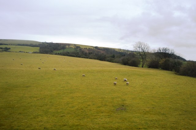
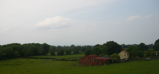
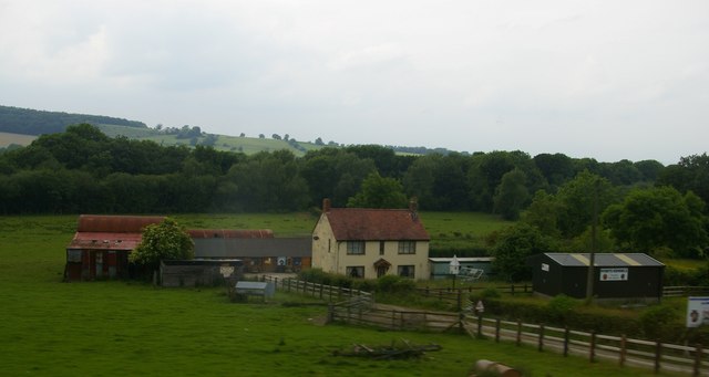
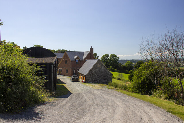
Brunant is a small rural village located in Montgomeryshire, Wales. Situated in the beautiful countryside, Brunant is known for its picturesque landscapes, rolling hills, and peaceful atmosphere. The village is home to a close-knit community of residents who take pride in their surroundings and heritage.

Brunant features a mix of traditional Welsh architecture and modern amenities, including a local pub, village hall, and small shops. The village also has a primary school, making it an ideal location for families looking for a quiet and safe environment to raise their children.

Surrounded by lush greenery and natural beauty, Brunant offers plenty of opportunities for outdoor activities such as hiking, cycling, and fishing in the nearby rivers and lakes. The village is also close to several historic sites and attractions, including Montgomery Castle and Powis Castle, making it a popular destination for tourists looking to explore the rich history and culture of the region.

Overall, Brunant is a charming and idyllic village that offers a peaceful and relaxing retreat for both residents and visitors alike.

If you have any feedback on the listing, please let us know in the comments section below.
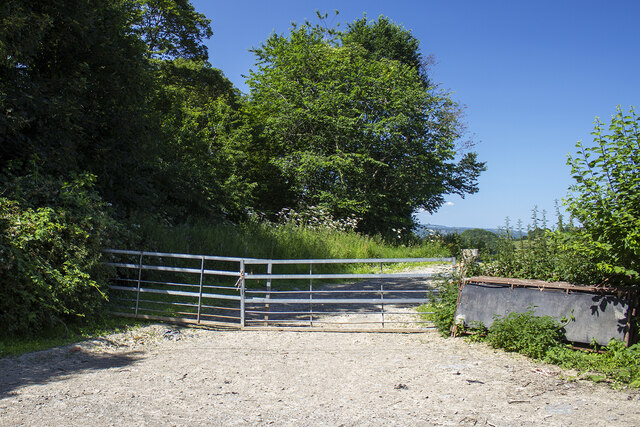
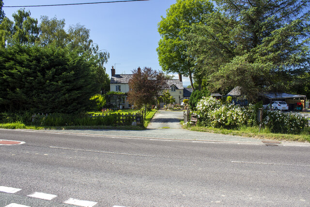
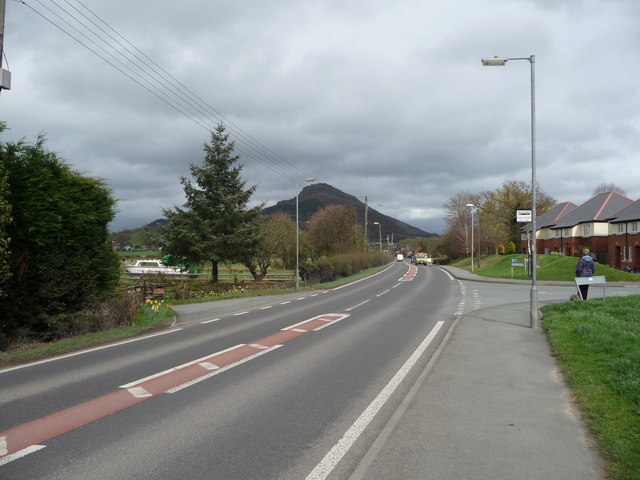
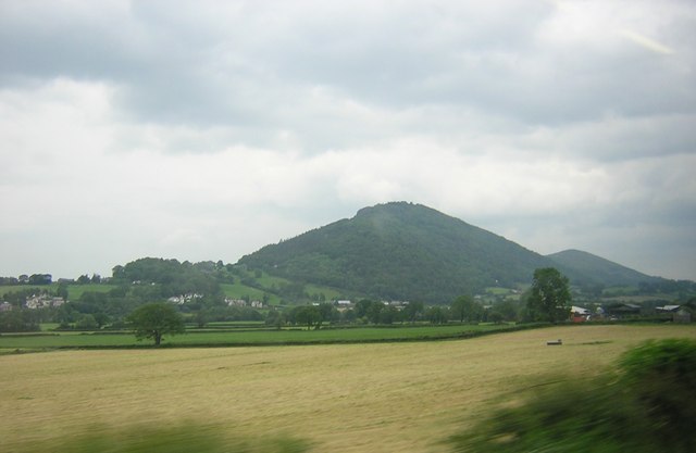
Brunant Images

Images are sourced within 2km of 52.679498/-3.061266 or Grid Reference SJ2809. Thanks to Geograph Open Source API. All images are credited.

Car on the A458 The A458 runs 87 miles across the West Midlands and Wales, from Quinton to Mallwyd.
<span class="nowrap"><a title="http://www.sabre-roads.org.uk/wiki/index.php?title=A458" rel="nofollow ugc noopener" href="http://www.sabre-roads.org.uk/wiki/index.php?title=A458">Link</a><img style="margin-left:2px;" alt="External link" title="External link - shift click to open in new window" src="https://s1.geograph.org.uk/img/external.png" width="10" height="10"/></span>
Car on the A458
The A458 runs 87 miles across the West Midlands and Wales, from Quinton to Mallwyd. LinkExternal link
Cefn Cottage
Cefn Cottage
Near Middle Heldre
Near Middle Heldre
Sheep grazing
Sheep grazing
Cefn, near Welshpool: Lower Cefn and Severn valley, from the train
Hollybush Farm Converted vernacular farm building at Hollybush Farm
Hollybush Farm
Converted vernacular farm building at Hollybush Farm
Farm track and trees Farm track and trees by Nant Yneauadd Dingle
Farm track and trees
Farm track and trees by Nant Yneauadd Dingle
The A458 Shrewsbury to Welshpool road in Cefn This scene shows the turning into Parc Caradog in Cefn and also shows Moel y Golfa behind, one of the Breidden Hills. It's almost at its best from this angle, but the telegraph wires, streetlamps and hedgerows somehow all conspire to pull down the view. I must head for higher ground.
The A458 Shrewsbury to Welshpool road in Cefn
This scene shows the turning into Parc Caradog in Cefn and also shows Moel y Golfa behind, one of the Breidden Hills. It's almost at its best from this angle, but the telegraph wires, streetlamps and hedgerows somehow all conspire to pull down the view. I must head for higher ground.
Part of the A458 Welshpool to Shrewsbury road in Cefn This shot is an attempt to capture Moel y Golfa from this angle but fails - I need to get the other side of extraneous material like the hedgerow and poles or get slightly higher up.
Part of the A458 Welshpool to Shrewsbury road in Cefn
This shot is an attempt to capture Moel y Golfa from this angle but fails - I need to get the other side of extraneous material like the hedgerow and poles or get slightly higher up.
Trewern Chapel The chapel was built in 1837 as a chapel of ease for the Church of England (despite being in Wales). Unusually, it never had a burial ground. It is now deconsecrated, having closed in 1994, and is used for storage by its current owner. The fabric of the building is starting to deteriorate badly, with a number of the stones at the near end of the roof having come off in recent bad weather.
Trewern Chapel
The chapel was built in 1837 as a chapel of ease for the Church of England (despite being in Wales). Unusually, it never had a burial ground. It is now deconsecrated, having closed in 1994, and is used for storage by its current owner. The fabric of the building is starting to deteriorate badly, with a number of the stones at the near end of the roof having come off in recent bad weather.
Farm land and stream towards Sale Lane Viewed from railway near Trewern
Farm land and stream towards Sale Lane
Viewed from railway near Trewern
Silhouette of Moel y Golfa at dusk in December The shapeliness of this hill from this angle has to be seen to be believed. What a beauty.

Yes, the sheep thinks I'm mad too....
Silhouette of Moel y Golfa at dusk in December
The shapeliness of this hill from this angle has to be seen to be believed. What a beauty. Yes, the sheep thinks I'm mad too....
Moel y Golfa from the A458 road over the railway Moel y Golfa can be appreciated as the highest and most shapely of the wonderful Breidden Hills from this angle.
Moel y Golfa from the A458 road over the railway
Moel y Golfa can be appreciated as the highest and most shapely of the wonderful Breidden Hills from this angle.
Moel y Golfa and Trewern village, from the train
The Tower, Maesfron Hall A small battlemented summerhouse in the grounds of Maesfron Hall.
The Tower, Maesfron Hall
A small battlemented summerhouse in the grounds of Maesfron Hall.
The Grotto, Maesfron Hall A small underground grotto at Maesfron Hall
The Grotto, Maesfron Hall
A small underground grotto at Maesfron Hall
Show me another place!

Brunant is located at Grid Ref: SJ2809 (Lat: 52.679498, Lng: -3.061266)

Unitary Authority: Powys

Police Authority: Dyfed Powys

What 3 Words

///sports.checked.undertook. Near Welshpool, Powys

Nearby Locations

Brunant Heldre Hill

Related Wikis

Trewern

Trewern is a small village, community and electoral ward in Montgomeryshire, Powys, Wales. The community includes the villages of Buttington and Middletown...

Buttington railway station

Buttington railway station was a station in Buttington, Powys, Wales. The station was opened in November 1860, several months after the line that served...

Battle of Buttington

The Battle of Buttington was fought in 893 between a Viking army and an alliance of Anglo-Saxons and Welsh. The annals for 893 reported that a large Viking...

Trewern Hall

Trewern Hall or Trewern Farmhouse is a country house in Montgomeryshire, Wales, close to the Shropshire border. It is on a spur in the floodplain of the...

Nearby Amenities

Located within 500m of 52.679498,-3.061266
Power: pole
Lat/Long: 52.6808098/-3.0678893
Power: pole
Lat/Long: 52.681122/-3.0664194
Power: pole
Lat/Long: 52.6814309/-3.0649388
Power: pole
Lat/Long: 52.6822082/-3.063925
Power: pole
Lat/Long: 52.6831578/-3.0647994
Power: pole
Lat/Long: 52.6820102/-3.0622318
Power: pole
Lat/Long: 52.6823078/-3.0607056
Power: pole
Lat/Long: 52.6825895/-3.0592807
Power: pole
Lat/Long: 52.6828338/-3.0580523
Give Way
Direction: forward
Lat/Long: 52.6827322/-3.0654054
Give Way
Direction: backward
Lat/Long: 52.6826711/-3.0653786
The data included in this document is from www.openstreetmap.org. The data is made available under ODbL.

Have you been to Brunant?

Leave your review of Brunant below (or comments, questions and feedback).