Rainhill

Civil Parish in Lancashire St. Helens

England

Rainhill

Sleet on Warrington Road Warrington Road
Sleet on Warrington Road Credit: Lauren

Rainhill is a civil parish located in the Metropolitan Borough of St Helens, in the county of Lancashire, England. It is situated approximately 2.5 miles east of Prescot and 8 miles east of Liverpool city centre. The area covers a total land area of around 2.7 square miles.

The village of Rainhill is known for its rich history, dating back to the medieval period when it was primarily an agricultural community. Today, it is a charming residential area with a population of around 11,000 people. The village offers a mix of modern housing developments and historic properties, providing a diverse range of accommodation options.

Rainhill is well-connected to other parts of the region, with easy access to major roads such as the M62 and M57 motorways, making it an attractive location for commuters. The village is also served by Rainhill railway station, providing convenient rail links to Liverpool, Manchester, and other nearby towns.

In terms of amenities, Rainhill has a variety of local shops, supermarkets, and restaurants, catering to the needs of its residents. The area is also home to several schools, including Rainhill High School, which has a good reputation for academic achievement.

For recreation, Rainhill offers several parks and green spaces, including the popular Victoria Park, which provides a peaceful retreat for residents to enjoy outdoor activities. The village also has a number of sports clubs and leisure facilities, including a golf course and a cricket club.

Overall, Rainhill is a picturesque and well-connected village, offering a pleasant living environment with a range of amenities and recreational opportunities for its residents.

If you have any feedback on the listing, please let us know in the comments section below.

Rainhill Images

Images are sourced within 2km of 53.410374/-2.762991 or Grid Reference SJ4990. Thanks to Geograph Open Source API. All images are credited.

Sleet on Warrington Road Warrington Road
Sleet on Warrington Road
Warrington Road
Waste ground of Chapel Lane
Chapel Lane
Chapel Lane
St Helens Linkway (A570)
Entrance to St Bartholomew's Roman Catholic Church, Rainhill Stoops
St Bartholomew's Roman Catholic Church, Rainhill Stoops
The Ship Inn
The Ship Inn
Sign for the Ship Inn
Milestone beside Warrington Road (A57) Carved stone post by the A57, in parish of RAINHILL (ST HELENS District), Warrington Road; 50m West of junction with School Lane, in front of school, on East side of road. Prescot stone, erected by the Liverpool, Prescot, Ashton & Warrington turnpike trust in the 19th century.

Inscription reads:-
: TO / WARRINGTON / VII / MILES : : TO PRESCOT / III / MILES / TO / LIVERPOOL / XI / MILES :


Milestone Society National ID: LA_WALV07.

See <a href="https://www.geograph.org.uk/photo/7439284">SJ5090 : Milestone and bus stop on Warrington Road (A57)</a> for context.
Milestone beside Warrington Road (A57)
Carved stone post by the A57, in parish of RAINHILL (ST HELENS District), Warrington Road; 50m West of junction with School Lane, in front of school, on East side of road. Prescot stone, erected by the Liverpool, Prescot, Ashton & Warrington turnpike trust in the 19th century. Inscription reads:- : TO / WARRINGTON / VII / MILES : : TO PRESCOT / III / MILES / TO / LIVERPOOL / XI / MILES : Milestone Society National ID: LA_WALV07. See SJ5090 : Milestone and bus stop on Warrington Road (A57) for context.
Milestone and bus stop on Warrington Road (A57)
Elizabeth II postbox on School Lane Postbox No. L35 17.
Elizabeth II postbox on School Lane
Postbox No. L35 17.
Micklehead Green Beefeater A good place to go if you like your burgers well done (when you didn't ask for it to be well done...).
Micklehead Green Beefeater
A good place to go if you like your burgers well done (when you didn't ask for it to be well done...).
War Memorial on Mill Lane
Old Boundary Marker on the B5413 Rainhill Road Parish Boundary Marker against the parapet of Hanging Bridge on the west side of the B5413 Rainhill Road. Inscribed RAINHILL and ECCLESTON. the lack of a clear inscription makes interpretation difficult, but this could mark the boundary of Rainhill and Eccleston parishes.

Milestone Society National ID: LA_RAIECC01pb
Old Boundary Marker on the B5413 Rainhill Road
Parish Boundary Marker against the parapet of Hanging Bridge on the west side of the B5413 Rainhill Road. Inscribed RAINHILL and ECCLESTON. the lack of a clear inscription makes interpretation difficult, but this could mark the boundary of Rainhill and Eccleston parishes. Milestone Society National ID: LA_RAIECC01pb
Car Park from Whiston Hospital
Old Milestone by the A57, Warrington Road, Rainhill Carved stone post on Skew Bridge, by the A57, in parish of Rainhill (St Helens District), Warrington Road; East side of bridge, against wall, on South side of road. Prescot stone, erected by the Liverpool, Prescot, Ashton & Warrington turnpike trust in the 19th century. 

Inscription reads:-
: TO / WARRINGTON / VIII / MILES : : TO PRESCOT / 11 / MILES / TO / LIVERPOOL / X / MILES : 

Grade II listed. 
List Entry Number: 1261826

Milestone Society National ID: LA_WALV08
Old Milestone by the A57, Warrington Road, Rainhill
Carved stone post on Skew Bridge, by the A57, in parish of Rainhill (St Helens District), Warrington Road; East side of bridge, against wall, on South side of road. Prescot stone, erected by the Liverpool, Prescot, Ashton & Warrington turnpike trust in the 19th century. Inscription reads:- : TO / WARRINGTON / VIII / MILES : : TO PRESCOT / 11 / MILES / TO / LIVERPOOL / X / MILES : Grade II listed. List Entry Number: 1261826 Milestone Society National ID: LA_WALV08
Rainhill railway station, Merseyside Opened in 1830 by the Liverpool & Manchester Railway. 
View west towards Whiston and Liverpool shortly after electrification. For a similar view six years earlier, see <a href="https://www.geograph.org.uk/photo/3444150">SJ4991 : Rainhill railway station, Merseyside</a>.
Rainhill railway station, Merseyside
Opened in 1830 by the Liverpool & Manchester Railway. View west towards Whiston and Liverpool shortly after electrification. For a similar view six years earlier, see SJ4991 : Rainhill railway station, Merseyside.
Show me another place!

Rainhill is located at Grid Ref: SJ4990 (Lat: 53.410374, Lng: -2.762991)

Administrative County: Merseyside

District: St. Helens

Police Authority: Merseyside

What 3 Words

///soon.vines.stop. Near Whiston, Merseyside

Related Wikis

Tower College

Tower College is an English independent non-denominational Christian school for boys and girls aged 3–16. == History == The school is named after the main...

Rainhill

Rainhill is a village and civil parish in the Metropolitan Borough of St Helens, Merseyside, England. The population at the 2011 census was 10,853.Historically...
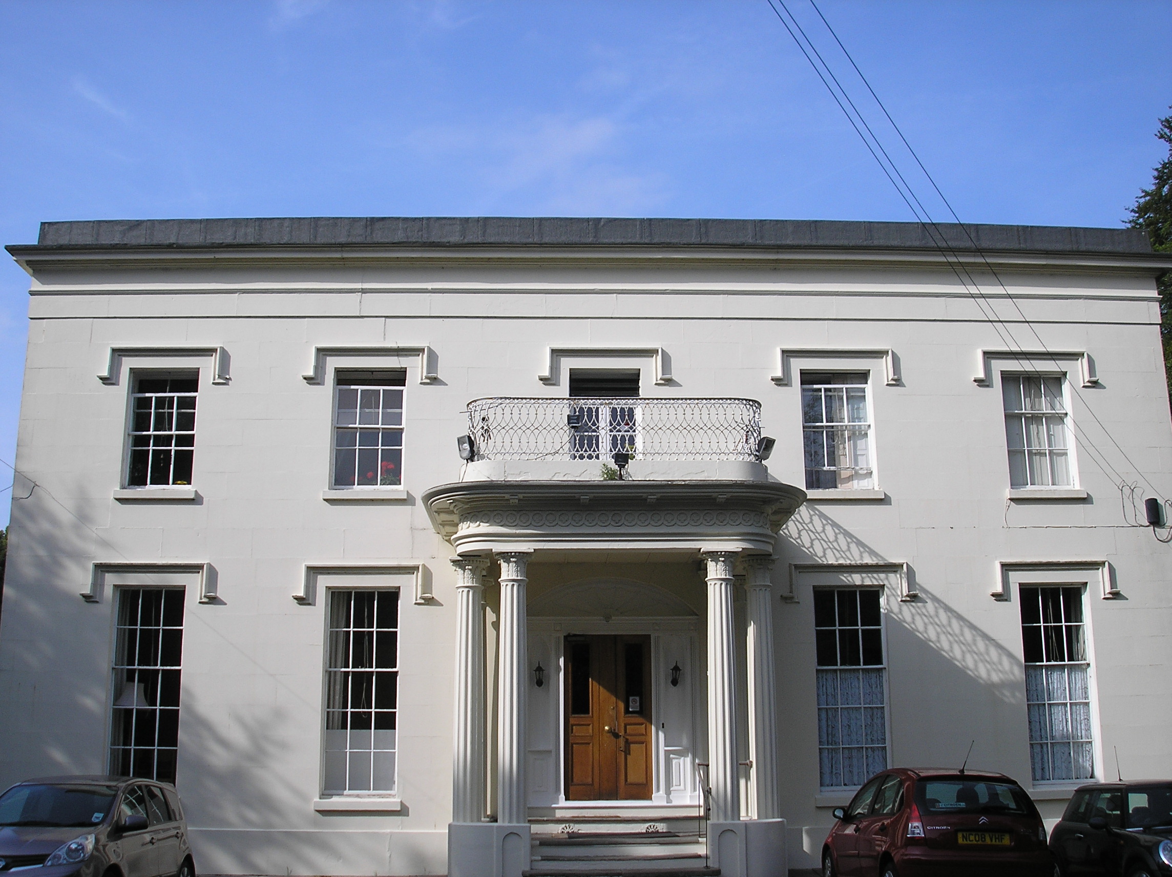
Rainhill Hall

Rainhill Hall or Loyola Hall is a Grade II listed country house built in the 19th century in Rainhill, Merseyside, England, by Bartholomew Bretherton....

Rainhill railway station

Rainhill railway station serves the district of Rainhill in Merseyside, England. It is situated on the electrified northern route of the Liverpool to...

Nearby Amenities

Located within 500m of 53.410374,-2.762991
Rainhill
Is In City: St Helens
Place: suburb
Source: npe
Wikidata: Q2429969
Wikipedia: en:Rainhill
Lat/Long: 53.4134383/-2.760785
Barrier: bollard
Lat/Long: 53.4078529/-2.7568036
Turning Circle
Lat/Long: 53.4088565/-2.7573921
Traffic Calming: cushion
Lat/Long: 53.4073845/-2.7602131
Turning Circle
Lat/Long: 53.4122229/-2.761169
Bus Stop
WARRINGTON RD/LAWTON RD
Bus: yes
Naptan AtcoCode: 2800S14037A
Naptan Bearing: NW
Naptan CommonName: WARRINGTON RD/LAWTON RD
Naptan Indicator: WARRINGTON ROAD/LAWTON ROAD
Naptan Landmark: OPP 623
Naptan NaptanCode: meragptg
Naptan Notes: No Notes
Naptan ShortCommonName: Warrington Rd
Naptan Street: WARRINGTON ROAD
Naptan Verified: no
Public Transport: platform
Source: naptan_import
Lat/Long: 53.4127731/-2.7578522
Bus Stop
WARRINGTON RD/LAWTON RD
Bus: yes
Naptan AtcoCode: 2800S14037B
Naptan Bearing: SE
Naptan CommonName: WARRINGTON RD/LAWTON RD
Naptan Indicator: WARRINGTON ROAD/LAWTON ROAD
Naptan Landmark: O/S 611
Naptan NaptanCode: meragptj
Naptan Notes: No Notes
Naptan ShortCommonName: Lawton Rd
Naptan Street: WARRINGTON ROAD
Naptan Verified: no
Public Transport: platform
Source: naptan_import
Lat/Long: 53.4132925/-2.7581623
Bus Stop
MILL LN/ST JAMES RD
Bus: yes
Naptan AtcoCode: 2800S14058A
Naptan Bearing: SE
Naptan CommonName: MILL LN/ST JAMES RD
Naptan Indicator: MILL LANE/ST JAMES ROAD
Naptan Landmark: OPP THE COTTAGE
Naptan NaptanCode: meragtja
Naptan Notes: No Notes
Naptan ShortCommonName: Mill Ln/St James Rd
Naptan Street: MILL LANE
Naptan Verified: no
Public Transport: platform
Source: naptan_import
Lat/Long: 53.4098374/-2.7671273
Bus Stop
MILL LN/ST JAMES RD
Bus: yes
Naptan AtcoCode: 2800S14058B
Naptan Bearing: NW
Naptan CommonName: MILL LN/ST JAMES RD
Naptan Indicator: MILL LANE/ST JAMES ROAD
Naptan Landmark: O/S THE SPINNEY
Naptan NaptanCode: mergjtdt
Naptan Notes: No Notes
Naptan ShortCommonName: The Spinney
Naptan Street: MILL LANE
Naptan Verified: no
Public Transport: platform
Source: naptan_import
Lat/Long: 53.409283/-2.7666811
Bus Stop
MILL LN/TOWER COLLEGE
Bus: yes
Naptan AtcoCode: 2800S14059A
Naptan Bearing: E
Naptan CommonName: MILL LN/TOWER COLLEGE
Naptan Indicator: MILL LANE/STONECROSS AVENUE
Naptan Landmark: O/S 2
Naptan NaptanCode: meragtjd
Naptan Notes: No Notes
Naptan ShortCommonName: Mill Ln/Tower Col
Naptan Street: MILL LANE
Naptan Verified: no
Public Transport: platform
Source: naptan_import
Lat/Long: 53.4074074/-2.7605699
Bus Stop
MILL LN/TOWER COLLEGE
Bus: yes
Naptan AtcoCode: 2800S14059B
Naptan Bearing: W
Naptan CommonName: MILL LN/TOWER COLLEGE
Naptan Indicator: MILL LANE/JAMES ROAD
Naptan Landmark: NEAR TO TOWER COLLEGE
Naptan NaptanCode: mergjtdw
Naptan Notes: No Notes
Naptan ShortCommonName: Tower College
Naptan Street: MILL LANE
Naptan Verified: no
Public Transport: platform
Source: naptan_import
Lat/Long: 53.4073081/-2.7606283
Bus Stop
Old Lane/marian Drive
Bus: yes
Naptan AtcoCode: 2800S14088A
Naptan Bearing: SE
Naptan CommonName: Old Lane/marian Drive
Naptan Indicator: Old Lane/marian Drive
Naptan Landmark: Marian Drive
Naptan NaptanCode: mertwgpj
Naptan ShortCommonName: Old Lane
Naptan Street: Old Lane
Naptan Verified: no
Public Transport: platform
Source: naptan_import
Lat/Long: 53.4117788/-2.7699606
Bus Stop
Old Lane/marian Drive
Bus: yes
Naptan AtcoCode: 2800S14088B
Naptan Bearing: SE
Naptan CommonName: Old Lane/marian Drive
Naptan Indicator: Old Lane/marian Drive
Naptan Landmark: Marian Drive
Naptan NaptanCode: mertwgpm
Naptan ShortCommonName: Old Lane
Naptan Street: Old Lane
Naptan Verified: no
Public Transport: platform
Source: naptan_import
Lat/Long: 53.4116524/-2.7700486
Post Box
Dunbeath/Railton
Operator: Royal Mail
Operator Wikidata: Q638098
Lat/Long: 53.4089208/-2.7563125
Sandstone Cross
Historic: monument
Lat/Long: 53.4074551/-2.7618528
Traffic Calming: cushion
Lat/Long: 53.4103875/-2.7677271
Traffic Calming: cushion
Lat/Long: 53.4113159/-2.7691628
Direction: forward
Traffic Calming: chicane
Lat/Long: 53.4091691/-2.7664321
Direction: backward
Traffic Calming: chicane
Lat/Long: 53.4087468/-2.7660011
Give Way
Direction: backward
Lat/Long: 53.4087003/-2.765951
Give Way
Direction: forward
Lat/Long: 53.4092071/-2.7664697
Traffic Calming: cushion
Lat/Long: 53.407817/-2.7640298
Traffic Calming: cushion
Lat/Long: 53.407399/-2.7620598
The data included in this document is from www.openstreetmap.org. The data is made available under ODbL.

Have you been to Rainhill?

Leave your review of Rainhill below (or comments, questions and feedback).