Bruar

Settlement in Perthshire

Scotland

Bruar

A9, Glen Garry The A9 is a strategic link between the Highlands of Scotland and the Central Belt. It runs 279 miles from junction 5 of the M9 at Polmont to Scrabster. Originally it ran from Edinburgh.
<span class="nowrap"><a title="https://www.sabre-roads.org.uk/wiki/index.php?title=A9" rel="nofollow ugc noopener" href="https://www.sabre-roads.org.uk/wiki/index.php?title=A9">Link</a><img style="margin-left:2px;" alt="External link" title="External link - shift click to open in new window" src="https://s1.geograph.org.uk/img/external.png" width="10" height="10"/></span>
A9, Glen Garry Credit: N Chadwick

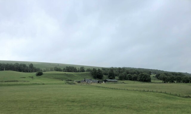
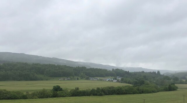
Bruar is a quaint village located in Perthshire, Scotland. Situated on the banks of River Bruar, it is nestled amidst the stunning scenery of the Scottish Highlands. The village is a popular tourist destination, known for its natural beauty and outdoor recreational opportunities.

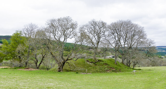
One of the major attractions in Bruar is the Bruar Falls, a picturesque waterfall cascading down the rocky terrain. Visitors can stroll along well-maintained paths that offer stunning views of the falls and the surrounding woodland. The area is also home to a variety of wildlife, including red squirrels and a wide range of bird species, making it a haven for nature enthusiasts and photographers.

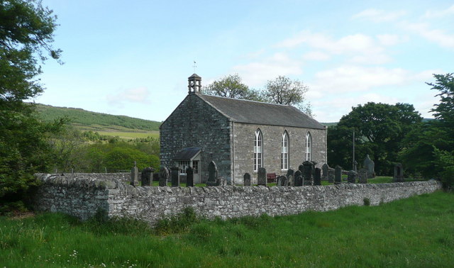
Bruar is renowned for its historic ties as well, with the nearby Blair Castle being a prominent landmark. This grand castle dates back to the 13th century and offers visitors a chance to explore its opulent interiors and extensive grounds. The castle also hosts various events and exhibitions throughout the year, providing a glimpse into Scotland's rich history.

In addition to its natural and historical attractions, Bruar boasts a range of amenities for visitors. The village is home to a selection of charming shops and boutiques, offering a variety of local crafts, traditional Scottish clothing, and gourmet food products. There are also several cafes and restaurants where visitors can sample regional delicacies and enjoy a warm Scottish welcome.

Overall, Bruar is a captivating destination that combines natural beauty, historical significance, and a warm village atmosphere, making it a must-visit location for those exploring Perthshire and the Scottish Highlands.

If you have any feedback on the listing, please let us know in the comments section below.

Bruar Images

Images are sourced within 2km of 56.761611/-3.9318349 or Grid Reference NN8265. Thanks to Geograph Open Source API. All images are credited.

A9, Glen Garry The A9 is a strategic link between the Highlands of Scotland and the Central Belt. It runs 279 miles from junction 5 of the M9 at Polmont to Scrabster. Originally it ran from Edinburgh.
<span class="nowrap"><a title="https://www.sabre-roads.org.uk/wiki/index.php?title=A9" rel="nofollow ugc noopener" href="https://www.sabre-roads.org.uk/wiki/index.php?title=A9">Link</a><img style="margin-left:2px;" alt="External link" title="External link - shift click to open in new window" src="https://s1.geograph.org.uk/img/external.png" width="10" height="10"/></span>
A9, Glen Garry
The A9 is a strategic link between the Highlands of Scotland and the Central Belt. It runs 279 miles from junction 5 of the M9 at Polmont to Scrabster. Originally it ran from Edinburgh. LinkExternal link
A9, northbound The A9 is a strategic link between the Highlands of Scotland and the Central Belt. It runs 279 miles from junction 5 of the M9 at Polmont to Scrabster. Originally it ran from Edinburgh.
<span class="nowrap"><a title="https://www.sabre-roads.org.uk/wiki/index.php?title=A9" rel="nofollow ugc noopener" href="https://www.sabre-roads.org.uk/wiki/index.php?title=A9">Link</a><img style="margin-left:2px;" alt="External link" title="External link - shift click to open in new window" src="https://s1.geograph.org.uk/img/external.png" width="10" height="10"/></span>
A9, northbound
The A9 is a strategic link between the Highlands of Scotland and the Central Belt. It runs 279 miles from junction 5 of the M9 at Polmont to Scrabster. Originally it ran from Edinburgh. LinkExternal link
A9 at the River Garry The A9 is a strategic link between the Highlands of Scotland and the Central Belt. It runs 279 miles from junction 5 of the M9 at Polmont to Scrabster. Originally it ran from Edinburgh.
<span class="nowrap"><a title="https://www.sabre-roads.org.uk/wiki/index.php?title=A9" rel="nofollow ugc noopener" href="https://www.sabre-roads.org.uk/wiki/index.php?title=A9">Link</a><img style="margin-left:2px;" alt="External link" title="External link - shift click to open in new window" src="https://s1.geograph.org.uk/img/external.png" width="10" height="10"/></span>
A9 at the River Garry
The A9 is a strategic link between the Highlands of Scotland and the Central Belt. It runs 279 miles from junction 5 of the M9 at Polmont to Scrabster. Originally it ran from Edinburgh. LinkExternal link
Calvine A9 underpass The other end of the underpass shown in <a title="https://www.geograph.org.uk/photo/2444601" href="https://www.geograph.org.uk/photo/2444601">Link</a>. Perhaps safer than crossing the A9 but the path approaching it is very muddy.
Calvine A9 underpass
The other end of the underpass shown in Link. Perhaps safer than crossing the A9 but the path approaching it is very muddy.
Signage - A9 northbound
Derelict fuel station in Calvine
Pitaldonick Farm in Glen Garry
Old Struan Viewed from the A9. The trees mark the route of the River Garry
Old Struan
Viewed from the A9. The trees mark the route of the River Garry
River Garry at Bruar
Glebe Steading
Glebe Steading
Heathery slopes above Pitagowan
Road and railway routes heading east The B8079 and the twin-tracked railway near to Pitagowan, heading towards Blair Atholl divided by a low rib of grassed ground.
Road and railway routes heading east
The B8079 and the twin-tracked railway near to Pitagowan, heading towards Blair Atholl divided by a low rib of grassed ground.
Footbridge over the Bruar Water The spectacularly located 'Lower Bridge' over the Bruar Water. The stream flows in a rocky gorge where there are waterfalls known collectively as the Falls of Bruar.
Footbridge over the Bruar Water
The spectacularly located 'Lower Bridge' over the Bruar Water. The stream flows in a rocky gorge where there are waterfalls known collectively as the Falls of Bruar.
B847 passing beneath railway bridge The south side of the railway bridge just east of Calvine.
B847 passing beneath railway bridge
The south side of the railway bridge just east of Calvine.
Access road for Kindrochet Lodge Kindrochet Lodge is a large house at Struan on the Atholl estate; it's used by the estate as a holiday let. Here the access road leaves a minor road at Struan and crosses the Errochty Water by the wooden-platformed bridge to enter the woodland ahead on the approach to the property.
Access road for Kindrochet Lodge
Kindrochet Lodge is a large house at Struan on the Atholl estate; it's used by the estate as a holiday let. Here the access road leaves a minor road at Struan and crosses the Errochty Water by the wooden-platformed bridge to enter the woodland ahead on the approach to the property.
Motte at Struan The tree-covered mound is accepted as being a motte or castle mound which would originally have had a building on top and also a surrounding fence of some kind.
Canmore lists the site, naming it as Tom An Tigh Mhoir - <span class="nowrap"><a title="https://canmore.org.uk/site/25807/tom-an-tigh-mhoir-struan" rel="nofollow ugc noopener" href="https://canmore.org.uk/site/25807/tom-an-tigh-mhoir-struan">Link</a><img style="margin-left:2px;" alt="External link" title="External link - shift click to open in new window" src="https://s1.geograph.org.uk/img/external.png" width="10" height="10"/></span> .
Motte at Struan
The tree-covered mound is accepted as being a motte or castle mound which would originally have had a building on top and also a surrounding fence of some kind. Canmore lists the site, naming it as Tom An Tigh Mhoir - LinkExternal link .
Bridge at the Falls of Bruar Stone arch bridge over the Bruar Water. A quiet oasis away from the crowd at the nearby retail park.
Bridge at the Falls of Bruar
Stone arch bridge over the Bruar Water. A quiet oasis away from the crowd at the nearby retail park.
Show me another place!

Bruar is located at Grid Ref: NN8265 (Lat: 56.761611, Lng: -3.9318349)

Unitary Authority: Perth and Kinross

Police Authority: Tayside

What 3 Words

///solutions.kebabs.atlas. Near Blair Atholl, Perth & Kinross

Nearby Locations

Bruar

Related Wikis

Struan, Perthshire

Struan is a small village in Perthshire in Scotland. The name derives from sruthan, the Gaelic for 'Little Stream'. It is 8 km west of Blair Atholl. It...

Calvine

Calvine is a hamlet in Perth and Kinross, Scotland. It is sandwiched between the A9 road, to its north, and the Highland mainline railway and River Garry...

Falls of Bruar

The Falls of Bruar are a series of waterfalls on the Bruar Water in Scotland, about 8 miles (13 kilometres) from Pitlochry in the council area of Perth...

Struan railway station

Struan railway station served the village of Struan, Perthshire, Scotland from 1863 to 1965 on the Inverness and Perth Junction Railway. == History... ==

Nearby Amenities

Located within 500m of 56.761611,-3.9318349
Power: pole
Lat/Long: 56.7652289/-3.92712
Power: pole
Lat/Long: 56.7648415/-3.9279661
Power: pole
Lat/Long: 56.7643838/-3.929007
The data included in this document is from www.openstreetmap.org. The data is made available under ODbL.

Have you been to Bruar?

Leave your review of Bruar below (or comments, questions and feedback).