Pattishall

Civil Parish in Northamptonshire

England

Pattishall

John's Motors, Pattishall
John's Motors, Pattishall Credit: David Howard

Pattishall is a civil parish located in the county of Northamptonshire, England. Situated approximately 12 miles south of Northampton and 10 miles west of Towcester, it covers an area of about 10 square kilometers. The parish is made up of several small villages and hamlets, including Astcote, Dalscote, Eastcote, Fosters Booth, and Pattishall itself.

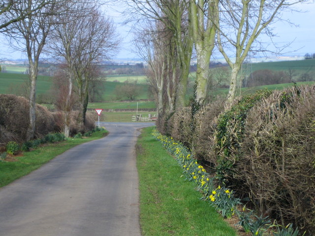
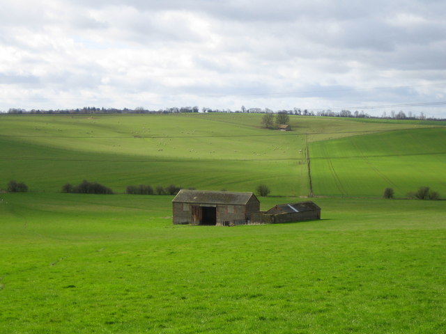
The area is predominantly rural, characterized by rolling countryside and farmland, with pockets of woodland scattered throughout. The River Tove runs through the southern part of the parish, adding to the scenic beauty of the area. Pattishall is known for its picturesque landscape, offering opportunities for outdoor activities such as walking, cycling, and horse riding.

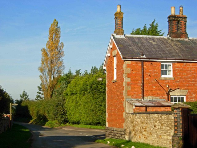
The local economy is largely based on agriculture, with many farms and small agricultural businesses operating in the area. The parish is also home to a number of historic buildings and landmarks, including Pattishall House, a Grade II listed Georgian manor house, and St. Peter's Church, which dates back to the 13th century.

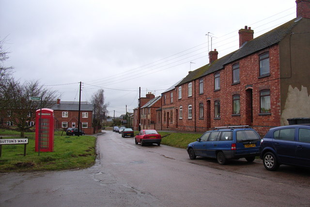
Pattishall has a close-knit community, with a range of amenities and services available to residents. These include a primary school, village hall, pub, and a small number of shops. The parish is well-connected, with good road links to nearby towns and villages, as well as easy access to the M1 motorway.

Overall, Pattishall offers a peaceful and idyllic countryside setting, making it an attractive place to live for those seeking a rural lifestyle within easy reach of urban amenities.

If you have any feedback on the listing, please let us know in the comments section below.
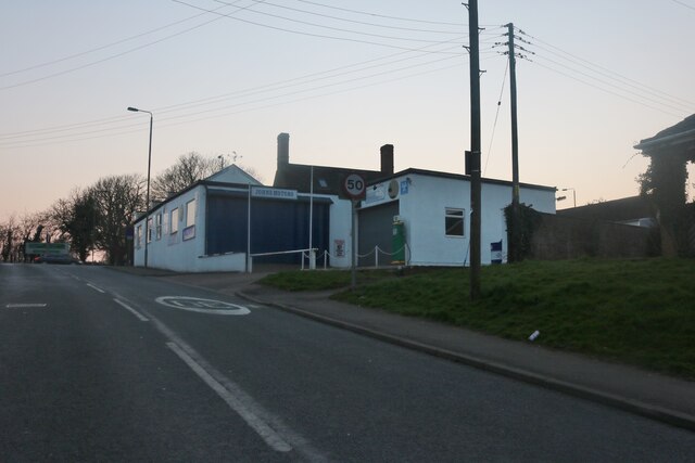
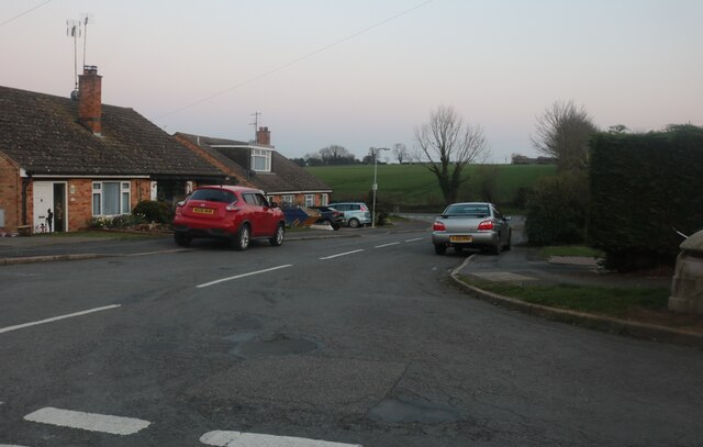
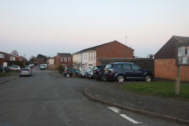
Pattishall Images

Images are sourced within 2km of 52.181331/-1.010536 or Grid Reference SP6754. Thanks to Geograph Open Source API. All images are credited.

John's Motors, Pattishall
Unusual house on Butcher's Lane, Pattishall
Pool Close, Pattishall
Simon's walk, Pattishall
Simon's Walk at the junction of Pool Close
Butchers Lane, Pattishall
St Luke's, Cold Higham
Holy Cross church, Pattishall
Astcote
Astcote
St Luke's, Cold Higham A typical Northamptonshire triangular cap atop the tower.
St Luke's, Cold Higham
A typical Northamptonshire triangular cap atop the tower.
"Wireless Station" north of Potcote Farm Looking NE from the adjacent byway.
"Wireless Station" north of Potcote Farm
Looking NE from the adjacent byway.
Lane to Grimscote The building on the left is Cold Higham Lodge; on the right can just be seen the roof of Grimscote Mill (going by the map). This lane is north of Fosters Booth.
Lane to Grimscote
The building on the left is Cold Higham Lodge; on the right can just be seen the roof of Grimscote Mill (going by the map). This lane is north of Fosters Booth.
Astcote Lodge These buildings in the middle of fields look to have been abandoned - or at least unused for a while. They are near the busy A5 north of an L-shaped wood called Astcote Thorns.
Astcote Lodge
These buildings in the middle of fields look to have been abandoned - or at least unused for a while. They are near the busy A5 north of an L-shaped wood called Astcote Thorns.
A5 near Astcote Taken near the junction with the lane to Astcote, a view roughly NW up the busy A5. The A5 tracks the route of the Roman Watling Street and is therefore composed of long straight sections of road.
A5 near Astcote
Taken near the junction with the lane to Astcote, a view roughly NW up the busy A5. The A5 tracks the route of the Roman Watling Street and is therefore composed of long straight sections of road.
Farmland south of Bugbrooke Typical Northamptonshire Uplands scenery, dissected by valleys which drain into the River Nene.
Farmland south of Bugbrooke
Typical Northamptonshire Uplands scenery, dissected by valleys which drain into the River Nene.
Dalscote Dalscote consists of a few houses to the east of Eastcote. A bridleway leads off to the right towards Gayton.
Dalscote
Dalscote consists of a few houses to the east of Eastcote. A bridleway leads off to the right towards Gayton.
Track to West Farm This unusual concrete track leads off the Dalcote - Tiffield road. A sign warns that the property is protected by closed circuit television and vehicle sensors.
Track to West Farm
This unusual concrete track leads off the Dalcote - Tiffield road. A sign warns that the property is protected by closed circuit television and vehicle sensors.
Signpost between Tiffield and Dalscote Directions to various Northamptonshire villages.
Signpost between Tiffield and Dalscote
Directions to various Northamptonshire villages.
Show me another place!

Pattishall is located at Grid Ref: SP6754 (Lat: 52.181331, Lng: -1.010536)

Unitary Authority: West Northamptonshire

Police Authority: Northamptonshire

What 3 Words

///reforming.symphonic.juniors. Near Bugbrooke, Northamptonshire

Nearby Locations

Pattishall Pattishall

Related Wikis

Eastcote, Northamptonshire

Eastcote is a small village in the shire county of Northamptonshire (Northants), England. It is about 7 miles (11.3 km) south-west of the county town of...

Pattishall

Pattishall, also known in antiquity as Pateshull, is a village and Parish in West Northamptonshire, England. The population of the civil parish (including...

Dalscote

Dalscote is a small village in West Northamptonshire, England. It is north of Towcester and between Gayton and Eastcote. There is a car-body repair workshop...

Astcote

Astcote is a hamlet near the town of Towcester in Northamptonshire, England. It is in the civil parish of Pattishall. The settlement was recorded in the...

Nearby Amenities

Located within 500m of 52.181331,-1.010536
Crossing
Lat/Long: 52.1814403/-1.0175675
Eastcote
Is In Country: United Kingdom
Is In County: Northamptonshire
Is In District: South Northamptonshire
Place: village
Wikidata: Q5329864
Lat/Long: 52.1797057/-1.0069579
Post Box
Brand: Royal Mail
Brand Wikidata: Q638098
Brand Wikipedia: en:Royal Mail
Operator: Royal Mail
Operator Wikidata: Q638098
Ref: NN12 465
Lat/Long: 52.1804883/-1.0069196
Bus Stop
Eastcote
Bus: yes
Public Transport: platform
Lat/Long: 52.18087/-1.0073681
Pub
The Eastcote Arms
Addr City: Towcester
Addr Country: GB
Addr Housenumber: 6
Addr Postcode: NN12 8NG
Addr Street: Gayton Road
Addr Village: Eastcote
Fhrs Authority: West Northamptonshire
Fhrs Id: 1601139
Fhrs Local Authority Id: FR/202300032
Wikidata: Q26292874
Lat/Long: 52.1802714/-1.0070998
Barrier: stile
Lat/Long: 52.1792219/-1.0106005
Power: tower
Lat/Long: 52.1834223/-1.0045401
Barrier: stile
Foot: yes
Lat/Long: 52.1798257/-1.0138132
Barrier: stile
Lat/Long: 52.1791739/-1.0143679
Place: farm
Lat/Long: 52.179192/-1.0087227
The Coach House B&B
Addr City: Towcester
Addr Country: GB
Addr Housename: The Old Stables
Addr Postcode: NN12 8NG
Addr Street: Gayton Road
Addr Village: Eastcote
Fhrs Authority: West Northamptonshire
Fhrs Id: 1541096
Fhrs Local Authority Id: FR/000002041
Tourism: guest_house
Lat/Long: 52.1790076/-1.0068047
Kindergarten
Little Dragons Day Nursery
Addr City: Towcester
Addr Country: GB
Addr Housename: Pattishall C Of E Primary School
Addr Postcode: NN12 8NE
Addr Street: School Road
Addr Village: Astcote
Fhrs Authority: West Northamptonshire
Fhrs Id: 1540860
Fhrs Local Authority Id: FR/000000938
Lat/Long: 52.1793431/-1.013572
Direction: 125
Generator Method: photovoltaic
Generator Output Electricity: yes
Generator Solar Modules: 10
Generator Source: solar
Generator Type: solar_photovoltaic_panel
Location: roof
Power: generator
Lat/Long: 52.1827424/-1.0169672
Direction: 170
Generator Method: photovoltaic
Generator Output Electricity: yes
Generator Solar Modules: 20
Generator Source: solar
Generator Type: solar_photovoltaic_panel
Location: roof
Power: generator
Lat/Long: 52.1805895/-1.0073715
Direction: 125
Generator Method: photovoltaic
Generator Output Electricity: yes
Generator Solar Modules: 4
Generator Source: solar
Generator Type: solar_photovoltaic_panel
Location: roof
Power: generator
Lat/Long: 52.1826737/-1.0170033
Direction: 235
Generator Method: photovoltaic
Generator Output Electricity: yes
Generator Solar Modules: 16
Generator Source: solar
Generator Type: solar_photovoltaic_panel
Location: roof
Power: generator
Lat/Long: 52.1782823/-1.0077661
Direction: 235
Generator Method: photovoltaic
Generator Output Electricity: yes
Generator Solar Modules: 16
Generator Source: solar
Generator Type: solar_photovoltaic_panel
Location: roof
Power: generator
Lat/Long: 52.1781706/-1.0055508
Direction: 235
Generator Method: photovoltaic
Generator Output Electricity: yes
Generator Solar Modules: 8
Generator Source: solar
Generator Type: solar_photovoltaic_panel
Location: roof
Power: generator
Lat/Long: 52.1786655/-1.0064493
Direction: 150
Generator Method: photovoltaic
Generator Output Electricity: yes
Generator Solar Modules: 16
Generator Source: solar
Generator Type: solar_photovoltaic_panel
Location: roof
Power: generator
Lat/Long: 52.1779188/-1.0073183
Direction: WSW
Generator Method: photovoltaic
Generator Output Electricity: yes
Generator Solar Modules: 8
Generator Source: solar
Generator Type: solar_photovoltaic_panel
Location: roof
Power: generator
Lat/Long: 52.181026/-1.0074162
Direction: WSW
Generator Method: photovoltaic
Generator Output Electricity: yes
Generator Solar Modules: 8
Generator Source: solar
Generator Type: solar_photovoltaic_panel
Location: roof
Power: generator
Lat/Long: 52.1809475/-1.0073639
Place Of Worship
Eastcote Chapel
Addr City: Towcester
Addr Country: GB
Addr Street: Gayton Road
Addr Village: Eastcote
Denomination: baptist
Religion: christian
Lat/Long: 52.1796967/-1.0066706
Entrance: main
Lat/Long: 52.177288/-1.0116684
Defibrillator
Defibrillator Location: on side of building around the corner from reception
Emergency: defibrillator
Ref GB The Circuit: CEAB41D7-A517-487C-8255-7442201AC270
Lat/Long: 52.1790997/-1.0135178
The data included in this document is from www.openstreetmap.org. The data is made available under ODbL.

Have you been to Pattishall?

Leave your review of Pattishall below (or comments, questions and feedback).