Owersby

Civil Parish in Lincolnshire West Lindsey

England

Owersby

Moor Road near North Owersby
Moor Road near North Owersby Credit: Steve Fareham

Owersby is a small civil parish located in Lincolnshire, England. It is situated approximately 10 miles east of the city of Lincoln and 6 miles west of the town of Market Rasen. The parish covers an area of around 1,500 acres and is home to a population of just over 100 residents.

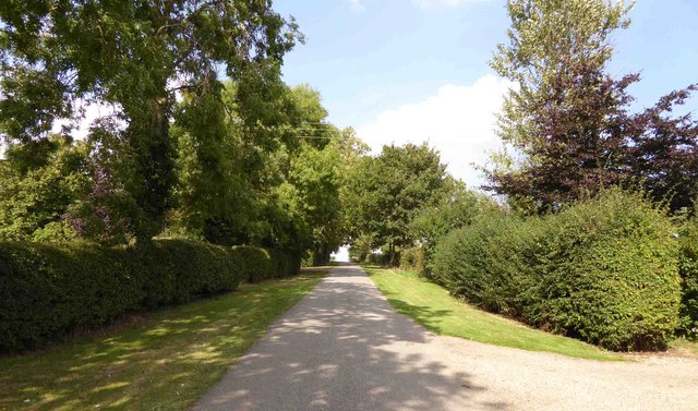
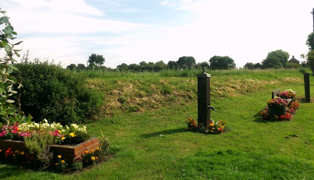
Owersby is a rural village surrounded by farmland, with picturesque countryside and rolling hills in the surrounding area. The parish is known for its quiet and peaceful atmosphere, making it an ideal location for those seeking a tranquil place to live.

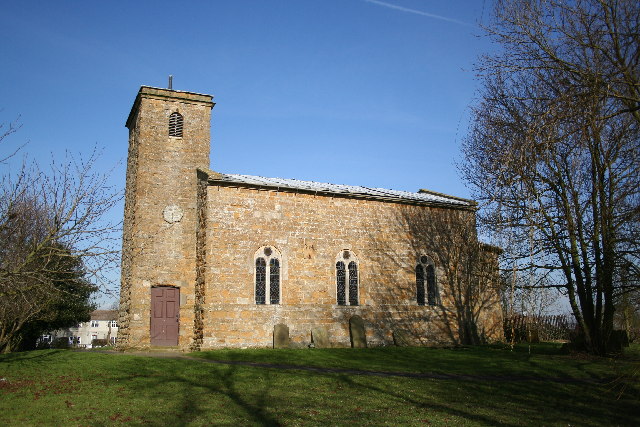
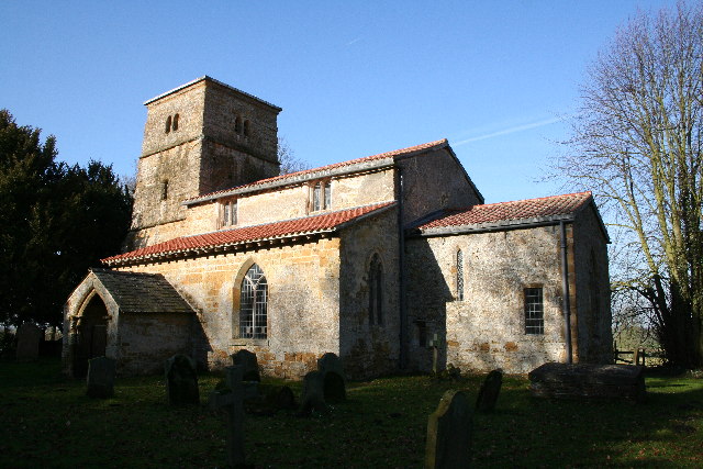
The village itself is small, with a few residential properties, a church, and a village hall. There are no shops or amenities in Owersby, with residents typically travelling to nearby towns for shopping and services.

Overall, Owersby is a charming and quaint village in Lincolnshire, offering a peaceful and idyllic setting for those looking to escape the hustle and bustle of city life.

If you have any feedback on the listing, please let us know in the comments section below.

Owersby Images

Images are sourced within 2km of 53.441787/-0.414546 or Grid Reference TF0595. Thanks to Geograph Open Source API. All images are credited.

Moor Road near North Owersby
North Owersby junction turn right to Brigg
Bridleway and farm road to Fieldhouse Farm
Farm track and stack
Cater Lane
Cater Lane
Cater Lane junction
Cater Lane junction
St Martin's Church
St Martin's Church
Village Green A small patch of ground affectionately known as the village green. On this site are Stocks, Bench and water Pump (not working), a brick made trough and a framed Honeysuckle. A relaxing place to rest after a hike.
Village Green
A small patch of ground affectionately known as the village green. On this site are Stocks, Bench and water Pump (not working), a brick made trough and a framed Honeysuckle. A relaxing place to rest after a hike.
St Martin's Church Pictured on a lovely August afternoon.
St Martin's Church
Pictured on a lovely August afternoon.
Ridge and furrow in Kingerby Beck Nature Reserve: aerial 2019 See also <a href="https://www.geograph.org.uk/photo/6202165">TF0593 : Kingerby Beck Nature Reserve and South Owersby: aerial 2019</a>.
Ridge and furrow in Kingerby Beck Nature Reserve: aerial 2019
Kingerby Beck Nature Reserve and South Owersby: aerial 2019 See also <a href="https://www.geograph.org.uk/photo/6202157">TF0593 : Ridge and furrow in Kingerby Beck Nature Reserve: aerial 2019</a>.
Kingerby Beck Nature Reserve and South Owersby: aerial 2019
St.Martin's church, North Owersby, Lincs. Rebuilt 1762-3 with medieval masonry but still with its Perpendicular font
St.Martin's church, North Owersby, Lincs.
Rebuilt 1762-3 with medieval masonry but still with its Perpendicular font
St.Martin's church, North Owersby
Five Star holiday home ? Even the horse has moved out
Five Star holiday home ?
Even the horse has moved out
Kingerby Beck Meadows Entrance to Kingerby Beck Meadows, a Lincolnshire Wildlife Trust nature reserve
Kingerby Beck Meadows
Entrance to Kingerby Beck Meadows, a Lincolnshire Wildlife Trust nature reserve
All Saints' church, Thornton-le-Moor, Lincs. All Saints' has early 12th century origins, a splendid south door and a rare Norman bellcote ... look carefully around the walls to spot some Norman corbels re-set with later additions. Early English lancet windows in the nave and curious clerestorey of tiny quatrefoils.
All Saints' church, Thornton-le-Moor, Lincs.
All Saints' has early 12th century origins, a splendid south door and a rare Norman bellcote ... look carefully around the walls to spot some Norman corbels re-set with later additions. Early English lancet windows in the nave and curious clerestorey of tiny quatrefoils.
Fields and Big White Ball The fields are just east of Thornton le Moor but the big white ball is over 7km away, <a title="https://www.geograph.org.uk/gridref/TF1296" href="https://www.geograph.org.uk/gridref/TF1296">Link</a>.
Fields and Big White Ball
The fields are just east of Thornton le Moor but the big white ball is over 7km away, Link.
Bridleway and Bricks This bridleway leads to Owersby Moor.  The bricks will lead to a good deal of hard work for someone.
Bridleway and Bricks
This bridleway leads to Owersby Moor. The bricks will lead to a good deal of hard work for someone.
Show me another place!

Owersby is located at Grid Ref: TF0595 (Lat: 53.441787, Lng: -0.414546)

Administrative County: Lincolnshire

District: West Lindsey

Police Authority: Lincolnshire

What 3 Words

///technical.outdoor.spared. Near Middle Rasen, Lincolnshire

Nearby Locations

Owersby

Related Wikis

Owersby

Owersby is a civil parish in the West Lindsey district of Lincolnshire, England, situated about 6 miles (10 km) north-west from the market town of Market...

North Owersby

North Owersby is a village and former civil parish, now in the parish of Owersby, in the West Lindsey district of Lincolnshire, England, and about 6 miles...

Thornton le Moor, Lincolnshire

Thornton le Moor is a village in the civil parish of Owersby, in the West Lindsey district of Lincolnshire, England, situated approximately 5 miles (8...

St Peter's Church, Kingerby

St Peter's Church is a redundant Anglican church in Kingerby, Lincolnshire, England. It is recorded in the National Heritage List for England as a designated...

Nearby Amenities

Located within 500m of 53.441787,-0.414546
Power: pole
Lat/Long: 53.4385051/-0.4114838
Power: pole
Lat/Long: 53.4391492/-0.4123721
Power: pole
Lat/Long: 53.4397813/-0.4132461
Power: pole
Lat/Long: 53.4403939/-0.4141445
Power: pole
Lat/Long: 53.4410961/-0.4151222
Power: pole
Lat/Long: 53.4418601/-0.4155979
Power: pole
Lat/Long: 53.4425526/-0.4159983
Power: pole
Lat/Long: 53.4429522/-0.4159264
Power: pole
Lat/Long: 53.4431183/-0.4147055
Power: pole
Lat/Long: 53.4432524/-0.4163764
Power: pole
Lat/Long: 53.4432895/-0.4134924
Power: pole
Lat/Long: 53.4434573/-0.4122937
Power: pole
Lat/Long: 53.4436405/-0.4110777
Power: pole
Lat/Long: 53.4438118/-0.4098991
Power: pole
Lat/Long: 53.4454058/-0.4190336
Power: pole
Lat/Long: 53.4454875/-0.4178086
Power: pole
Lat/Long: 53.4447382/-0.4173276
The data included in this document is from www.openstreetmap.org. The data is made available under ODbL.

Have you been to Owersby?

Leave your review of Owersby below (or comments, questions and feedback).