Over

Civil Parish in Cambridgeshire South Cambridgeshire

England

Over

Over, St Mary <span class="nowrap"><a title="http://www.druidic.org/camchurch/churches/over.htm" rel="nofollow ugc noopener" href="http://www.druidic.org/camchurch/churches/over.htm">Link</a><img style="margin-left:2px;" alt="External link" title="External link - shift click to open in new window" src="https://s1.geograph.org.uk/img/external.png" width="10" height="10"/></span>
Over, St Mary Credit: mym

Over is a civil parish located in the county of Cambridgeshire, England. It is situated approximately 7 miles northwest of the city of Cambridge, making it a popular residential area for those who work in the city. The parish covers an area of around 4 square miles and is home to a population of approximately 2,500 people.

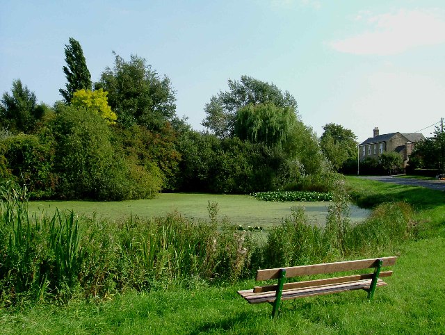
The village of Over is known for its charming rural setting, with picturesque countryside and open green spaces surrounding the area. It has a rich history, dating back to the Roman times, and some archaeological remains have been found in the vicinity. The village itself features a mix of traditional and modern architecture, with a range of period cottages, farmhouses, and more contemporary housing developments.

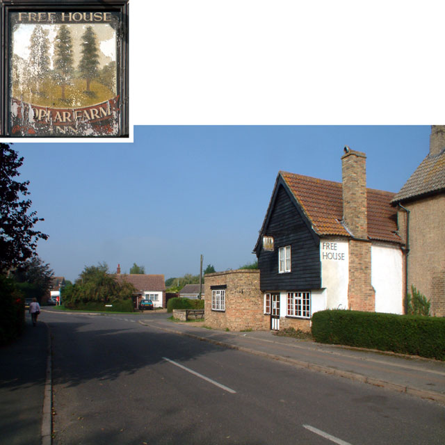
Over has a strong sense of community, with several local amenities and facilities available to its residents. These include a primary school, a community center, a village hall, and a number of shops, pubs, and restaurants. The village also has a local sports ground, which hosts various sporting events and activities throughout the year.

Transport links in Over are convenient, with regular bus services connecting the village to nearby towns and cities, including Cambridge. The village is also well-connected by road, with the A14 and A428 highways passing nearby, providing easy access to other parts of Cambridgeshire and beyond.

Overall, Over offers a peaceful and attractive living environment, with its idyllic countryside setting, strong community spirit, and convenient access to nearby urban areas.

If you have any feedback on the listing, please let us know in the comments section below.

Over Images

Images are sourced within 2km of 52.321801/0.025351 or Grid Reference TL3871. Thanks to Geograph Open Source API. All images are credited.

Over, St Mary <span class="nowrap"><a title="http://www.druidic.org/camchurch/churches/over.htm" rel="nofollow ugc noopener" href="http://www.druidic.org/camchurch/churches/over.htm">Link</a><img style="margin-left:2px;" alt="External link" title="External link - shift click to open in new window" src="https://s1.geograph.org.uk/img/external.png" width="10" height="10"/></span>
Over, St Mary
“At Over They Fling Oaths at One” These days oaths are only likely to be thrown at you for fishing in the local pond shown here. There is a prominently displayed by-law, “Fishing in this pond is only permitted for Over residents under the age of eleven years”. For an explanation of the title see <span class="nowrap"><a title="http://www.poetsgraves.co.uk/Classic%20Poems/Brooke/grantchester.htm" rel="nofollow ugc noopener" href="http://www.poetsgraves.co.uk/Classic%20Poems/Brooke/grantchester.htm">Link</a><img style="margin-left:2px;" alt="External link" title="External link - shift click to open in new window" src="https://s1.geograph.org.uk/img/external.png" width="10" height="10"/></span>
“At Over They Fling Oaths at One”
These days oaths are only likely to be thrown at you for fishing in the local pond shown here. There is a prominently displayed by-law, “Fishing in this pond is only permitted for Over residents under the age of eleven years”. For an explanation of the title see LinkExternal link
Road towards Over, Willingham CB4 Looking west, in the direction of Over. I'm unsure whether, at this point, it is "Over Road" or "Willingham Road".
Road towards Over, Willingham CB4
Looking west, in the direction of Over. I'm unsure whether, at this point, it is "Over Road" or "Willingham Road".
Willingham Road, Over CB4 Looking west, towards Over.
Willingham Road, Over CB4
Looking west, towards Over.
Over High Street CB24 looking west
Over High Street CB24
looking west
Poplar Farm Free House, Over CB4 Poplar Farm Free House, in The Lanes, is open only in the evenings, except Tuesdays (closed all day) and Sundays (open 12 noon - 3pm).
Poplar Farm Free House, Over CB4
Poplar Farm Free House, in The Lanes, is open only in the evenings, except Tuesdays (closed all day) and Sundays (open 12 noon - 3pm).
Taking a break next to the Greenwich Meridian Line marker on Ouse Valley Way
Brownshill Lock and Staunch Hadn't come across this use of the verb 'to staunch' but the meaning is clear - the flow of the River Great Ouse is controlled here by the staunch and boats travel through the lock.
Brownshill Lock and Staunch
Hadn't come across this use of the verb 'to staunch' but the meaning is clear - the flow of the River Great Ouse is controlled here by the staunch and boats travel through the lock.
The lock at Brownshill Lock and Staunch
The former end of Lowburyholme Rd Copper Beech tree in Mel's yard.
The former end of Lowburyholme Rd
Copper Beech tree in Mel's yard.
Gravel works beyond
Gravel works beyond
Yellow path You will be yellow if you go there.
Yellow path
You will be yellow if you go there.
Needingworth gravel Pit/Ouse Fen Nature Reserve This area is being excavated by Hanson Aggregates for gravel but rather than return the land to arable fields (as was originally proposed) the land is being taken over by the RSPB to recreate fenland habitat - most fenland recreation requires water levels to be raised (which means a whole drainage unit is needed, so neighbouring fields aren't flooded) but here the land level is being lowered by the gravel extraction. The site should be 700 hectares of wetland by the end of the project.
Needingworth gravel Pit/Ouse Fen Nature Reserve
This area is being excavated by Hanson Aggregates for gravel but rather than return the land to arable fields (as was originally proposed) the land is being taken over by the RSPB to recreate fenland habitat - most fenland recreation requires water levels to be raised (which means a whole drainage unit is needed, so neighbouring fields aren't flooded) but here the land level is being lowered by the gravel extraction. The site should be 700 hectares of wetland by the end of the project.
Peas are yonder to the right Peas in April?
Peas are yonder to the right
Peas in April?
Yes peas! I have some peas 3 times as big in my garden.  I didn't know better being from California.
Yes peas!
I have some peas 3 times as big in my garden. I didn't know better being from California.
Fenland field boundary Looking along the line of a bridleway (on the map) which seems, like the sign, to have disappeared.
Fenland field boundary
Looking along the line of a bridleway (on the map) which seems, like the sign, to have disappeared.
Tredon Farm, Willingham
Water tower and Hill Farm, over a hedge There's a tall hawthorn hedge between Gravel Bridge Road and Hill Farm.  This picture was taken at a slight gap in the hedge, with the camera held over my head.
Water tower and Hill Farm, over a hedge
There's a tall hawthorn hedge between Gravel Bridge Road and Hill Farm. This picture was taken at a slight gap in the hedge, with the camera held over my head.
Show me another place!

Over is located at Grid Ref: TL3871 (Lat: 52.321801, Lng: 0.025351)

Administrative County: Cambridgeshire

District: South Cambridgeshire

Police Authority: Cambridgeshire

What 3 Words

///carriage.unloaded.booth. Near Over, Cambridgeshire

Nearby Locations

Bare Fen Over

Related Wikis

Over, Cambridgeshire

Over is a large village near the River Great Ouse in the English county of Cambridgeshire, just east of the prime meridian. The parish covers an area of...

New Bedford River

The New Bedford River, also known as the Hundred Foot Drain because of the distance between the tops of the two embankments on either side of the river...

Mare Fen

Mare Fen is a 16.3 hectare Local Nature Reserve north of Swavesey in Cambridgeshire, England. It is owned by Cambridgeshire County Council, and was formerly...

Cambridgeshire

Cambridgeshire (abbreviated Cambs.) or the County of Cambridge is a ceremonial county and historic county in the East of England and East Anglia. It is...

Nearby Amenities

Located within 500m of 52.321801,0.025351
Access: no
Barrier: kissing_gate
Foot: designated
Lat/Long: 52.3202864/0.0303548
Access: no
Barrier: kissing_gate
Foot: designated
Lat/Long: 52.3196951/0.0297521
Access: no
Barrier: kissing_gate
Foot: designated
Lat/Long: 52.320143/0.0317492
Access: no
Barrier: kissing_gate
Foot: designated
Lat/Long: 52.3207379/0.0307586
Bare Fen
Place: locality
Lat/Long: 52.3247347/0.0301785
Hawcrofts
Place: locality
Lat/Long: 52.3224396/0.0208229
The data included in this document is from www.openstreetmap.org. The data is made available under ODbL.

Have you been to Over?

Leave your review of Over below (or comments, questions and feedback).