Osmotherley

Civil Parish in Yorkshire Hambleton

England

Osmotherley

Track and skeletal tree Track at Foxton, once part of a medieval route from Thirsk to Yarm, long before the A19 was even thought of.
Track and skeletal tree Credit: Gordon Hatton

Osmotherley is a civil parish located in the Hambleton district of North Yorkshire, England. Situated on the western edge of the North York Moors National Park, it is a picturesque village that offers stunning natural beauty and a rich historical heritage.

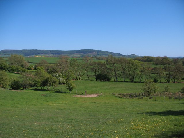
The village itself is nestled in a valley, surrounded by rolling hills and expansive moorland. It is renowned for its charming stone-built houses, many of which date back to the 18th and 19th centuries, giving it a quaint and traditional atmosphere. The village also features a picturesque church, St. Peter's, which dates back to the Norman era and is a popular attraction for visitors.

Osmotherley is a popular destination for outdoor enthusiasts, with numerous walking and cycling trails crisscrossing the surrounding countryside. The Cleveland Way, a long-distance footpath, passes through the village, offering breathtaking views of the surrounding landscape. The nearby Cod Beck Reservoir is a haven for birdwatching and fishing, while the nearby Wainwright's Coast to Coast Walk attracts hikers from around the world.

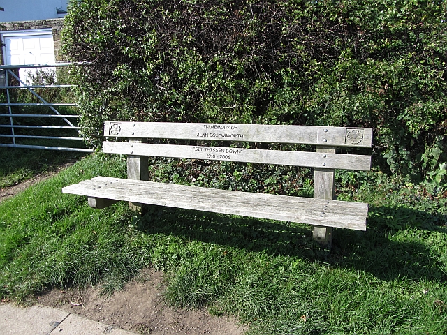
The village is also known for its vibrant community spirit, with a range of amenities and activities available to residents and visitors alike. There are several charming pubs and tearooms where visitors can enjoy traditional Yorkshire fare, and the village hosts a variety of events throughout the year, including a popular village fair.

In conclusion, Osmotherley is a picturesque village in Yorkshire that offers a blend of natural beauty, historical charm, and a vibrant community spirit. It is a must-visit destination for those seeking to explore the stunning countryside of the North York Moors.

If you have any feedback on the listing, please let us know in the comments section below.

Osmotherley Images

Images are sourced within 2km of 54.371811/-1.327718 or Grid Reference SE4397. Thanks to Geograph Open Source API. All images are credited.

Track and skeletal tree Track at Foxton, once part of a medieval route from Thirsk to Yarm, long before the A19 was even thought of.
Track and skeletal tree
Track at Foxton, once part of a medieval route from Thirsk to Yarm, long before the A19 was even thought of.
Crossing Howl Beck The point at which the lane crosses Howl Beck. To the right is a concrete footbridge typical of the type erected by the North Riding in the fifties and sixties.
Crossing Howl Beck
The point at which the lane crosses Howl Beck. To the right is a concrete footbridge typical of the type erected by the North Riding in the fifties and sixties.
Crossing Cod Beck At this point an ancient lane crosses Cod Beck by a ford, but walkers can stay dry shod by using the footbridge a few metres downstream.
Crossing Cod Beck
At this point an ancient lane crosses Cod Beck by a ford, but walkers can stay dry shod by using the footbridge a few metres downstream.
Across the valley of Cod Beck Looking south east across the valley of Cod beck towards the edge of the hills above Over Silton. The photo is taken from the line of a footpath heading for Beech Hill, but this cannot be recommended due to access problems further on.
Across the valley of Cod Beck
Looking south east across the valley of Cod beck towards the edge of the hills above Over Silton. The photo is taken from the line of a footpath heading for Beech Hill, but this cannot be recommended due to access problems further on.
Mount Grace Priory - the manor house from the gardens
The tower of Mount Grace Priory from the gardens The point from which this picture was taken is some tens of yards to the west of the original monastic compound.
The tower of Mount Grace Priory from the gardens
The point from which this picture was taken is some tens of yards to the west of the original monastic compound.
West End, Osmotherley in 1984 The house nearest to the camera, on the left, is The Old Police House while on the right is the tower of St Peter's church
West End, Osmotherley in 1984
The house nearest to the camera, on the left, is The Old Police House while on the right is the tower of St Peter's church
West End, Osmotherley in 1984 My Renault 4GTL is seen parked outside The Golden Lion public house
West End, Osmotherley in 1984
My Renault 4GTL is seen parked outside The Golden Lion public house
North End, Osmotherley An uphill view past a cafe.
North End, Osmotherley
An uphill view past a cafe.
Bench, Quarry Lane In memory of Alan Bosomworth.  A bench on Quarry Lane, above Osmotherley.
Bench, Quarry Lane
In memory of Alan Bosomworth. A bench on Quarry Lane, above Osmotherley.
Ruebury Lane, Osmotherley A loose surfaced residential street above the village with big views. The lane is used by the Cleveland Way.
Ruebury Lane, Osmotherley
A loose surfaced residential street above the village with big views. The lane is used by the Cleveland Way.
Old railway wagon, Chapel Wood Farm Beeching surplus stock put to use as an agricultural building. The road is used by the Cleveland Way.
Old railway wagon, Chapel Wood Farm
Beeching surplus stock put to use as an agricultural building. The road is used by the Cleveland Way.
Path, Chapel Wood Farm A path used by the Cleveland Way, which used to be advertised on television!  Those were the days - backpacking trips promoted in the advertising breaks.
Path, Chapel Wood Farm
A path used by the Cleveland Way, which used to be advertised on television! Those were the days - backpacking trips promoted in the advertising breaks.
Sheep by Stony Lane In the distance is Rueberry Hill.
Sheep by Stony Lane
In the distance is Rueberry Hill.
Stony Lane A quiet single track lane forming a marked contrast with the A19 dual carriageway at its far end.
Stony Lane
A quiet single track lane forming a marked contrast with the A19 dual carriageway at its far end.
A19 - 1/4 mile to A172 exit This should have been my turning, but feeling certain that a place as big as Guisborough would be on the sign, the turning was overshot.
A19 - 1/4 mile to A172 exit
This should have been my turning, but feeling certain that a place as big as Guisborough would be on the sign, the turning was overshot.
A19 - Tyne Tunnel 48 The brown sign directs to Mount Grace Priory, an ancient monument.
A19 - Tyne Tunnel 48
The brown sign directs to Mount Grace Priory, an ancient monument.
A19 - exit to A684 The A684 passes under the A19 just ahead of the lorry.
A19 - exit to A684
The A684 passes under the A19 just ahead of the lorry.
Show me another place!

Osmotherley is located at Grid Ref: SE4397 (Lat: 54.371811, Lng: -1.327718)

Division: North Riding

Administrative County: North Yorkshire

District: Hambleton

Police Authority: North Yorkshire

What 3 Words

///slack.nuns.sketching. Near Brompton, North Yorkshire

Nearby Locations

Sandpit Hill Osmotherley

Related Wikis

Ellerbeck

Ellerbeck is a small village and civil parish in North Yorkshire, England. The population of the parish was estimated at 50 in 2011 and 2011. As the population...
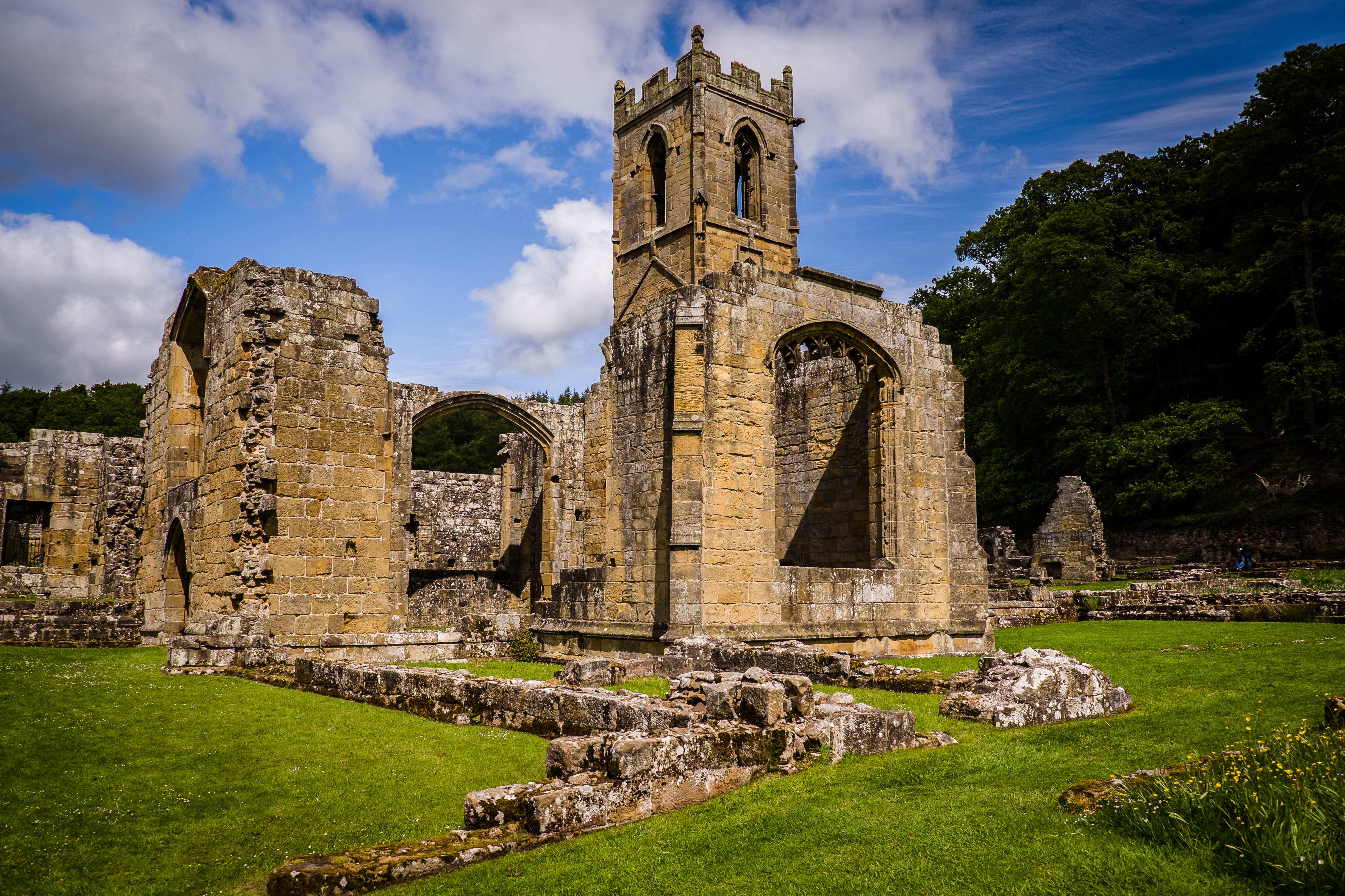
Mount Grace Priory

Mount Grace Priory is a monastery in the parish of East Harlsey, North Yorkshire, England. Set in woodlands within the North York Moors National Park,...

Osmotherley Friends Meeting House

Osmotherley Friends Meeting House is a Friends Meeting House of the Religious Society of Friends (Quakers), situated in the village of Osmotherley in North...

The Shrine of Our Lady of Mount Grace

The Shrine of Our Lady of Mount Grace is a place of Marian devotion and pilgrimage sited in the North Yorkshire village of Osmotherley. Christians have...

Nearby Amenities

Located within 500m of 54.371811,-1.327718
Power: tower
Lat/Long: 54.3691265/-1.3318931
Power: tower
Lat/Long: 54.3721292/-1.3317847
Power: tower
Lat/Long: 54.3748394/-1.3316869
Motorway Junction
Osmotherley Interchange
Lat/Long: 54.372441/-1.3206512
Power: pole
Lat/Long: 54.3697039/-1.3213031
Power: pole
Lat/Long: 54.3696024/-1.3221024
Power: pole
Lat/Long: 54.3689586/-1.3266823
Power: pole
Lat/Long: 54.3686086/-1.328541
Power: pole
Lat/Long: 54.3683257/-1.3301235
The data included in this document is from www.openstreetmap.org. The data is made available under ODbL.

Have you been to Osmotherley?

Leave your review of Osmotherley below (or comments, questions and feedback).