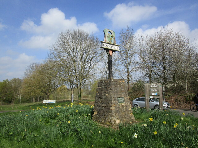
Orton Longueville

Civil Parish in Huntingdonshire

England

Orton Longueville

Vetchfield, road
Vetchfield, road Credit: Alex McGregor

Orton Longueville is a civil parish located in the county of Huntingdonshire, in the eastern region of England. It is situated approximately two miles south of the town of Peterborough, and covers an area of around 1,200 acres.

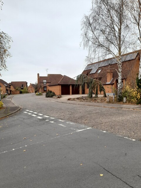
The parish is primarily known for its picturesque village, which is surrounded by beautiful open countryside. It has a population of approximately 1,200 residents, according to the latest census data. The village features a mix of traditional stone cottages and more modern houses, giving it a charming and diverse character.

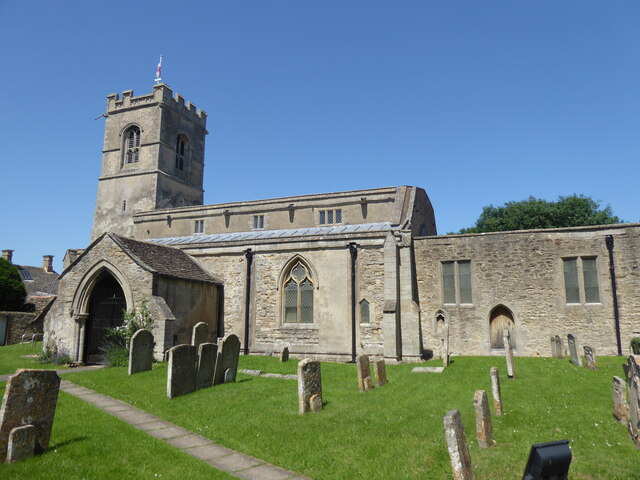
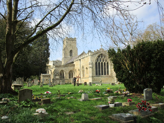
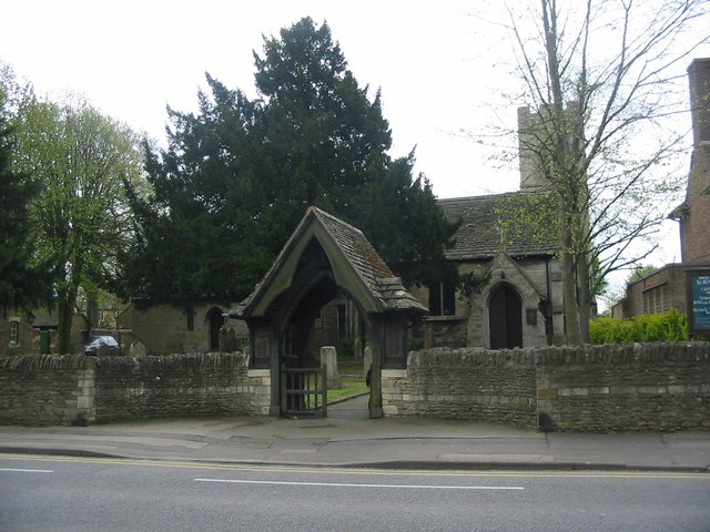
One of the notable landmarks in Orton Longueville is the All Saints' Church, a historic building dating back to the 13th century. The church is known for its beautiful stained glass windows and intricate architectural details.

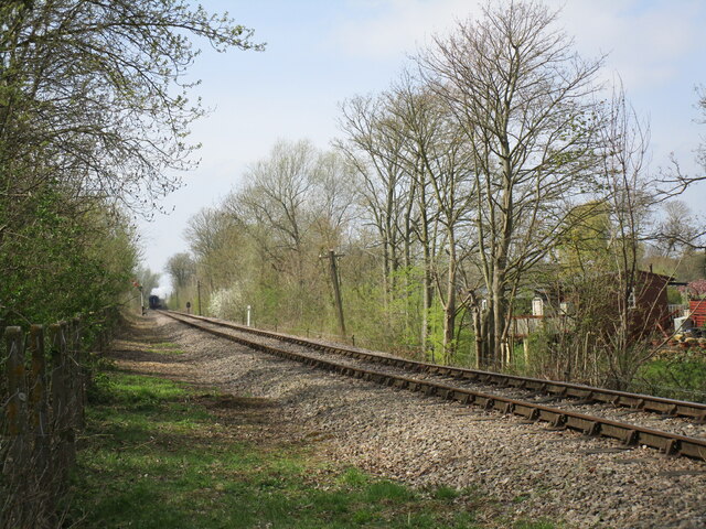
The village is well-connected to the surrounding areas, with good transport links to Peterborough and other nearby towns. There are also several bus routes that serve the area, providing easy access to amenities and facilities.

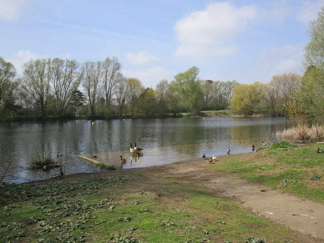
Orton Longueville offers a range of amenities to its residents, including a primary school, a community center, and a small selection of shops and pubs. The village is also home to several parks and green spaces, providing opportunities for outdoor activities and leisure.

Overall, Orton Longueville is a peaceful and picturesque civil parish that offers a mix of historical charm and modern amenities. It is a desirable place to live for those seeking a quieter and more rural lifestyle, while still being within easy reach of nearby towns and cities.

If you have any feedback on the listing, please let us know in the comments section below.

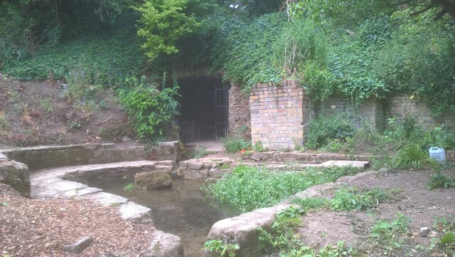
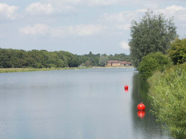
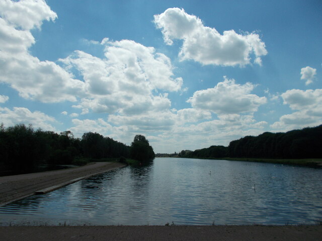
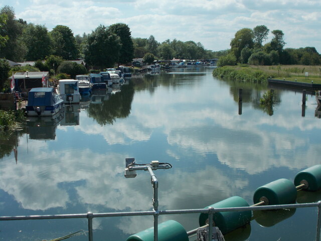
Orton Longueville Images

Images are sourced within 2km of 52.553125/-0.275197 or Grid Reference TL1796. Thanks to Geograph Open Source API. All images are credited.

Vetchfield, road
Vetchfield, road
Orton Waterville, St Mary
Holywell Ponds, Longthorpe Holywell Ponds, located in the Longthorpe area of Peterborough, are a series of eight medieval ponds which formerly belonged to and provided a source of fresh fish for the Thorpe Hall estate. They are situated in a 3.5-hectare area of land which was designated as a nature reserve in 1992.
The ponds themselves are fed by a natural spring at one corner of the site. The grotto from which the spring emanates was reputedly home to a holy hermit (possibly St. Botolph, to whom the local church is dedicated), hence the name "Holywell". The spring water is reputed to have healing qualities owing to the high level of Total Dissolved Solids (TDS), which were measured at 550 milligrams per litre.
Commencing in September 2020, a team of local volunteers began establishing a wildflower meadow in the area around the spring.

Sources: <span class="nowrap"><a title="https://www.visitpeterborough.com/things-to-do/holywell-ponds-p874501#:~:text=The%20site%20of%20Holywell%20Ponds,constant%20supply%20of%20fresh%20fish" rel="nofollow ugc noopener" href="https://www.visitpeterborough.com/things-to-do/holywell-ponds-p874501#:~:text=The%20site%20of%20Holywell%20Ponds,constant%20supply%20of%20fresh%20fish">Link</a><img style="margin-left:2px;" alt="External link" title="External link - shift click to open in new window" src="https://s1.geograph.org.uk/img/external.png" width="10" height="10"/></span>
<span class="nowrap"><a title="https://www.cambridge-news.co.uk/news/local-news/historic-local-ponds-transformed-idyllic-23335581" rel="nofollow ugc noopener" href="https://www.cambridge-news.co.uk/news/local-news/historic-local-ponds-transformed-idyllic-23335581">Link</a><img style="margin-left:2px;" alt="External link" title="External link - shift click to open in new window" src="https://s1.geograph.org.uk/img/external.png" width="10" height="10"/></span>
<span class="nowrap"><a title="https://findaspring.com/spring/locations/europe/holy-well-mineral-spring-peterborough-cambridgeshire-england/" rel="nofollow ugc noopener" href="https://findaspring.com/spring/locations/europe/holy-well-mineral-spring-peterborough-cambridgeshire-england/">Link</a><img style="margin-left:2px;" alt="External link" title="External link - shift click to open in new window" src="https://s1.geograph.org.uk/img/external.png" width="10" height="10"/></span>
Holywell Ponds, Longthorpe
Holywell Ponds, located in the Longthorpe area of Peterborough, are a series of eight medieval ponds which formerly belonged to and provided a source of fresh fish for the Thorpe Hall estate. They are situated in a 3.5-hectare area of land which was designated as a nature reserve in 1992. The ponds themselves are fed by a natural spring at one corner of the site. The grotto from which the spring emanates was reputedly home to a holy hermit (possibly St. Botolph, to whom the local church is dedicated), hence the name "Holywell". The spring water is reputed to have healing qualities owing to the high level of Total Dissolved Solids (TDS), which were measured at 550 milligrams per litre. Commencing in September 2020, a team of local volunteers began establishing a wildflower meadow in the area around the spring. Sources: LinkExternal link LinkExternal link LinkExternal link
Holywell Ponds, Longthorpe Holywell Ponds, located in the Longthorpe area of Peterborough, are a series of eight medieval ponds which formerly belonged to and provided a source of fresh fish for the Thorpe Hall estate. They are situated in a 3.5-hectare area of land which was designated as a nature reserve in 1992.
The ponds themselves are fed by a natural spring at one corner of the site. The grotto from which the spring emanates was reputedly home to a holy hermit (possibly St. Botolph, to whom the local church is dedicated), hence the name "Holywell". The spring water is reputed to have healing qualities owing to the high level of Total Dissolved Solids (TDS), which were measured at 550 milligrams per litre.
Commencing in September 2020, a team of local volunteers began establishing a wildflower meadow in the area around the spring.

Sources: <span class="nowrap"><a title="https://www.visitpeterborough.com/things-to-do/holywell-ponds-p874501#:~:text=The%20site%20of%20Holywell%20Ponds,constant%20supply%20of%20fresh%20fish" rel="nofollow ugc noopener" href="https://www.visitpeterborough.com/things-to-do/holywell-ponds-p874501#:~:text=The%20site%20of%20Holywell%20Ponds,constant%20supply%20of%20fresh%20fish">Link</a><img style="margin-left:2px;" alt="External link" title="External link - shift click to open in new window" src="https://s1.geograph.org.uk/img/external.png" width="10" height="10"/></span> 
<span class="nowrap"><a title="https://www.cambridge-news.co.uk/news/local-news/historic-local-ponds-transformed-idyllic-23335581" rel="nofollow ugc noopener" href="https://www.cambridge-news.co.uk/news/local-news/historic-local-ponds-transformed-idyllic-23335581">Link</a><img style="margin-left:2px;" alt="External link" title="External link - shift click to open in new window" src="https://s1.geograph.org.uk/img/external.png" width="10" height="10"/></span>
<span class="nowrap"><a title="https://findaspring.com/spring/locations/europe/holy-well-mineral-spring-peterborough-cambridgeshire-england/" rel="nofollow ugc noopener" href="https://findaspring.com/spring/locations/europe/holy-well-mineral-spring-peterborough-cambridgeshire-england/">Link</a><img style="margin-left:2px;" alt="External link" title="External link - shift click to open in new window" src="https://s1.geograph.org.uk/img/external.png" width="10" height="10"/></span>
Holywell Ponds, Longthorpe
Holywell Ponds, located in the Longthorpe area of Peterborough, are a series of eight medieval ponds which formerly belonged to and provided a source of fresh fish for the Thorpe Hall estate. They are situated in a 3.5-hectare area of land which was designated as a nature reserve in 1992. The ponds themselves are fed by a natural spring at one corner of the site. The grotto from which the spring emanates was reputedly home to a holy hermit (possibly St. Botolph, to whom the local church is dedicated), hence the name "Holywell". The spring water is reputed to have healing qualities owing to the high level of Total Dissolved Solids (TDS), which were measured at 550 milligrams per litre. Commencing in September 2020, a team of local volunteers began establishing a wildflower meadow in the area around the spring. Sources: LinkExternal link LinkExternal link LinkExternal link
Mineral water spring at Holywell Ponds, Longthorpe Holywell Ponds, located in the Longthorpe area of Peterborough, are a series of eight medieval ponds which formerly belonged to and provided a source of fresh fish for the Thorpe Hall estate. They are situated in a 3.5-hectare area of land which was designated as a nature reserve in 1992.
The ponds themselves are fed by a natural spring at one corner of the site. The grotto from which the spring emanates was reputedly home to a holy hermit (possibly St. Botolph, to whom the local church is dedicated), hence the name "Holywell". The spring water is reputed to have healing qualities owing to the high level of Total Dissolved Solids (TDS), which were measured at 550 milligrams per litre.
Commencing in September 2020, a team of local volunteers began establishing a wildflower meadow in the area around the spring.

Sources: <span class="nowrap"><a title="https://www.visitpeterborough.com/things-to-do/holywell-ponds-p874501#:~:text=The%20site%20of%20Holywell%20Ponds,constant%20supply%20of%20fresh%20fish" rel="nofollow ugc noopener" href="https://www.visitpeterborough.com/things-to-do/holywell-ponds-p874501#:~:text=The%20site%20of%20Holywell%20Ponds,constant%20supply%20of%20fresh%20fish">Link</a><img style="margin-left:2px;" alt="External link" title="External link - shift click to open in new window" src="https://s1.geograph.org.uk/img/external.png" width="10" height="10"/></span> 
<span class="nowrap"><a title="https://www.cambridge-news.co.uk/news/local-news/historic-local-ponds-transformed-idyllic-23335581" rel="nofollow ugc noopener" href="https://www.cambridge-news.co.uk/news/local-news/historic-local-ponds-transformed-idyllic-23335581">Link</a><img style="margin-left:2px;" alt="External link" title="External link - shift click to open in new window" src="https://s1.geograph.org.uk/img/external.png" width="10" height="10"/></span>
<span class="nowrap"><a title="https://findaspring.com/spring/locations/europe/holy-well-mineral-spring-peterborough-cambridgeshire-england/" rel="nofollow ugc noopener" href="https://findaspring.com/spring/locations/europe/holy-well-mineral-spring-peterborough-cambridgeshire-england/">Link</a><img style="margin-left:2px;" alt="External link" title="External link - shift click to open in new window" src="https://s1.geograph.org.uk/img/external.png" width="10" height="10"/></span>
Mineral water spring at Holywell Ponds, Longthorpe
Holywell Ponds, located in the Longthorpe area of Peterborough, are a series of eight medieval ponds which formerly belonged to and provided a source of fresh fish for the Thorpe Hall estate. They are situated in a 3.5-hectare area of land which was designated as a nature reserve in 1992. The ponds themselves are fed by a natural spring at one corner of the site. The grotto from which the spring emanates was reputedly home to a holy hermit (possibly St. Botolph, to whom the local church is dedicated), hence the name "Holywell". The spring water is reputed to have healing qualities owing to the high level of Total Dissolved Solids (TDS), which were measured at 550 milligrams per litre. Commencing in September 2020, a team of local volunteers began establishing a wildflower meadow in the area around the spring. Sources: LinkExternal link LinkExternal link LinkExternal link
Holywell Ponds, Longthorpe Holywell Ponds, located in the Longthorpe area of Peterborough, are a series of eight medieval ponds which formerly belonged to and provided a source of fresh fish for the Thorpe Hall estate. They are situated in a 3.5 hectare area of land which was designated as a nature reserve in 1992.
The ponds themselves are fed by a natural spring at one corner of the site. The grotto from which the spring emanates was reputedly home to a holy hermit (possibly St. Botolph, to whom the local church is dedicated), hence the name "Holywell". The spring water is reputed to have healing qualities owing to the high level of Total Dissolved Solids (TDS), which were measured at 550 milligrams per litre.
Commencing in September 2020, a team of local volunteers began establishing a wildflower meadow in the area around the spring.

Sources: <span class="nowrap"><a title="https://www.visitpeterborough.com/things-to-do/holywell-ponds-p874501#:~:text=The%20site%20of%20Holywell%20Ponds,constant%20supply%20of%20fresh%20fish" rel="nofollow ugc noopener" href="https://www.visitpeterborough.com/things-to-do/holywell-ponds-p874501#:~:text=The%20site%20of%20Holywell%20Ponds,constant%20supply%20of%20fresh%20fish">Link</a><img style="margin-left:2px;" alt="External link" title="External link - shift click to open in new window" src="https://s1.geograph.org.uk/img/external.png" width="10" height="10"/></span>
<span class="nowrap"><a title="https://www.cambridge-news.co.uk/news/local-news/historic-local-ponds-transformed-idyllic-23335581" rel="nofollow ugc noopener" href="https://www.cambridge-news.co.uk/news/local-news/historic-local-ponds-transformed-idyllic-23335581">Link</a><img style="margin-left:2px;" alt="External link" title="External link - shift click to open in new window" src="https://s1.geograph.org.uk/img/external.png" width="10" height="10"/></span>
<span class="nowrap"><a title="https://findaspring.com/spring/locations/europe/holy-well-mineral-spring-peterborough-cambridgeshire-england/" rel="nofollow ugc noopener" href="https://findaspring.com/spring/locations/europe/holy-well-mineral-spring-peterborough-cambridgeshire-england/">Link</a><img style="margin-left:2px;" alt="External link" title="External link - shift click to open in new window" src="https://s1.geograph.org.uk/img/external.png" width="10" height="10"/></span>
Holywell Ponds, Longthorpe
Holywell Ponds, located in the Longthorpe area of Peterborough, are a series of eight medieval ponds which formerly belonged to and provided a source of fresh fish for the Thorpe Hall estate. They are situated in a 3.5 hectare area of land which was designated as a nature reserve in 1992. The ponds themselves are fed by a natural spring at one corner of the site. The grotto from which the spring emanates was reputedly home to a holy hermit (possibly St. Botolph, to whom the local church is dedicated), hence the name "Holywell". The spring water is reputed to have healing qualities owing to the high level of Total Dissolved Solids (TDS), which were measured at 550 milligrams per litre. Commencing in September 2020, a team of local volunteers began establishing a wildflower meadow in the area around the spring. Sources: LinkExternal link LinkExternal link LinkExternal link
Swedish diesel railcar approaching Overton station on the Nene Valley Railway "Helga", a Swedish-built Y7 diesel railcar (no. 1212), was built in 1958. It was one of 122 such railcars manufactured for Swedish state railway Statens Järnvägar (SJ) between 1957 and 1960. It was transferred to the United Kingdom and has been preserved by the Nene Valley Railway (NVR) since 1984.
The NVR opened a station at Ferry Meadows when it commenced operating passenger services in 1977. The current station building was added in 2004. The building itself was originally located at Fletton Junction on the East Coast Main Line (ECML) and was demolished and rebuilt at its present location. Previously known as Ferry Meadows, the station was renamed Overton for Ferry Meadows in June 2017.
The NVR was opened by the Peterborough Railway Society (PRS) in 1974. It began operating passenger services in June 1977 and now ranks as one of the United Kingdom's leading heritage railways. The seven-and-a-half-mile route runs between Peterborough Nene Valley and Yarwell Junction. The NVR is a popular venue for location filming and has appeared in the James Bond movies "Octopussy" and "GoldenEye" and the BBC television drama series "Secret Army" and "Casualty" amongst others.

Sources: <span class="nowrap"><a title="https://en.wikipedia.org/wiki/SJ_Y6" rel="nofollow ugc noopener" href="https://en.wikipedia.org/wiki/SJ_Y6">Link</a><img style="margin-left:2px;" alt="External link" title="External link - shift click to open in new window" src="https://s1.geograph.org.uk/img/external.png" width="10" height="10"/></span>
<span class="nowrap"><a title="http://preserved.railcar.co.uk/1212.html" rel="nofollow ugc noopener" href="http://preserved.railcar.co.uk/1212.html">Link</a><img style="margin-left:2px;" alt="External link" title="External link - shift click to open in new window" src="https://s1.geograph.org.uk/img/external.png" width="10" height="10"/></span>
<span class="nowrap"><a title="https://en.wikipedia.org/wiki/Ferry_Meadows_railway_station" rel="nofollow ugc noopener" href="https://en.wikipedia.org/wiki/Ferry_Meadows_railway_station">Link</a><img style="margin-left:2px;" alt="External link" title="External link - shift click to open in new window" src="https://s1.geograph.org.uk/img/external.png" width="10" height="10"/></span>
<span class="nowrap"><a title="https://en.wikipedia.org/wiki/Nene_Valley_Railway" rel="nofollow ugc noopener" href="https://en.wikipedia.org/wiki/Nene_Valley_Railway">Link</a><img style="margin-left:2px;" alt="External link" title="External link - shift click to open in new window" src="https://s1.geograph.org.uk/img/external.png" width="10" height="10"/></span>
Swedish diesel railcar approaching Overton station on the Nene Valley Railway
"Helga", a Swedish-built Y7 diesel railcar (no. 1212), was built in 1958. It was one of 122 such railcars manufactured for Swedish state railway Statens Järnvägar (SJ) between 1957 and 1960. It was transferred to the United Kingdom and has been preserved by the Nene Valley Railway (NVR) since 1984. The NVR opened a station at Ferry Meadows when it commenced operating passenger services in 1977. The current station building was added in 2004. The building itself was originally located at Fletton Junction on the East Coast Main Line (ECML) and was demolished and rebuilt at its present location. Previously known as Ferry Meadows, the station was renamed Overton for Ferry Meadows in June 2017. The NVR was opened by the Peterborough Railway Society (PRS) in 1974. It began operating passenger services in June 1977 and now ranks as one of the United Kingdom's leading heritage railways. The seven-and-a-half-mile route runs between Peterborough Nene Valley and Yarwell Junction. The NVR is a popular venue for location filming and has appeared in the James Bond movies "Octopussy" and "GoldenEye" and the BBC television drama series "Secret Army" and "Casualty" amongst others. Sources: LinkExternal link LinkExternal link LinkExternal link LinkExternal link
Red buoys on the rowing lake, Thorpe Meadows
Rowing lake, Thorpe Meadows Home to Peterborough City Rowing Club.
Rowing lake, Thorpe Meadows
Home to Peterborough City Rowing Club.
Orton Lock - view downstream
Orton Lock - towards the bridge
On the Nene Way - graffiti under A1260 Nene Parkway
Holy Trinity church, Orton Longuevlle Largely of the thirteenth and fourteenth centuries though the upper part of the tower dates from the fifteenth century <span class="nowrap"><a title="https://historicengland.org.uk/listing/the-list/list-entry/1166191?section=official-list-entry" rel="nofollow ugc noopener" href="https://historicengland.org.uk/listing/the-list/list-entry/1166191?section=official-list-entry">Link</a><img style="margin-left:2px;" alt="External link" title="External link - shift click to open in new window" src="https://s1.geograph.org.uk/img/external.png" width="10" height="10"/></span>
Holy Trinity church, Orton Longuevlle
Largely of the thirteenth and fourteenth centuries though the upper part of the tower dates from the fifteenth century LinkExternal link
War Memorial, Orton Longueville
Parkside, Orton Longueville Access to a few houses.
Parkside, Orton Longueville
Access to a few houses.
Orton Longueville village sign
Osier Lake, Orton Meadows
Nene Valley Railway Looking west near Orton Mere station. A4 pacific 60007 Sir Nigel Gresley approaches tender first.
Nene Valley Railway
Looking west near Orton Mere station. A4 pacific 60007 Sir Nigel Gresley approaches tender first.
Show me another place!

Orton Longueville is located at Grid Ref: TL1796 (Lat: 52.553125, Lng: -0.275197)

Unitary Authority: Peterborough

Police Authority: Cambridgeshire

What 3 Words

///assure.brass.living. Near Peterborough, Cambridgeshire

Related Wikis

Orton Community Sixth Form

Orton Community Sixth Form is a consortium sixth form for Bushfield Community College and Orton Longueville School. == See also == List of schools in Peterborough...

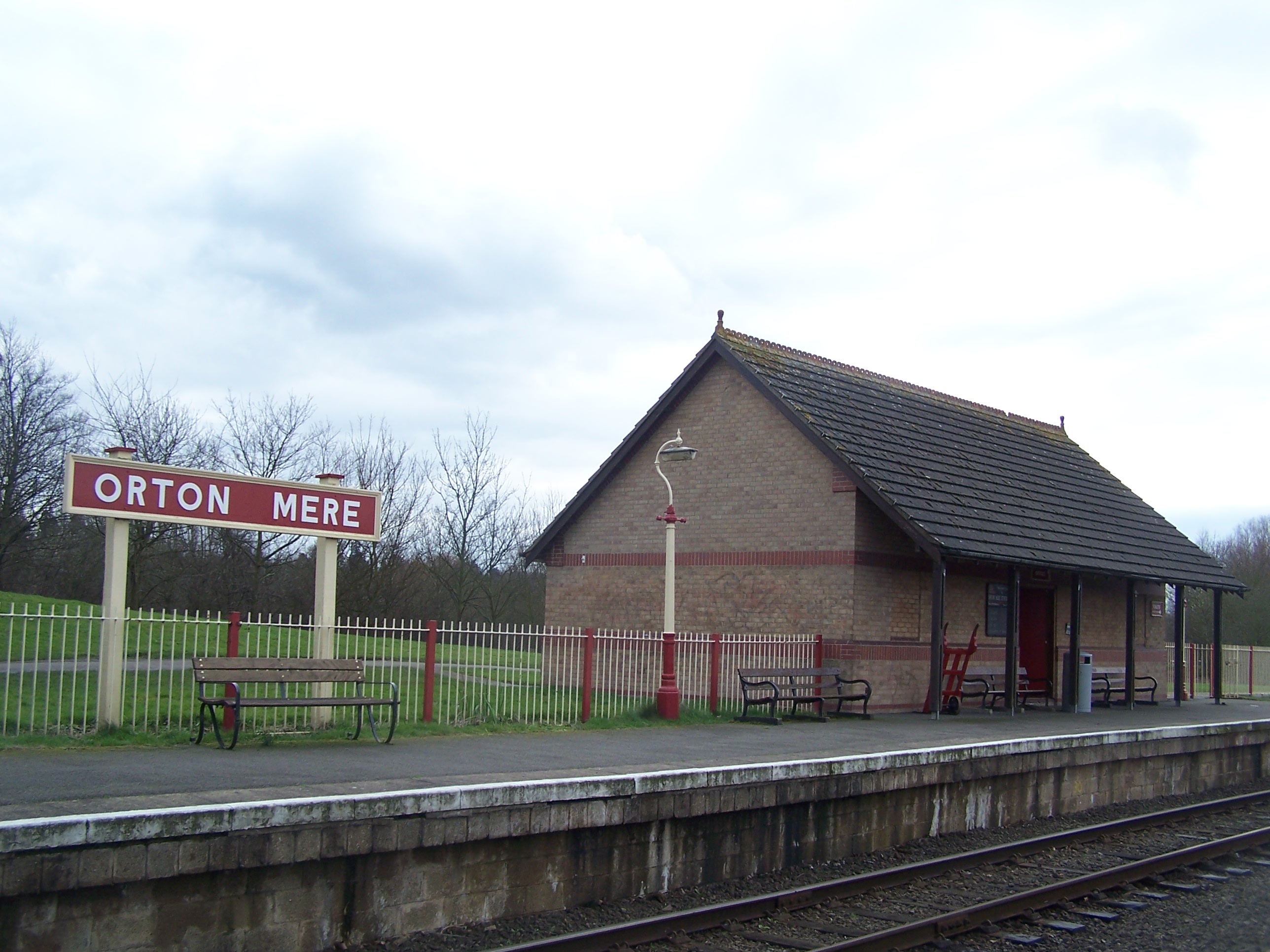
Orton Mere railway station

Orton Mere is a station on the Nene Valley Railway and is situated between Ferry Meadows and Peterborough Nene Valley, adjacent to the River Nene. Orton...

Orton, Peterborough

Orton is a suburb of the City of Peterborough, in Cambridgeshire, England, about 3 miles (4.8 km) south west of Peterborough city centre to the south of...

Woodston, Peterborough

Woodston is a largely residential and industrial area of the city of Peterborough, in the ceremonial county of Cambridgeshire, England. For electoral purposes...

Nearby Amenities

Located within 500m of 52.553125,-0.275197
Motorway Junction
Orton East Interchange
Ref: 31
Lat/Long: 52.5537295/-0.2703373
Mini Roundabout
Direction: clockwise
Lat/Long: 52.5575849/-0.2760521
Mini Roundabout
Direction: clockwise
Lat/Long: 52.5573007/-0.2769041
Crossing
Crossing: traffic_signals
Crossing Ref: pelican
Kerb: lowered
Sloped Curb: yes
Source: Bing
Lat/Long: 52.5563631/-0.2797498
Mini Roundabout
Lat/Long: 52.5534692/-0.2678387
Crossing
Crossing: unmarked
Lat/Long: 52.5534979/-0.2682158
Crossing
Bicycle: yes
Crossing: unmarked
Kerb: lowered
Sloped Curb: yes
Lat/Long: 52.5522937/-0.2750753
Barrier: cycle_barrier
Lat/Long: 52.5520267/-0.2766987
Barrier: cycle_barrier
Lat/Long: 52.5520171/-0.2769155
Crossing
Bicycle: yes
Crossing: unmarked
Kerb: lowered
Sloped Curb: yes
Lat/Long: 52.5520215/-0.276817
Crossing
Crossing: unmarked
Kerb: lowered
Source: Bing
Lat/Long: 52.5564757/-0.2795969
Traffic Signals
Source: Bing
Traffic Signals Direction: backward
Lat/Long: 52.5565107/-0.2796519
Post Box
Lat/Long: 52.5543622/-0.2777521
Crossing
Bicycle: yes
Crossing: unmarked
Lat/Long: 52.551381/-0.271574
Orton Longueville
Is In: Peterborough
Place: suburb
Lat/Long: 52.5551094/-0.2759303
Turning Circle
Lat/Long: 52.5496834/-0.2777329
Post Box
Lat/Long: 52.5508225/-0.2762211
Crossing
Bicycle: yes
Crossing: unmarked
Kerb: lowered
Sloped Curb: yes
Tactile Paving: no
Lat/Long: 52.5522253/-0.2741077
Traffic Signals
Source: Bing
Traffic Signals Direction: forward
Lat/Long: 52.5565159/-0.2792559
Crossing
Crossing: traffic_signals
Crossing Ref: pelican
Kerb: lowered
Sloped Curb: yes
Source: Bing
Lat/Long: 52.5563605/-0.2795
Traffic Signals
Source: Bing
Traffic Signals Direction: forward
Lat/Long: 52.5563185/-0.2794521
Traffic Signals
Source: Bing
Traffic Signals Direction: backward
Lat/Long: 52.5563457/-0.2798061
Street Lamp
Lat/Long: 52.5509862/-0.2813323
Bus Stop
Orton Mere
Bus: yes
Naptan AtcoCode: 0590POL132
Naptan NaptanCode: PETMPAD
Network: stagecoach
Operator: Stagecoach
Public Transport: platform
Lat/Long: 52.556534/-0.27933
Bus Stop
Orton Mere
Bus: yes
Network: stagecoach
Operator: Stagecoach
Public Transport: platform
Lat/Long: 52.5562161/-0.2800899
Addr Postcode: PE2 7EW
Building: yes
Lat/Long: 52.5562913/-0.2768528
Orton Mere
Bus: yes
Network: stagecoach
Operator: Stagecoach
Public Transport: stop_position
Lat/Long: 52.5562444/-0.2801156
Orton Mere
Bus: yes
Network: stagecoach
Operator: Stagecoach
Public Transport: stop_position
Lat/Long: 52.5565014/-0.2793027
Street Lamp
Lat/Long: 52.550365/-0.2717394
Street Lamp
Lat/Long: 52.5504388/-0.2712922
Generator Method: photovoltaic
Generator Output Electricity: yes
Generator Source: solar
Generator Type: solar_photovoltaic_panel
Location: roof
Power: generator
Lat/Long: 52.552619/-0.2758062
Generator Method: photovoltaic
Generator Output Electricity: yes
Generator Source: solar
Generator Type: solar_photovoltaic_panel
Location: roof
Power: generator
Lat/Long: 52.5537949/-0.276694
Generator Method: photovoltaic
Generator Output Electricity: yes
Generator Source: solar
Generator Type: solar_photovoltaic_panel
Location: roof
Power: generator
Lat/Long: 52.5537688/-0.2757284
Generator Method: photovoltaic
Generator Output Electricity: yes
Generator Source: solar
Generator Type: solar_photovoltaic_panel
Location: roof
Power: generator
Lat/Long: 52.5532094/-0.2753395
Generator Method: photovoltaic
Generator Output Electricity: yes
Generator Source: solar
Generator Type: solar_photovoltaic_panel
Location: roof
Power: generator
Lat/Long: 52.5524233/-0.2700475
Generator Method: photovoltaic
Generator Output Electricity: yes
Generator Source: solar
Generator Type: solar_photovoltaic_panel
Location: roof
Power: generator
Lat/Long: 52.5530039/-0.2709246
Generator Method: photovoltaic
Generator Output Electricity: yes
Generator Source: solar
Generator Type: solar_photovoltaic_panel
Location: roof
Power: generator
Lat/Long: 52.5525783/-0.270313
Generator Method: photovoltaic
Generator Output Electricity: yes
Generator Source: solar
Generator Type: solar_photovoltaic_panel
Location: roof
Power: generator
Lat/Long: 52.5524853/-0.2708817
Generator Method: photovoltaic
Generator Output Electricity: yes
Generator Source: solar
Generator Type: solar_photovoltaic_panel
Location: roof
Power: generator
Lat/Long: 52.5525929/-0.2721369
Generator Method: photovoltaic
Generator Output Electricity: yes
Generator Source: solar
Generator Type: solar_photovoltaic_panel
Location: roof
Power: generator
Lat/Long: 52.552332/-0.2723327
Generator Method: photovoltaic
Generator Output Electricity: yes
Generator Source: solar
Generator Type: solar_photovoltaic_panel
Location: roof
Power: generator
Lat/Long: 52.5521689/-0.2709433
Generator Method: photovoltaic
Generator Output Electricity: yes
Generator Source: solar
Generator Type: solar_photovoltaic_panel
Location: roof
Power: generator
Lat/Long: 52.5521673/-0.2710372
Generator Method: photovoltaic
Generator Output Electricity: yes
Generator Source: solar
Generator Type: solar_photovoltaic_panel
Location: roof
Power: generator
Lat/Long: 52.5521787/-0.2712491
Generator Method: photovoltaic
Generator Output Electricity: yes
Generator Source: solar
Generator Type: solar_photovoltaic_panel
Location: roof
Power: generator
Lat/Long: 52.552195/-0.2714396
Generator Method: photovoltaic
Generator Output Electricity: yes
Generator Source: solar
Generator Type: solar_photovoltaic_panel
Location: roof
Power: generator
Lat/Long: 52.5518232/-0.2735853
Generator Method: photovoltaic
Generator Output Electricity: yes
Generator Source: solar
Generator Type: solar_photovoltaic_panel
Location: roof
Power: generator
Lat/Long: 52.5515753/-0.2724534
Generator Method: photovoltaic
Generator Output Electricity: yes
Generator Source: solar
Generator Type: solar_photovoltaic_panel
Location: roof
Power: generator
Lat/Long: 52.5512132/-0.2741164
Generator Method: photovoltaic
Generator Output Electricity: yes
Generator Source: solar
Generator Type: solar_photovoltaic_panel
Location: roof
Power: generator
Lat/Long: 52.5512409/-0.2726465
Generator Method: photovoltaic
Generator Output Electricity: yes
Generator Source: solar
Generator Type: solar_photovoltaic_panel
Location: roof
Power: generator
Lat/Long: 52.5511936/-0.2728102
Generator Method: photovoltaic
Generator Output Electricity: yes
Generator Source: solar
Generator Type: solar_photovoltaic_panel
Location: roof
Power: generator
Lat/Long: 52.5501596/-0.2737463
Generator Method: photovoltaic
Generator Output Electricity: yes
Generator Source: solar
Generator Type: solar_photovoltaic_panel
Location: roof
Power: generator
Lat/Long: 52.5504499/-0.2725098
Generator Method: photovoltaic
Generator Output Electricity: yes
Generator Source: solar
Generator Type: solar_photovoltaic_panel
Location: roof
Power: generator
Lat/Long: 52.5489266/-0.2745134
Generator Method: photovoltaic
Generator Output Electricity: yes
Generator Source: solar
Generator Type: solar_photovoltaic_panel
Location: roof
Power: generator
Lat/Long: 52.5489837/-0.2744517
Generator Method: photovoltaic
Generator Output Electricity: yes
Generator Source: solar
Generator Type: solar_photovoltaic_panel
Location: roof
Power: generator
Lat/Long: 52.5489511/-0.2743256
Generator Method: photovoltaic
Generator Output Electricity: yes
Generator Source: solar
Generator Type: solar_photovoltaic_panel
Location: roof
Power: generator
Lat/Long: 52.549093/-0.2743417
Generator Method: photovoltaic
Generator Output Electricity: yes
Generator Source: solar
Generator Type: solar_photovoltaic_panel
Location: roof
Power: generator
Lat/Long: 52.5491794/-0.2740815
Generator Method: photovoltaic
Generator Output Electricity: yes
Generator Source: solar
Generator Type: solar_photovoltaic_panel
Location: roof
Power: generator
Lat/Long: 52.5491419/-0.2739742
Generator Method: photovoltaic
Generator Output Electricity: yes
Generator Source: solar
Generator Type: solar_photovoltaic_panel
Location: roof
Power: generator
Lat/Long: 52.5489886/-0.2733761
Generator Method: photovoltaic
Generator Output Electricity: yes
Generator Source: solar
Generator Type: solar_photovoltaic_panel
Location: roof
Power: generator
Lat/Long: 52.5489967/-0.2732903
Generator Method: photovoltaic
Generator Output Electricity: yes
Generator Source: solar
Generator Type: solar_photovoltaic_panel
Location: roof
Power: generator
Lat/Long: 52.5499264/-0.2719183
Generator Method: photovoltaic
Generator Output Electricity: yes
Generator Source: solar
Generator Type: solar_photovoltaic_panel
Location: roof
Power: generator
Lat/Long: 52.5497592/-0.2728826
Generator Method: photovoltaic
Generator Output Electricity: yes
Generator Source: solar
Generator Type: solar_photovoltaic_panel
Location: roof
Power: generator
Lat/Long: 52.5497738/-0.2727941
Generator Method: photovoltaic
Generator Output Electricity: yes
Generator Source: solar
Generator Type: solar_photovoltaic_panel
Location: roof
Power: generator
Lat/Long: 52.5496279/-0.2726224
Generator Method: photovoltaic
Generator Output Electricity: yes
Generator Source: solar
Generator Type: solar_photovoltaic_panel
Location: roof
Power: generator
Lat/Long: 52.5495708/-0.272601
Generator Method: photovoltaic
Generator Output Electricity: yes
Generator Source: solar
Generator Type: solar_photovoltaic_panel
Location: roof
Power: generator
Lat/Long: 52.5495056/-0.2725822
Generator Method: photovoltaic
Generator Output Electricity: yes
Generator Source: solar
Generator Type: solar_photovoltaic_panel
Location: roof
Power: generator
Lat/Long: 52.549442/-0.2725554
Generator Method: photovoltaic
Generator Output Electricity: yes
Generator Source: solar
Generator Type: solar_photovoltaic_panel
Location: roof
Power: generator
Lat/Long: 52.5493506/-0.2725124
Generator Method: photovoltaic
Generator Output Electricity: yes
Generator Source: solar
Generator Type: solar_photovoltaic_panel
Location: roof
Power: generator
Lat/Long: 52.549287/-0.2724856
Generator Method: photovoltaic
Generator Output Electricity: yes
Generator Source: solar
Generator Type: solar_photovoltaic_panel
Location: roof
Power: generator
Lat/Long: 52.5493246/-0.2719679
Generator Method: photovoltaic
Generator Output Electricity: yes
Generator Source: solar
Generator Type: solar_photovoltaic_panel
Location: roof
Power: generator
Lat/Long: 52.5569521/-0.2745107
Generator Method: photovoltaic
Generator Output Electricity: yes
Generator Source: solar
Generator Type: solar_photovoltaic_panel
Location: roof
Power: generator
Lat/Long: 52.5565003/-0.2728316
Generator Method: photovoltaic
Generator Output Electricity: yes
Generator Source: solar
Generator Type: solar_photovoltaic_panel
Location: roof
Power: generator
Lat/Long: 52.5558138/-0.2723488
Generator Method: photovoltaic
Generator Output Electricity: yes
Generator Source: solar
Generator Type: solar_photovoltaic_panel
Location: roof
Power: generator
Lat/Long: 52.5554045/-0.2712438
Generator Method: photovoltaic
Generator Output Electricity: yes
Generator Source: solar
Generator Type: solar_photovoltaic_panel
Location: roof
Power: generator
Lat/Long: 52.5554681/-0.2721798
Generator Method: photovoltaic
Generator Output Electricity: yes
Generator Source: solar
Generator Type: solar_photovoltaic_panel
Location: roof
Power: generator
Lat/Long: 52.5519439/-0.2749425
Generator Method: photovoltaic
Generator Output Electricity: yes
Generator Source: solar
Generator Type: solar_photovoltaic_panel
Location: roof
Power: generator
Lat/Long: 52.5519324/-0.2748165
Generator Method: photovoltaic
Generator Output Electricity: yes
Generator Source: solar
Generator Type: solar_photovoltaic_panel
Location: roof
Power: generator
Lat/Long: 52.5521705/-0.2746904
Generator Method: photovoltaic
Generator Output Electricity: yes
Generator Source: solar
Generator Type: solar_photovoltaic_panel
Location: roof
Power: generator
Lat/Long: 52.5533301/-0.2751249
Generator Method: photovoltaic
Generator Output Electricity: yes
Generator Source: solar
Generator Type: solar_photovoltaic_panel
Location: roof
Power: generator
Lat/Long: 52.5519634/-0.2738911
Generator Method: photovoltaic
Generator Output Electricity: yes
Generator Source: solar
Generator Type: solar_photovoltaic_panel
Location: roof
Power: generator
Lat/Long: 52.5521167/-0.2727672
Generator Method: photovoltaic
Generator Output Electricity: yes
Generator Source: solar
Generator Type: solar_photovoltaic_panel
Location: roof
Power: generator
Lat/Long: 52.5527772/-0.2705357
Generator Method: photovoltaic
Generator Output Electricity: yes
Generator Source: solar
Generator Type: solar_photovoltaic_panel
Location: roof
Power: generator
Lat/Long: 52.5567221/-0.271064
Generator Method: photovoltaic
Generator Output Electricity: yes
Generator Source: solar
Generator Type: solar_photovoltaic_panel
Location: roof
Power: generator
Lat/Long: 52.5567074/-0.2710184
Generator Method: photovoltaic
Generator Output Electricity: yes
Generator Source: solar
Generator Type: solar_photovoltaic_panel
Location: roof
Power: generator
Lat/Long: 52.5551762/-0.2689505
Bicycle Parking
Bicycle Parking: stands
Capacity: 8
Covered: no
Lat/Long: 52.5539501/-0.2784294
Generator Method: photovoltaic
Generator Output Electricity: yes
Generator Source: solar
Generator Type: solar_photovoltaic_panel
Location: roof
Power: generator
Lat/Long: 52.5503961/-0.2769327
Generator Method: photovoltaic
Generator Output Electricity: yes
Generator Source: solar
Generator Type: solar_photovoltaic_panel
Location: roof
Power: generator
Lat/Long: 52.5561057/-0.2775416
Generator Method: photovoltaic
Generator Output Electricity: yes
Generator Source: solar
Generator Type: solar_photovoltaic_panel
Location: roof
Power: generator
Lat/Long: 52.5519406/-0.2740306
Generator Method: photovoltaic
Generator Output Electricity: yes
Generator Source: solar
Generator Type: solar_photovoltaic_panel
Location: roof
Power: generator
Lat/Long: 52.5502379/-0.278078
Generator Method: photovoltaic
Generator Output Electricity: yes
Generator Source: solar
Generator Type: solar_photovoltaic_panel
Location: roof
Power: generator
Lat/Long: 52.5495692/-0.2773485
Generator Method: photovoltaic
Generator Output Electricity: yes
Generator Source: solar
Generator Type: solar_photovoltaic_panel
Location: roof
Power: generator
Lat/Long: 52.549548/-0.2772921
Generator Method: photovoltaic
Generator Output Electricity: yes
Generator Source: solar
Generator Type: solar_photovoltaic_panel
Location: roof
Power: generator
Lat/Long: 52.5502346/-0.2782282
Generator Method: photovoltaic
Generator Output Electricity: yes
Generator Source: solar
Generator Type: solar_photovoltaic_panel
Location: roof
Power: generator
Lat/Long: 52.5507109/-0.2777588
Generator Method: photovoltaic
Generator Output Electricity: yes
Generator Source: solar
Generator Type: solar_photovoltaic_panel
Location: roof
Power: generator
Lat/Long: 52.5509099/-0.2773351
Generator Method: photovoltaic
Generator Output Electricity: yes
Generator Source: solar
Generator Type: solar_photovoltaic_panel
Location: roof
Power: generator
Lat/Long: 52.5509637/-0.2772573
Generator Method: photovoltaic
Generator Output Electricity: yes
Generator Source: solar
Generator Type: solar_photovoltaic_panel
Location: roof
Power: generator
Lat/Long: 52.550962/-0.2743337
Generator Method: photovoltaic
Generator Output Electricity: yes
Generator Source: solar
Generator Type: solar_photovoltaic_panel
Location: roof
Power: generator
Lat/Long: 52.5510028/-0.2730328
Generator Method: photovoltaic
Generator Output Electricity: yes
Generator Source: solar
Generator Type: solar_photovoltaic_panel
Location: roof
Power: generator
Lat/Long: 52.5499231/-0.2703238
The data included in this document is from www.openstreetmap.org. The data is made available under ODbL.

Have you been to Orton Longueville?

Leave your review of Orton Longueville below (or comments, questions and feedback).