Old Newton with Dagworth

Civil Parish in Suffolk Mid Suffolk

England

Old Newton with Dagworth

Stonebridge Lane towards Old Newton
Stonebridge Lane towards Old Newton Credit: JThomas

Old Newton with Dagworth is a civil parish located in the county of Suffolk, England. Situated in the Mid Suffolk district, the parish covers an area of approximately 9.5 square miles. The parish consists of two separate settlements, Old Newton and Dagworth, which are situated about 1.5 miles apart.

Old Newton is a small village with a population of around 700 residents. It is characterized by its picturesque countryside setting and traditional English charm. The village is home to a range of amenities, including a primary school, a village hall, a local pub, and a post office. The village also has a rich history, with evidence of settlement dating back to the medieval period.

Dagworth, on the other hand, is a smaller settlement with a population of around 100 residents. It is predominantly a rural area with a few scattered houses and farms. The village is known for its tranquil atmosphere and beautiful natural surroundings. It offers residents and visitors alike the opportunity to enjoy peaceful walks and explore the stunning countryside.

Both Old Newton and Dagworth benefit from excellent transport links, with the A140, a major road connecting Norwich and Ipswich, passing nearby. This makes it convenient for residents to access nearby towns and cities for work and leisure purposes.

Overall, Old Newton with Dagworth provides a peaceful and idyllic rural lifestyle, with its charming villages, beautiful countryside, and strong sense of community.

If you have any feedback on the listing, please let us know in the comments section below.

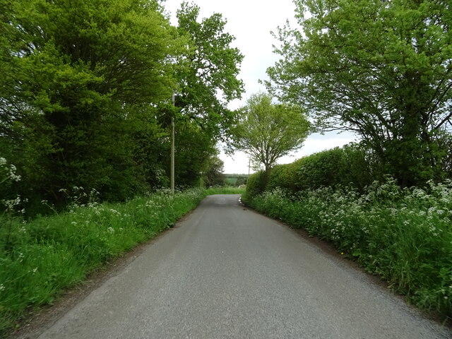
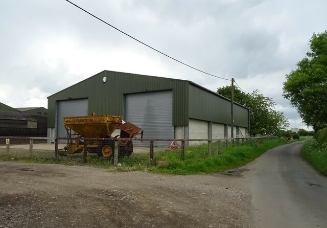
Old Newton with Dagworth Images

Images are sourced within 2km of 52.223478/1.004924 or Grid Reference TM0562. Thanks to Geograph Open Source API. All images are credited.

Stonebridge Lane towards Old Newton
Cereal crop towards the River Gipping
Stonebridge Lane towards Old Newton
Barn, Colt Meadow Farm
Farmland off Stonebridge Lane
Stonebridge Lane towards Old Newton
Farm buildings, Hill Farm
Cereal crop near Hill Farm
School Road, Old Newton
St Mary's Church, Old Newton
Thatched Cottage, Old Newton
Church Road, Old Newton
The Mandarin Chinese Takeaway, Old Newton The former Shoulder of Mutton public house <a href="https://www.geograph.org.uk/photo/1229664">TM0562 : 'Shoulder of Mutton' public house in Old Newton</a>
The Mandarin Chinese Takeaway, Old Newton
The former Shoulder of Mutton public house TM0562 : 'Shoulder of Mutton' public house in Old Newton
Houses on Silver Street, Old Newton
Silver Street, Old Newton
Barn, Dagworth Farm
Barn, Dagworth Farm
House and footpath on Silver Street
Crop field off Silver Street
Show me another place!

Old Newton with Dagworth is located at Grid Ref: TM0562 (Lat: 52.223478, Lng: 1.004924)

Administrative County: Suffolk

District: Mid Suffolk

Police Authority: Suffolk

What 3 Words

///scrub.advances.popular. Near Haughley, Suffolk

Related Wikis

Old Newton

Old Newton is a village in the Mid Suffolk district of Suffolk in eastern England. Located within the civil parish of Old Newton with Dagworth, the village...

Old Newton with Dagworth

Old Newton with Dagworth is a civil parish in the Mid Suffolk district of Suffolk in eastern England. The parish contains the village of Old Newton, as...

Haughley railway station

Haughley railway station was located in Haughley, Suffolk on the Great Eastern Main Line between Liverpool Street Station and Norwich. It opened on 7 July...

Gipping

Gipping is a village and civil parish in the Mid Suffolk district of Suffolk in eastern England. Located around three miles north north-east of Stowmarket...

Nearby Amenities

Located within 500m of 52.223478,1.004924
Turning Circle
Lat/Long: 52.2225665/1.000528
Post Office
Old Newton Village Shop & Post Office
Addr City: Stowmarket
Addr Housenumber: 18
Addr Postcode: IP14 4EG
Addr Street: Finningham Road
Addr Village: Old Newton
Fixme: Check on ground
Opening Hours Post Office: Mo-Fr 09:00-17:00; Sa 09:00-13:00
Ref Pol Id: 148656
Shop: convenience
Source Addr: pol_branch_list_2019-03
Source Opening Hours Post Office: pol_branch_list_2019-03
Lat/Long: 52.224414/1.0011439
Bus Stop
Shoulder of Mutton
Naptan AtcoCode: 390040396
Naptan Bearing: S
Naptan CommonName: Shoulder of Mutton
Naptan Indicator: adj
Naptan Landmark: Shoulder of Mutton
Naptan NaptanCode: sufawtgp
Naptan Street: B1113
Naptan Verified: no
Public Transport: platform
Source: naptan_import
Lat/Long: 52.2228128/0.999875
Bus Stop
Shoulder of Mutton
Naptan AtcoCode: 390040397
Naptan Bearing: N
Naptan CommonName: Shoulder of Mutton
Naptan Indicator: opp
Naptan Landmark: Shoulder of Mutton
Naptan NaptanCode: sufawtgt
Naptan Street: B1113
Naptan Verified: no
Public Transport: platform
Source: naptan_import
Lat/Long: 52.2227885/0.9997099
Power: pole
Lat/Long: 52.220825/1.0099974
Power: pole
Lat/Long: 52.2225613/1.0084035
Power: pole
Lat/Long: 52.2214079/1.0094817
Fast Food
The Mandarin
Addr City: Stowmarket
Addr Housename: Shoulder of Mutton
Addr Postcode: IP14 4EF
Addr Street: Stowmarket Road
Addr Village: Old Newton
Cuisine: chinese
Fhrs Id: 1539213
Url: http://www.themandarinoldnewton.com/
Lat/Long: 52.2231486/1.0002654
Power: pole
Lat/Long: 52.2255781/1.0093728
Power: pole
Lat/Long: 52.224502/1.0084645
Power: pole
Lat/Long: 52.2235369/1.0076095
Generator Source: solar
Location: roof
Power: generator
Lat/Long: 52.2232023/1.001105
Generator Source: solar
Location: roof
Power: generator
Lat/Long: 52.2225138/1.0011439
Generator Source: solar
Location: roof
Power: generator
Lat/Long: 52.2223134/1.0018856
Generator Source: solar
Location: roof
Power: generator
Lat/Long: 52.2226469/1.0021765
Generator Source: solar
Location: roof
Power: generator
Lat/Long: 52.2226584/1.0020491
Generator Source: solar
Location: roof
Power: generator
Lat/Long: 52.2226939/1.0018685
Generator Source: solar
Location: roof
Power: generator
Lat/Long: 52.2227291/1.0017434
Generator Source: solar
Location: roof
Power: generator
Lat/Long: 52.2232237/1.0010232
The data included in this document is from www.openstreetmap.org. The data is made available under ODbL.

Have you been to Old Newton with Dagworth?

Leave your review of Old Newton with Dagworth below (or comments, questions and feedback).